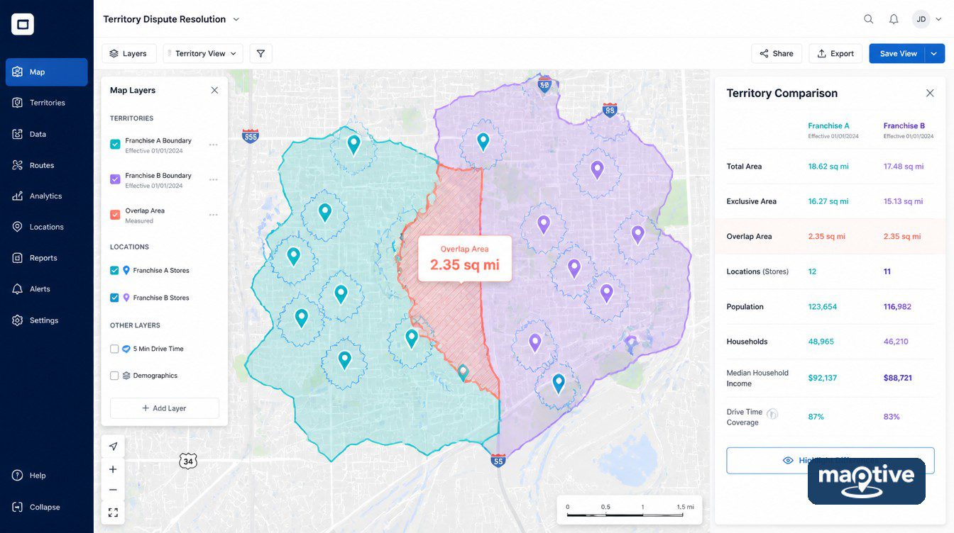
Both parties in a franchise territory dispute already know where the new unit is. The disagreement is over what that address is allowed to mean under the agreement. Half of that question has a checkable answer, namely how much ground the two units share and how many customer records fall inside the shared part. Territory mapping software settles that half and nothing else. The rest turns on contract language, and reading any specific agreement is work for the parties and their counsel.
Why Franchise Territory Disputes Start With Two Definitions
Franchisee-side counsel describe the injury as any franchisor activity that reduces the ability to earn a profit at the location. Franchisor-side counsel treat the same complaints as unhappiness with terms that were agreed and signed. Both descriptions can be accurate about the same event. The dispute then moves to the two documents the outcome turns on, the franchise agreement and the disclosure that came with it.
The numbers underneath rarely look dramatic on a single statement. Take a system with four units in one metro, all performing to plan. A fifth opens nearby and misses its projection, while two of the originals slip below theirs. Nothing closes, and no single month looks like a catastrophe, while three profit-and-loss statements get worse together. In a year when many franchise owners report lower earnings than the year before, a few points of transferred sales change what those units earn.
Reported disputes have turned on what the agreement text grants and on the disclosure that accompanied it. The distance between two front doors is rarely the thing an outcome hangs on. That leaves an operator with a set of questions that have checkable answers. Which ground does each unit cover, how much of it is shared, and what does the agreement say about the overlap?
Exclusive, Protected and Non-Exclusive Territories
Exclusive, protected and non-exclusive get used interchangeably in conversation, and they promise three different things. Each label points at a clause without defining one. The paragraph it refers to is the thing to read.
What Counts as an Exclusive Territory
The exclusive label is used where an agreement promises no company-owned or franchised outlet selling the same or similar goods or services under the same or similar marks inside the granted area. Every phrase in that formula narrows it. Operators who skip past the wording are usually surprised later by one of those narrowing phrases.
Marks, goods and area each have a limit. A sibling brand in the same portfolio, a different store format or an address a block outside the drawn boundary each raise a question the phrase does not answer on its own. An address either falls inside the drawn line or it does not. The sibling brand and the store format have no equivalent test.
Why Protected Does Not Mean Exclusive
Protected is commercial shorthand with no defined meaning. It signals that the agreement places some restriction on putting another unit nearby.
The same word can grant materially different things in two agreements. One bars any second unit inside a ZIP list. Another restricts only a full-format store and leaves an express counter permitted. A third holds the restriction open only while the operator hits a stated sales figure.
What a Non-Exclusive Territory Reserves
A unit appears in an airport, a stadium, a hospital, a campus or a military base, inside ground the operator considered theirs. Reserved-rights language covers exactly that placement. A non-exclusive territory reserves the franchisor’s right to open a company-owned or franchised unit inside the area, and those reservations often include non-traditional and captive venues.
A captive venue can be a mile from an existing unit and serve a population that never enters it. Distance measures the overlap and predicts almost nothing about the harm, since the people inside a hospital or a terminal were never going to cross the street. Reserved venues are also missing from most territory maps, because the operator built the map out of retail addresses.
What FDD Item 12 Discloses About a Territory
A territory can depend on a sales volume the operator has to hit, or on a market penetration figure. Item 12 requires the franchisor to disclose that contingency, along with the circumstances under which the territory may be altered. Those are the two disclosures to go through line by line. Between them they state the conditions under which a territory can be reduced or removed, and in many systems those conditions exist.
Read Item 12 of the Franchise Disclosure Document as a disclosure requirement rather than as a protection requirement. An operator who expects Item 12 to protect a territory is reading a disclosure rule as a grant. It requires the franchisor to state the terms accurately without requiring it to grant anything.
The disclosure covers the location arrangement. That is either a specific site or one to be approved later. It also covers the existence of a territory, the methodology used to set it and the way it is defined. Where no exclusive territory is granted, the franchisor has to say so and has to state that the franchisee may face competition from other franchisees and from company outlets.
Why ZIP Code Territories Drift Apart
Writing a territory as a list of ZIP codes gives a boundary that is easy to draft and easy to check. The list is also the least stable geography available. Draw the same list of codes as polygons from two different vintages and the two outlines will not agree.
USPS ZIP Codes Against Census ZCTAs
USPS ZIP codes identify mail delivery routes assigned to addresses. They are not fixed polygons. Nearly 42,000 US ZIP codes are in circulation, added, retired and re-routed as delivery patterns change. The Census Bureau’s mappable equivalent, the ZIP Code Tabulation Area, numbered 33,121 in the 2020 vintage and is fixed until the next census.
Mapping tools draw the census polygons because those are the only mappable geography of the two. Agreements signed years apart, both naming the same codes, can describe slightly different ground. Two mapping products can draw the same code slightly differently. Drift happens mechanically and without anybody acting in bad faith. A list naming 40 codes can therefore produce 40 slightly different outlines depending on which vintage each side’s mapping tool loaded.
Radius, Drive Time and What Goes in the Contract
Descriptions like “the greater Phoenix area” are the ones that generate arguments later, because two people can draw that phrase in good faith and produce different outlines. A radius is one distance measured from one address. It gives every operator the same number, is simple to write, and avoids that problem.
The road network has no say in where a circle falls, and customers reach a unit by road. Demographic data is published for tracts, block groups and ZIP codes, none of which are circles, so counting people inside a circle takes an apportionment step first. A drive-time polygon follows the road network instead. Rivers, highways and access points all appear in its outline. The conventional thresholds for trade-area work are 5, 10 and 15 minutes.
Common practice is to analyze with drive time and then write the contract boundary as the ZIP list or radius that approximates it. Territory clauses in franchise agreements usually pair a written description with a map exhibit, and careful drafting states which of the two governs where they disagree.
Do Online and Delivery Orders Count as Encroachment?
Online and delivery orders count as encroachment only where the agreement’s reserved-channel language says they do. The ground itself did not change when the order started arriving through an app. Item 12 requires disclosure of any reserved right to sell through other channels of distribution, including the internet, catalog sales, telemarketing and direct marketing. It also requires disclosure of any restriction on soliciting or accepting orders from consumers inside a territory.
Delivery apps and online ordering are argued under that reserved-channel language, and each clause reaches only as far as its own terms. Agreements written before those platforms existed are the hardest cases, since the drafters were describing catalog and telephone ordering and the words now have to cover a marketplace that routes an order to whichever unit an algorithm picks.
Plotting delivery destinations against the two territory boundaries shows which unit’s ground the demand came from. That count will not resolve the clause. No argument about the clause gets far without it either.
How Territory Mapping Software Proves Overlap
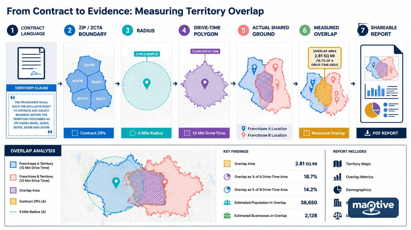
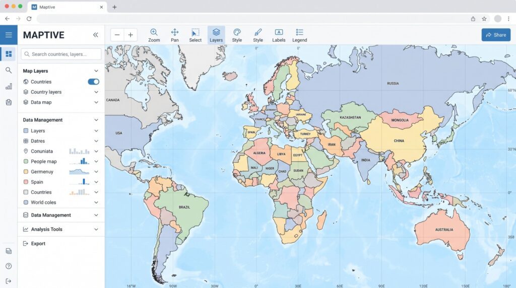
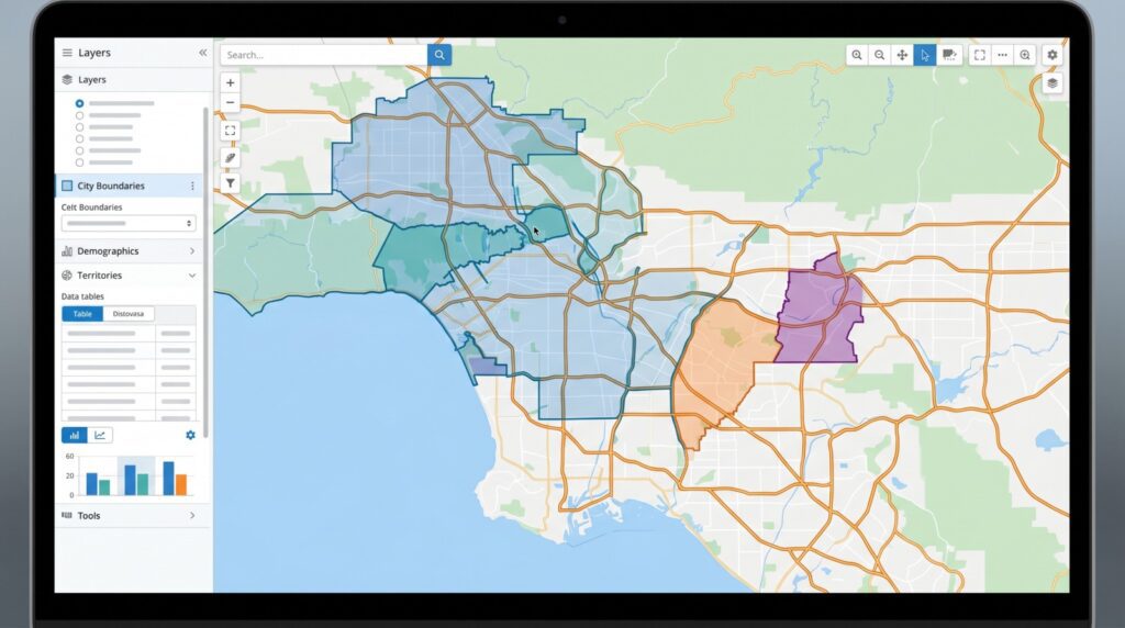
An overlap argument conducted from two different maps produces two people describing different pictures while believing they are describing one place. Maptive removes that by putting both boundaries and both datasets into one definition. The franchisor-side interpretation and the franchisee-side interpretation are then applied to the same object.
How to Put Both Territories on One Map
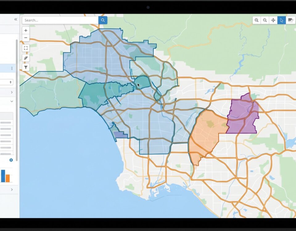
Two readings stop diverging once both boundaries come off one source. For a territory written as a ZIP list, that source is the US Zip Codes set. Opening the Boundary Tool and loading that set with No Fill gives outlines only, which keeps shading out of a conversation about where the lines run. Clicking any boundary opens a popup naming that ZIP code and reporting how many locations fall inside it. When both operators click that boundary in the same session, they take one figure off one popup, and the count stops being one side’s number.
An operator who already tracks an owner column has less work to do. Choosing My Group / Territory Data as the fill type shades every boundary by the franchisee or territory name in that column. The assignment that exists on paper then appears on the map before anyone proposes redrawing it.
The Territories Tool builds the boundaries by hand:
Set Select Action to Create Territories.
Choose Create Territories Manually, then Selection.
Pick Boundaries, name the group and click Create Territory Group.
Select the boundaries On Click, On Hover or with the Lasso Tool.
The lasso asks first for Full Boundaries Only or Full and Partial Boundaries. The choice changes which boundaries end up inside the territory. A map that reaches the other party without that setting noted produces a second argument about the same line.
Measuring the Shared Ground
The Drive Time Polygon Tool asks for a starting address or a marker and a travel time in hours and minutes. What comes back is the reachable area with the locations inside it already counted. Traffic is absent from that calculation, so a polygon offered as evidence should arrive with the assumption stated alongside it.
Any outline on the map takes the same treatment through Customize Metrics, whether that outline is a loaded boundary, a drawn territory, a radius or a polygon. Total a transaction column inside each of two overlapping outlines and both parties hold one figure for the contested ground. Two units claiming the same corridor produce two numbers here, computed from one dataset.
Sharing a Territory Map With the Other Party
Timing changes what the same map is worth. An overlap count produced while a site is still under consideration is a number both parties can act on, since nothing is signed and the terms are still open. The same count assembled after the lease is signed and a decline shows up in the statements costs no more to produce and arrives too late to move the site.
A shared link converts a private analysis into evidence both parties can open, which makes the privacy setting a decision about who is allowed into the dispute rather than a settings choice. Share Externally sends the map to people with no license and no login. They cannot make permanent edits. Password Protected puts one password over the whole map, and Public lets anyone holding the link open it without making the map findable in search.
Either the default map view or the current view can be shared, so a filtered map opens already filtered for the person receiving it, and the same map can be embedded on an internal intranet page. Both parties then work from one artifact, with one boundary set and one set of counts.
Frequently Asked Questions
No, and the disclosure rules do not require one either. Item 12 governs what has to be told to a prospective franchisee, not what has to be handed over. Where an agreement grants no exclusive territory, the franchisor is obliged to say so plainly and to state that competition may come from other franchisees, from company-owned outlets and from other channels of distribution.
That depends on what the agreement made changeable. Some territories are conditional on a sales volume or a market penetration figure the operator has to keep hitting, and Item 12 obliges the franchisor to disclose any such contingency together with the circumstances under which the area may be altered. Many systems disclose exactly that. Whether a particular clause permits a particular change is a question for the parties and their counsel.
It is whatever the drafted paragraph says it is. Protected carries no fixed content of its own, so one agreement can bar any second unit inside a ZIP list while another restricts a full-format store and leaves an express counter permitted. Two operators using the same word in the same conversation may hold two unlike restrictions.
Yes, once the owner of the map shares it. External sharing reaches people with no license and no login, and nothing they do to the map is permanent. A single password can be placed over the whole thing, or a public link can be used, which opens for anyone holding it without putting the map into search results. An internal intranet page can carry the same map as an embed.
By a ZIP code list, by a radius measured from the unit address, by named streets or municipal lines, or by a demographic target such as a household or population count. A map exhibit is usually attached alongside the written description, and the careful agreements state which of the two governs where they disagree.
The postal ones do, continuously, because they describe delivery routes and not areas. Codes are added, retired and re-routed as mail volumes move. The census equivalent used for mapping holds still for the length of a vintage, which is how two agreements written years apart from the same list of code names end up describing slightly different ground once somebody draws them.
A drive-time polygon outlines the ground reachable from a point inside a stated travel time, measured along real roads. Franchises use it because a customer’s willingness to visit is a time budget more than a distance, and a river with one bridge changes the time without changing the mileage. Trade-area work conventionally runs it at 5, 10 and 15 minutes.
Cannibalization is the portion of an existing unit’s sales that moves to a new unit of the same brand nearby. Development teams estimate it by laying the proposed trade area over the units already open and measuring the shared ground. That estimate then goes against the cost of the new unit, since a system can gain in total while an individual operator loses.
A right of first refusal is a standing option over a named area, usually the ground next door to the existing territory. Should a third party come forward to develop it, the franchisor has to notify the existing franchisee, who can take the deal on the same terms inside a set window. 30 to 45 days is the common length.
One map, one boundary source, both datasets, with both parties in front of it at the same time. Load the ZIP boundary layer or the drawn territories, click into the shared boundaries and take the location count each one reports. Those counts are the base numbers, and the argument that follows is about the clause instead of about whose map is right.
Start with documents ahead of the map. Record the sales change and keep the correspondence with the franchisor. Work through what the agreement and the Franchise Disclosure Document grant, since the answer to whether anything was breached is in that text. Counsel is normally involved before any escalation.