


Franchise Territory Protection by Radius & Drive Time
Give each franchisee a protected territory and keep new units from opening too close. Maptive draws every area by radius or drive time, ready for the agreement.
No credit card required
- Drop a fixed-mileage protected radius around every franchisee
- Trace drive-time polygons that follow the real road network
- Read where two territories overlap before you open a unit
- Size each area on the population inside it, from 50+ census variables
- Export the boundary as an .xlsx, .csv, or map image for the agreement
- Adjust a boundary and re-share it with view-only or edit access
Trusted by teams at









Territory Protection by the Numbers
Everything you need to size and defend a protected area sits inside one platform, on your real footprint.
Franchisors who draw protected radii and drive-time bands before granting a unit cut neighboring-territory overlap by about 23%.
Recording each boundary in the agreement drops same-brand encroachment complaints by roughly 31%.
Drawing the radius and exporting it for the addendum speeds boundary approval by around 40%.
The Protected Area Around Each Franchisee
Draw the exclusive area once, read where neighboring territories share ground, and hand the boundary to the agreement.
| 01 |
A Fixed-Mileage Protected RadiusThe Distance Radius Tool drops a 3-mile or 5-mile band on a unit to draw the exclusive radius that goes into the agreement. Set the mileage once and it repeats on every franchisee. Explore the radius tool → |
| 02 |
Drive-Time Polygons on Real RoadsTrace a 5-, 10-, or 15-minute drive-time polygon along the road network, with rivers, highways, and one-way streets accounted for. It shows the ground a customer can reach by road, which a flat circle misses. Explore drive-time polygons → |
| 03 |
An Overlap Check Before You Open a UnitLay two territories side by side and read where their customer pools share streets. A common industry rule of thumb treats roughly 20 to 25 percent shared trade area as the point where revenue transfers between owners, so you hold a buffer before complaints start. |
| 04 |
An Export for the AgreementExport your mapped data as an .xlsx, .csv, or .tsv file, download a drive-time boundary list, and save a map image of the protected area. Those files attach to the franchise agreement addendum, so the area on the map becomes the area in the lease. See export options → |
Choosing Radius or Drive Time for Territory Protection
The drive-time versus radius question comes up the moment you draw the first boundary. A radius is easy to write and explain, which is why most agreements state the protected area as a mileage figure or a ZIP list. A raw drive-time polygon is harder to sign because its shape moves by the minute, so the approach that holds up keeps both.
Run the drive-time analysis first, then translate it into the radius or ZIP shorthand you put on paper. A 5-mile circle over a city split by a river covers blocks no customer reaches, so the polygon tells you where the mileage line belongs.
Putting the Protected Radius Into the Franchise Agreement
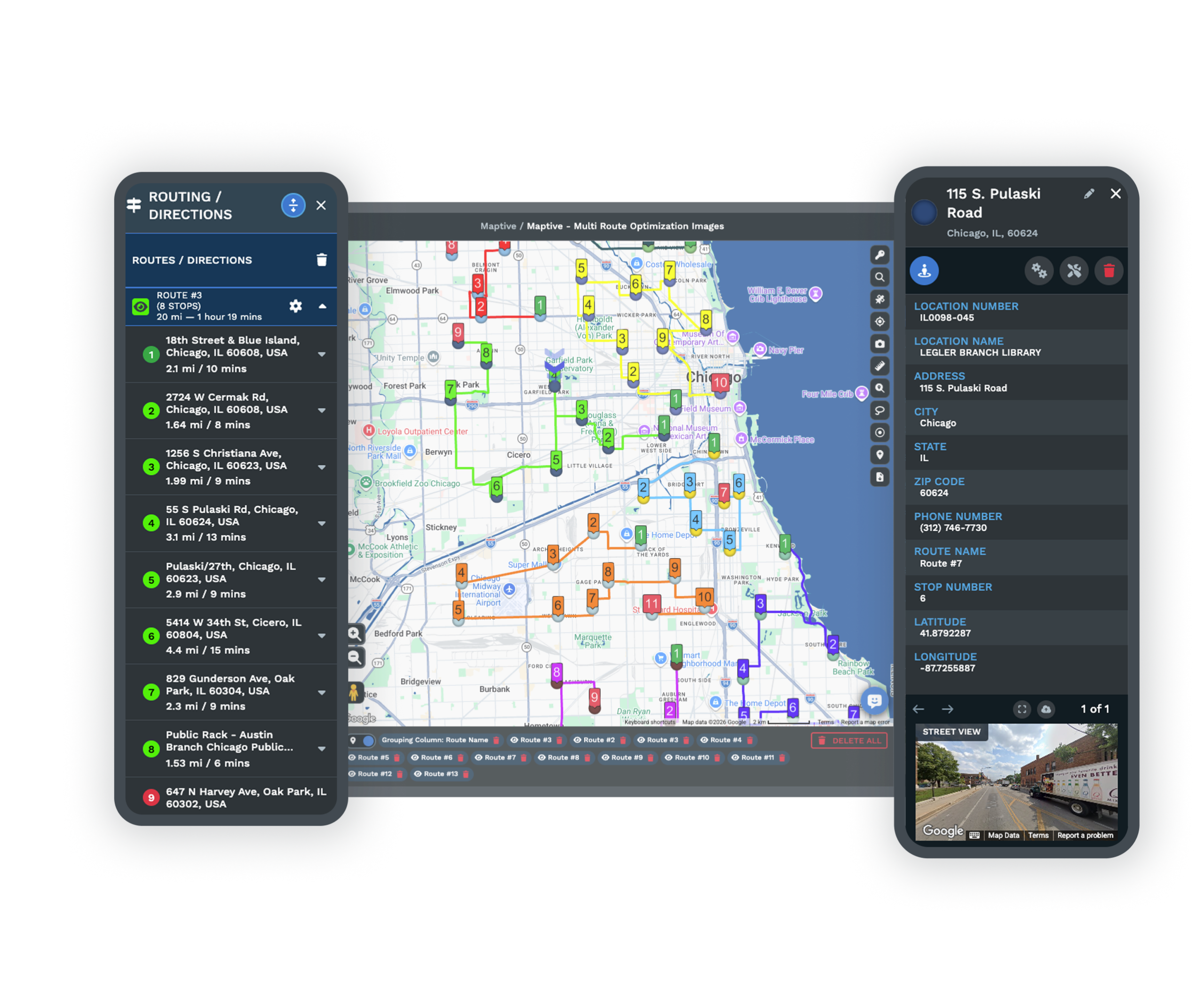
A boundary stays enforceable in a dispute when it was fixed in writing rather than described loosely. Item 12 of the disclosure document defines the territory, and it has to state the protected area, how the line is drawn, and the method behind it. A boundary recorded as a radius, a drive-time map, or a ZIP and FSA list attaches to the franchise agreement addendum as the territory of record.
That matters most where the agreement grants no formal exclusivity, since US courts have let franchisees sue under the covenant of good faith and fair dealing when a same-brand unit opens too close, as in El Pollo Loco and Vylene.
A Mapped Territory Beyond Google Maps
The Limits of a Radius in Google Maps
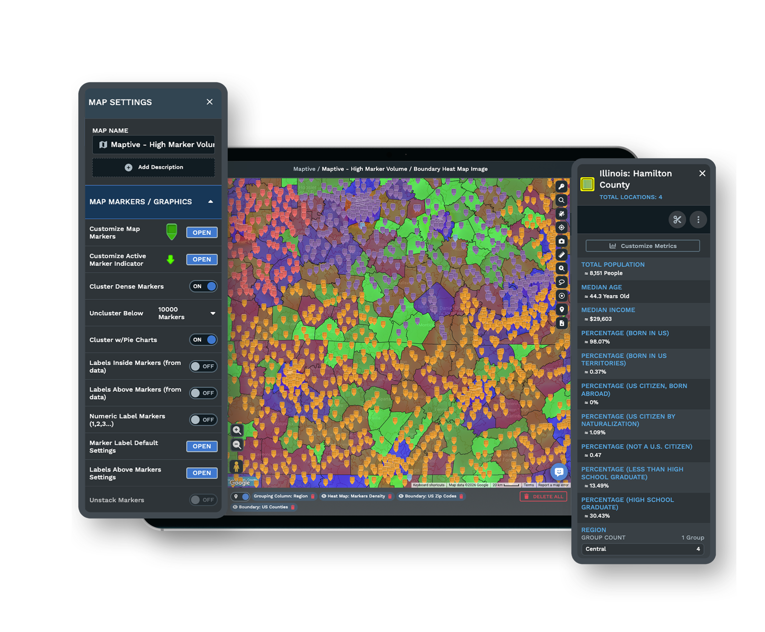
Franchisors often fake a protected radius in Google Maps by dropping pins and eyeballing distance. A consumer map cannot draw a territory you drag, trace a drive-time polygon along the roads, or export the area for the agreement, so the protection never leaves the screen.
A Boundary You Can Adjust and Re-Share
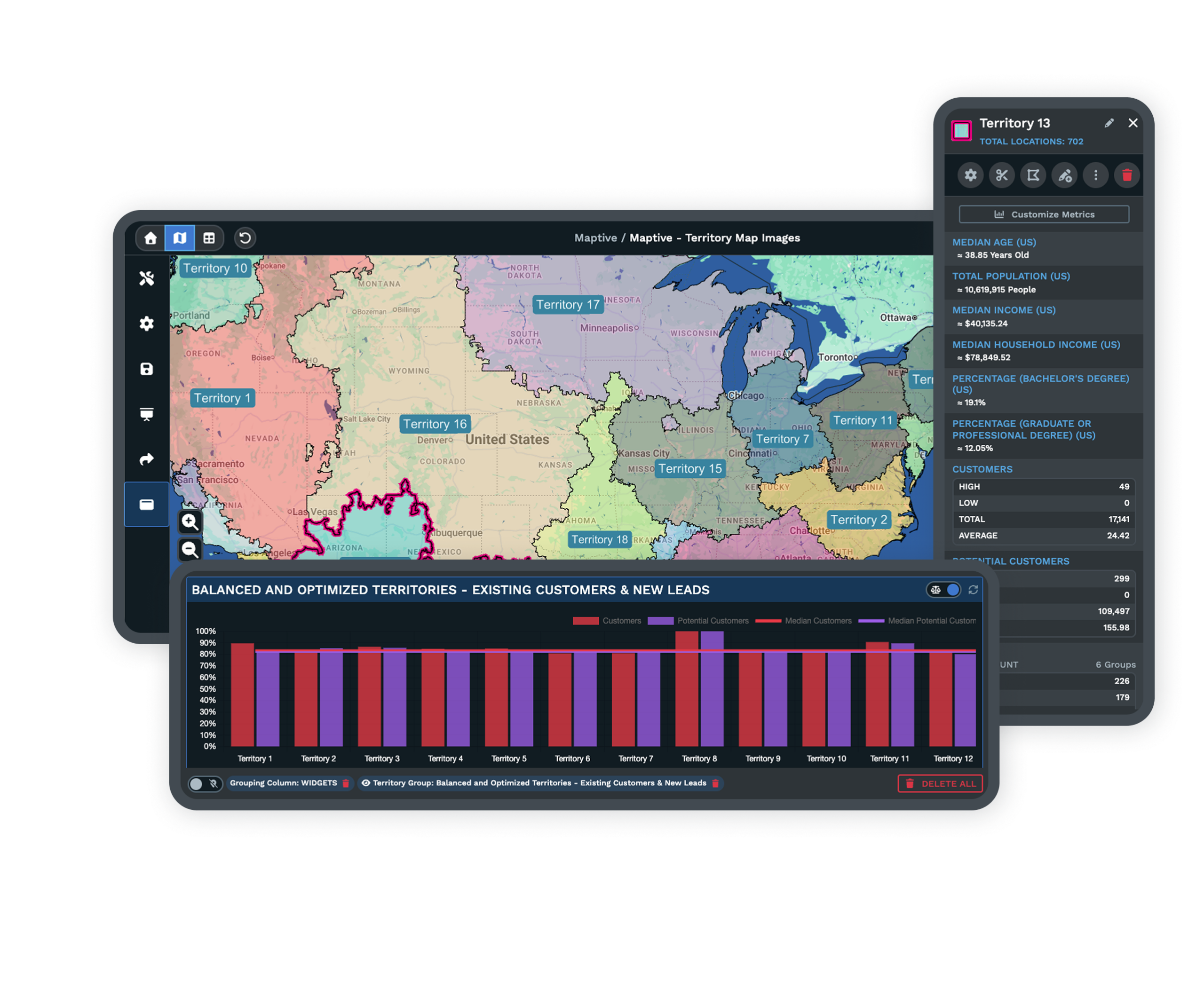
Group ZIP or postal codes and US states into a territory, then drag its edge until the line matches the area each franchisee is paying to keep. When a territory changes, you redraw the boundary and re-share it through a map link, so the map stays the working reference rather than a static file.
See the grouping tool →Enterprise Security for Your Network
The platform protects your network with 256-bit SSL encryption, two-factor authentication, single sign-on, role-based access, and audit logging, and it has passed the Salesforce AppExchange security review. You decide who can open the territory data and who can change it.
See enterprise security →Free trial with the full platform and no credit card
Set Up Your Protected Territories Free
Start a 10-day free trial with no credit card and all 60+ tools unlocked. Upload your unit list, drop a protected radius and a drive-time polygon around each franchisee, read the overlap between neighboring territories, and export the data for the agreement, all on your real footprint.
Walk Your Franchise Map With a Specialist
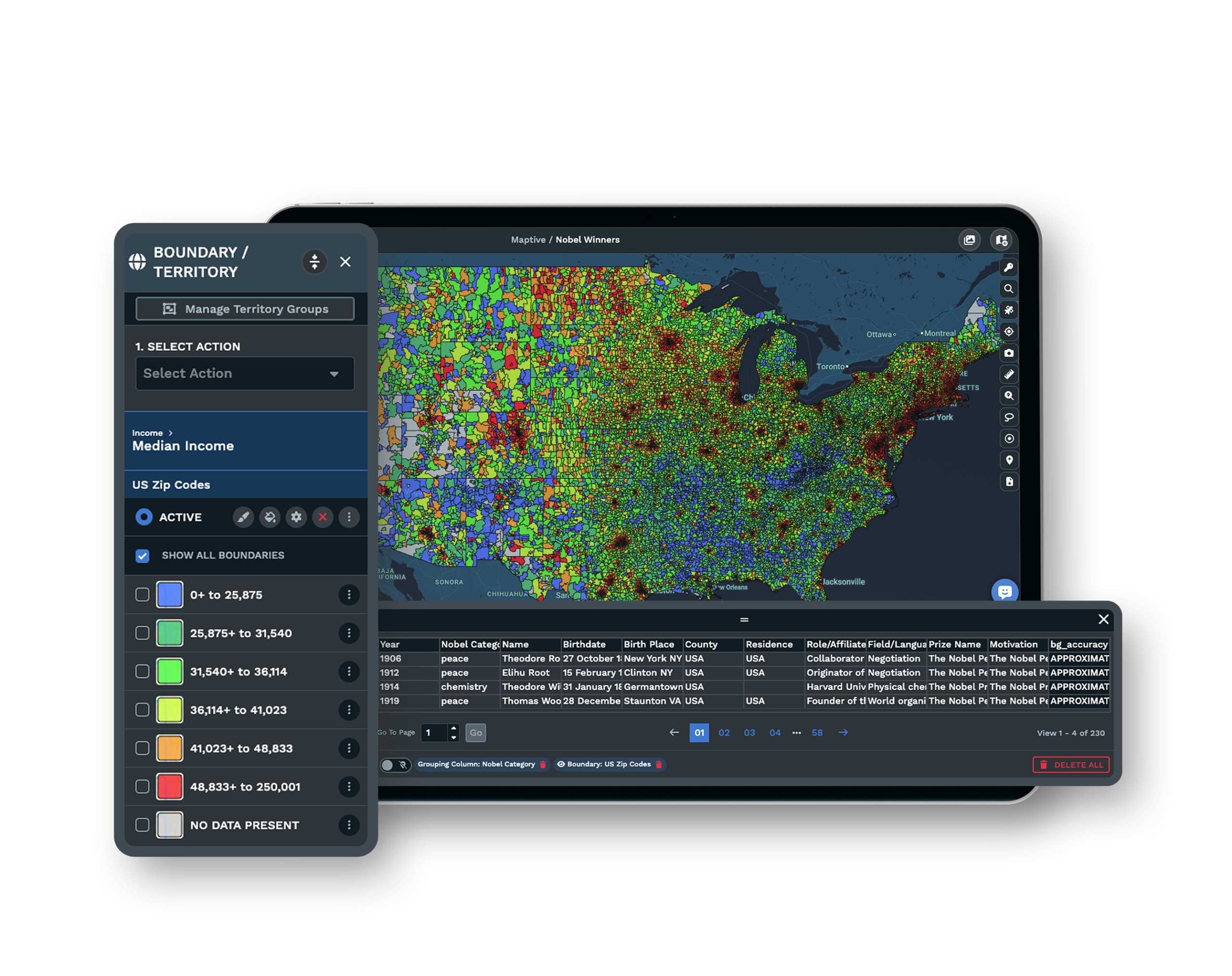
If your decision runs through a development committee or a close read of the franchise agreement, a Maptive specialist will work through your network with you. Bring the units you are worried about, and the session traces the radius, the drive-time picture, and the overlap in front of the people who approve it.
Frequently Asked Questions
How do I draw a 5-mile protected radius around each franchise?
Plot each franchisee, then drop a fixed-distance radius band set to 5 miles around the point so the circle becomes the territory boundary. You can set the mileage once, apply it to every unit at the same time, and export a clean boundary map that attaches to the franchise agreement.
Radius or drive-time for territory protection?
A radius is simpler to write into a contract and explain to a franchisee, but it ignores rivers, highways, and the road network. A drive-time polygon traces the real roads and reflects the area a customer can reach. Most systems state the contract boundary as a radius or ZIP shorthand and use drive-time analysis to decide where that boundary should sit.
What is a protected franchise territory?
A protected territory is a defined area where the franchisor agrees not to open another same-brand storefront near a location. It usually stops short of full exclusivity, since franchisors often keep the right to sell online, serve corporate or national accounts, or run an alternate brand inside the area. The protection covers nearby brick-and-mortar units, not every channel.
What is the difference between an exclusive territory and a protected territory?
An exclusive territory means the franchisor promises no company-owned or franchised same-brand outlet inside the area at all. A protected territory blocks nearby storefronts but commonly reserves online, corporate, and alternate-channel rights to the franchisor. Many real agreements are a hybrid, exclusive for storefronts and reserved for e-commerce, so the wording in the agreement matters more than the label.
What is Item 12 of the FDD?
Item 12 of the Franchise Disclosure Document is the territory section. It states if you receive a specific area, if that area is exclusive, protected, or non-exclusive, how the boundary is defined, and the method used to draw it. Even an undefined territory has to state a minimum size, often as a radius, a ZIP list, or a population figure.
Can a franchisor open a new location near mine?
It depends on the agreement. If the territory is non-exclusive, the franchisor may be permitted to, but US courts have let franchisees sue under the implied covenant of good faith and fair dealing when a new unit is planted unreasonably close. The El Pollo Loco and Vylene cases are well-known examples where that claim held.
How do I protect my franchisees from territory overlap?
Map every existing and proposed unit, measure how much their trade areas overlap, and hold a buffer between boundaries. When two territories share more than roughly 20 to 25 percent of their drive-time polygons, revenue transfer is nearly certain, so operators commonly leave a half-mile to one-mile neutral zone. Running that check before approval keeps owners from competing with each other.
Should I check for territory overlap before signing a lease?
Yes. Overlap and cannibalization analysis belongs before the lease is signed, not after same-store sales start dropping. Checking first lets you estimate the revenue impact on existing units and weigh it against the cost of the new one, while you can still pick a different site.
How are franchise territories defined in Canada?
Canadian territories are commonly built from Forward Sortation Areas, the first three characters of a postal code such as M5V. They serve the same role that ZIP-code bundles do in the US for franchise zones and service areas. You group and color them into territories the same way, so a cross-border network plans on one map.








