


Map Multiple Locations at Once
Upload your data or spreadsheet to map multiple locations on an interactive map. Color the pins by any column, draw areas around them, manage territories, and route between them from one workspace.
No credit card required
- Plot up to 200,000 locations
- Import from Excel, CSV, or Sheets
- Color-code pins by any column
- Radius & drive-time areas
- Optimize routes with multiple stops
- Share, embed, or export the map
- Plot up to 200,000 locations
- Import from Excel, CSV, or Sheets
- Color-code pins by any column
- Radius & drive-time areas
- Optimize routes with multiple stops
- Share, embed, or export the map
Trusted by teams at
















What Our Customers Say About Us
See what others have to say about Maptive.
What One Map of Every Location Gives You
Plot an address list of almost any size without splitting it into batches or across separate maps.
Group, filter, heat map, route across multiple stops, and build territories from the same plotted list.
Read income, age, density, and household detail underneath every location you have mapped.
From a List of Addresses to a Working Map
Five steps take a raw address list and turn it into something a team can act on.
| 01 | Upload the List You Already KeepPaste addresses in, or import an Excel file, a CSV, or a Google Sheet. Maptive geocodes each row and drops a pin, and the map and the spreadsheet sit side by side so you can trace any pin back to its record. Latitude and longitude columns plot directly if your data already carries them. |
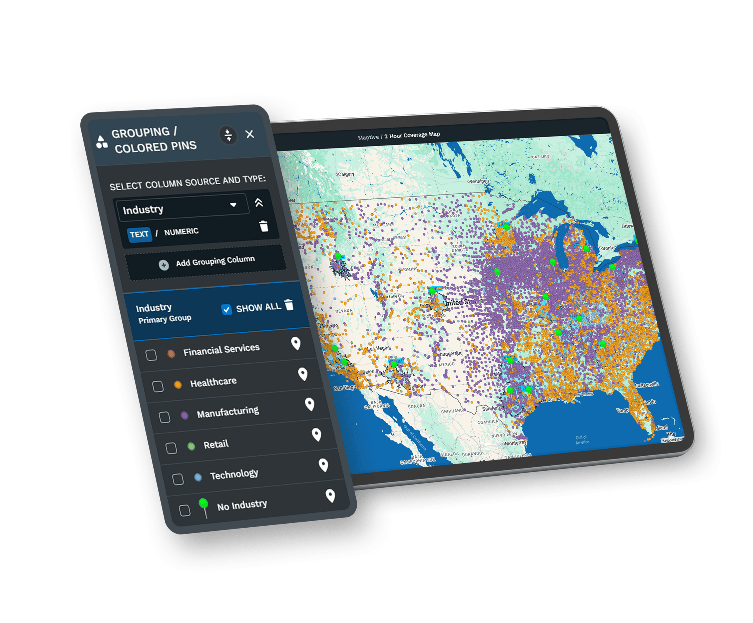
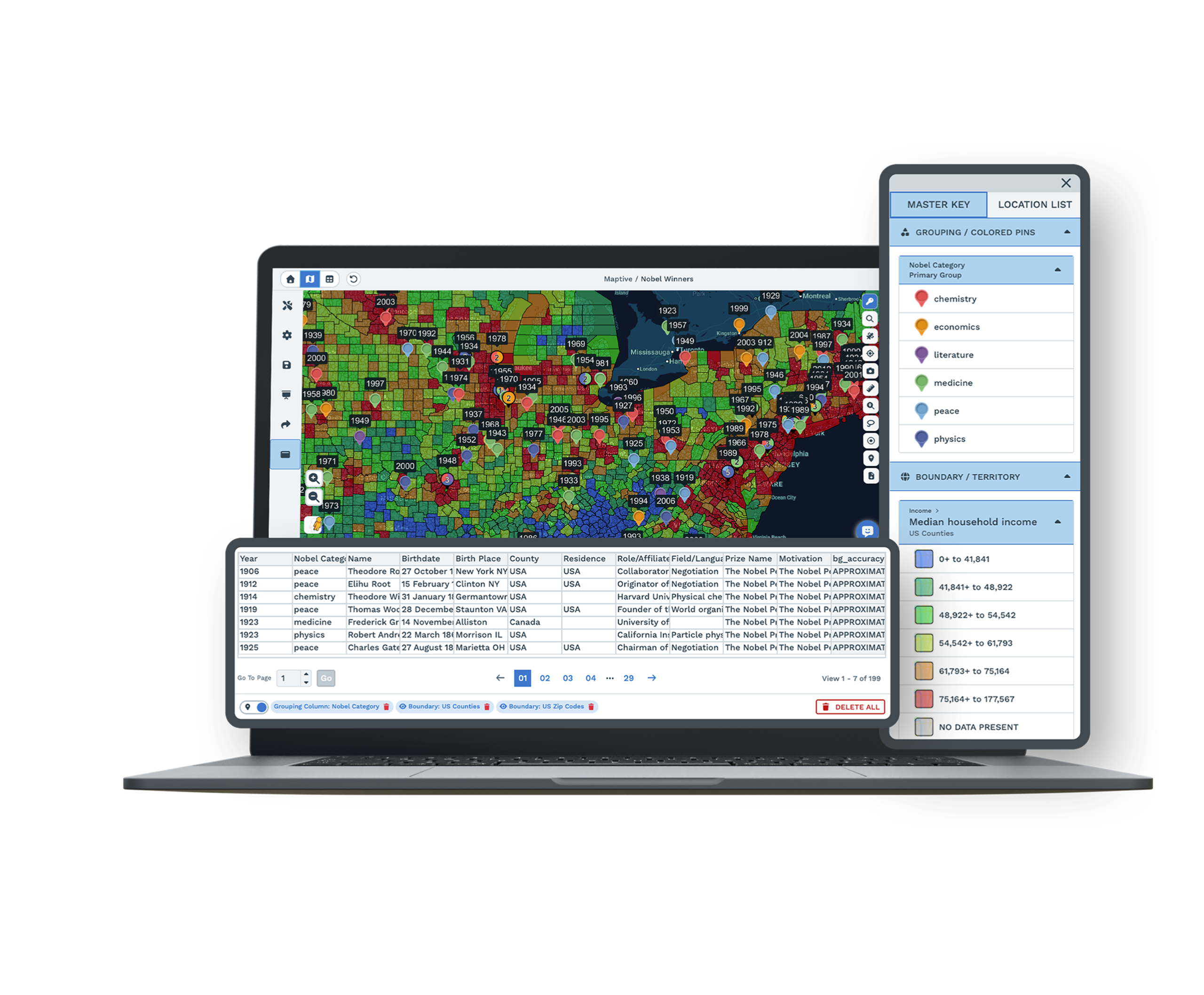
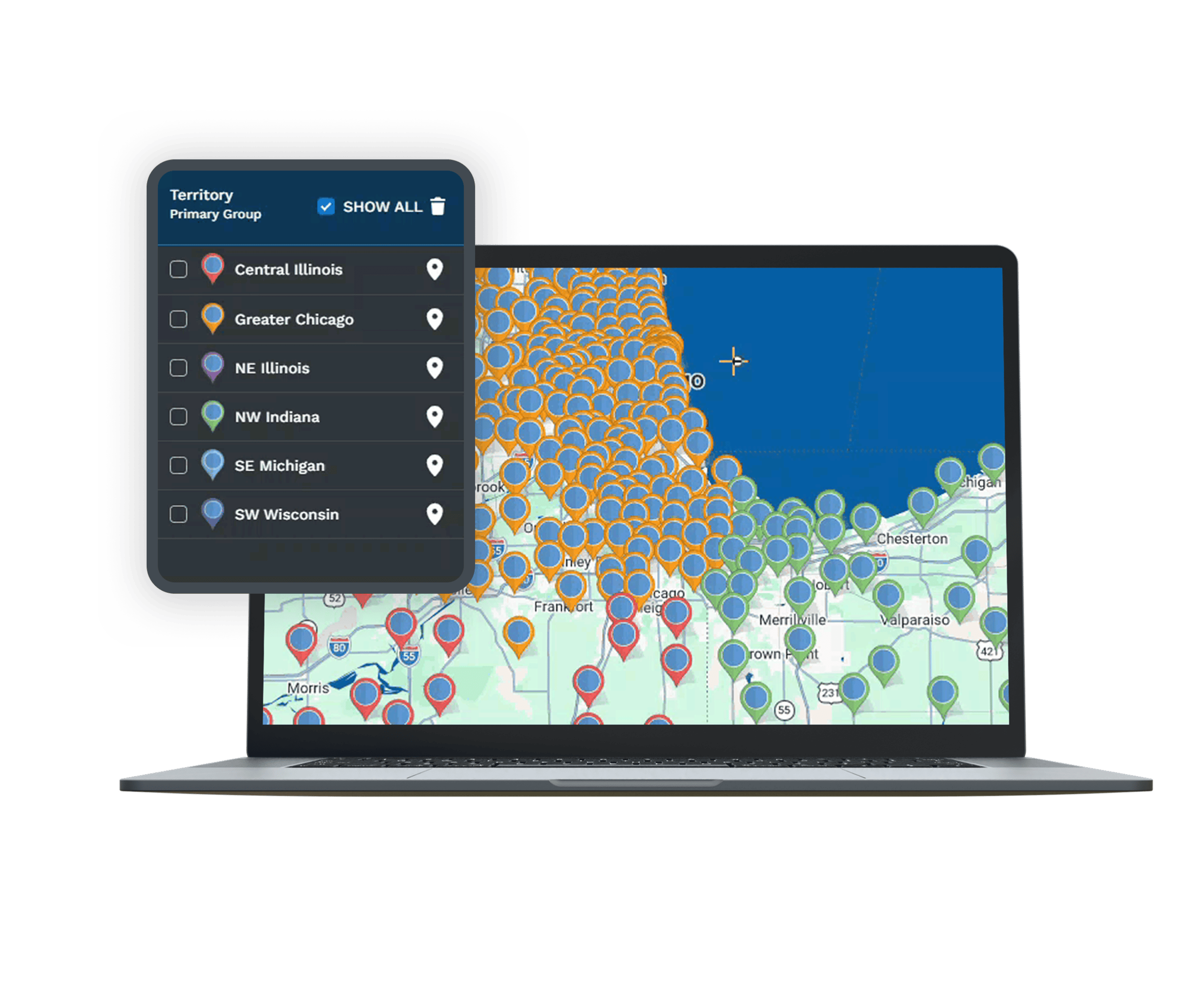
| 02 | Color and Group the Pins by Any ColumnPick a column such as status, region, rep, revenue band, or store type, and every marker takes a color from it. A legend lets you toggle one group on or off, so a map of 5,000 mixed records becomes a map of the 400 that matter right now. |
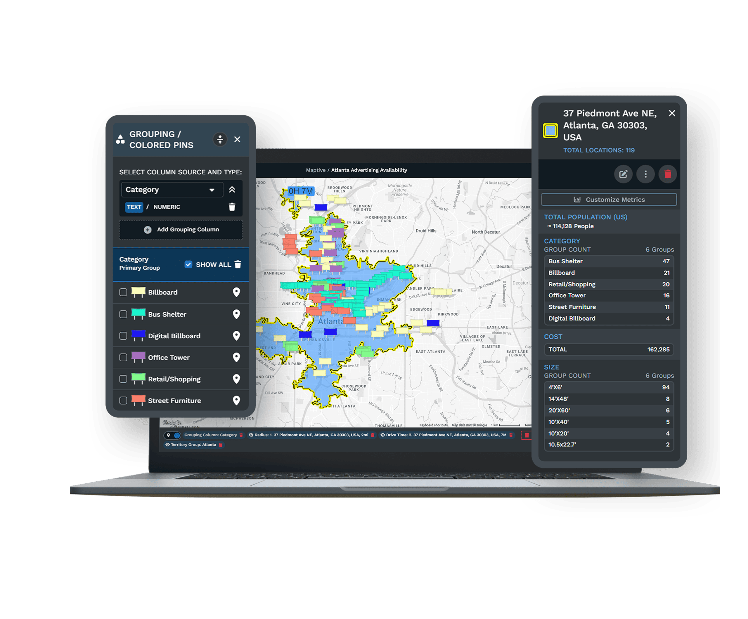
| 03 | Draw Areas Around Any LocationAdd radius rings, drive-time polygons, or ZIP and county boundaries around one location or all of them. The count of records inside an area updates as you drag the boundary, so coverage gaps and doubled-up zones show themselves. |
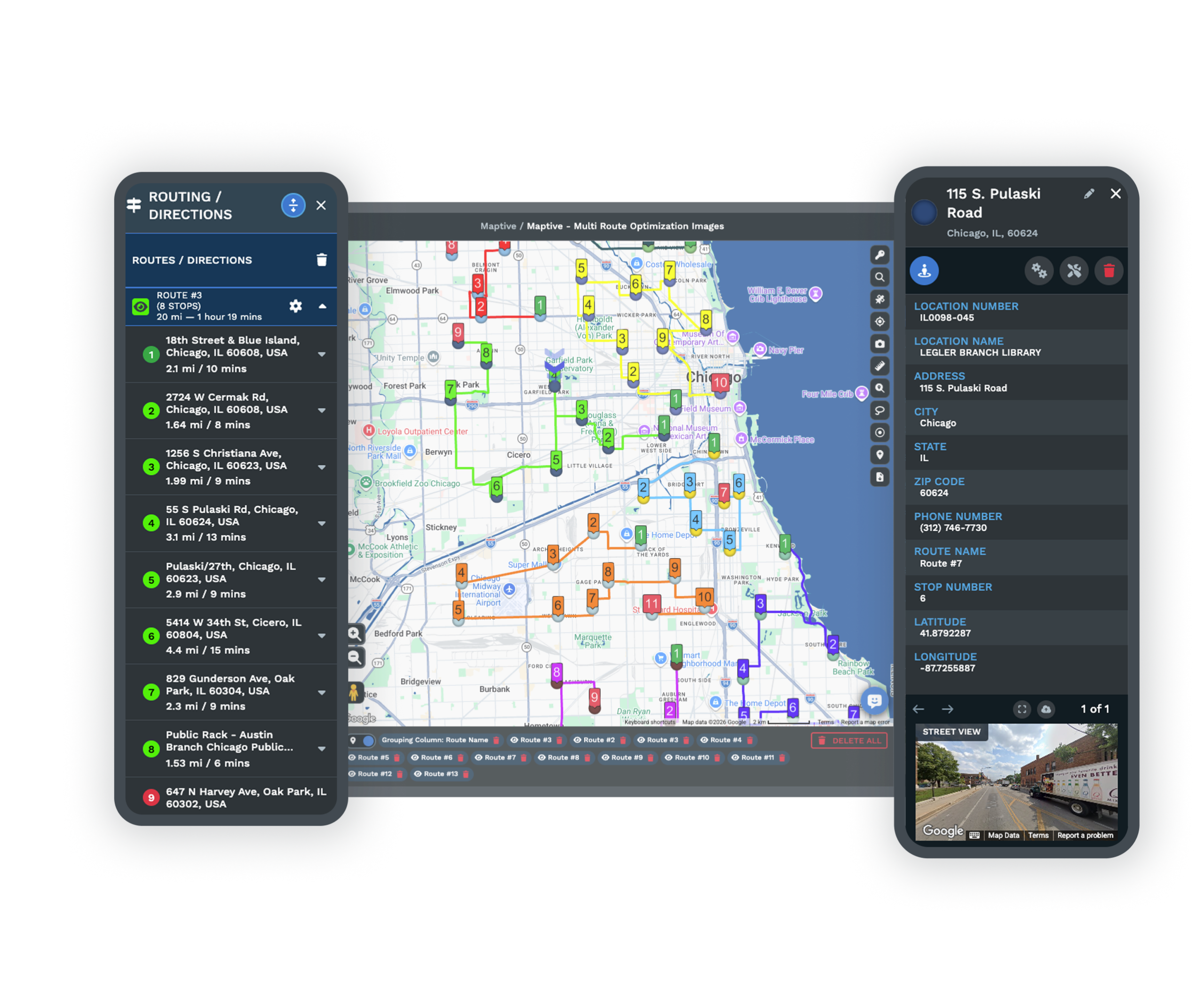
| 04 | Route Between the StopsSelect a set of pins with the lasso, then optimize the order into the shortest drive across multiple stops. Turn-by-turn directions export to a phone, and the distance matrix measures point-to-point drives across the whole list at once. |
| 05 | Share the Map Instead of the FileSend a view-only link, embed the map on a page, or export the data back to XLS, CSV, or TSV. Password protection and role-based permissions control who opens the map and which tools they can reach once inside it. |
When a Free Map Stops Being Enough
The Ceilings You Hit Without a Warning
Google My Maps handles a short address list well, and it is a reasonable free starting point. The trouble is that its limits arrive without an error message. Google documents a 2,000-row import cap, and an import of 5,000 rows still reports success while leaving 3,000 locations off the map. Performance starts to drag near 500 markers, a map holds 10 layers and 10,000 places at the outside, and standard directions stop at 10 stops. Our walkthrough of how to map multiple locations on Google Maps covers each of those walls and where they land.
Maptive plots the same list past 200,000 markers on one map, with clustering that keeps panning quick and a record count you can check against your file.
Pins Are the Starting Point, Not the Answer
Plotting the list answers where everything sits. The questions that follow are harder. Which clusters carry the most value, how coverage should be split across a team, which areas nobody reaches, and what a route through them costs in hours. Answering any of those takes counting and weighting rather than another pin.
A heat map weighted by a numeric column shows where value concentrates instead of where records are dense. Census overlays put income, age, and household data underneath each area. The marker grouping tool sorts thousands of pins into readable segments in a click, and filters narrow the view to one product line, one rep, or one status band. The same list that used to sit in a spreadsheet of locations starts producing decisions.
Built for Lists That Keep Growing
Teams Mapping at Every Scale
Coca-Cola, Hilton, Frito-Lay, CBRE, Bridgestone, and Chobani run location work on Maptive. A 60-account list and a 200,000-record dataset use the same tools, so the map you build in your first week still works when the list has multiplied.
Security for Shared Location Data
256-bit SSL encryption, two-factor authentication, single sign-on, role-based access, and audit logging protect your address data, and the platform has passed the Salesforce AppExchange security review. Uptime runs at 99.9%, and rendering holds at 200,000 markers.
Help With the Messy First Upload
The US and Canada support team answers in under 15 minutes and rates 9.7 out of 10. White-glove onboarding covers data cleaning, geocoding checks, and map setup, which matters most on a first import where the address formatting is inconsistent.
Free trial, full platform, no credit card
Put Every Location on One Map
Upload your address list and see the whole set plotted, grouped, and ready to route in a single session.
See Your Own List on the Map
For teams weighing tools or moving off a free map, a Maptive specialist runs the session on your own address file. Bring the list that has outgrown its current tool, along with the questions you have not been able to answer from it, and the demonstration works through your data rather than a sample map.
Frequently Asked Questions
How do I map multiple locations at once?
You upload a list rather than adding pins one at a time. In Maptive you paste addresses in or import an Excel file, CSV, or Google Sheet, and the platform geocodes every row and plots it on one map. Latitude and longitude columns plot directly if your file has them. From there you color the pins by a data column, draw areas around them, and route between them, all without adding a location by hand.
How many locations can I plot on one map?
Maptive renders up to 200,000 markers on a single map, with clustering that keeps the map responsive as you pan and zoom. Free consumer tools sit far below that. Google My Maps documents a 2,000-row import limit and a 10,000-place cap per map, and performance often drags near 500 markers. If your list runs to tens of thousands of records, the size of the file stops being the thing you plan around.
Can I map multiple addresses from an Excel spreadsheet?
Yes. Excel, CSV, TSV, and Google Sheets all import directly. Put your headers in the first row and split the address across Street, City, State, and ZIP columns where you can, since split fields geocode more accurately than one long string. Any other columns you bring, such as revenue, status, or owner, become the fields you group, filter, and color the map by once the locations are plotted.
What is the difference between mapping multiple locations in Google Maps and in Maptive?
Google My Maps plots a small list for free and stops there. It cannot count how many of your records fall inside a drawn shape, weight a heat map by a sales column, add census data, or build balanced territories, and its row and performance limits arrive with no warning. Maptive is built for the analysis that follows the pins, so the map answers questions about coverage, value, and routes rather than only showing where things are.
Can I color-code the locations by category?
Yes. Choose any column in your data, such as status, region, product line, or store type, and every marker takes its color from that field. A legend appears with the map, and toggling a group hides or isolates it. You can also size markers by a numeric column with bubble maps, upload your own branded pin icons, and stack a second grouping underneath the first.
Can I plan a route between multiple locations?
Yes. Select the stops on the map and route optimization orders them into the shortest drive across multiple stops, well past the 10-stop ceiling in standard Google Maps directions. Turn-by-turn directions export to a phone for the field, and the distance matrix calculator measures drives between many points at once when you need the numbers rather than the route.
Do my locations stay private?
Your data stays yours. Maptive protects it with 256-bit SSL encryption, two-factor authentication, single sign-on, role-based access, and audit logging, and the platform has passed the Salesforce AppExchange security review. When you share a map, you control what the viewer sees through a view-only link, a password, and permissions that limit which tools and menus are available to them.
Do I need GIS experience to map multiple locations?
No. Maptive is built for sales, operations, and marketing teams rather than GIS analysts. You upload a spreadsheet, the platform geocodes it, and grouping, filtering, radius, drive-time, and routing tools work through a plain interface. Onboarding from the US and Canada support team covers data cleaning and map setup, so a first import with inconsistent address formatting is not something you sort out alone.








