


Mapping Software for Neighborhood Canvassing
Which doors should your volunteers knock tomorrow? If your list includes addresses, Maptive can turn it into turf, walk lists and routes instead of a spreadsheet nobody reads. You can cut your first turf inside the free trial.
No credit card required
Trusted by teams at
















Canvassing Maps Built for Door-to-Door Work
An address list becomes turf your volunteers can work. Cut the territory on the map, then send each volunteer a link. It opens on any phone with no account and no app to install. Change something once and everyone holding the link sees it.
Build Walk Lists From the Map
Your address list uploads as a spreadsheet, and geocoding fixes incomplete addresses on upload. Select a group of doors with the lasso, and the selection exports as a walk list.
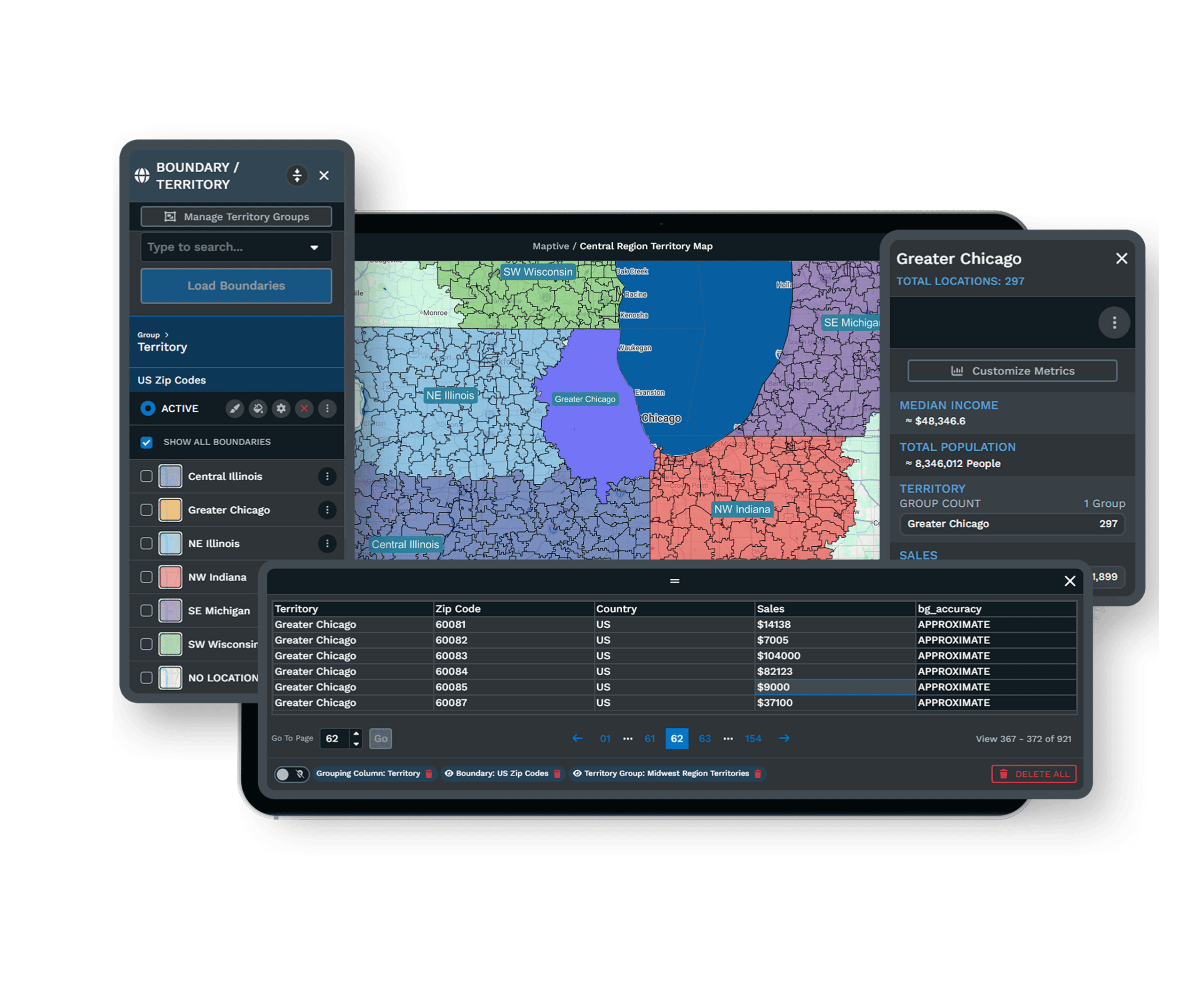
Cut Turf That Balances the Work
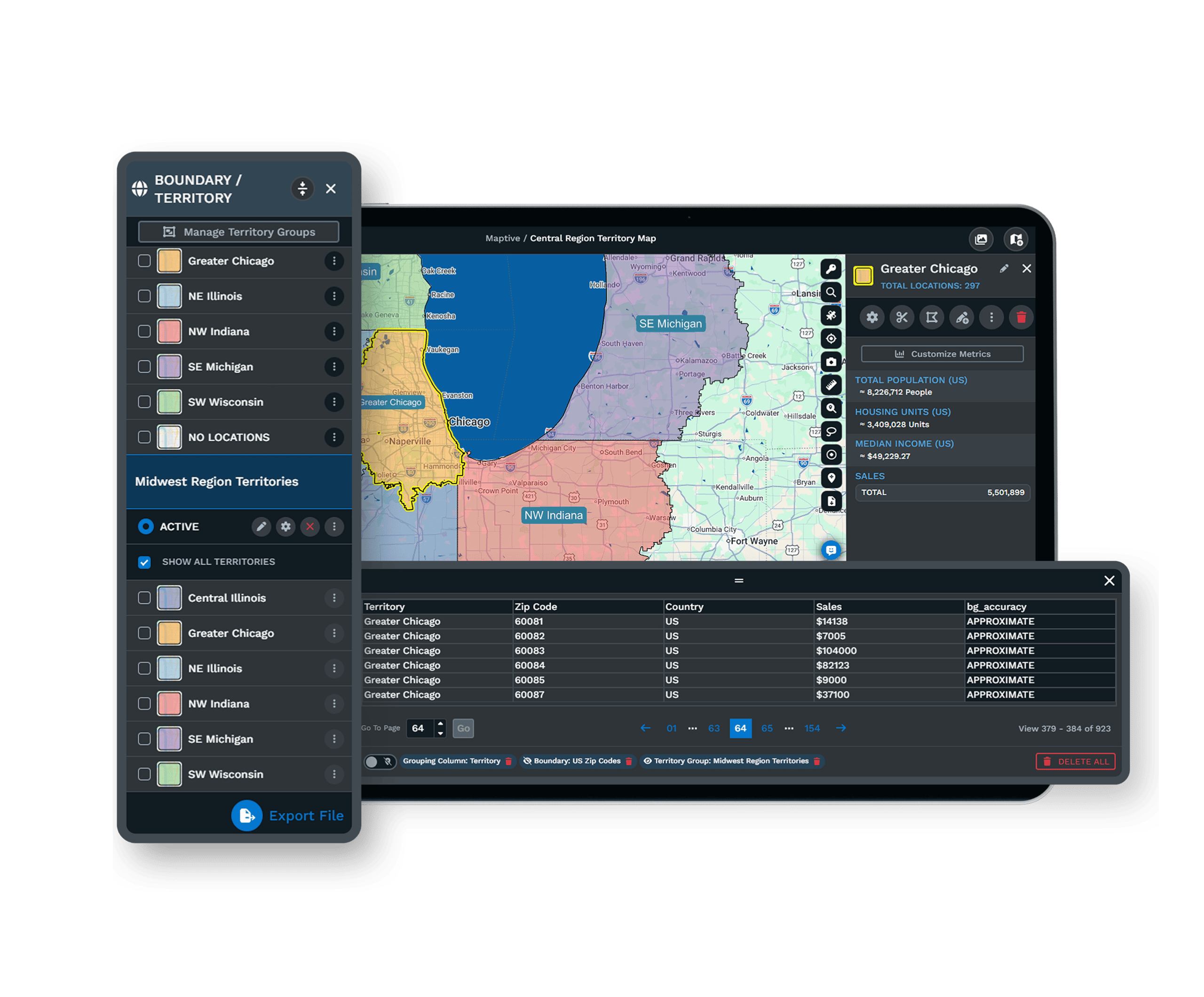
Draw turf freehand or build it from ZIP codes and counties, and totals recalculate as boundaries move. If one patch outweighs the rest, drag the boundary until the counts even out.
Read Each Neighborhood Before You Knock
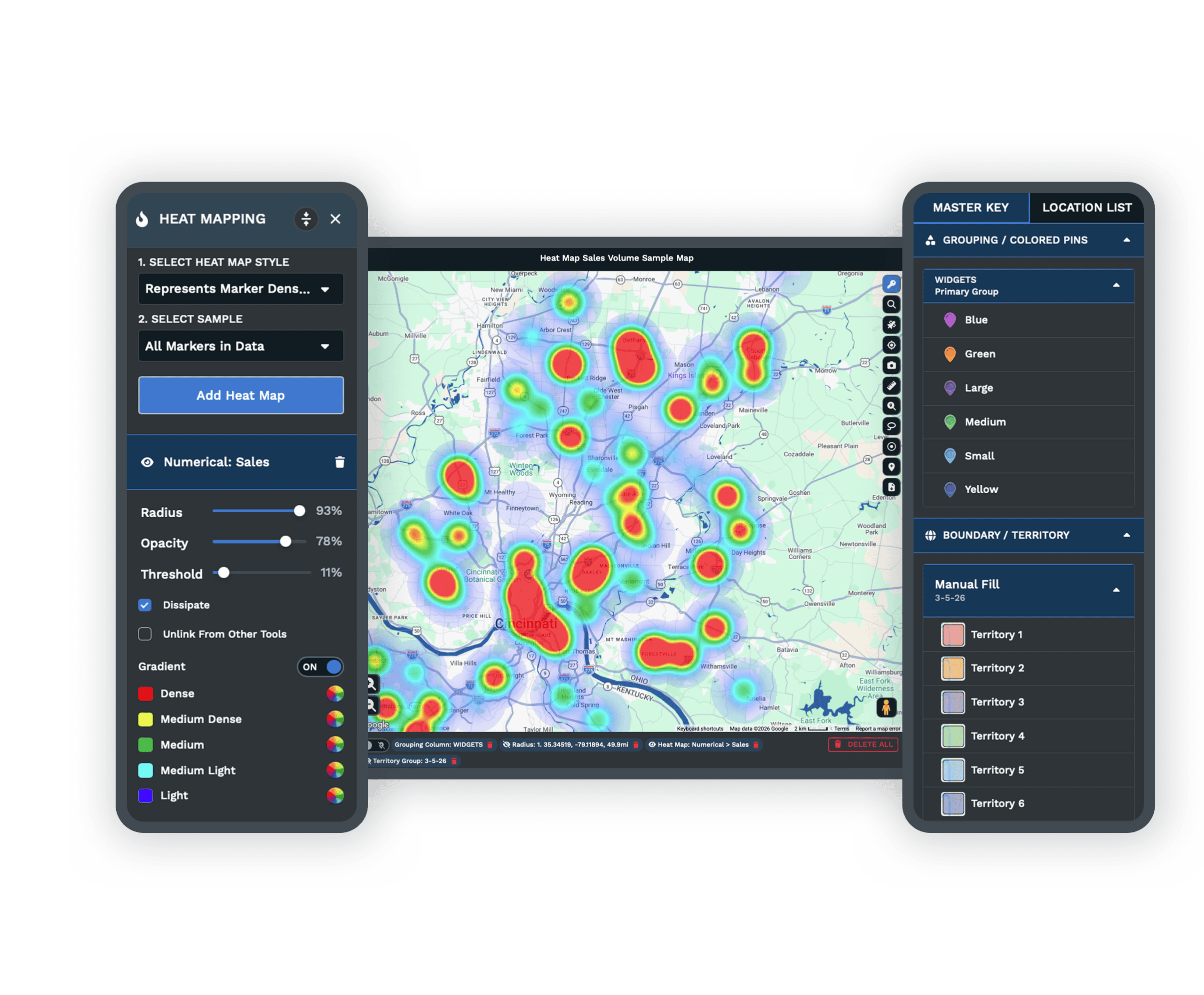
Over 50 Census variables, down to tract and block-group level, layer under your address list. A neighborhood's population and income mix shows before the first door is assigned.
Send Routes to Volunteers' Phones
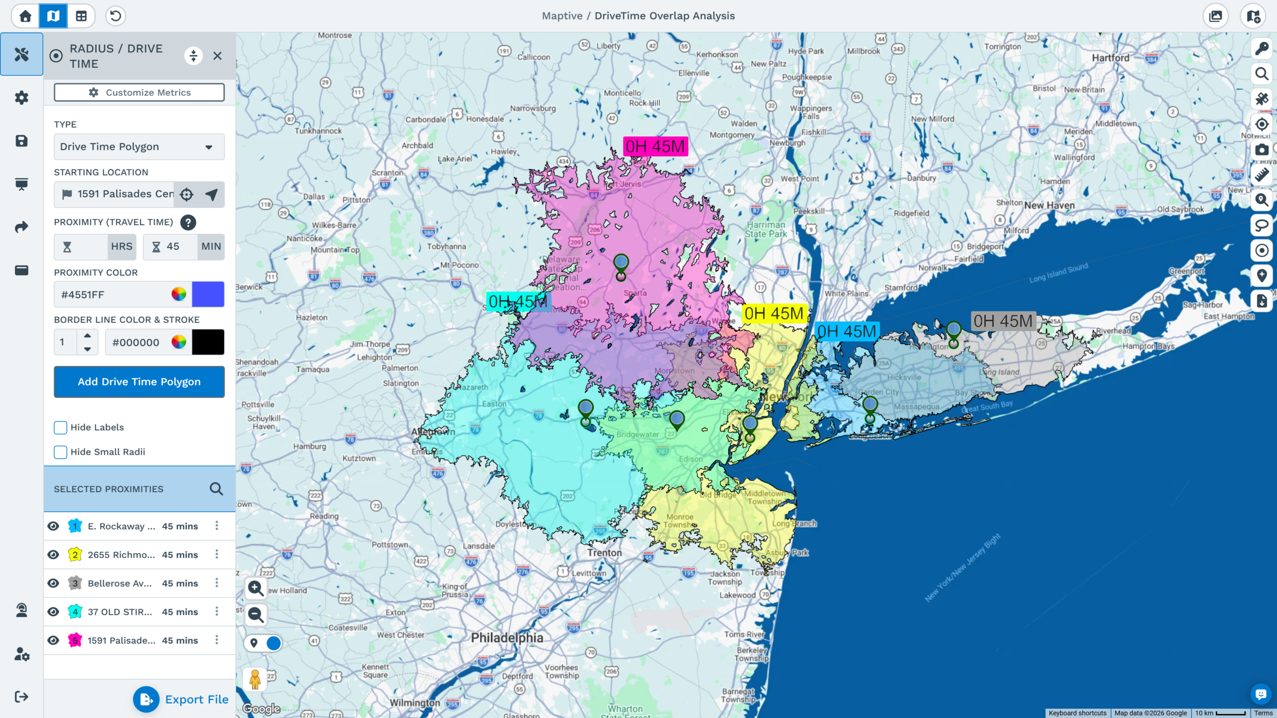
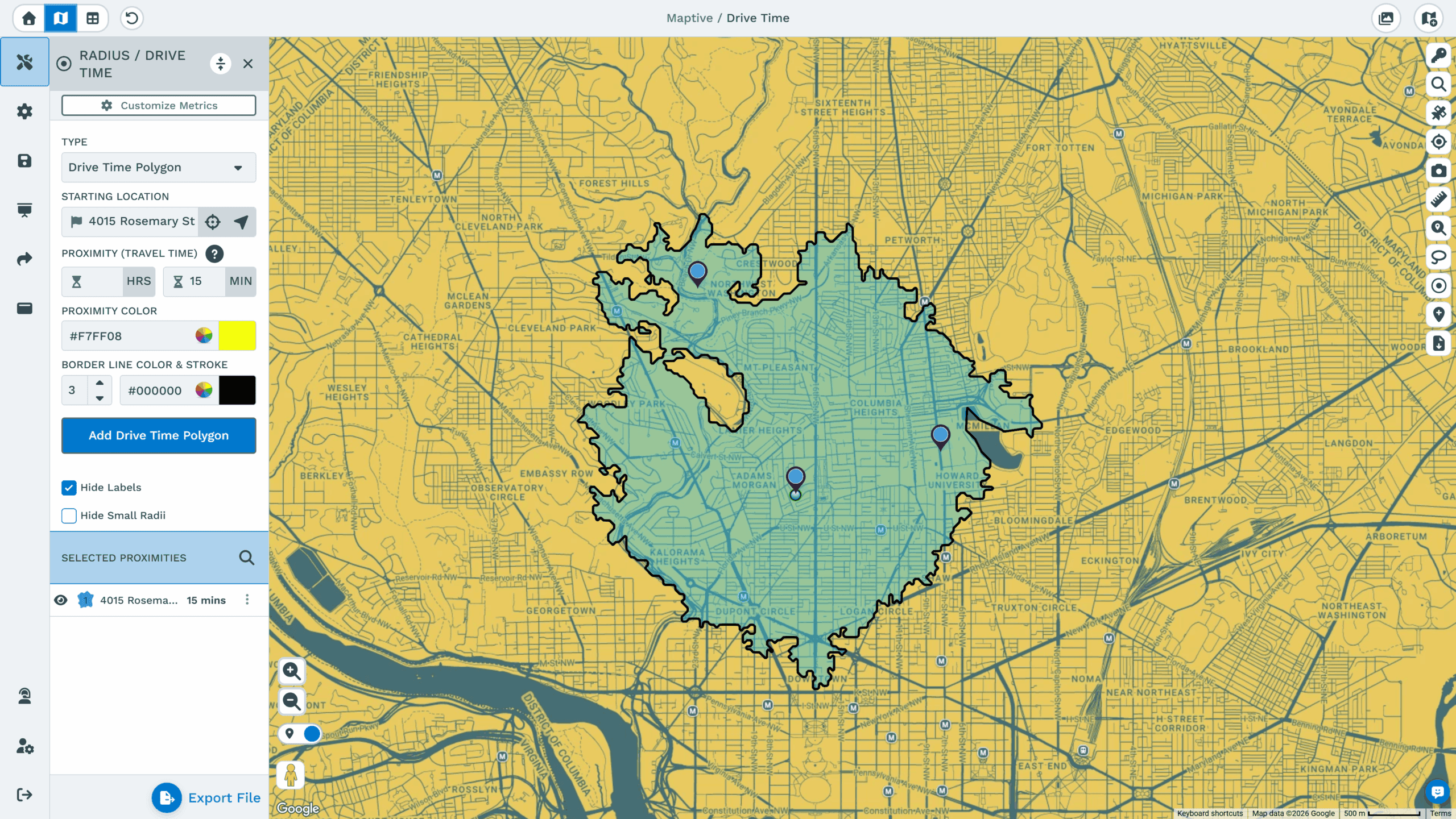
Route optimization orders the day's doors along the roads and sends turn-by-turn directions to a phone. Volunteers walk the route on their phones with nothing printed or installed.
Cut New Turf as Often as You Need
One uploaded list carries the whole canvass day. Routes, layered days and staging lookups work from the same upload, so a new plan does not mean a re-upload.
Walk Routes by Street
Group the day's doors with the lasso or a boundary, then optimize the order along the road network itself. The route exports with directions, so the walk list and the path match.
Layered Maps for Each Canvass Day
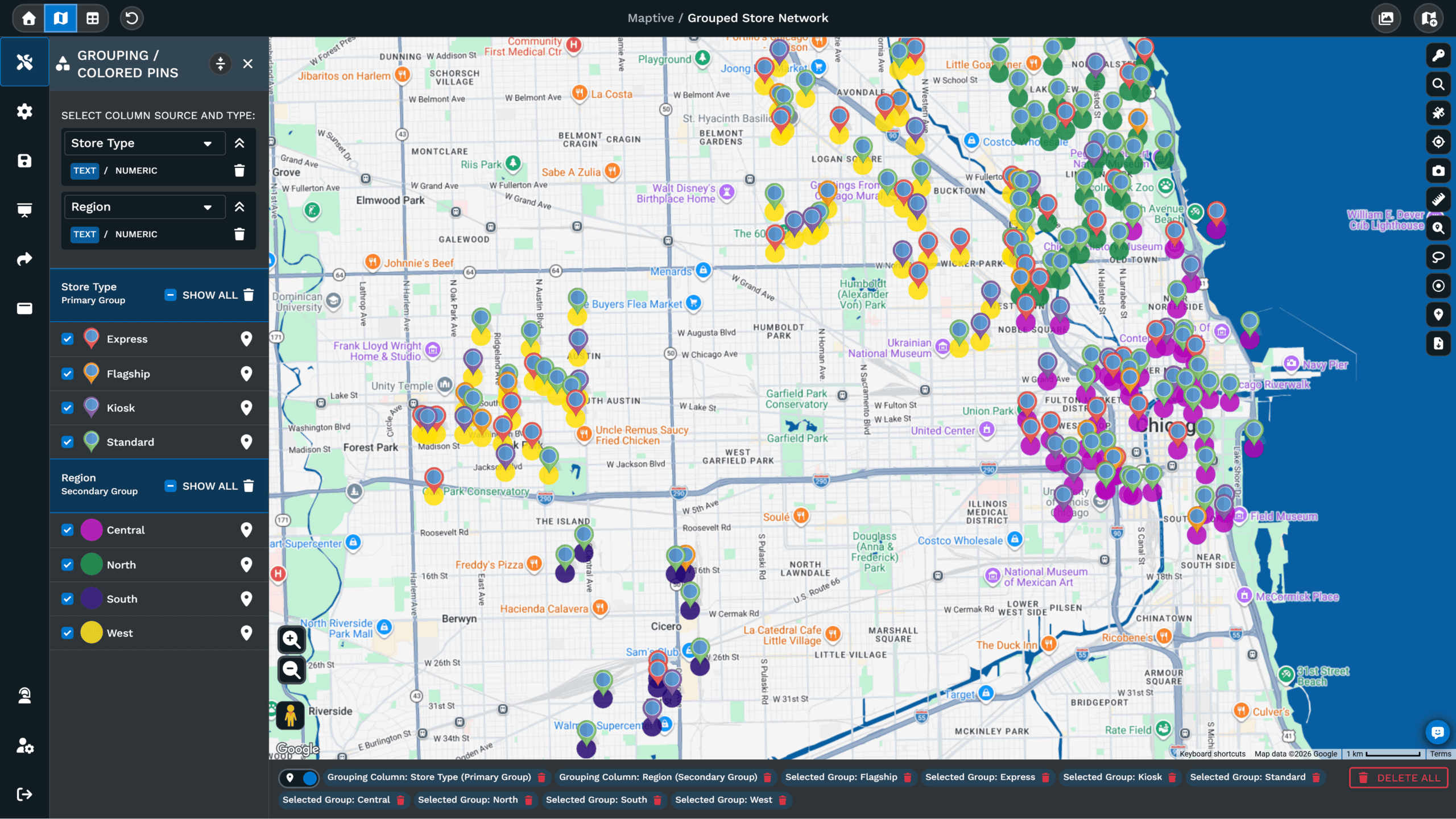
Layered maps combine several turf maps into one view, updated automatically when the base maps change. A week of canvass days can be compared without merging the underlying lists.
Location Finder for Staging Points
The location finder lists the addresses nearest a staging point or a volunteer's spot, which helps when turf gets reassigned mid-day, and the results can go into a spreadsheet.
Maps That Open on Any Phone
A shared map opens from a link without an account, so every volunteer sees the same live map. You control which tools and columns the viewers get, and a password can be required.
Volunteer Lists Stay Locked Down
Address lists carry names and contact details, and Maptive protects them with 256-bit SSL, two-factor authentication and per-user permissions. Shared maps can be password-protected, and sensitive columns stay hidden from viewers.
Opens on Any Phone From One Link
Maptive is web-based, so a volunteer's phone opens the map from a link. Most organizers build a first map within about thirty minutes, and the US and Canada support team answers in under 15 minutes when a canvass day is close.
See Your Neighborhood Canvassing Data on a Map
Upload a spreadsheet and get a working map in minutes, with every tool unlocked from the first login.
Frequently Asked Questions
What is mapping software for neighborhood canvassing?
It is software that turns an address list into turf assignments, walk lists and routes for door-to-door work. Maptive runs in the browser and builds the map from a spreadsheet, so no GIS background is involved. The platform includes more than 60 mapping and analysis tools on every plan, covering boundary drawing, heat maps, route optimization and spreadsheet exports taken directly from the map. Nothing is reserved for a higher tier, and volunteers open shared maps on their phones without an account.
How much does canvassing mapping software cost?
Maptive's 45 Day Pass is $250 for one user, which fits a single canvassing drive or a short campaign. The Pro plan is $1,250 a year or $110 a month billed monthly. The Team plan is $2,500 a year or $220 a month, and it covers five users with collaboration and a dedicated success manager. Enterprise pricing is volume-based. All 60+ tools and the census data come with every tier, so the choice is about users and data capacity rather than features.
Is there a free trial of Maptive for canvassing?
Yes. The trial lasts 10 days and asks for no credit card, with every tool unlocked from the first login. Your team evaluates the platform on its own address list rather than demo data, so the turf and routes you build during the trial match your actual ground. Upload a spreadsheet or paste from the clipboard, and a working map is ready in minutes. When the trial ends, the account expires unless you choose a plan. Support by phone, chat and email is available during the trial.
Do volunteers need to install an app?
No. A shared Maptive map opens from a link in any phone's browser, and volunteers need no account and no installation. The organizer controls what each viewer can do, from which tools appear to which data columns are visible. Routes open with turn-by-turn directions in the phone's own maps application. Because everyone views the same live map, a turf correction made once reaches every volunteer without anything being re-sent. Any phone with a browser works, iPhone or Android, and the organizer's controls apply on phones as well.
How do I turn my address list into a map?
An Excel or CSV file uploads directly, and rows can also be pasted from the clipboard or connected from a Google Sheet. Geocoding happens during the upload and reconciles what the file contains, including missing ZIP codes and inconsistent address fields. Every other column stays attached to its marker, so fields like status, priority or notes become things to color by and filter on. For a list that grows between canvass days, a connected Google Sheet refreshes the map when the sheet does.
How do I cut turf for my volunteers?
Draw turf by hand with the territory tool, or assemble it from county, ZIP or tract boundaries when the assignment should match official lines. Totals recalculate as you adjust a boundary, so balancing the load between volunteers is a matter of watching the counts. The lasso can select any group of addresses for a quick assignment. The finished turf exports to a spreadsheet, each volunteer's share can be shared as its own map link, and most organizers finish a first turf in about thirty minutes.
Can I plan walking routes for canvassers?
Yes. Select the day's doors with the lasso or a boundary, and route optimization orders the stops along the road network. Turn-by-turn directions open on a phone, so the walk follows a planned order instead of whatever order the list was in. When a volunteer finishes early or a block gets reassigned, the route can be rebuilt from the updated selection. The route and its directions also export for printing when paper is easier. Routes can be rebuilt whenever the list changes.
What demographic data can I see for a neighborhood?
Every plan includes more than 50 US Census variables at no extra cost, published at state, county, ZIP code, census-tract and block-group level, with Canadian data included as well. The variables cover population density, household income and age, among other measures, and they appear underneath your own list. That pairing lets an organizer read a neighborhood's profile before assigning doors, rather than discovering it street by street. It is included on every plan, with nothing extra to buy. A heat map of the same data adds one more read.
Is my address list secure in Maptive?
Maptive encrypts data with 256-bit SSL in transit and at rest, and access controls include two-factor authentication and single sign-on, with role-based permissions set per user, so a viewer can be given one map and nothing else. Sensitive columns, such as phone numbers or notes, can be hidden from everyone you share with. Audit logging records what was accessed and by whom, and uptime across 2025 was 99.9%. The platform passed the Salesforce AppExchange security review, and regional data-storage options are available.
How many addresses can fit on one canvassing map?
One map can show over 200,000 markers, and a data set can include up to 100,000 locations on the Pro and Team plans, or 50,000 on the 45 Day Pass. Enterprise capacity is volume-based for larger holdings. Every marker has the columns that came with it, so filtering and turf totals work at full volume rather than on a sample. For very large lists, the filter tool is the practical way to work, since one turf can be isolated and shared on its own.








