Mapping Software for Every Location Challenge
Maptive gives every team that thinks in locations 60+ spatial tools, demographic data, territories, and routing on a single map, all from one upload of your data.
No credit card required
Trusted by teams at


How Teams Use Maptive Across Industries
The questions change from one industry to the next, but the platform stays the same. Pick the workflow that fits your team.
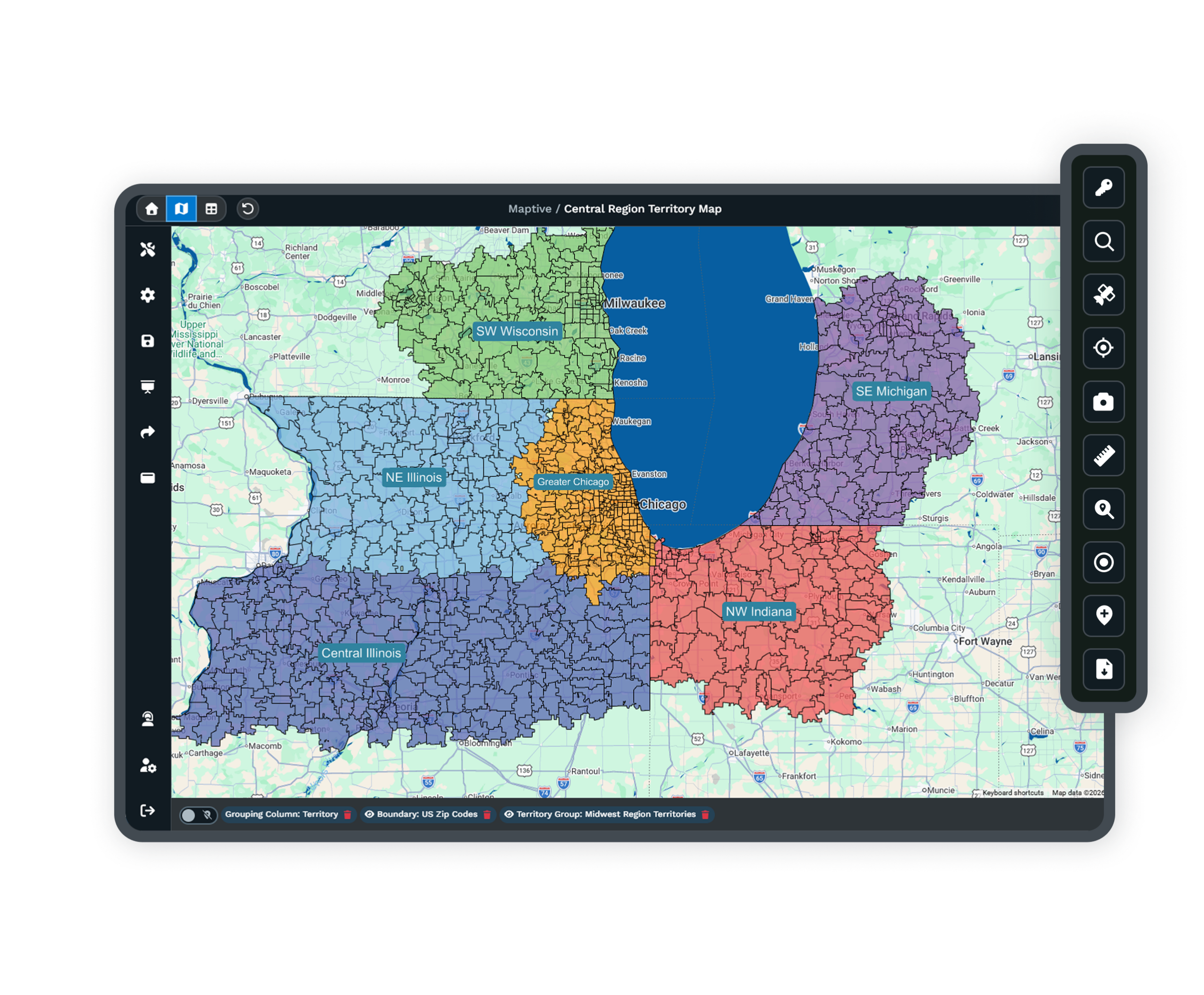
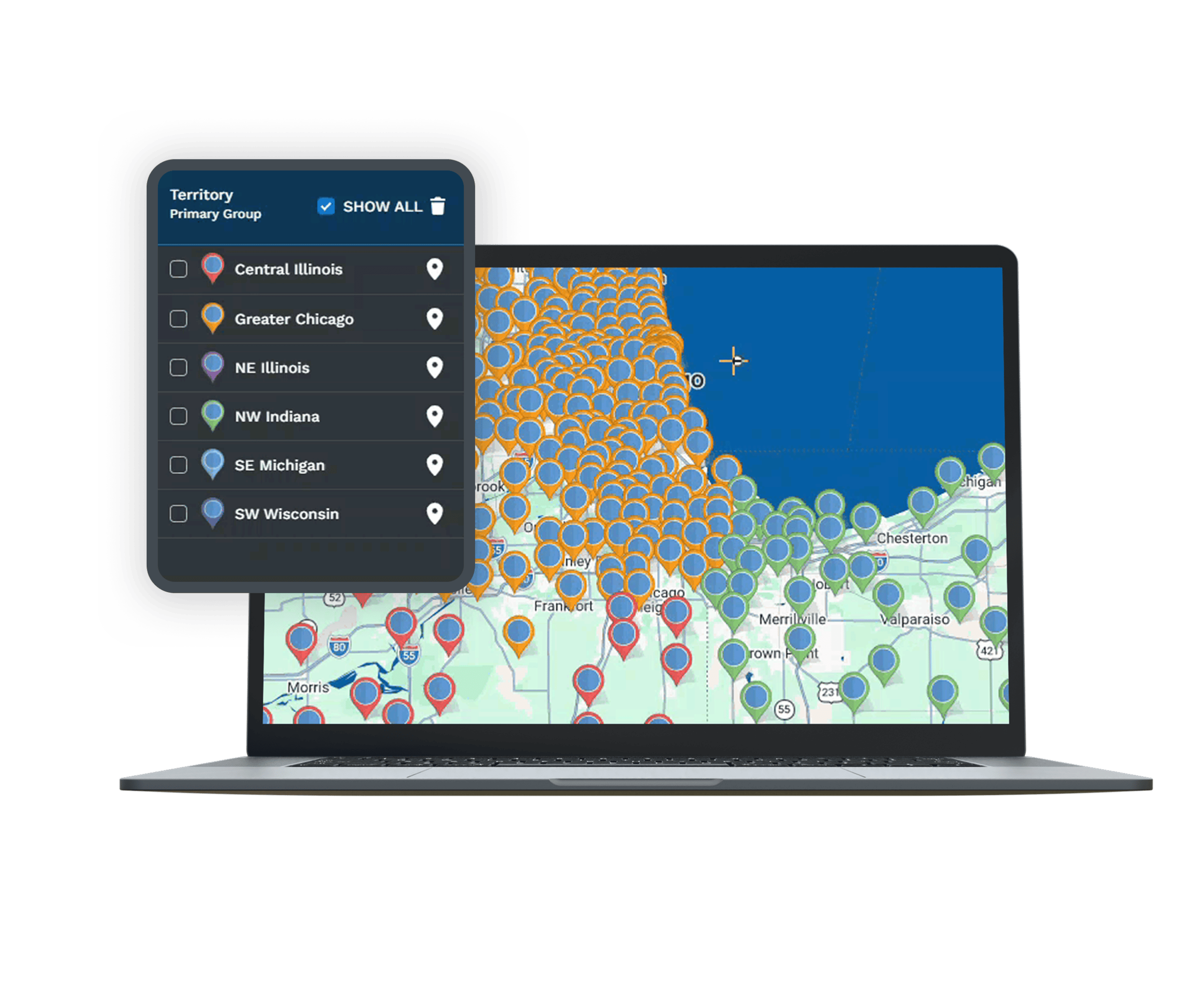
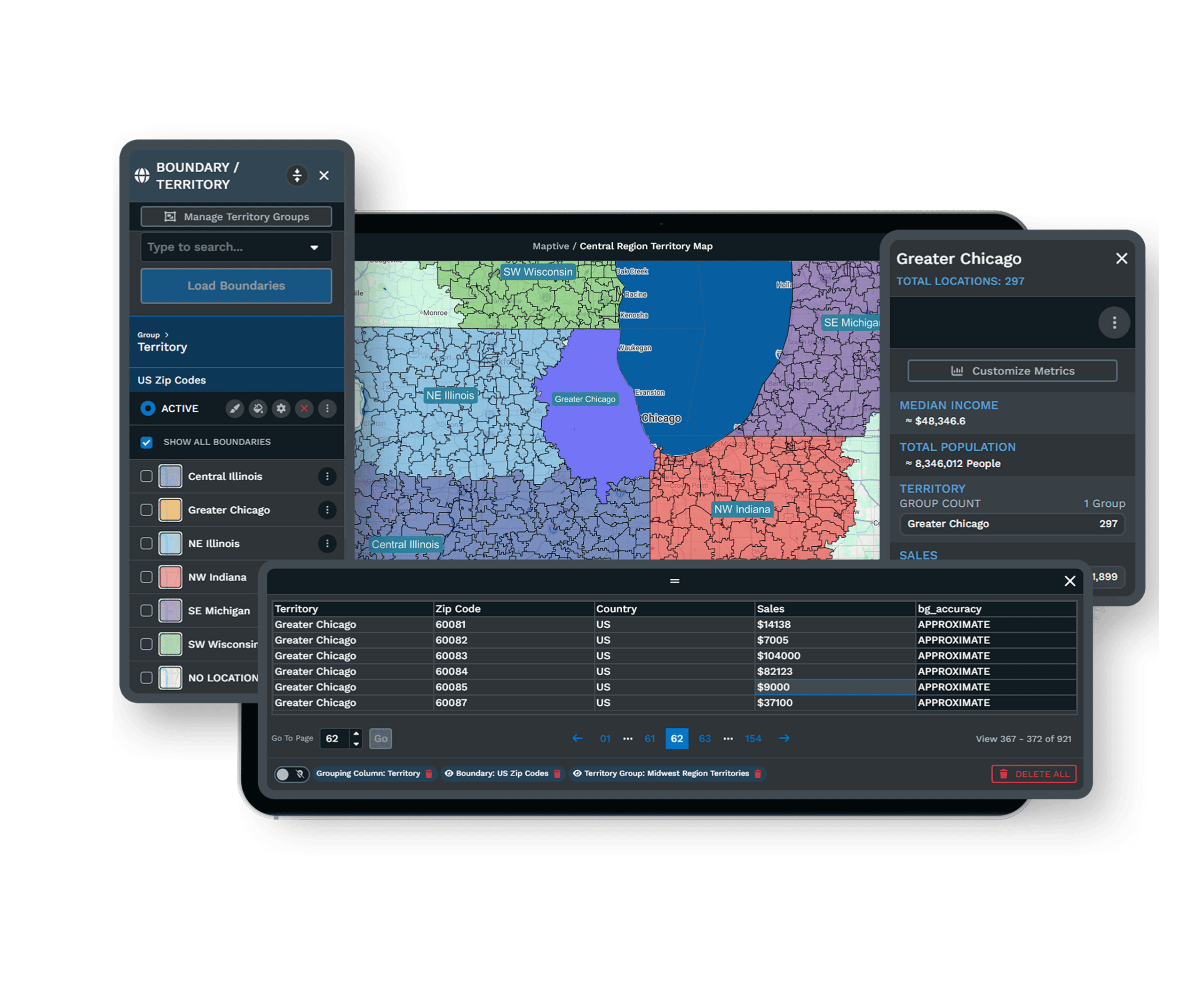
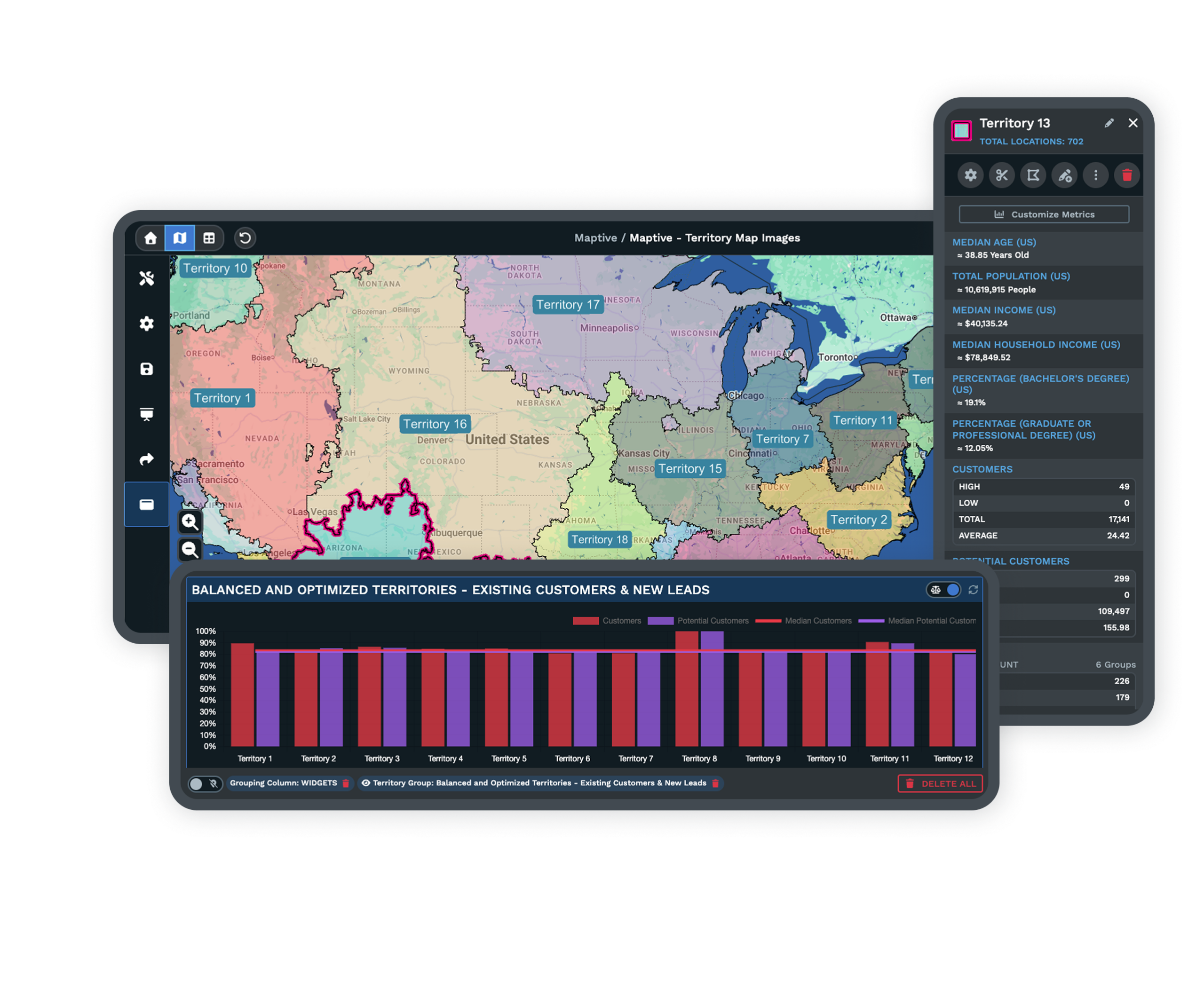
Territory Management
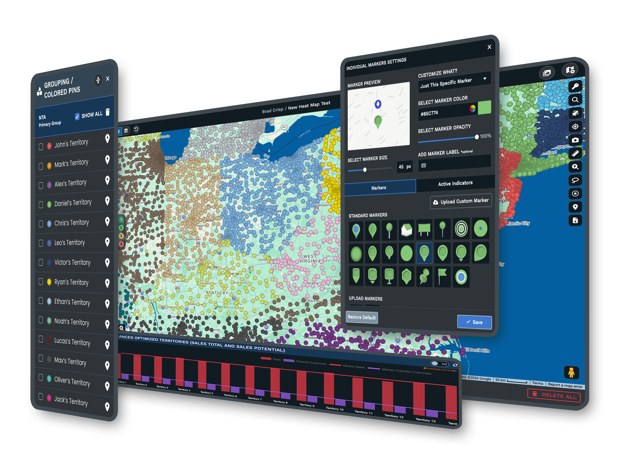
Maptive builds balanced sales territories from rep locations, account density, and drive-time limits in a single session, turning a week of spreadsheet work into an afternoon with data behind every boundary. Automated balancing keeps the plan current as reps, quotas, and headcount change.
Location Intelligence
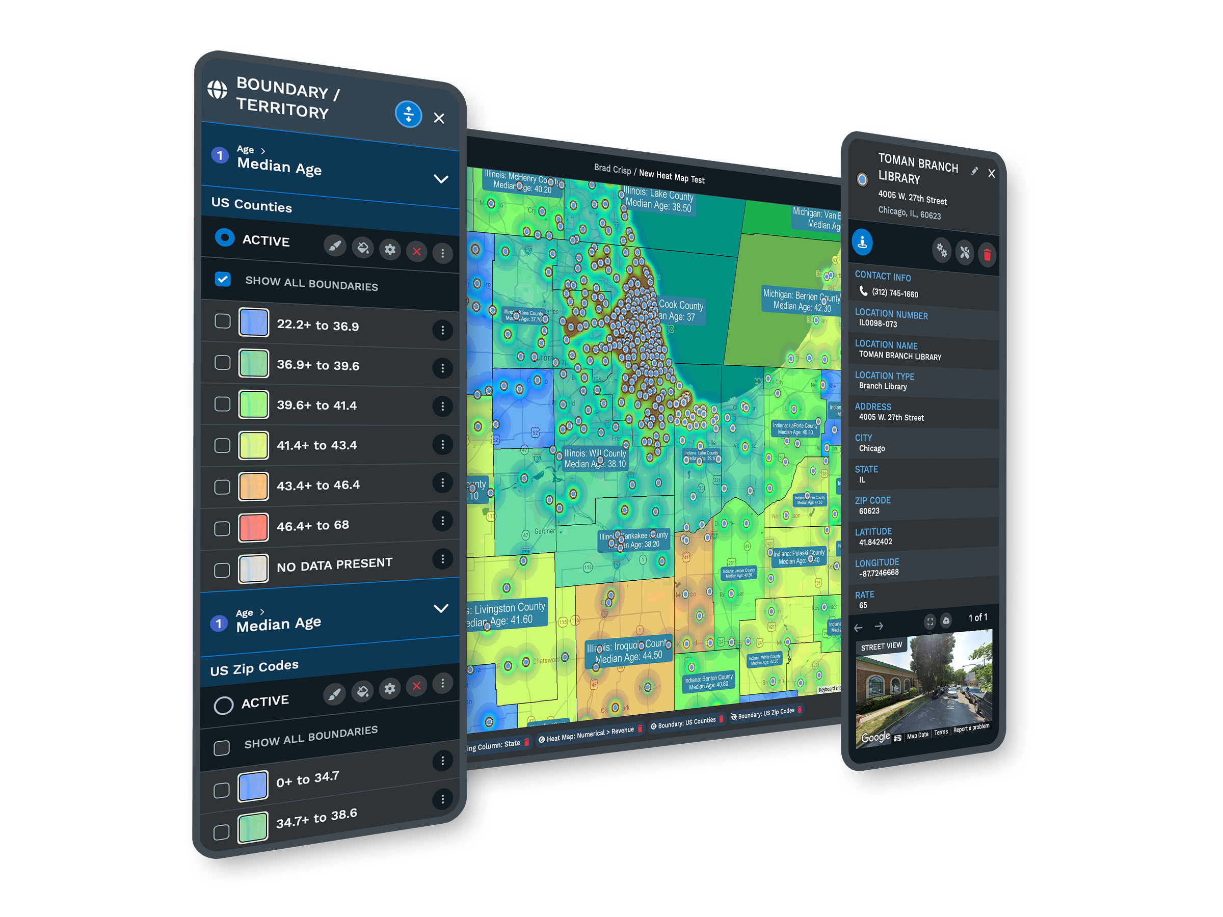
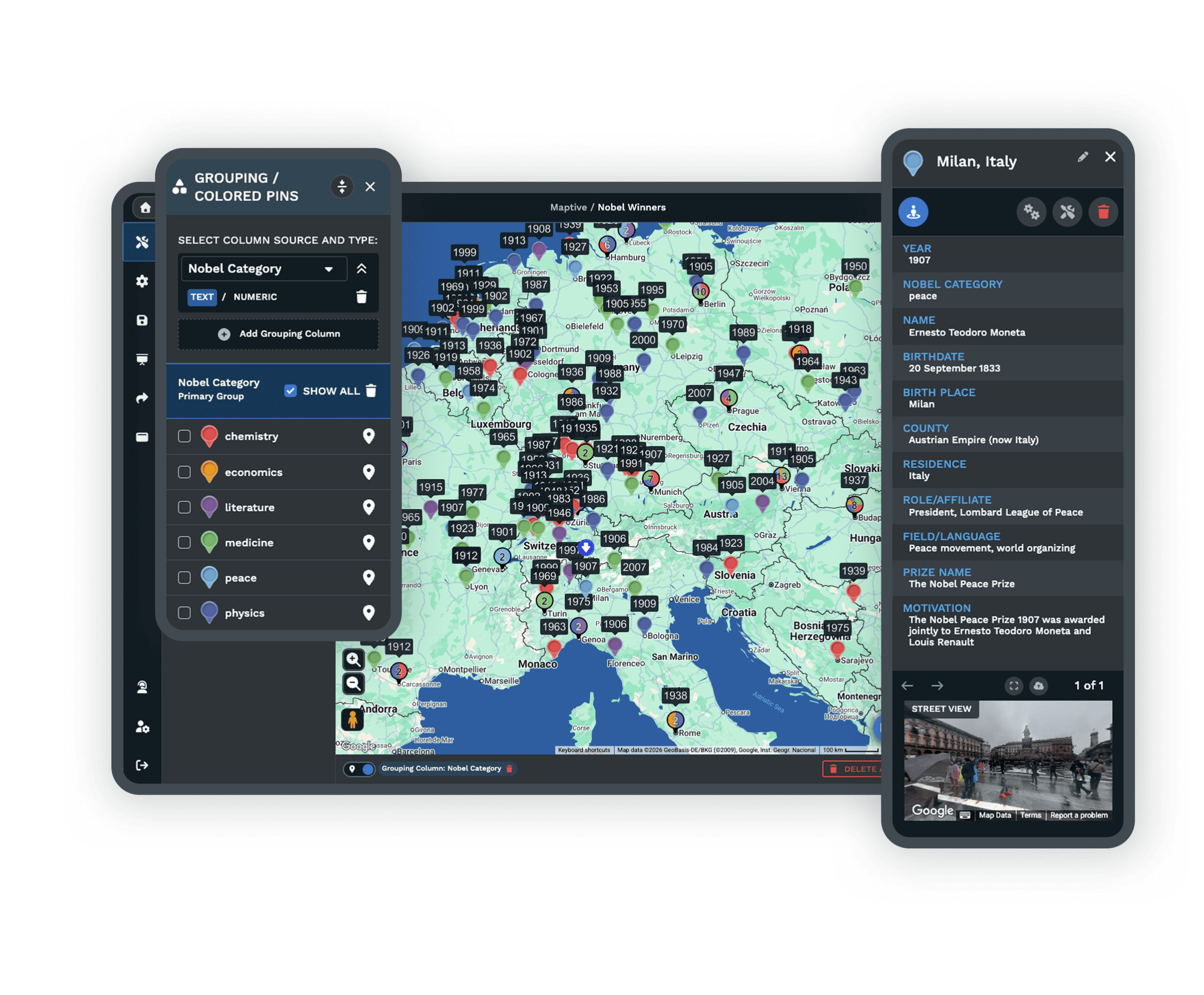
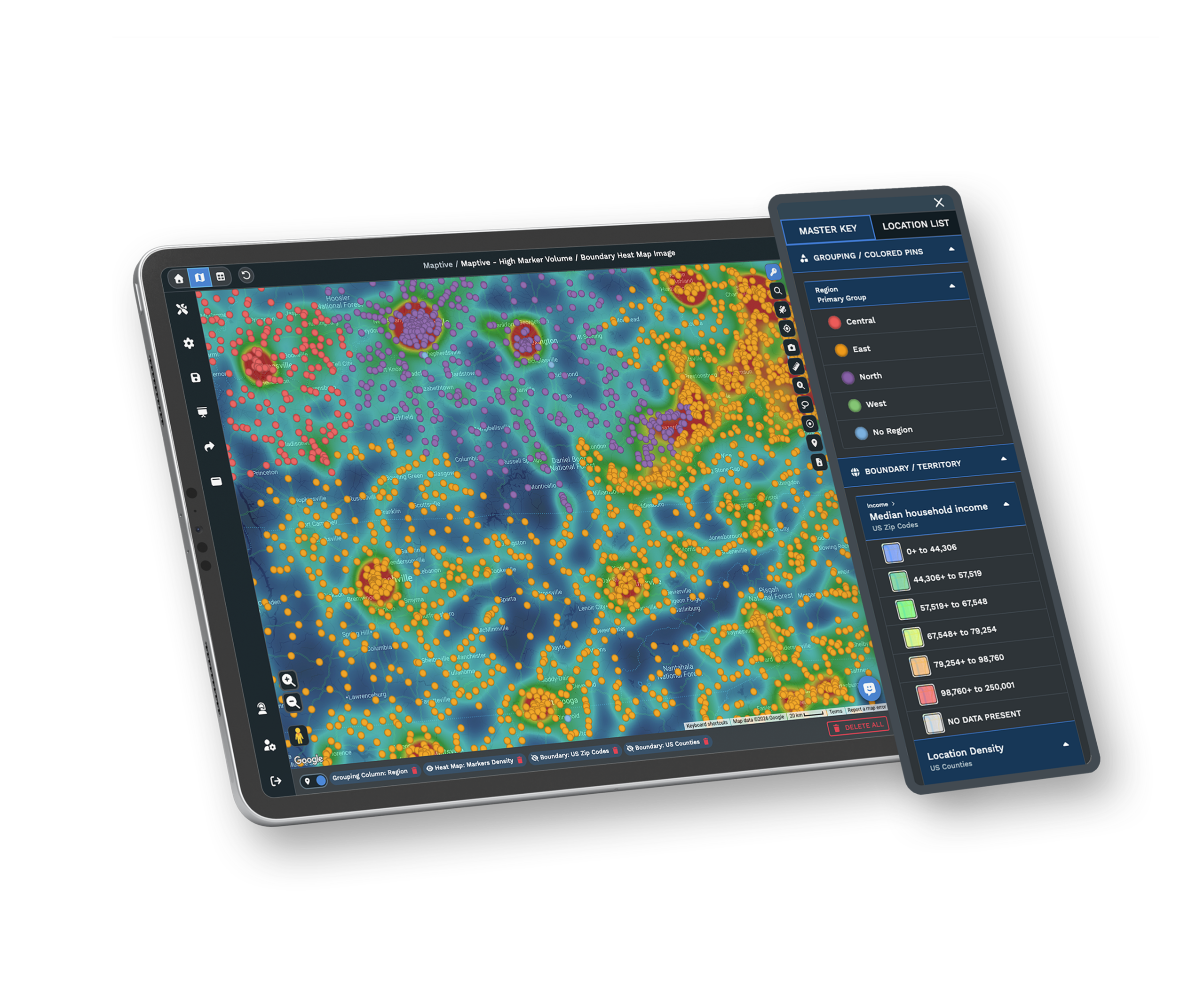
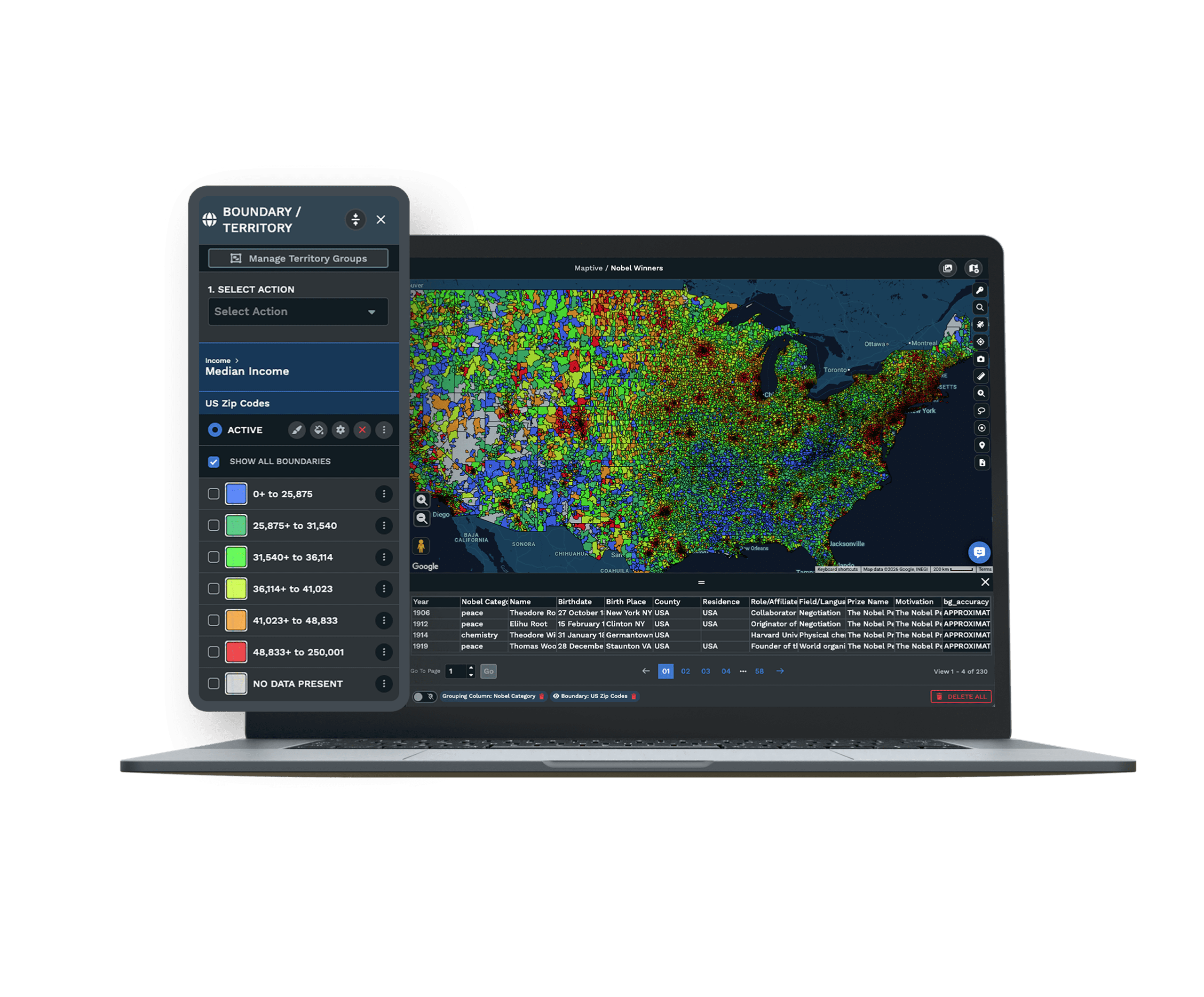
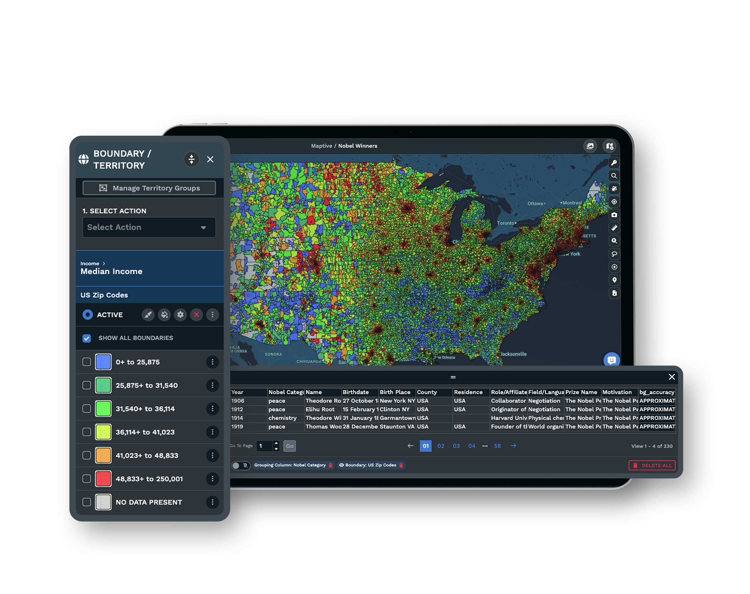
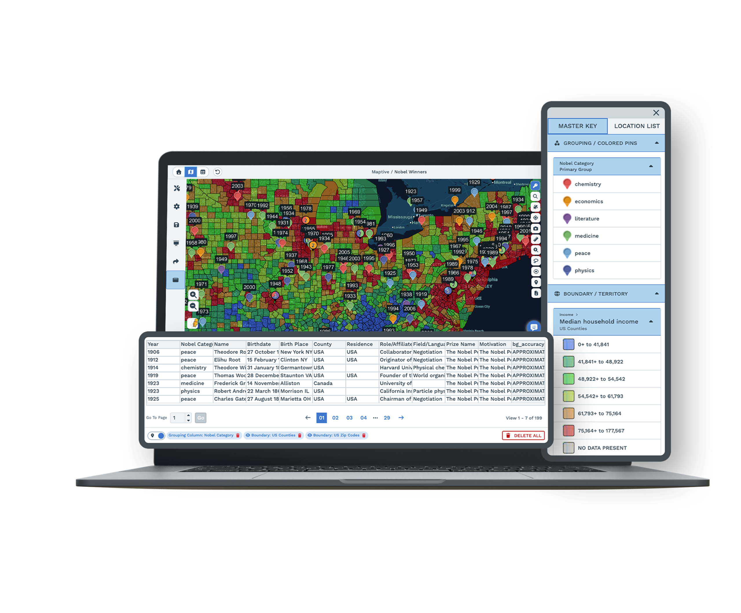
Your internal data shows where your customers are. Maptive shows where they should be, layering census demographics and a growing library of market data at ZIP and tract level under every record. No GIS training is required to read it.
Franchise & Multi-Location
Drive-time overlap analysis surfaces cannibalization risk before a lease is signed, and role-based access lets corporate see the full network while each franchisee sees only their territory. One network found 18% trade-area overlap this way and reworked its expansion in a single session.
Retail Store Planning
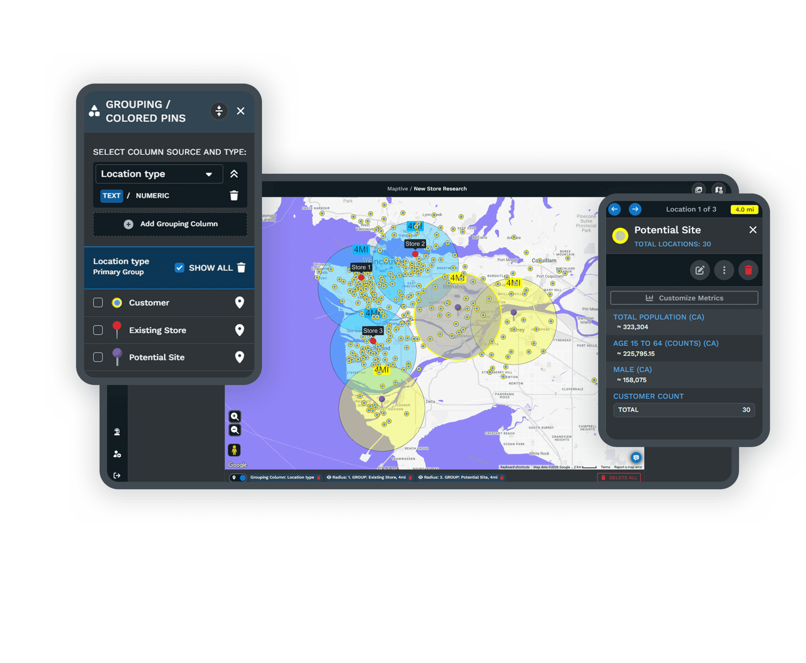
Site selection moves faster when every candidate shares one map. Maptive brings demographic scoring, trade-area analysis, and customer density into a single session, so you can rank locations and draw a drive-time polygon around each without a GIS analyst in the workflow.
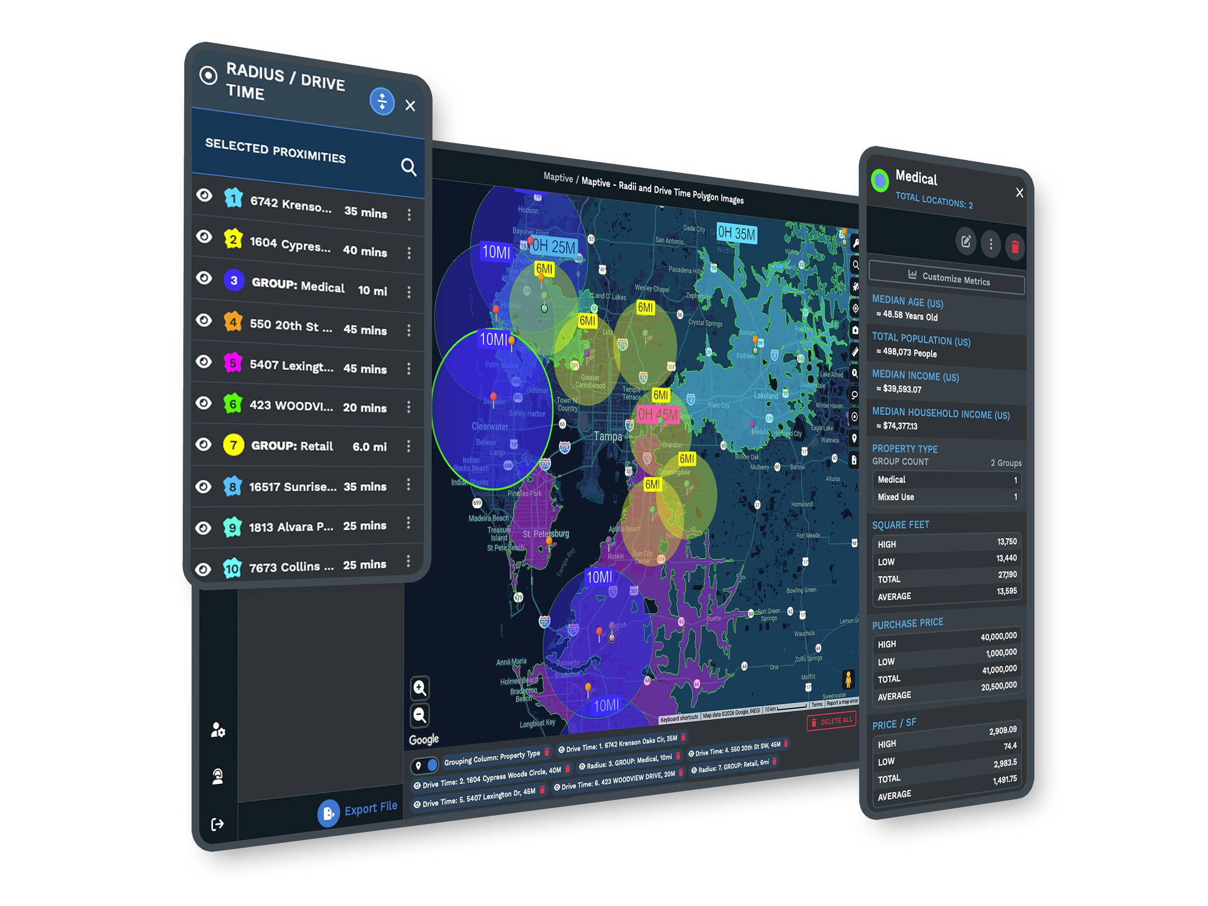
Commercial Real Estate
Maptive keeps properties, demographics, and drive-time polygons in one workspace. Poster-quality exports and password-protected links send the analysis straight to a client, so a deliverable that used to run through several tools and a design cycle now comes out of one session.

Insurance
A book of business becomes a map of exposure once you upload it to Maptive. Weight a heat map by insured value to see where risk concentrates, balance producer territories against policy density, and build adjuster routes from claim clusters, all from one upload.
Supply Chain & Logistics
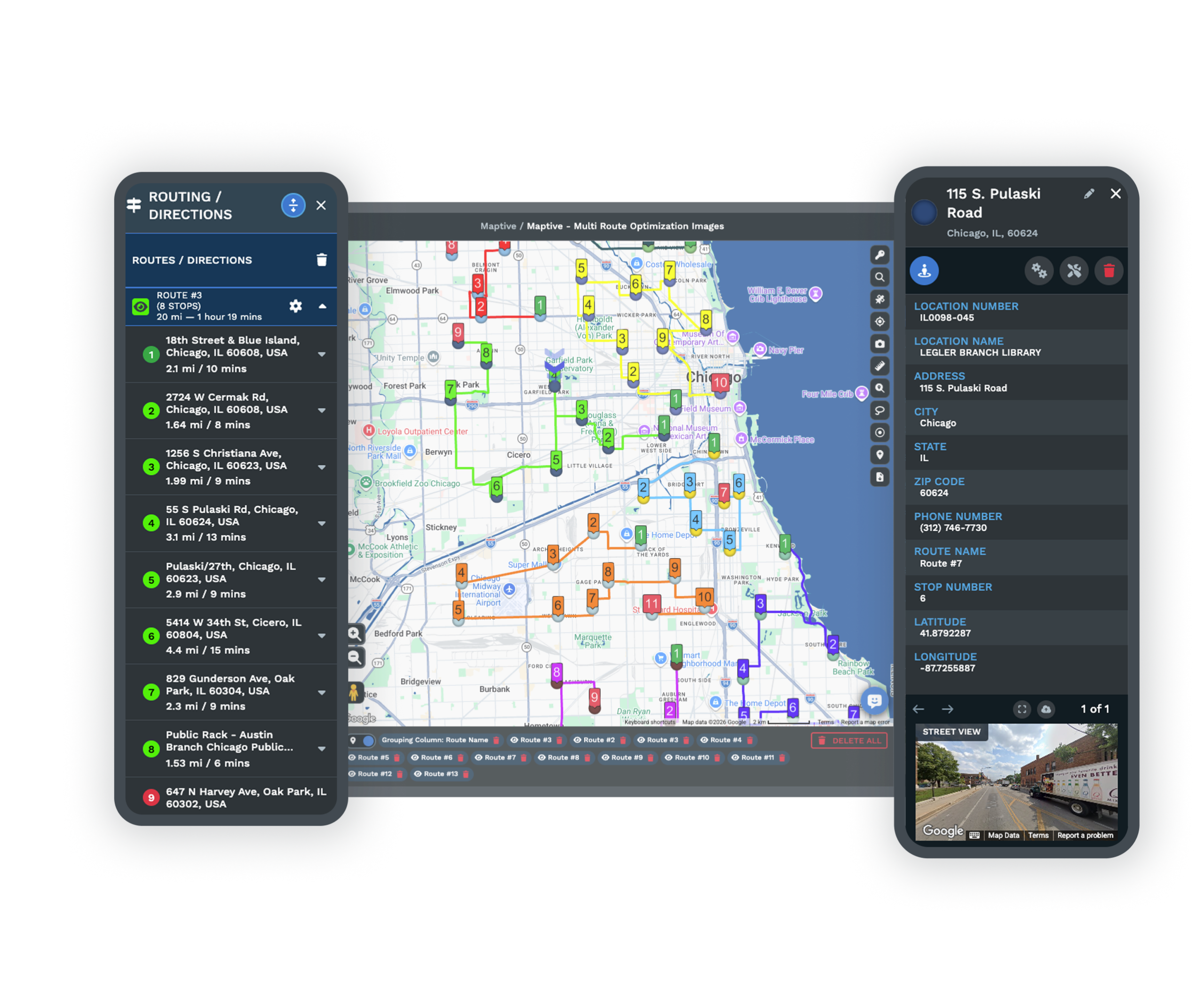
Every node in your network shares one map, with facilities, routes, and coverage zones visible together. Route optimization trims mileage while drive-time analysis guides facility placement. Teams report fuel costs down 18% and routing errors down 22%.
Field Service
Maptive rebuilds service territories in an afternoon with drive-time coverage on real road networks, then routes each technician through the day to cut windshield time. Teams report completing 22% more service calls with the same headcount.
Manufacturing & Distribution
Territory maps, delivery routes, and dealer coverage zones share one workspace with CRM sync. Heat maps show where demand concentrates and where coverage runs thin. A nationwide parts distributor cut a territory redesign from two weeks to one afternoon.
By Team Size and Goal
Not every map starts with an industry. Pick the page that fits how your team works.
Enterprise
Enterprise teams clear the security review with SSO, role-based access, 256-bit encryption, and audit logging, then plot up to 200,000 records on one map. No heavy GIS deployment to stand up first.
Small Business
A small business turns a single spreadsheet into a working map in minutes. Plot customers, optimize routes, and read the census data around a site, with every tool included and no GIS skills required.
Teams
Put the whole team on one shared map instead of scattered spreadsheets. Send each person a link they open without an account, set what every viewer can see, and keep territories balanced as the work changes.
Custom Map Maker
Turn your data into a branded, presentation-ready map. Style the base map, color-code markers, add your own logo, then share it by link, embed, or full-resolution print, with no design or GIS background.
By Task
Jobs people bring to Maptive, start to finish.
Map Multiple Locations
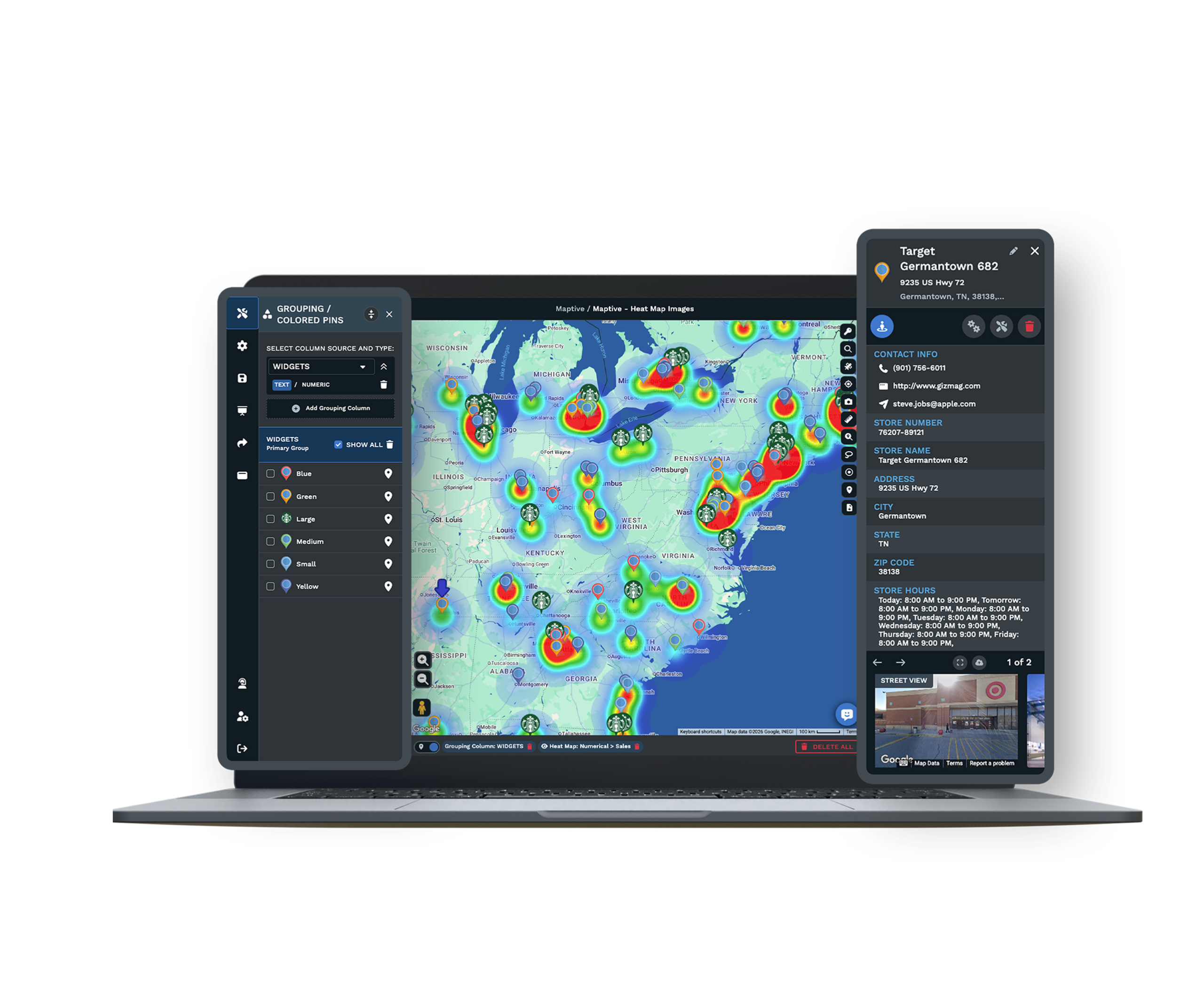
Plot a whole address list on one interactive map, up to 200,000 locations. Color the pins by any column, draw areas around them, and route between them.
Map Customer Locations
See every account on an interactive map. Color-code by status or value, read the demographics around each one, and route between them.
Zip Code Map
Turn a spreadsheet into a zip code map. Fill each zip by your own numbers or census data, shade it into a heat map, or group zips into sales territories.
Map Excel Data
Turn an Excel spreadsheet into an interactive map. Plot every row, then color-code, filter, and map your data by boundary, with no formulas or GIS work.
Postal Code Mapping
Map postal codes across roughly 20 countries. Fill each boundary by your data, and plot US zips and international postcodes on one map.
One Platform, 60+ Tools, Every Industry
Whatever your vertical, the same workflow runs from a single spreadsheet upload.
| 01 | Your Data Is the Starting PointEvery use case here starts the same way. You upload a spreadsheet and Maptive's geocoding engine plots it, correcting the messy formatting, missing ZIP codes, and inconsistent address fields most teams have learned to live with. Within minutes your rows become an interactive map you can filter, color-code, and query. The barrier to getting started is a file already sitting in a folder, not a procurement cycle. |
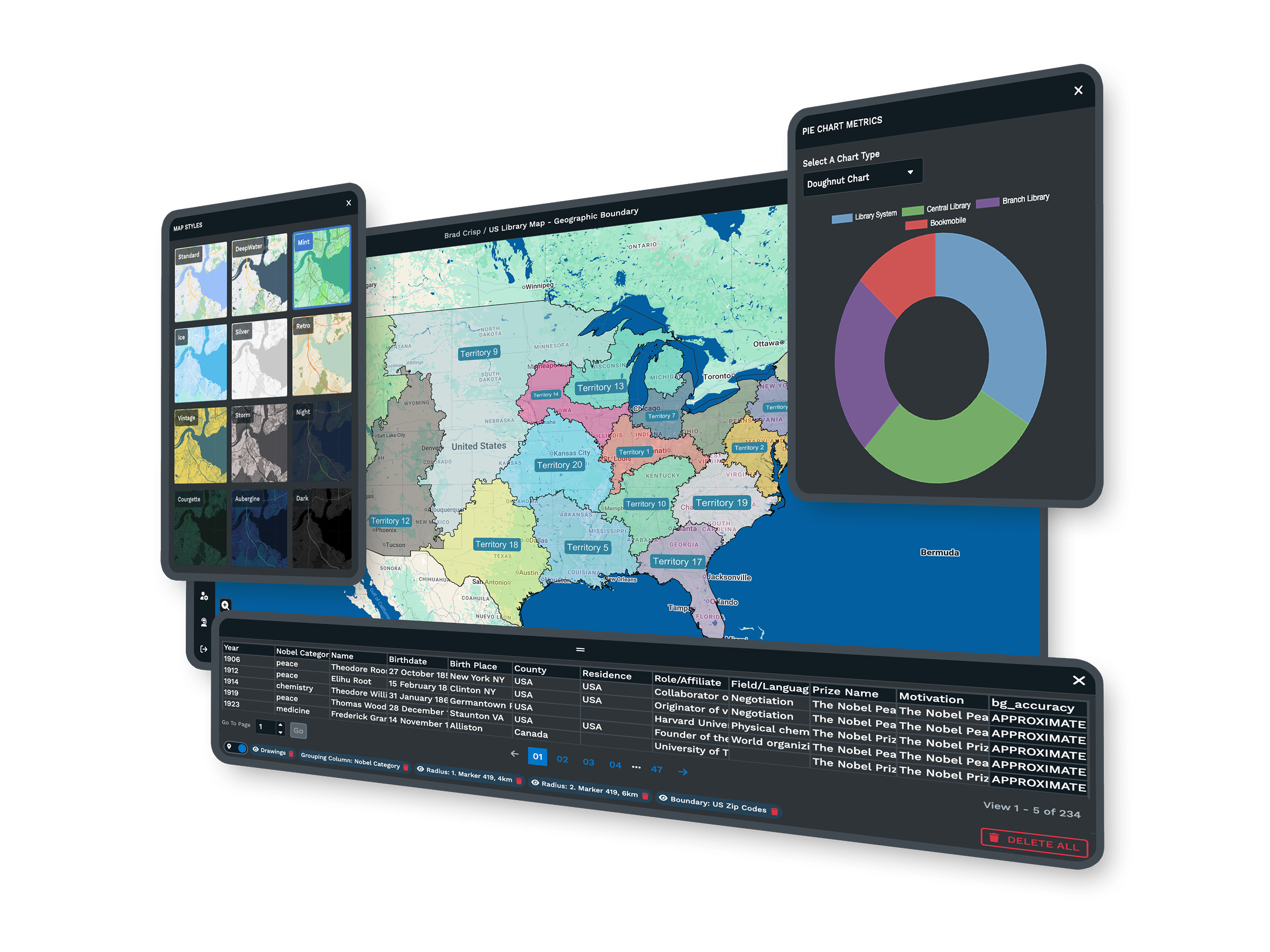
| 02 | 60+ Spatial Tools on One MapYour data already contains the patterns, and the 60+ tools built into Maptive surface them, with territory optimization, drive-time polygons, heat maps, demographic overlays, and proximity analysis running on the same map in the same session. Census data at ZIP and tract level comes on every plan, with no tier restrictions and no add-ons. |
| 03 | From Insight to Territory to Route in One SessionThe workflow stays in one place. You spot a coverage gap on a heat map, confirm it with a demographic overlay, draw a territory, assign a rep, optimize the route, and send directions to a phone, with no export step and no handoff to a second tool. Maptive keeps that sequence together with 200,000-marker capacity and every feature on every plan. |
Trusted by Enterprise Teams
Enterprise Names Already Mapping
Amazon, General Electric, Coca-Cola, CBRE, Capital One, Hilton, and the US Department of Energy run location work on Maptive. Teams with stricter procurement than yours have already walked the approval path.
Security and Compliance
Security includes 256-bit SSL encryption, two-factor authentication, single sign-on, role-based access, and audit logging, with 99.9% uptime across 2025 and a passed Salesforce AppExchange security review.
Support Rated 9.7 Out of 10
Maptive's 30-plus person team across the US and Canada answers in under 15 minutes, and the specialists are trained in spatial analysis rather than reading from a script. White-glove onboarding covers data cleaning, map setup, and team training on every plan, so help is fast and specific from the first session.
Free trial, every tool, no credit card
See Your Data on a Map
The free trial runs ten days with no credit card and every feature unlocked on the full platform. Upload a spreadsheet and see something about your business that has been sitting invisible inside rows and columns. The first useful answer often surfaces within the first hour.
Book a Demo for Your Industry
If you would rather see the platform applied to your own data, the Maptive team can walk you through territory design, demographic analysis, and routing for your specific use case.
Frequently Asked Questions
Which industries use Maptive?
Sales teams balance territories, retailers select store sites, insurers analyze concentration risk, logistics teams optimize routes and networks, franchise developers prevent cannibalization, commercial real estate brokers build client deliverables, field service teams plan dispatch, and manufacturers manage distribution and dealer coverage. The common thread is a decision that depends on where, not only how much. Each of those verticals has its own page on this site with the workflows and data that matter to it.
What can Maptive do that a basic map cannot?
A basic map places pins. Maptive turns those pins into decisions, with territory creation and optimization, drive-time analysis, heat maps, demographic overlays, route optimization, and proximity analysis all running on the same map in one session. It handles up to 200,000 markers, cleans messy address data on upload, and exports or shares the result. The difference is the gap between seeing your data on a map and acting on it without leaving the platform.
Do I need GIS training to use Maptive?
No. Maptive is built for business teams, not GIS specialists. You upload a spreadsheet, the platform geocodes it, and every tool works through a plain interface with menus rather than code. Most users have a working map and a first answer within their opening session, and the support team helps set up the first analysis. The point is to put spatial analysis in the hands of the people who own the decision, without a specialist in between.
Is every feature included on every plan?
Yes. All 60+ mapping and analysis tools come on every plan, with no tier restrictions and no add-ons. Census data at ZIP and tract level is included as well. That means your plan choice comes down to data volume and user count, not which features you unlock, so a small team and an enterprise use the same toolset. It also keeps evaluation simple, because the trial exposes everything the paid platform can do.
How much data can one map hold?
A single Maptive map holds up to 200,000 markers, rendered with WebGL so the view stays responsive as you pan and zoom. Your full customer base, network, or portfolio loads together rather than splitting into regional batches. That capacity matters because the patterns most teams are looking for, like clusters, coverage gaps, and overlap, only become visible when the entire dataset sits on one screen at the same time instead of across separate files.
What data does Maptive include?
Maptive includes more than 50 US Census variables at state, county, ZIP, tract, and block-group levels, covering household income, population density, age, and household composition, with Canadian data as well. The census data comes on every plan. A growing library of market data categories, drawn from a long-standing data partnership, adds spending and household detail alongside it, so you can read your own records against the demand and demographics around them rather than in isolation.
Can Maptive connect to my CRM?
Yes. You can import data from any CRM through an Excel or CSV export, and Maptive also offers direct integrations that keep maps current as records change. Your CRM remains the system of record for account details, while Maptive becomes the layer that shows where those accounts sit and what the market around them looks like. That keeps the customers and territories on your map aligned with the accounts your team manages every day.
How secure is the Maptive platform?
Maptive runs 256-bit SSL encryption in transit and at rest, two-factor authentication, single sign-on, role-based access controls, and audit logging, with regional data-storage options and 99.9% uptime across 2025. It has passed the Salesforce AppExchange security review, and enterprises with strict procurement requirements, including Amazon and the US Department of Energy, have already approved it. Permissions can be set down to the individual user, so each person sees only the data they should.
What support comes with Maptive?
Every plan includes the same support. A 30-plus person team across the US and Canada answers the phone, chat, or email in under 15 minutes, with a 9.7 out of 10 rating on G2. The specialists are trained in spatial analysis rather than reading from a script, and white-glove onboarding covers data cleaning, map setup, and team training. Help is fast and specific from the first session, with no bots and no waiting days for a reply.
How do I get started with Maptive?
Start a ten-day free trial with no credit card, or book a demo to see the platform applied to your industry. Upload a spreadsheet, paste from your clipboard, or connect a live Google Sheet, and the geocoding engine plots your data into a working map within the first session, with every feature unlocked. The barrier to a first insight is a file you already have, not a procurement cycle or a training course.

