


Build Franchisee Territories by ZIP Code & FSA
Group your US ZIP codes or Canadian FSAs into each owner’s area and color them on one map. Maptive builds the balanced code list you attach to the agreement.
No credit card required
- Click ZIPs on the map or import a spreadsheet to assign each code
- Shade each franchisee’s codes in a color of their own
- Group Canadian FSAs and US ZIPs on one canvas
- Read population and income under each set of codes to balance areas
- Export the grouped list as an .xlsx, .csv, or .tsv for the agreement
- Re-group changed codes and re-share with view-only or edit access
Trusted by teams at









ZIP-Code Territories in Brief
Everything you need to group, balance, and defend a set of ZIP-code territories sits inside one platform, on your real network.
Grouping ZIPs and FSAs into balanced areas cuts territory-drawing time by about 34%.
Reading population behind each code narrows the size gap between owner areas by 21%.
A clean code list attached to the agreement drops later boundary-redraw requests by 29%.
Grouping and Coloring Codes Into Each Area
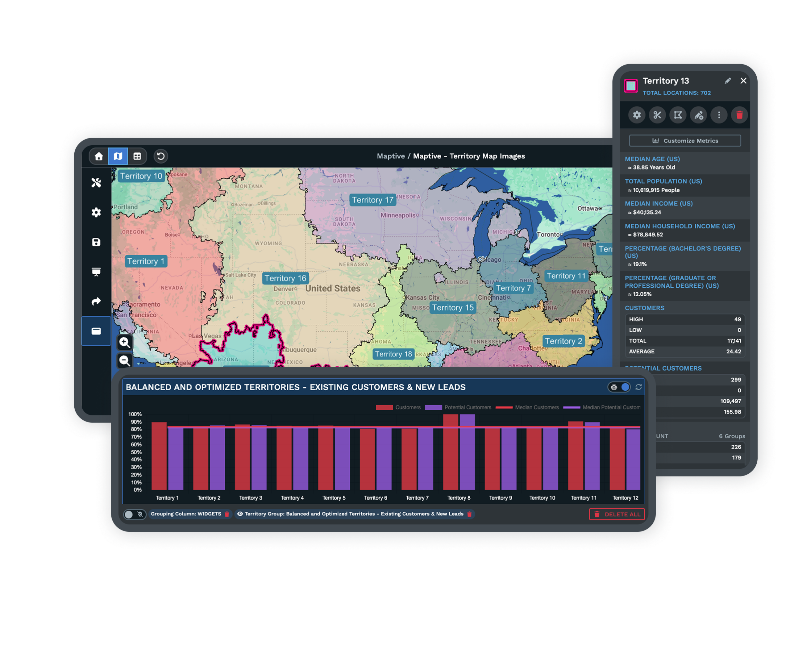
Assign each ZIP to an owner, shade the network by color, group US and Canadian codes on one canvas, and export the list for the agreement.
| 01 |
The Boundary Tool for Assigning ZIPsClick ZIPs on the map or import a spreadsheet with a ZIP column and a territory-name column, and the Geographic Boundary Tool assigns each code to an owner. Add, move, or drop a code afterward and the area updates. Explore the boundary tool → |
| 02 |
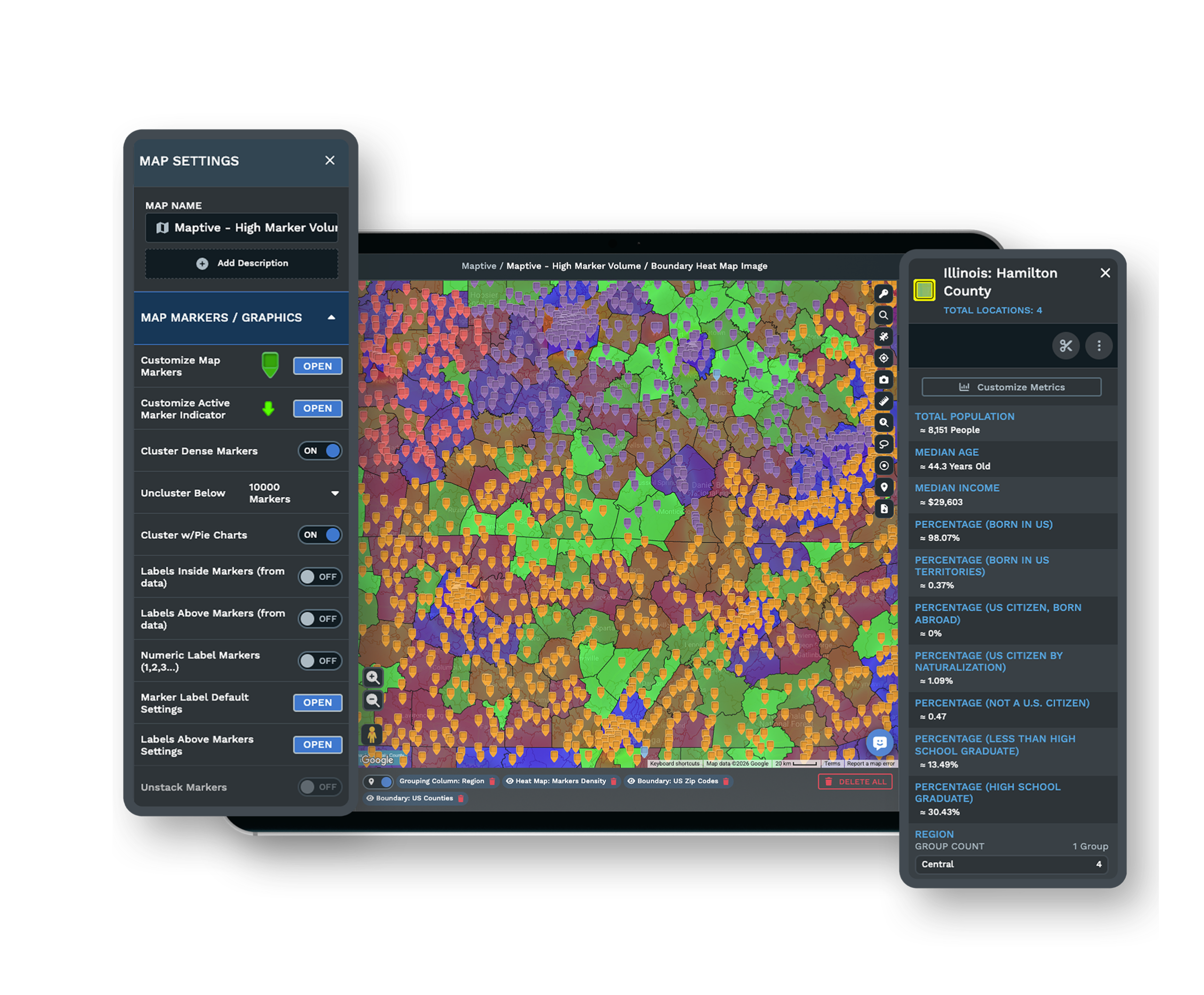
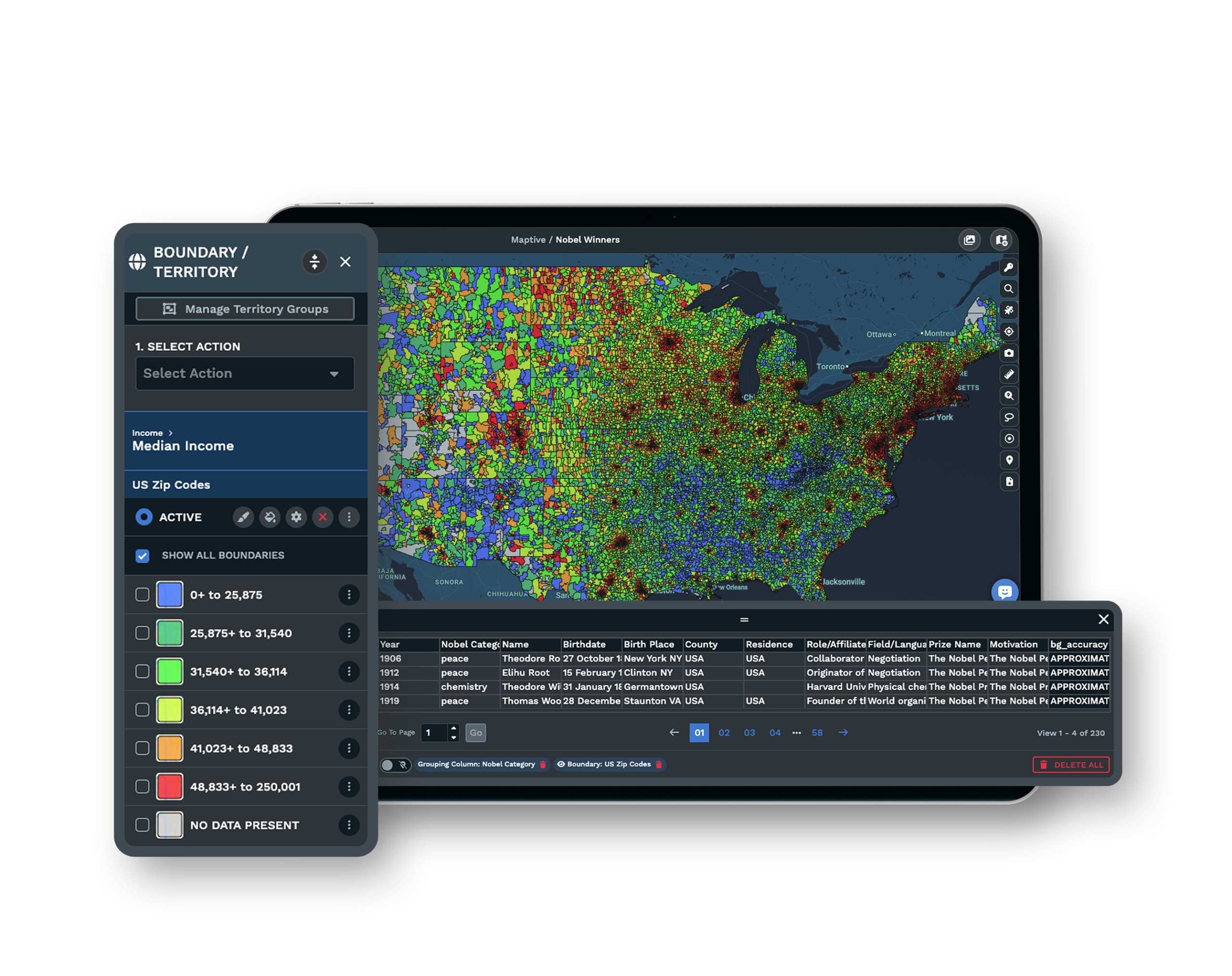
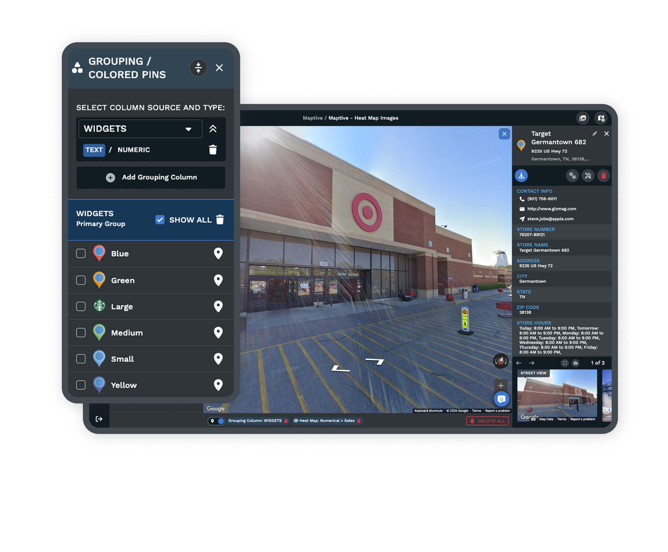
Owner Colors Across the NetworkThe Grouping Tool shades each franchisee’s codes in a color of their own, so overlaps and gaps read at a glance. Colored Pins mark units, and a custom marker carries an owner’s logo where you want the map to name them. See the grouping tool → |
| 03 |
Canadian FSAs and US ZIPs on One CanvasGroup Forward Sortation Areas, the first three characters of a Canadian postal code, exactly as you group US ZIP codes. A cross-border network plans on one canvas rather than two systems that never quite line up. |
| 04 |
Exports for the Disclosure DocumentExport your grouped data as an .xlsx, .csv, or .tsv file so each owner’s code list moves straight into the franchise agreement. The saved list becomes the territory of record that Item 12 points to. See export options → |
A Balanced Column, an Unbalanced Area
A ZIP list in a spreadsheet looks even because the column hides the one thing that matters, the shape and the demand each code holds. A ZIP is a set of mail routes, not an area, so codes vary enormously. One covers a single Midtown block with almost no residents, while a rural code spans hundreds of square miles.
Split two owners on ZIP count and one can inherit a fraction of the market the other holds. Grouping the same codes on a map, with census population and income shading underneath, moves the imbalance into view. You watch each territory’s totals change as you add or drop a code, so you balance on the demand inside the area rather than on the length of the list.
Settling the Area and the White Space Around It
Once the codes are grouped and balanced, the map holds two pictures a development team reads together. Owned ground is the set of ZIPs already granted to a franchisee. Serviceable white space is the open ground with enough population and reachable demand to support the next unit, which you verify before you grant it.
A ZIP or FSA list carries into Item 12 and the agreement addendum as a reproducible definition, and a multi-state rollout attaches its own code exhibit per unit. Because USPS retires and splits roughly one ZIP in 20 each year, the list needs a review once or twice a year, and again when a new unit goes in or a metro fills in.
Built to Stay Accurate and Secure
Review Cycles for Changing Codes
USPS adds, splits, and merges ZIP codes as delivery volume moves, near one code in 20 a year. A territory pinned to a frozen list drifts out of date, so you reopen the map, re-group the affected codes, and re-share the corrected areas.
See the territory map maker →Encryption and Controlled Access
The platform protects your code lists with 256-bit SSL encryption, two-factor authentication, single sign-on, role-based access, and audit logging. You set each person you invite to view-only or edit access, so a developer sees the whole network while an owner sees their own area.
Data Cleaning From the Support Team
The US and Canada support team, more than 30 people rated 9.7 out of 10, replies in under 15 minutes and takes on the messy part. White-glove onboarding cleans your code file, fixes the leading zeros Excel strips off Northeast ZIPs, and sets the first territories up with you.
Free trial with the full platform and no credit card
Start With Your Own ZIP List
Start a 10-day free trial with no credit card and all 60+ tools unlocked. Import your ZIP or FSA file, group the codes into each owner’s area, shade them by population and income to balance the market, and export the lists for the agreement, all on your real network.
See It Built on Your Own ZIP List
If the grouping runs through a development committee or a franchise counsel review, a Maptive specialist will build the first territories with you on your own codes. Bring the market you are dividing, and the session groups the ZIPs, balances them on the census data, and exports the lists in front of the people who sign off.
Frequently Asked Questions
How do I assign zip codes to franchise territories?
Either click the ZIP codes on the map and label them as one territory, or import a spreadsheet with a ZIP column and a matching territory-name column so each unique name colors its own codes. The Geographic Boundary Tool groups them, and the resulting ZIP list is what goes into the franchise agreement.
Can I combine zips into a franchise area?
Yes. A single territory is normally a bundle of ZIP codes grouped under one owner’s name, and you can add codes, move them between owners, or remove them afterward. Canadian FSAs group the same way, so one owner’s area can be defined by as few or as many codes as the market needs.
What is the difference between a ZIP code and a ZCTA?
A USPS ZIP code is a set of mail-delivery routes rather than an area, and USPS publishes no official ZIP boundary map. A ZCTA is the Census Bureau’s polygon approximation of a ZIP’s delivery area, built so ZIP-level data can be mapped. The boundaries you group into territories are these areal approximations, not the postal routes themselves.
How many ZIP codes should a franchise territory have?
There is no fixed number. Territories are sized to a target population, household count, or market potential, not to a ZIP count. The same demand can be a handful of codes in a dense city or many codes across a rural county, so balance each owner’s area on the population inside it rather than on how many codes the list contains.
ZIP code versus county for franchise territories, which is better?
ZIP bundles give finer control and align to demographic data and sales reporting, which suits higher-volume, smaller-footprint concepts. Counties are larger and legally stable, which suits higher-cost, lower-volume concepts. You can outline a county area with a freehand boundary when the unit economics call for it, so the right unit is the one whose population and area fit the model.
Can two franchisees end up with overlapping ZIP code territories?
Yes. Even areas that read as exclusive can overlap in practice, because a flat ZIP bundle ignores how customers travel and a highway interchange can draw traffic across a line. Overlap becomes common once a brand passes 20 to 30 units in a metro without checking how the areas interact, so it helps to read neighboring territories side by side before you grant one.
How do I build franchise territories in Canada with postal codes?
Use Forward Sortation Areas, the first three characters of a Canadian postal code such as M5V, as the grouping unit. All codes sharing those three characters form one FSA, and you group and color them into territories the same way you group US ZIP codes. A cross-border franchise network plans both countries on the same map.
Why do my ZIP codes lose their leading zero in Excel?
Excel treats a ZIP code as a number and drops the leading zero, so a Northeast code like 01234 becomes 1234 and the territory file no longer matches. Format the column as Text, or as Special then Zip Code, before you import it, so all five digits stay intact and every code lands in the right owner’s area.
How do I balance franchise territories so they are fair?
Layer census data, population, households, income, and density, onto the ZIP grouping and watch each owner’s totals change as you add or drop codes, so you equalize market potential rather than ZIP count. Color shading shows high-value clusters against low-activity codes, so a lopsided area is visible before anyone signs for it.








