


See Your Whole Franchise Network on One Live Map
Put every unit and licensee location on one live map, each with its status, brand, and franchisee contact in the pop-up. Maptive plots all locations from your list.
No credit card required
- Plot every unit and licensee location on one live map
- Show status, brand, and franchisee contact in each marker pop-up
- Color-code markers by unit status, from open to closed
- Group a multi-brand system by brand on the same map
- Map US and Canadian units together on one shared view
- Share one live link and set each viewer to view-only or edit
Trusted by teams at









The Whole Network at a Glance
Putting every unit on one live map cuts the time to review the network by about 45%.
One shared map replaces scattered spreadsheets and cuts duplicate location records by 26%.
New regional managers get up to speed on their network about 33% faster.
The Data Behind Each Network Marker
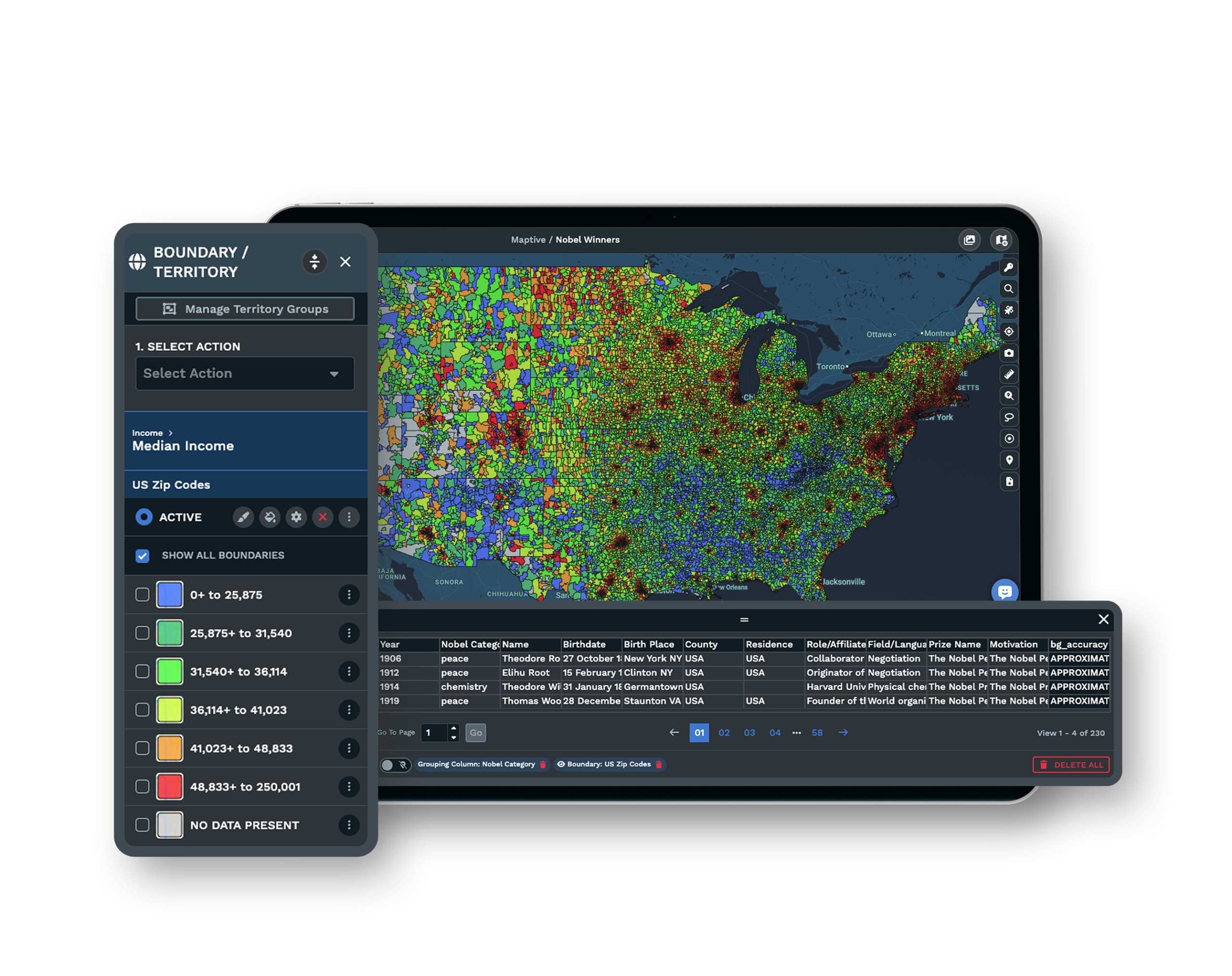
| 01 |
Every Unit Plotted From Your Existing ListUpload the list you already keep, with unit name, address, status, brand, operator, and contact, and the platform geocodes the addresses and plots all locations as markers. You start from your spreadsheet rather than a rebuild. Explore location finder → |
| 02 |
Pop-Ups Carrying Status, Brand, and ContactClick any marker and its information panel shows the unit name, address, status, brand, the franchisee's name, and a direct contact such as a phone number or email. A dot becomes a record the field team can act on. Explore custom markers → |
| 03 |
Color-Coding by Unit StatusThe Grouping Tool and colored pins shade each marker by status, from open to under construction to sold-not-open to closed or transferred, so you read the whole network by status at a glance. In a multi-brand system the same markers group by brand instead. See filtering options → |
| 04 |
A Single Link the Whole System OpensOne shared map link lets the franchisor, the development team, and field consultants all open the same live map. You set the link public or password-protected and hold each viewer to view-only or edit, so one link replaces a fresh spreadsheet emailed every month. See sharing options → |
The Location Layer Beyond a Spreadsheet
A location spreadsheet holds together at five units and strains near ten. Past twenty, every location generates its own pocket of information and reconciling it falls on one operations person. When someone who knows the territory reads the file, a unit marked open closed months ago and an address moved, so decisions rest on numbers that lagged reality.
A franchise network map answers from one current source instead. Plot all locations once and the franchisor, the development team, and the field open the same live map, each viewer held to their permission.
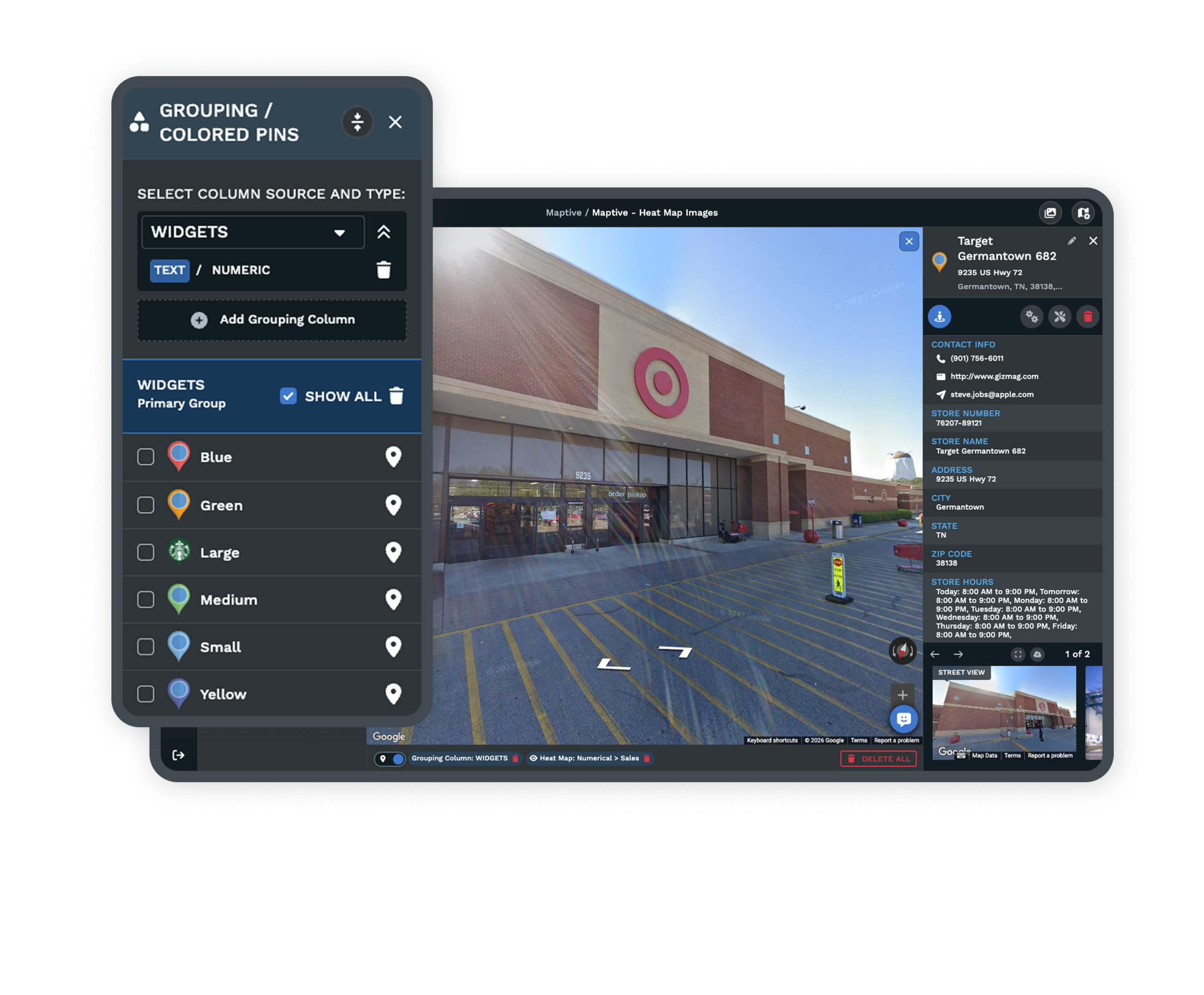
Reading Network Health Straight From the Status Colors
Buyers describe the goal plainly, to track where all their units sit on one map and read them by status. Open units read in one color and the rest by their stage, so the development team sees who is signed and who is in build, a field consultant sees which units they own on a trip and who to call from the pop-up, and leadership gets a board-ready picture of where the system is thin.
The status categories line up with what franchising already records in FDD Item 20, the openings, closures, and transfers. Sold-not-open marks a signed agreement that has not reached opening day. On the live map it becomes a color anyone can chase.
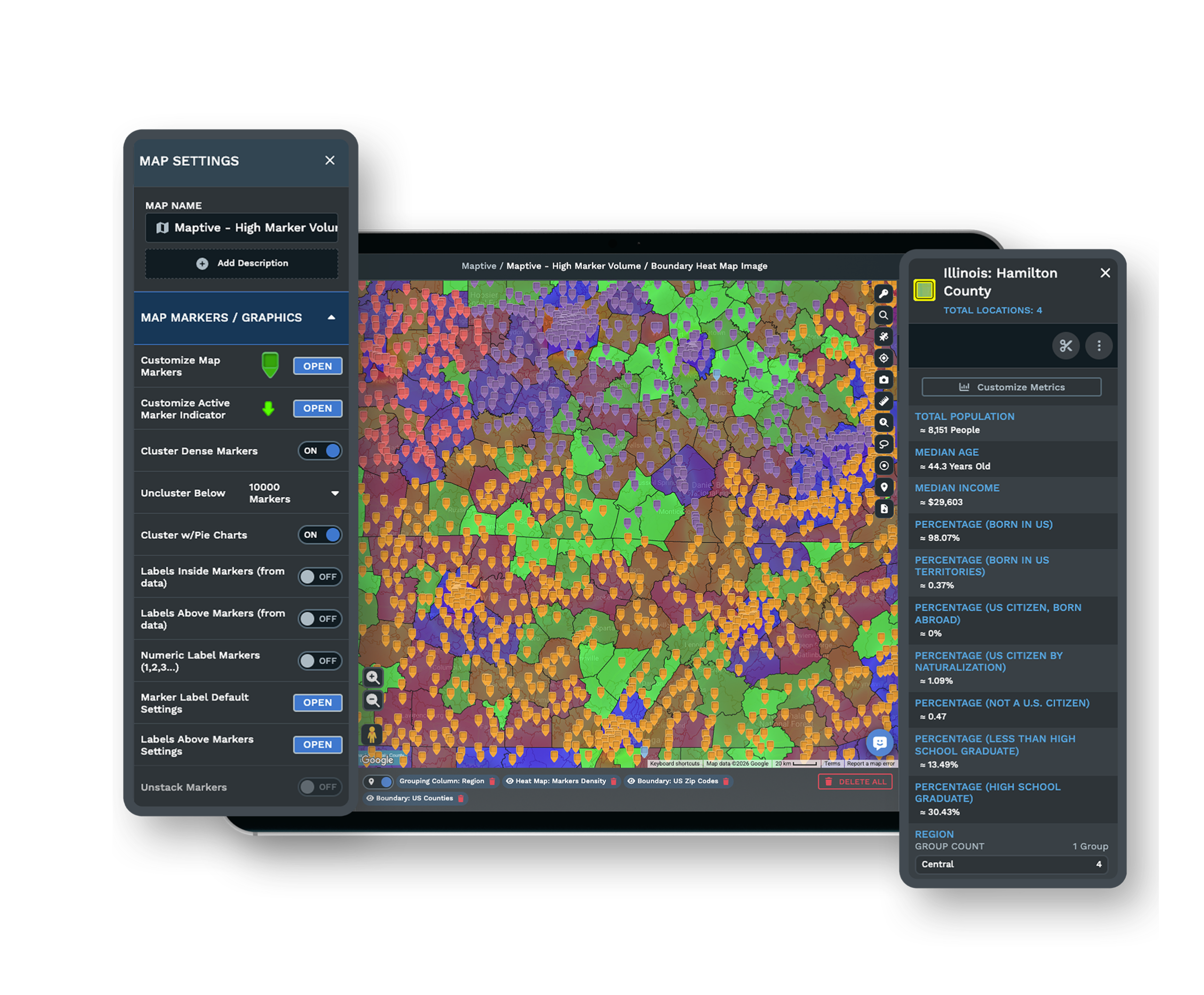
Built for a Growing Network
Location Teams at National Brands
Coca-Cola, Hilton, Frito-Lay, and CBRE run location work on the platform across consumer goods, hospitality, logistics, and real estate. A 30-unit system and a several-hundred-unit network open the same tools on the same map, and the location layer keeps room to plot more markers as new franchisees sign.
A Map You Adjust and Re-Share
When a unit opens, transfers, or closes, you recolor its marker and update the fields in its pop-up, and the shared link carries the change to everyone already viewing it. The map stays the working reference the whole network reads from, rather than a static file someone exports, emails, and reissues by hand every month.
See the territory map maker →One View Across the US and Canada
US units plot to ZIP-code and county geographies while Canadian units plot to Forward Sortation Areas and postal codes, so a cross-border network reads on one live map instead of two. Both countries sit on the same view, colored by status and grouped by brand the same way, so leadership reads the whole system without switching files.
Free trial with the full platform and no credit card
Try It on Your Whole Network
Start with the list you already keep. A 10-day free trial with no credit card plots all your locations, takes the status colors you assign, and fills each marker pop-up with the franchisee's contact, then hands you a shared link to send. Your whole network comes onto one live map in the first session.
Book a Live Network Walkthrough
A map headed for a board deck or a development review earns a closer look first. A Maptive specialist plots your network alongside you, building the status colors, the marker pop-ups, and the shared link from your own list, so the people who will read the map understand the one live view of every unit before it reaches the room.
Frequently Asked Questions
How do I map my whole franchise network?
Export your location list with unit name, address or ZIP, status, brand, operator, and contact to a spreadsheet, then upload it. The platform geocodes the addresses and plots all locations as markers on one map. From there you color the markers by status and fill each pop-up, so the result is one live shareable map of the whole network.
Can I show every franchisee's contact and status on one live map?
Yes. Each marker pop-up can hold the unit name, address, status, brand, the franchisee's name, and a direct contact such as a phone number or email. A dot becomes a record the field team can act on, and the shared map link keeps it current for everyone who opens it, so leadership and consultants read the same live view.
How do I put all my franchise locations on one map?
Upload the list you already keep with unit name and address or ZIP, and the platform plots all locations as markers once the addresses are geocoded. You can plot up to 200,000 locations on a single map, so a small system and a several-hundred-location network both see everything on the same map as units are added.
Can I color-code franchise units by status?
Yes. The Grouping Tool and colored pins shade markers by status such as open, under construction, sold-not-open, and closed or transferred, so the whole network reads by status at a glance. The colors are yours to define, and a viewer reads the system's health from the colors alone.
How do I share a franchise map with my team and franchisees?
The map produces one shared link, so development, field consultants, and leadership open the same live map. You can make the link public or password-protected, and permission controls set each viewer to view-only or edit, so the franchisor keeps control while the right people stay current.
What does sold, not open mean for a franchise?
It refers to units under a signed franchise agreement that have not yet opened. A large backlog of them can be a warning sign in Item 20 of the FDD that development has stalled. On a status-coded network map, sold-not-open is its own color, so the backlog is visible and a development team can chase it location by location.
How do I map franchise locations from an Excel spreadsheet?
Upload the spreadsheet with columns for unit name and address or latitude and longitude, plus status, brand, operator, and contact, and the platform plots every row automatically. The addresses are geocoded for you, so the list you already maintain becomes the map with no retyping.
Can I see all my brands on one map if I run a multi-brand franchise?
Yes. In a multi-concept system markers group or filter by brand, so every concept's units appear on one map and read together or one brand at a time. The same markers can also carry status colors, so you see brand and stage on the same live map.
Does a franchise network map work for Canadian locations?
Yes. US units plot to ZIP-code and county geographies and Canadian units plot to Forward Sortation Areas and postal codes, so a cross-border network maps on one view. Both countries sit on the same live map, colored and grouped the same way.








