


Franchise Territory Software Beyond Google Maps & Spreadsheets
Maptive is purpose-built franchise territory software that draws every zone by ZIP, radius, or drive time and holds the whole network on one map, no hand-drawing required.
No credit card required
- Hold up to 200,000 units, candidate sites, and accounts on one territory map
- Group ZIP or postal codes and US states into a territory in a few clicks
- Distribute ZIP codes across balanced territories from weighted variables
- Drop a fixed-mileage radius or trace a drive-time polygon on real roads
- Read 50+ census variables inside every boundary you draw
- Export the ZIP list as an .xlsx, .csv, or .tsv file for the agreement
Trusted by teams at









A Purpose-Built Tool's Edge Over the Manual Method
Purpose-built mapping cuts territory-drawing time versus consumer maps by about 41%.
Holding the network on one platform removes roughly 30% of spreadsheet workarounds.
Structured territory data drops hand-entry errors by about 25%.
Drawing Franchise Zones Without the Point-by-Point Clicking
| 01 |
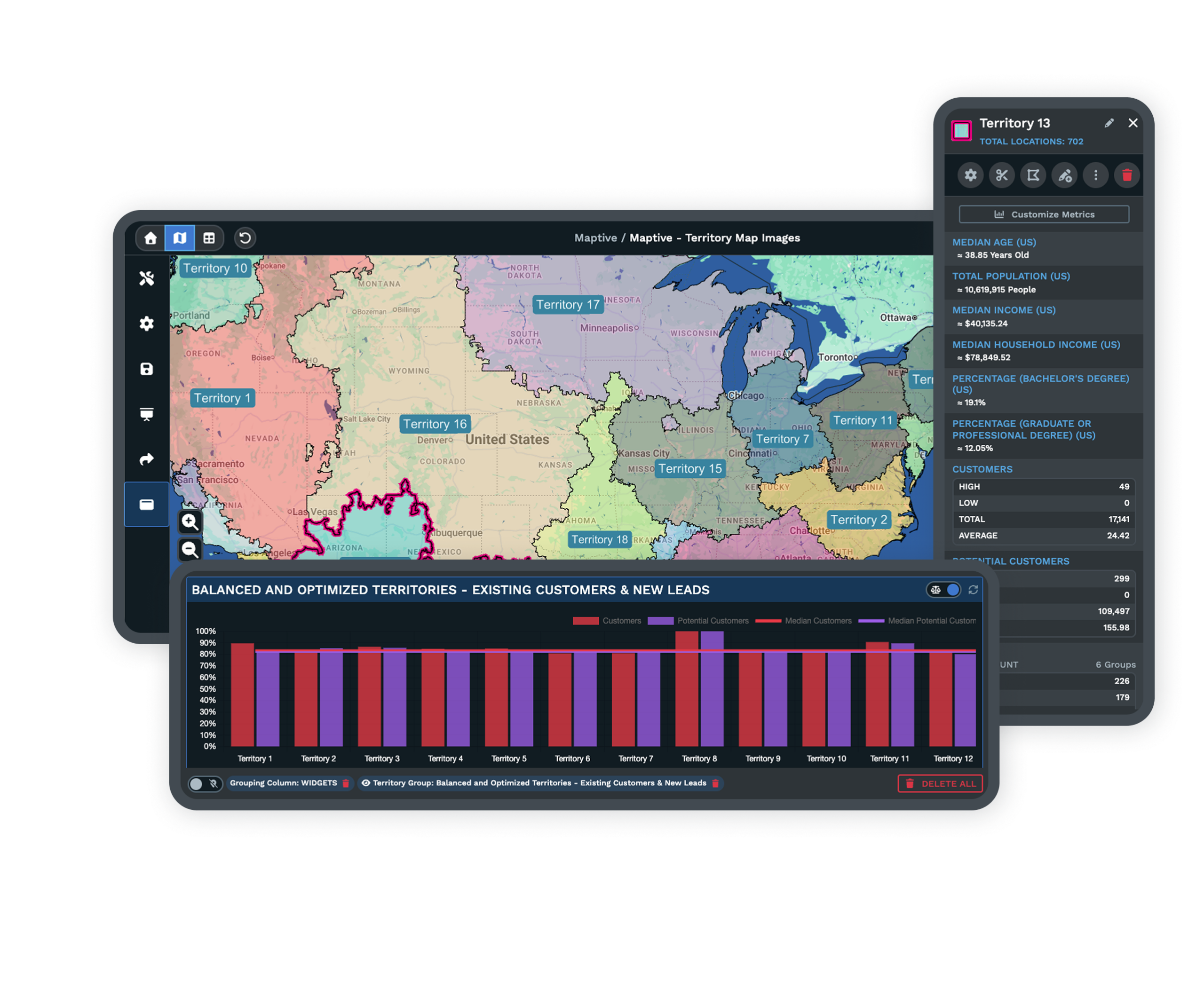
ZIP and State Grouping Instead of Manual PolygonsThe Geographic Boundary Tool groups ZIP or postal codes and US states into a territory in a few clicks, then lets you drag the edge to adjust. No tracing a shape point by point the way My Maps makes you. |
| 02 |
A Balanced Build the Manual Method Cannot MatchThe Automated Territory Creator and Optimizer distributes ZIP codes across territories from weighted variables and constraints in about one to fifteen minutes, so no franchisee lands a boundary that looks equal but holds far fewer households. |
| 03 |
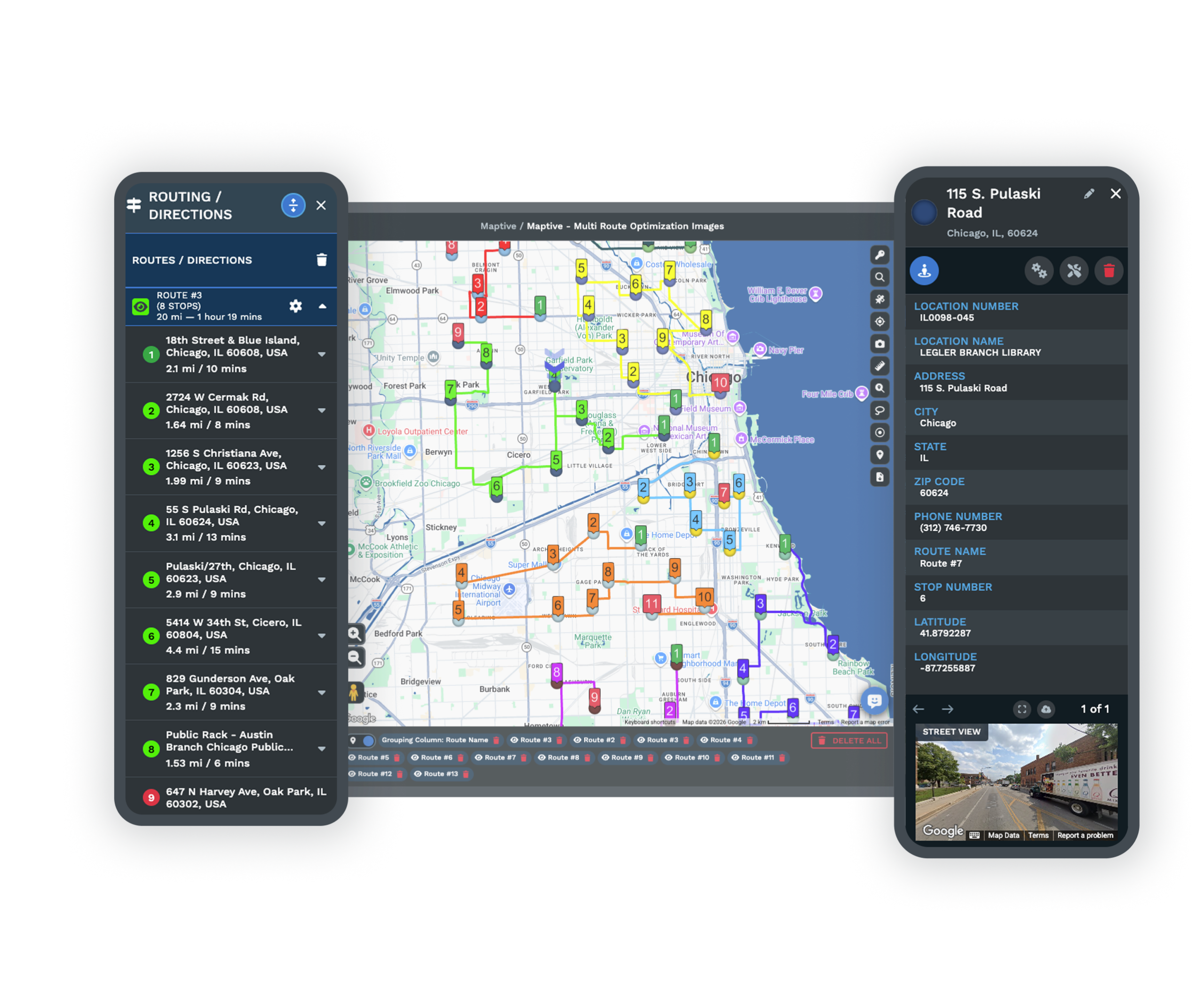
Radius and Drive-Time Areas Native to the ToolThe Distance Radius Tool drops a fixed-mileage circle for the classic agreement definition, while Drive Time Polygons trace the area reachable within a set number of minutes along real roads. |
| 04 |
An Export Ready for the AgreementExport the ZIP list inside any drawn territory and export it as an .xlsx, .csv, or .tsv file, plus a drive-time boundary list, so the area on the map becomes the language in the franchise agreement. |
The Silent Truncation Nobody Re-Counts
A spreadsheet holds each franchisee's ZIP list, and My Maps renders a rough polygon, so for a handful of neat areas the manual pair looks fine, and the break arrives without warning. Import a file over 2,000 rows into My Maps and it keeps only the first 2,000, often with no error, so the map looks complete while units are missing.
The gap surfaces at the worst moment, when you sign a franchisee whose territory silently dropped rows or find an overlap after both agreements are already signed. A tool that plots 200,000 locations on one map removes the ceiling that forces the guesswork.
The List and the Map Drifting Apart
A spreadsheet cannot render a boundary, show where two franchisees' ZIP lists touch, or check a candidate address against every existing territory, so the list and the map drift the moment either one changes. My Maps adds geometry but no count inside a boundary, no census data, and no version history to roll a change back.
Because an FDD references a boundary as it stood at signing, franchisors are told to keep areas backed up in a separate spreadsheet, which is the drift restated as advice. Purpose-built software keeps the boundary, the count, and the data in one place that stays current.
The Foundations of a Network Running on One File
Demographics Read Inside Every Boundary
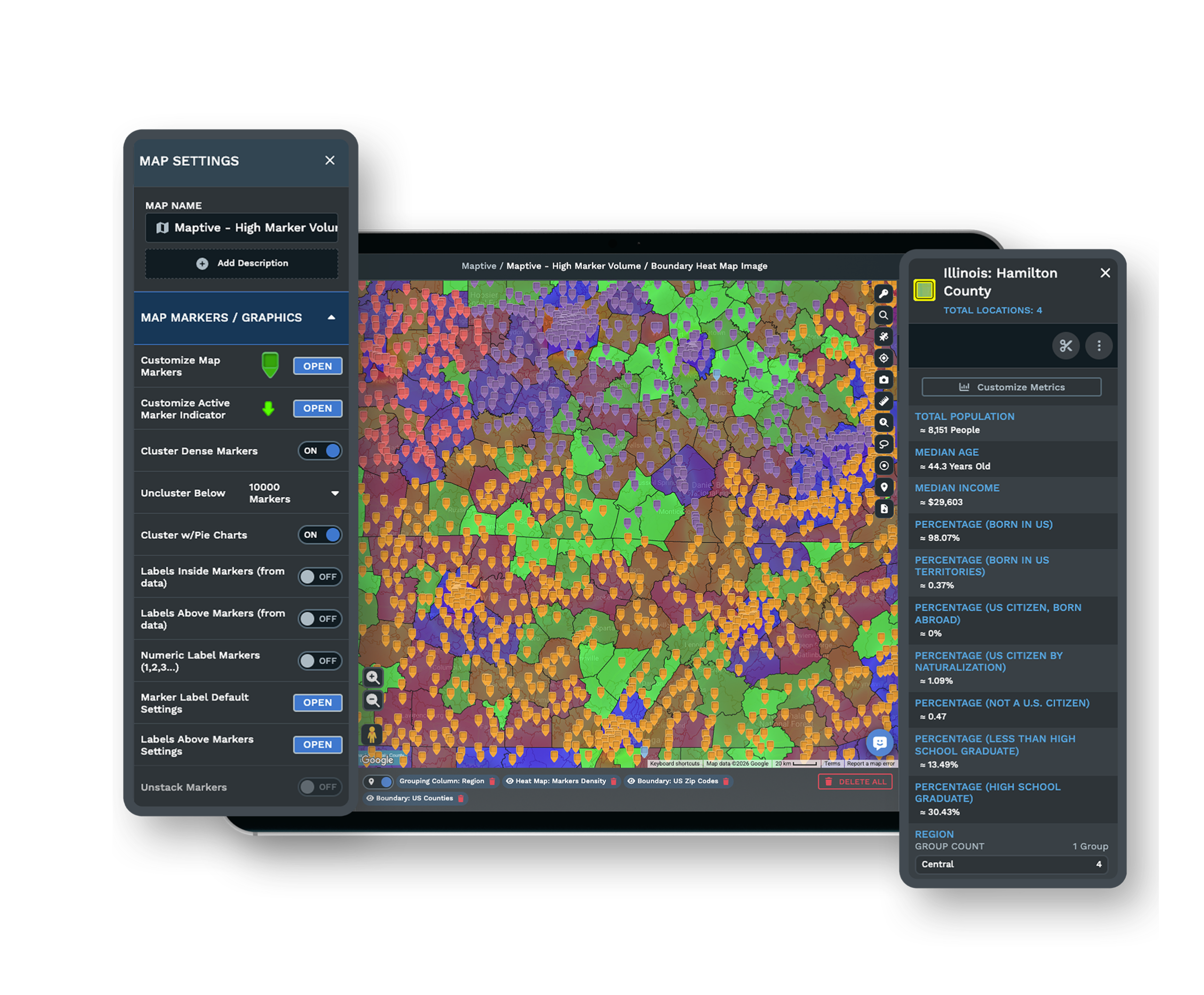
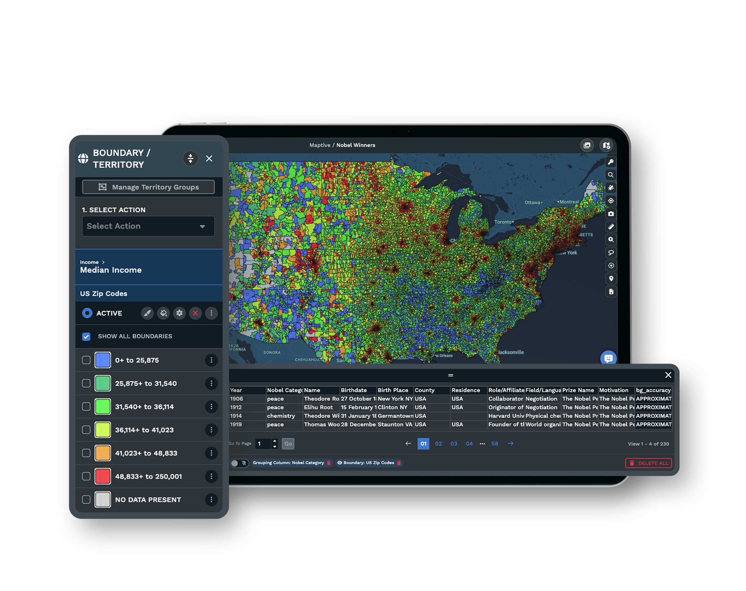
More than 50 US and Canada census variables sit behind each area at the state, county, ZIP, census tract, and block group level, so you qualify a boundary against a target profile, something Google My Maps cannot do at all.
Permissioned Sharing Over Emailing the File
Share a map by link with public or password-protected access and set each teammate to view-only or edit, so headquarters holds one live reference instead of emailing a KML around and losing track of the current version.
Security and Support Behind the Switch
The platform runs on 256-bit SSL, two-factor authentication, single sign-on, role-based access, and audit logging, and a US and Canada support team answers in under 15 minutes at a 9.7 out of 10 rating.
Free trial with the full platform and no credit card
Take Your Franchise Territories Off Google Maps
Start a 10-day free trial with no credit card and all 60+ tools unlocked. Import the unit list you keep in a spreadsheet, group it into territories by ZIP or radius, read the population inside each one, and export the boundary, all on your own network.
Compare the Tools Side by Side in a Walkthrough
If you are weighing the switch from My Maps and spreadsheets, a Maptive specialist will rebuild one of your current territories in the platform while you watch. Bring the ZIP list you manage today, and the session shows what changes when the ceiling and the manual drawing go away.
Frequently Asked Questions
What's the best software for franchise territory planning?
The best fit is a purpose-built franchise territory tool that draws areas by radius, ZIP or postal code, or a balanced optimizer, counts what sits inside each boundary, and exports the ZIP list for the agreement. Google My Maps and spreadsheets do none of those. Maptive builds and adjusts territories on one map that holds up to 200,000 locations.
A tool to replace Google Maps for franchise zones?
Dedicated territory software replaces hand-drawn My Maps zones with drag-to-edit boundaries built from ZIP or postal codes, US states, radius, or drive time. It adds census data inside each boundary, an overlap check, and permissioned sharing, and it carries the whole roster past the 10,000-feature ceiling that ends My Maps at scale.
What is the location limit on Google My Maps?
Google My Maps caps each layer at 2,000 features and allows up to 10 layers per map, for a maximum of 10,000 features per map. Imports over 2,000 rows are truncated to the first 2,000, often with no error message, so missing locations go unnoticed until someone searches for a store that should be there.
Why does Google My Maps stop importing at 2,000 rows?
Google's own import guidance states not to import files with more than 2,000 rows. Above that count, My Maps keeps only the first 2,000 and usually gives no warning, so the map looks like it imported cleanly while later rows never loaded. That silent truncation is why a franchise network past a couple thousand units outgrows the tool.
Can you draw franchise territories in Google My Maps?
You can draw a polygon by clicking point to point and closing the shape, then share it with your team. But My Maps has no count inside the boundary, no demographics, no overlap check, and no version history, so it breaks down past a handful of neat areas and gets tedious the moment zones must tile without gaps.
Can you use a spreadsheet to manage franchise territories?
A spreadsheet can hold each franchisee's ZIP list, but it cannot render a boundary, show overlap between two lists, or check a new address against every territory. The list and the map drift apart as soon as either one changes, which is how an overlap slips through until after both agreements are signed.
Is Google My Maps good for managing a franchise network at scale?
Not past a small network. The 2,000-per-layer and 10-layer limits force you to split units across separate maps, and there is no version history, no count inside a boundary, and no demographics. Practitioners put manual mapping's break point around 100-plus units, where a purpose-built tool becomes the safer option.
Can you build territories from a list of ZIP codes?
Yes. A territory tool groups ZIP or postal codes and US states into a boundary and lets you drag to adjust it, then exports the ZIP list back out for the agreement. ZIP codes are popular in franchise contracts because you list them directly in the document, which is the same list the tool generates from a drawn area.
How do you balance franchise territories fairly?
An automated territory builder distributes ZIP codes or accounts across territories using weighted variables and constraints, so no franchisee gets a boundary that looks equal on the map but holds far fewer households. Google My Maps and spreadsheets have no way to count inside an area or balance across several at once.








