In the storm of uncertainty, real-time maps become crucial for emergency management. Welcome to Maptive, where cutting-edge technology meets life-saving emergency response.
Unveil a new era of disaster response with features meticulously crafted to empower swift and strategic risk management. When every moment counts, trust Maptive to map your way to safety.
Harness the Power of Maptive for Emergency Response
With Maptive, emergency response personnel can craft emergency response routes with ease, map out critical infrastructure in seconds, and deploy disaster management strategies on the spot.
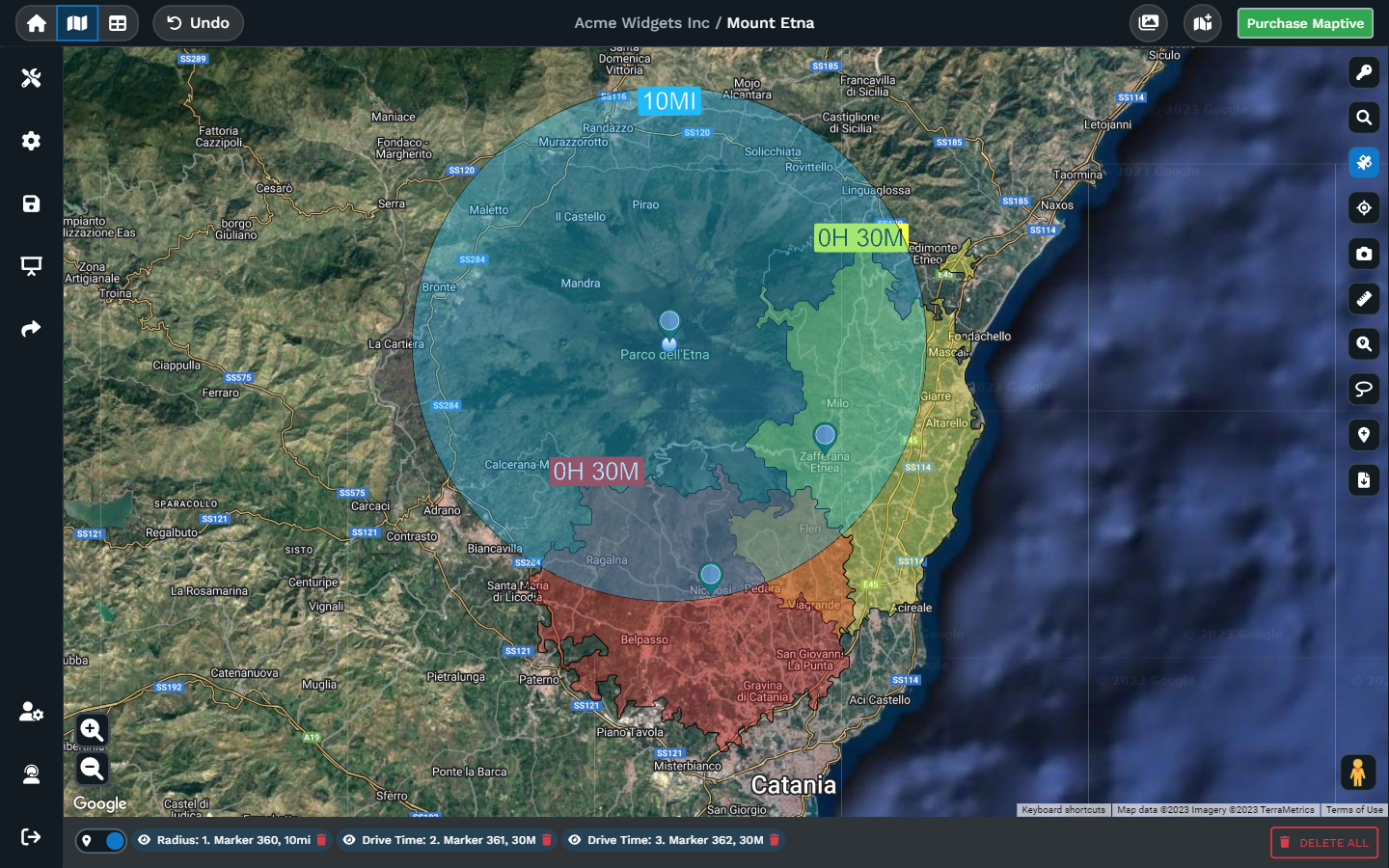
Navigate the fastest path to safety during natural disasters by using drive time maps, and proactively identify danger zones to maintain situational awareness. In the aftermath of chaos, Maptive’s tools become a guiding light, helping communities organize, spot hazards, and reestablish public safety.
How Digital Maps Empower Emergency Management
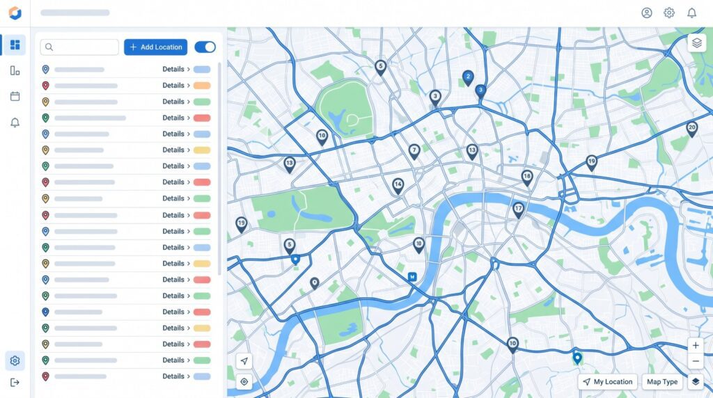
Digital maps have the power to completely change how disaster management unfolds. Up-to-date maps aid in damage assessment while emergency teams feed geospatial data, incident reports, and GPS coordinates into the emergency management software to make sure decision-makers always have the most accurate information.
These interactive functionalities go well beyond what traditional paper maps can do, offering real-time insights to response teams to manage emergencies. Unlike non-digital maps, emergency management software like Maptive can help first responders generate maps for:
- Instant Situational Awareness
- Precision Routing
- Predictive Analysis
- Resource Allocation
- Communication Hub
- Aftermath Assessment
Master the Art of Emergency Management with Maptive
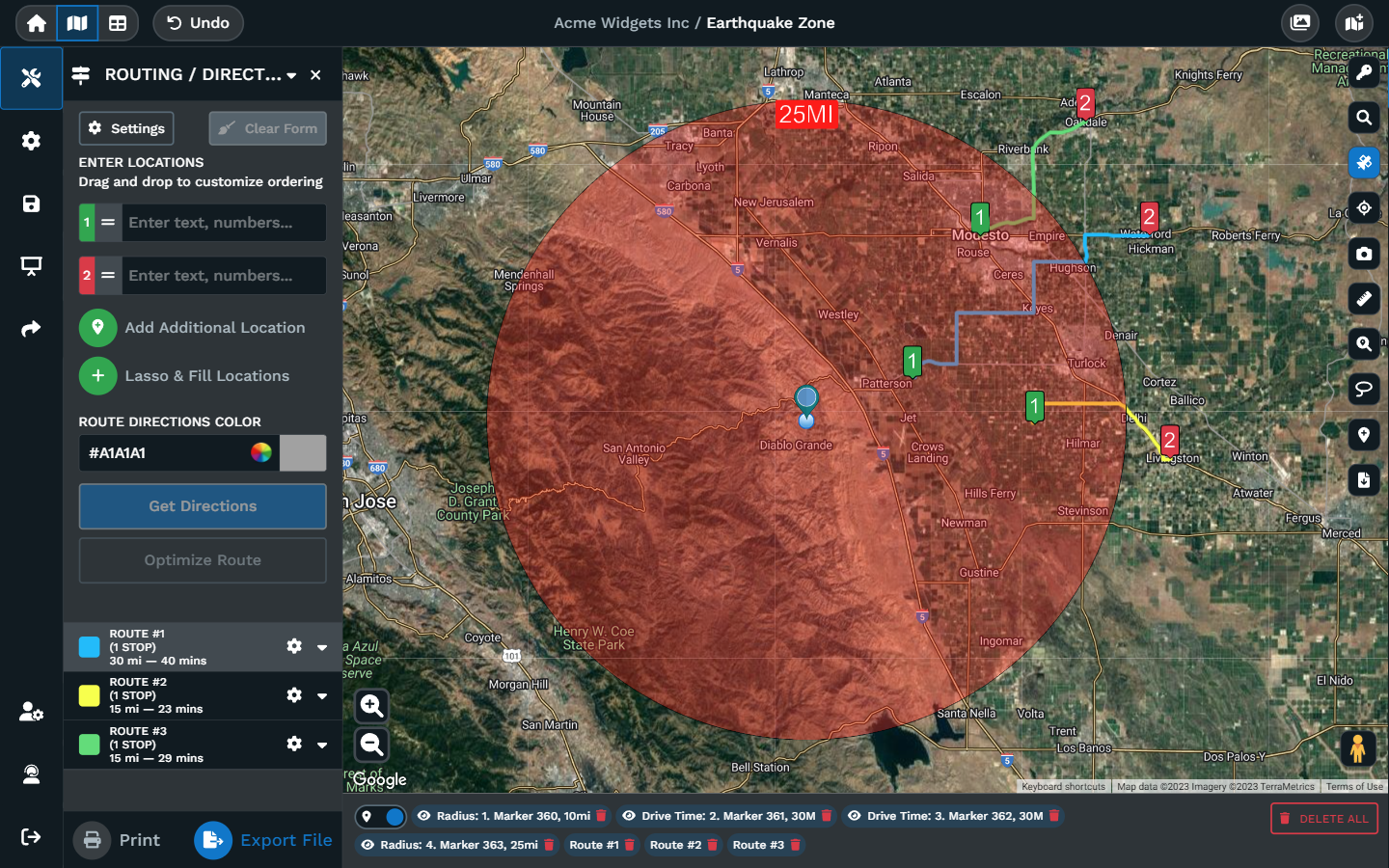
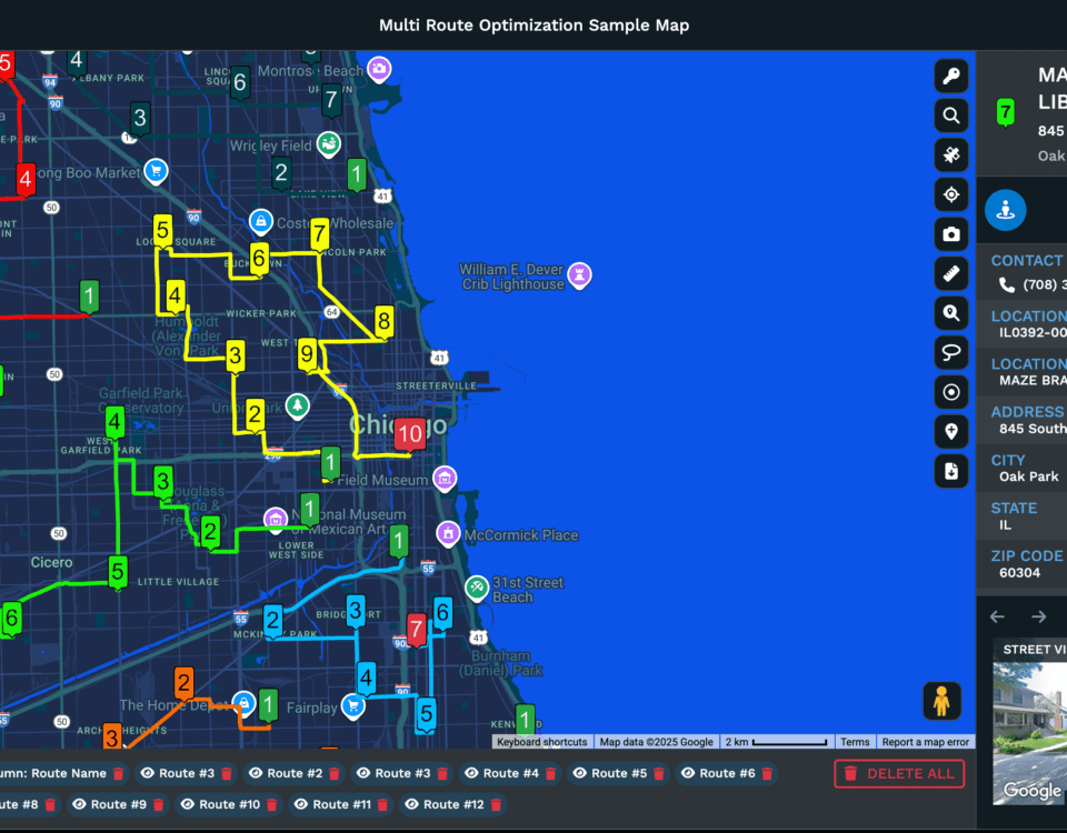
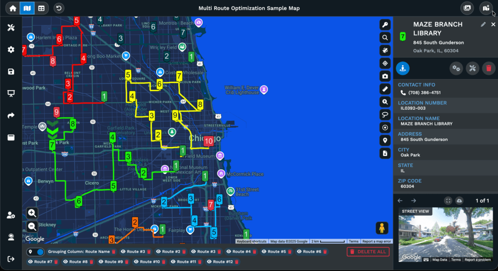
Emergency Route Planning When Every Second Counts
Maptive’s intuitive interface helps first responders and emergency workers create optimal routes for emergency vehicles to ensure swift navigation.
When urgency strikes, Maptive paves the way for timely and effective action, saving lives through strategic route planning.

Maptive Version 5 (Coming Mid 2024)
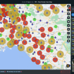
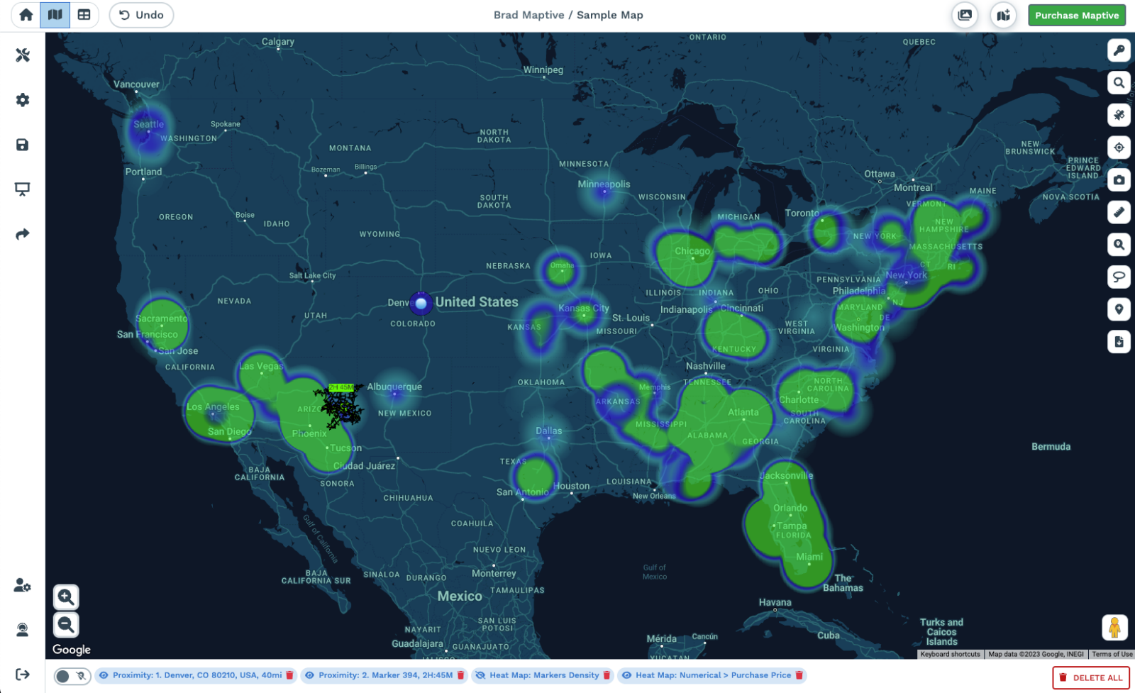
Heat Mapping for Proactive Response Efforts
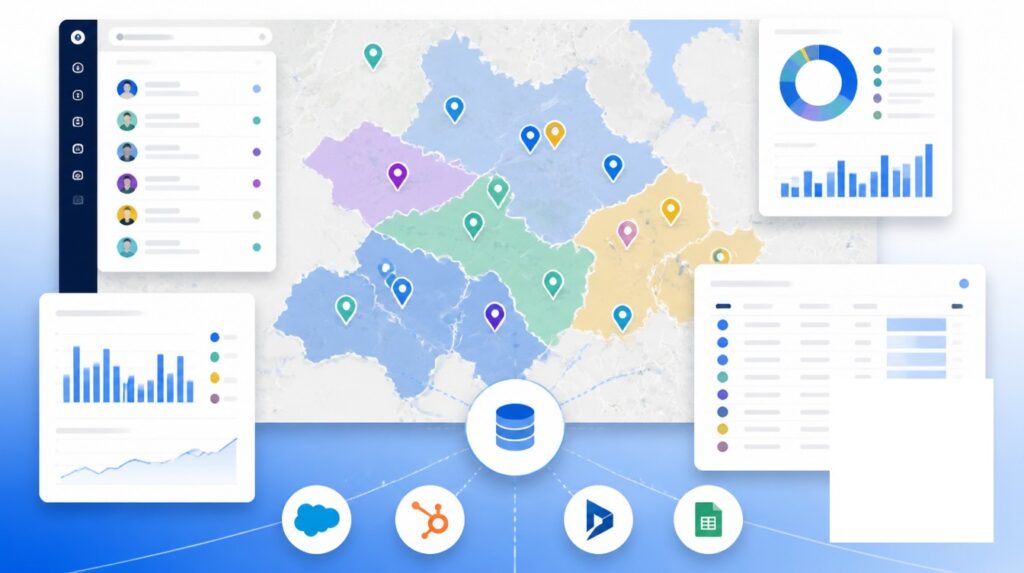
Empower your team to make informed decisions by visualizing data-driven patterns. With Maptive’s dynamic heat maps, emergency workers can instantly detect high-activity zones and potential risks.
When disaster strikes, Maptive’s heat maps can help track the ebb and flow of people and resources, optimizing aid distribution and resource allocation.
Maptive Version 5 (Coming Mid 2024)
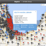
Hazard Mapping: Build a Blueprint for Risk Management
Anticipate nature’s uncertainties and plan for the worst with data-backed risk assessments. Maptive’s satellite mapping lays the groundwork for emergency preparedness.
Emergency managers can pinpoint vulnerabilities with precision, from flood-prone zones to wildfire paths and seismic hotspots.
Maptive Version 5 (Coming Mid 2024)
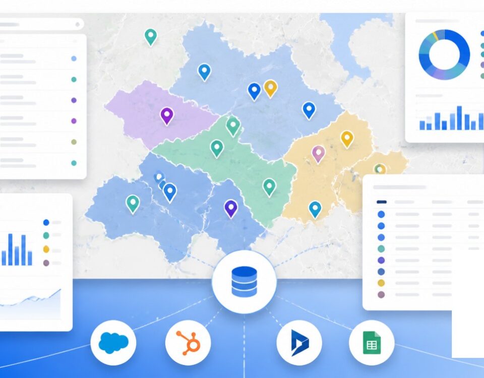
Seamless Organization: Uniting Efforts in the Face of Adversity
Use Maptive as your digital command center, helping responders establish a centralized repository for vital information–survivor locations, infrastructure status, and resource availability–enabling rapid and coordinated decision-making.
Easily share maps and information across agencies and organizations, fostering collaboration that transcends boundaries.
Evaluating the Aftermath
When the dust settles after a disaster, emergency management software like Maptive can generate digital maps to create a visual chronicle of the event’s repercussions. Those maps can facilitate damage evaluation, guide future emergency response planning, and even help streamline insurance claims.
Getting Started with Maptive
- Create Your Account. Begin by signing up for Maptive. Visit our website and follow the simple steps to create your account for emergency responders.
- Access the Software. Once registered, log in to your account to access Maptive’s powerful tools. Experience the user-friendly interface designed to simplify your crisis management journey.
- Explore Features. Dive into Maptive’s arsenal of features tailored for emergency scenarios. Discover route planning, heat mapping, organization tools, hazard mapping, and more. Unleash the potential of data-driven decision-making.
- Try Before You Buy. Test-drive Maptive firsthand with our free trial or request a demo. Let emergency responders try its capabilities and see how it transforms crisis management for you.
Empower Your Emergency Services with Maptive
Elevate your emergency management strategy with Maptive’s emergency management software.
Harness the power of your lessons learned and our location data to create disaster response maps for natural or man-made disasters.
Give your emergency response teams the best chance at response and recovery, securing critical infrastructure, and leveraging real-time data and critical information to restore public safety.


