


Yes. Maptive lets you put up to 100,000 locations in a single data set on the 45 Day Pass, Pro and Team, and on Enterprise the limit depends on your volume. So you can put a file of 20,000, 50,000 or 80,000 rows on one map.
How Many Addresses Fit in One Maptive Data Set
The limit is 100,000 locations per data set on the 45 Day Pass, Pro and Team. On Enterprise it depends on your volume.
A data set is one upload, which usually means one spreadsheet. Every plan includes unlimited maps, so the only cap here is on the size of each file.
The 100,000-location cap applies to a single data set. Layering combines locations from several maps, so check the combined map capacity separately. Maptive also lists up to 200,000 markers per map, which is a different limit from locations per data set.
Bailiwick, a Maptive customer, has put close to 20,000 sites on a single map.
Records Stored and Total Locations Geocoded on Each Plan
Your account also has a limit on location records stored. That’s 250,000 on the 45 Day Pass, 600,000 on Pro and 15,000,000 on Team. It’s the total across all the maps in your account, while the 100,000 is the limit on any one of them.
Total locations geocoded is counted across the account too. Geocoding is the step that turns an address into a point on the map, and this number counts those points. It’s 150,000 on the 45 Day Pass, 400,000 on Pro and 1,000,000 on Team.
Take three separate files of 100,000 rows each. Together they come to 300,000 records. That’s over the 250,000 on the 45 Day Pass and well under the 600,000 on Pro.
On Enterprise, all three limits are based on volume.
Why Do Free Map Makers and Browsers Struggle Past a Few Thousand Pins
Free map makers often stop at a few thousand rows per import, and past that point the trouble is usually the browser. In an ordinary web map, each marker is its own element on the page. Every time you pan or zoom, the browser has to move thousands of those elements at once. The standard fixes are to draw the markers with the computer’s graphics processor and to group nearby markers into clusters. Maptive does both. It draws the map with WebGL, which lets it show more markers and boundaries at the same time, and clustering is on by default.
How the Upload and Geocoding Work
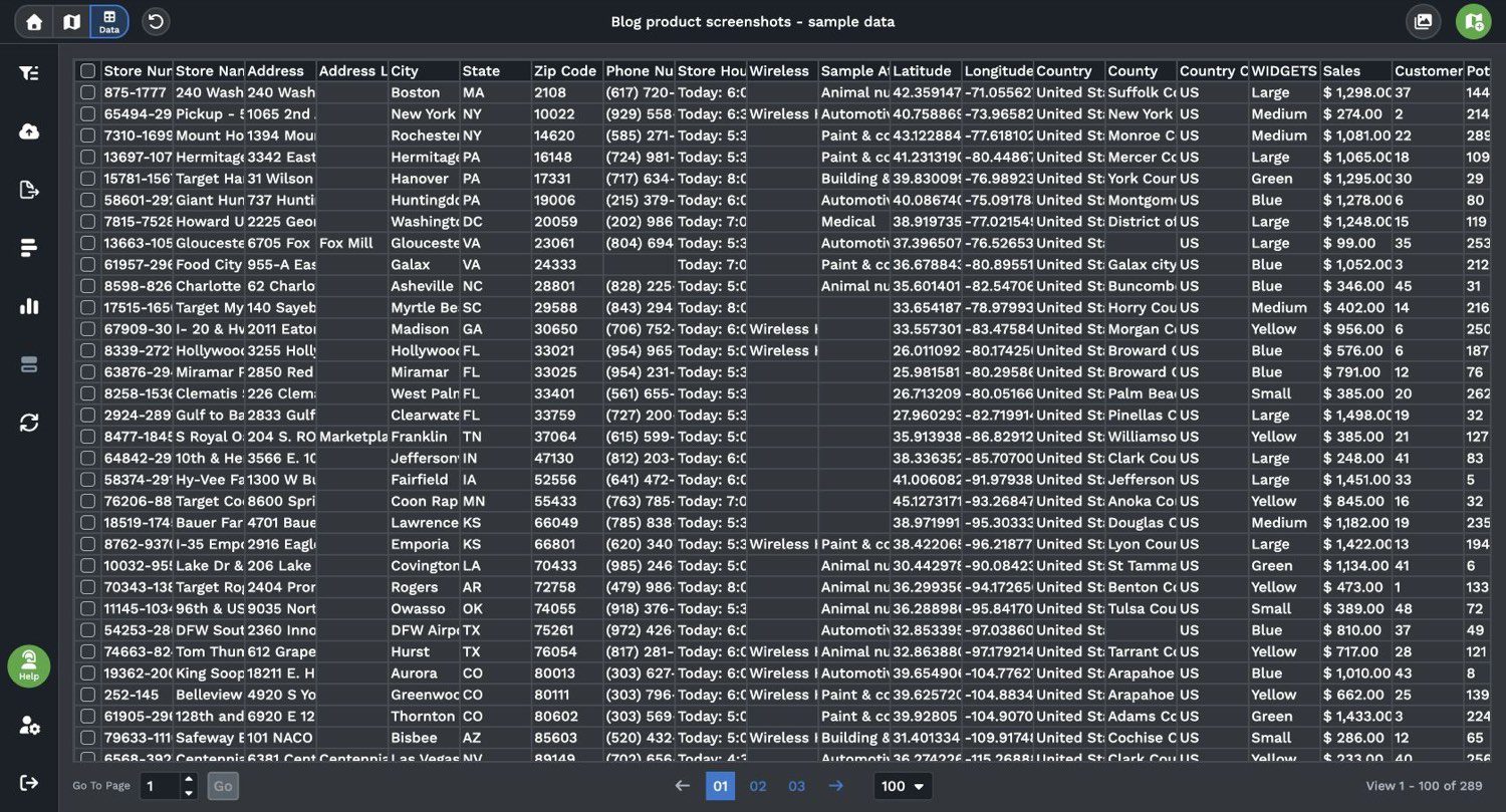
There are three ways to load a file. You can drag and drop an Excel, CSV or TSV file or click “Add File”. You can copy your data, column headers included, and paste it in. Or you can start from a Google Sheet. Then click “Map Now”.
The file needs a header row. Headers such as Address, City and Zip code tell Maptive what each column is.
The matching screen comes next, and it’s the step that matters most on a large upload. In Section 1, match only the address information, never a location name or a phone number. Click Done and geocoding begins. Unmatched columns still show in the marker pop-out.
Split the address across Street, City, State and ZIP columns if you can, because split fields geocode more accurately than one long string. As a general spreadsheet habit, store ZIP codes as text so leading zeros aren’t dropped.
How Long Does a Large File Take to Map
It depends on the size of the file. After you click Done, the map starts loading. You wait while Maptive turns the addresses into map points. If your data already has latitude and longitude columns, Maptive plots those directly.
Which Views Keep a Large Map Readable
On a national view, 60,000 individual pins are a solid block of color. A map that size is still useful if you use clusters and views that summarize the data. Leave clustering on while you work, because turning it off can make your map load more slowly.
Marker Clusters and When They Break Apart
Cluster Dense Markers is on by default. To find the setting, click the gear icon at the top left of the map to open Map Settings, then go to “Map Markers/Graphics”. Turning it off stops all clustering, and it can also change the way you click on a marker.
The same setting controls when clusters break apart into single pins. Choose 2,000 and the map unclusters when 2,000 or fewer markers are visible. The 5,000 and 7,500 choices work the same way.
On a map of 60,000 points, you see clusters when you’re zoomed out. Zoom in to one metro area and the pins appear.
If you’re clustering and using the Grouping Tool, the clusters can show as pie charts instead of plain blue circles.
Heat Maps, Filters, Grouping and Boundary Counts
Other tools under Map Tools summarize a big file or narrow it down.
- The Heat Mapping Tool has a “Marker Density” style that colors the map by where your records are most concentrated. Click “Add Heat Map” to draw it. You can hide the markers underneath.
- The Filter Tool narrows the map to the rows you want. Click “Create Filters” and pick from Group, Text, Number, Attribute and Date filters.
- The “Grouping Tool / Colored Pins Tool” colors the pins by any column, and you can check groups on and off.
- The Boundary Tool has a fill type called “Marker Count / Location Density”. It counts the markers in each boundary, so 80,000 pins become a count per county or ZIP code.
Checking That Every Row Made It Onto the Map
Rows that can’t be matched to a place aren’t dropped. Maptive flags them and pulls them out, so you can export them, correct them and upload them again.
That gives you a simple check after a large upload. The rows on the map plus the flagged rows should equal the rows in your source file. To count the mapped rows, use “Export Entire Dataset”. Keeping an ID column in the source file is good general practice, because it lets you match the two lists.
If the file is messy, Maptive’s support team helps for free. Send the spreadsheet or address list, and an expert reviews it, fixes errors and helps you through the import.