


Publish a Public Coverage & Pricing Map on Your Website
Want site visitors to see if you cover their area? Embed a map where they type an address and get your coverage.
No credit card required
- Show visitors your coverage and pricing by region or a metro.
- Let a customer type an address to see your local price there.
- Publish one interactive map on any page, no developer needed.
- Add an opportunity, income, or population figure to each area.
- Refresh the map from a Google Sheet whenever your prices move.
- Grab the embed code and drop the coverage map on your website.
Trusted by teams at









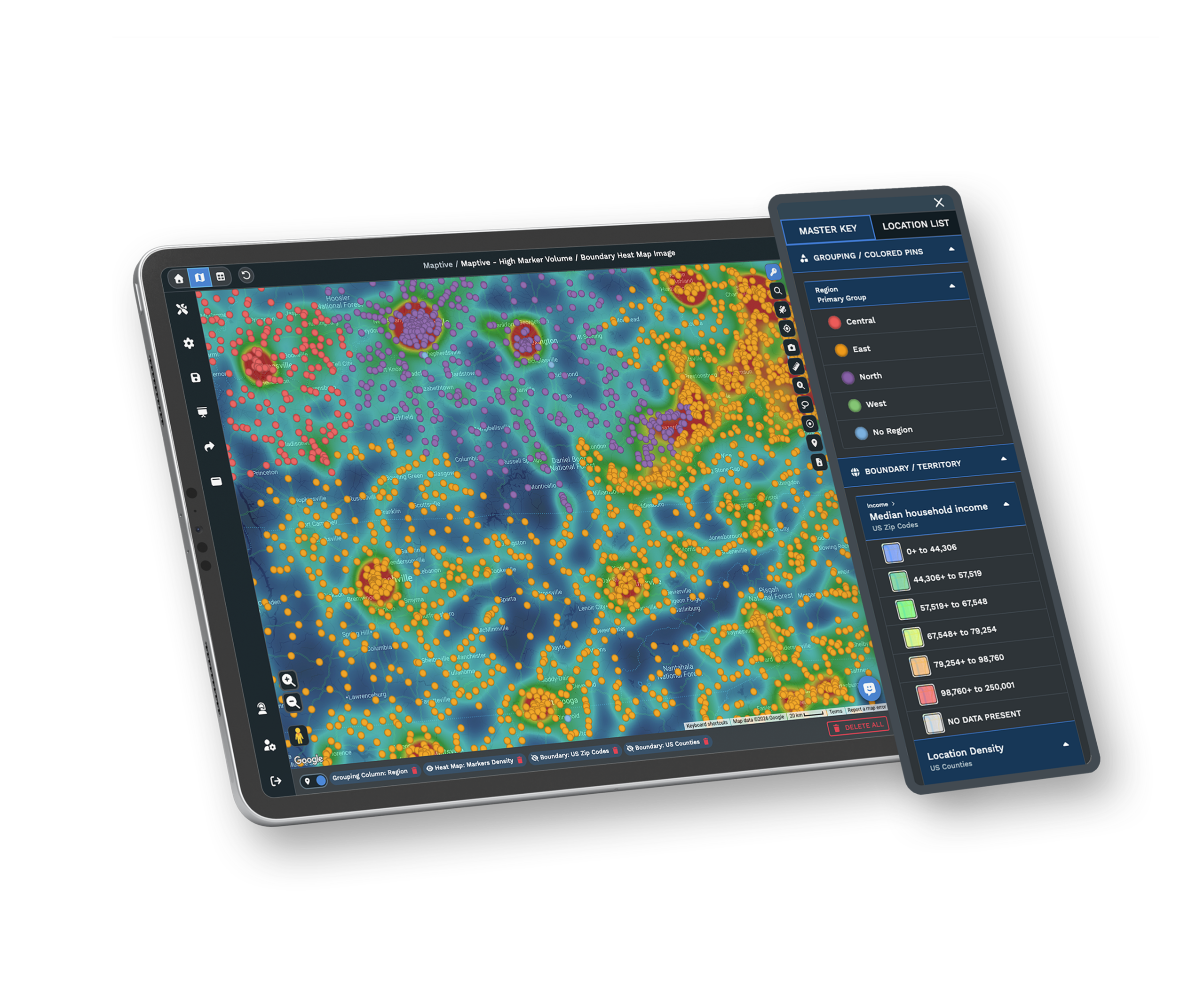
A Live Coverage Map Your Visitors Can Search
You can't see that on an Excel file.
Getting the Map Onto Your Site
-
1
Import Your Metro List
Bring your metros in from a Google Sheet or Excel, with a price and any figures per area.
-
2
Color and Label the Areas
Shade each metro and add pop-ups so a visitor sees its coverage and your price.
-
3
Turn On the Address Search
Switch on Location Finder so anyone can type an address and land on their own area.
-
4
Copy the Embed Code
Grab the embed code and paste it into your page, and the live map appears for visitors.
Put Your Coverage Map Online Today
Start with the 10-day free trial, no credit card needed. Import a handful of metros and add a price to each. Switch on the address search to see it work the way a visitor would. Then copy the embed code and drop it onto a test page. Prefer a hand? A Maptive specialist will build the first areas and hand you the embed code, ready to publish.
No credit card required
Frequently Asked Questions
How do I put a coverage map on my website?
You build the map in Maptive, then grab its embed code and paste that into the page where you want it. Import your metros and shade each one. Add a price or any figures you want a visitor to see. Turn on the address search so a customer can type where they are. When the map looks right, open the sharing options and copy the embed code Maptive gives you. Paste it into your site the way you would any snippet. The live, searchable map then loads on your page, and you never touch code or wait on a developer.
Can I show territory pricing by metro on the map?
Yes. Add a price column to your data, one price for each metro. Maptive reads it straight onto the map. When a visitor opens a metro or lands on it through the address search, the pop-up can show your price for that area alongside coverage. You can list more than a price too, like an opportunity score or a population count, so each area tells a fuller story. Because the price lives in your source sheet, you change it in one place and the map reflects it. Nothing about it looks like a spreadsheet to the visitor.
Can visitors search their own address on the embedded map?
Yes, that is what the address search is for. With Location Finder switched on, a visitor types their address into the embedded map and it takes them to the metro that covers them. They see your coverage there and the price and figures you added for that area. It works right on your page, so nobody leaves your site or opens a separate tool. Visitors only look, never edit, so your map and its pricing stay exactly as you set them. On the page you chose, it works as a normal searchable map.
How do I keep the pricing on the map up to date?
Connect your map to a Google Sheet and edit the sheet whenever a price moves. Maptive reads from that sheet, so a change you make in one row shows up on the map without a rebuild. This keeps a single source for your numbers, which matters when prices move by metro or a new area comes online. Update the sheet, and the embedded map on your site follows. You skip re-exporting files or emailing a developer, and visitors always see the current coverage and pricing you meant to show them.
What data can I show for each metro on the map?
Whatever you put in your source data. A metro can carry a price and an opportunity score, plus an income or population figure, all readable in the pop-up when a visitor opens that area. You bring these in from your Google Sheet or Excel file, and Maptive maps each metro and its numbers. You choose which figures show, so the map stays clean and speaks to what your visitors care about. Add or trim a column in your source and refresh. The map reflects it, so each area shows exactly the story you want it to tell.
Do I need a developer to add the map to my site?
No. The embed code Maptive gives you is a short snippet you paste into your page, the same way you would add any other embedded element. If you can edit a page or add a block in your site builder, you can add the map. There is nothing to install and no code to write yourself. Build and color the map in Maptive, copy the code, paste it where you want the map to appear, and save the page. The live, searchable coverage map shows up for your visitors, and you did it without waiting on anyone.
Can I organize the map around metropolitan statistical areas?
Yes. Build your areas around the metros that matter to you, and give each one its own coverage and price. You group the places you serve into named areas on the map, shade them so they read at a glance, and attach the numbers a visitor wants to see. If you think in metros, in regions, or in your own service zones, you shape the map to match how you sell. Once the areas are set, the address search sends each visitor to the right one, so they see the coverage and pricing for their own metro.
Will the map look right on phones and tablets?
Yes. The embedded map runs in a browser, so it opens on a phone, a tablet, or a laptop the same way your site does. A visitor on their phone can type an address and land on their metro, then read the coverage and price you set for it. Because it lives on your page through the embed code, it sits inside your layout rather than off in a separate app. Your visitors get the same searchable map wherever they open it, which matters when many of them will check your coverage from a phone before they reach out.
How many locations or areas can the map hold?
A single Maptive map holds up to 200,000 locations, which is far more than a coverage map by metro usually needs. You can build out every metro you serve, add the points inside them, and still have plenty of room. Each area carries its own price and figures, and the map stays quick for a visitor to search. So if you cover a dozen metros or spread across the country, one embedded map can show the whole picture. You will not have to split coverage across several maps or leave any of your service area off.
Can I control who sees the embedded map?
The map you embed is public, meant for visitors to your site, so anyone who reaches the page can search it. That is the point of a coverage map, letting a customer look up their area and see your pricing. If you also want a private, internal version for staff, you can share a separate view-only link and even set a password on it. So you can keep one open map on your public page and, if you like, a protected one for your own team. You decide which map goes where, and each keeps its own sharing.








