


Build Sales Territories From ZIP Codes
Have a spreadsheet of ZIP codes and reps? Maptive turns it into a map where each ZIP is colored by the rep who owns it.
No credit card required
- Import your ZIP list right from a spreadsheet, CSV, or Excel
- Color each ZIP by the rep who owns it, right there on the map
- Group nearby ZIP codes and save them as one named territory
- Turn a whole metro into a single area, one ZIP code at a time
- Give each rep the exact ZIPs they cover, with no gray zones
- Move a ZIP to another rep later by dragging it across the map
Trusted by teams at









Your Territory Work, Made Simple
It's a very intuitive tool, all of the functions within it are very clearly depicted.
Building It in Maptive
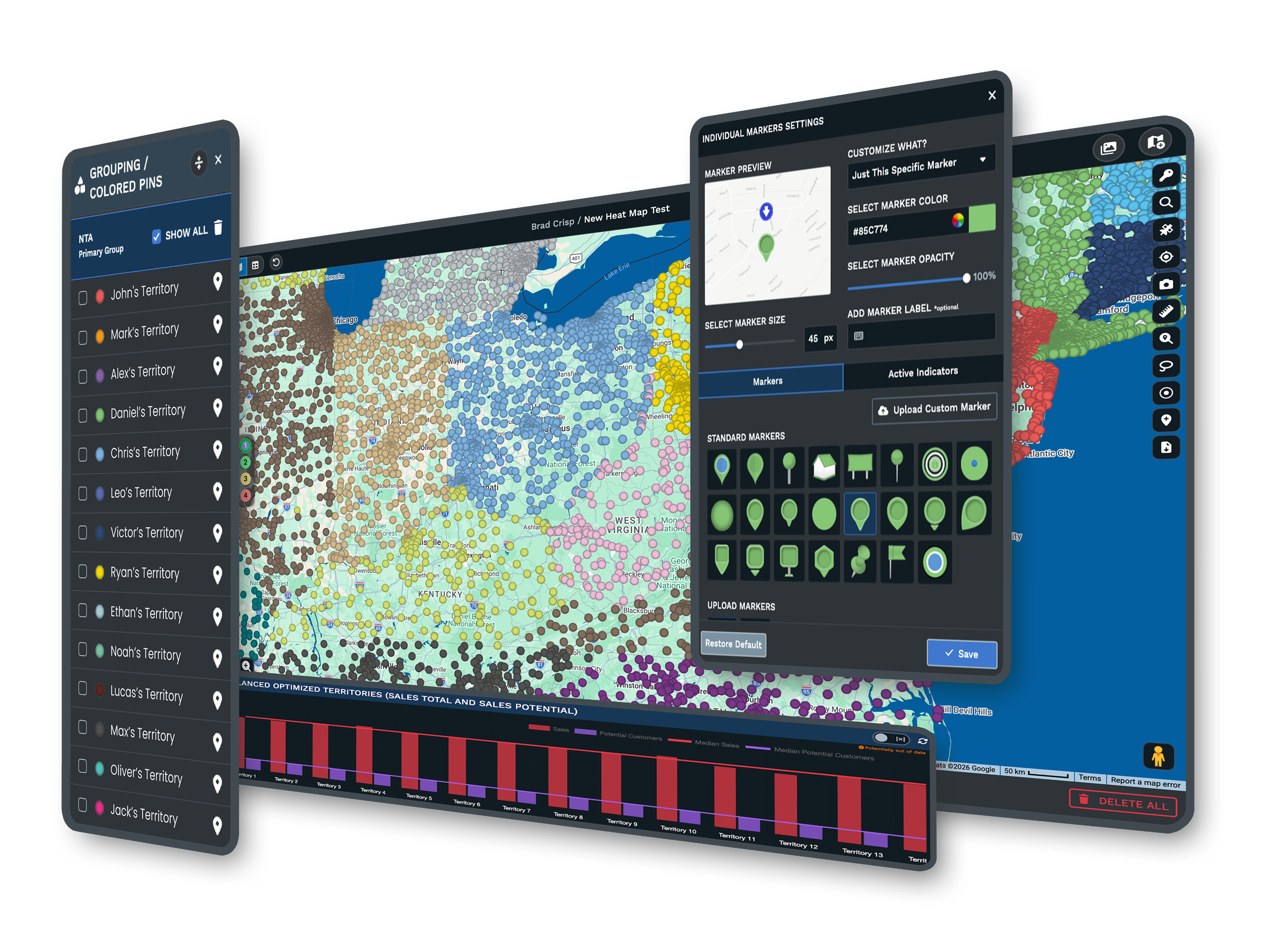
-
1
Import Your ZIP List
Upload your spreadsheet with a ZIP column and a rep column, and every ZIP lands on the map.
-
2
Color Each ZIP by Rep
Point Maptive at the rep column and the map shades every ZIP in that person's color.
-
3
Group ZIPs Into a Territory
Select the ZIP codes that go together and save them as one named area you can hand off.
-
4
Reassign a ZIP Anytime
Drag a ZIP to another rep and the colors and the counts update on the spot.
Try It on Your Own ZIP List
The 10-day free trial is the fastest way to see it, with no credit card. Upload your ZIP list and color it by rep, then set up your first few territories on your own data. Want a hand? A Maptive specialist will walk your list with you and build the first ones together.
No credit card required
Frequently Asked Questions
How do I turn a list of ZIP codes into rep territories?
Start by importing your ZIP list from a spreadsheet, with the ZIP codes in one column and the rep who owns each one in another. Maptive plots every ZIP on the map and shades it by rep. From there you select the ZIP codes that belong together and save them as a named territory using the boundary tool. You end up with real areas on a map instead of a column of numbers, and you can rename or reassign any of them whenever your team changes.
Can I import my ZIP codes from a spreadsheet or Excel?
Maptive reads Excel and CSV files, and it also pulls straight from a Google Sheet. Keep your data simple, with one column for the ZIP code and another for the rep or salesperson who covers it. When you upload, the map builds itself from those two columns and places every ZIP for you. You do not need to reformat anything or learn a new file type. If you already track territories in a sheet today, that same sheet is usually all you need to get started.
Can I color-code ZIP codes by salesperson?
Point Maptive at the column that holds the rep or salesperson name, and each ZIP takes on that person's color. A busy metro then shows up as a set of colored areas instead of a wall of dots, so you can see at a look where one rep's ground ends and the next begins. If you add or rename a rep, the colors update to match. This is also the fastest way to spot a gap where no one is assigned, or a spot where two reps overlap.
How do I group ZIP codes into a single territory?
Select the ZIP codes you want on the map, either by clicking them or by choosing them from your rep column, and save the selection as a named territory. Maptive draws a single boundary around that group so it shows up as one area rather than a scatter of separate ZIPs. You can name it, measure the size of it, and hand it to a rep. If you need to adjust it later, you add or remove a ZIP and the territory updates on the spot.
How do I move a ZIP code from one rep to another?
Open the map, click the ZIP code you want to move, and reassign it to the other rep's territory. The color changes right away, and any counts you are tracking update with it, so you can see the trade the moment you make it. There is no rule to re-key and no rows to edit by hand. If a rep leaves or a region is split, you can move a whole batch of ZIP codes at once and the map keeps everyone's areas current.
Can I build territories by county or state instead of ZIP?
The same grouping tool works with counties and states, not only ZIP codes. Many teams mix them, using ZIP codes in dense metros where they want fine control and switching to counties across rural ground where a ZIP-level plan would be more detail than they need. You can start with one approach and change your mind later without rebuilding from scratch, since the territories sit on the same map and follow the same group-and-name steps. It is the same short workflow whichever unit you pick.
Does it work for US ZIP codes and Canadian postal codes?
Maptive draws United States ZIP codes and Canadian Forward Sortation Areas, which are the first three characters of a Canadian postal code. A team that sells across both countries can plan the whole thing on one map instead of keeping a separate file for each side of the border. The steps are the same either way. You import your list and color it by rep, then group the codes into territories, US ZIPs or Canadian FSAs alike. Nothing about the process changes when you cross the border.
How many ZIP codes or locations can one map hold?
Maptive holds up to 200,000 locations on a single map, so even a national sales team can keep every account and every ZIP code in one place instead of splitting the plan across several files. You do not have to break a big territory map into regional chunks to keep it working. Everything stays on one canvas, which makes it easy to see the whole country at once and then zoom into a single metro when you want to check one rep's area up close.
Can I balance territories by workload or revenue later?
Once your territories are on the map, you can bring in more than 50 census variables along with your own account or sales figures to see how balanced they are. If one rep is carrying far more population or revenue than the next, you can move ZIP codes between them until the load evens out. Some teams also use the automated territory tool to build balanced areas from the start. Either way, you are adjusting real areas on a map rather than guessing from a spreadsheet.
Can the team see the territory map without editing it?
You can share a view-only link so managers and reps open the map, look up who covers a ZIP, and check their own area without changing anything. You decide who can edit and who can only view, and you can password-protect the link when the plan is sensitive. This means the sales ops owner keeps the master map while everyone else works from the same picture. There is no stack of emailed screenshots that go stale the day after you send them.








