
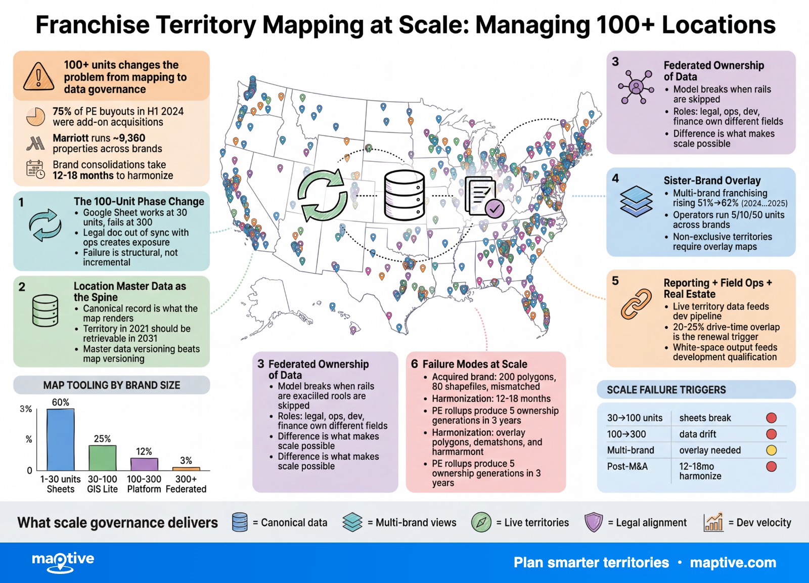
At 100+ units, franchise territory mapping stops being a mapping problem and becomes a data governance problem. The systems that scale cleanly past that threshold treat their location list as a governed master record. The systems that do not scale cleanly accumulate technical debt that surfaces years later inside encroachment arbitration filings.
Yum! Brands ended 2024 with more than 61,000 restaurants across KFC, Pizza Hut, Taco Bell, and Habit Burger. Inspire Brands operates more than 33,300 units across six concepts. Restaurant Brands International closed 2024 at 32,125 locations across Tim Hortons, Burger King, Popeyes, and Firehouse Subs, with a stated target of 40,000 by 2028. At those scales, no single person inside any of those organizations knows where every territory boundary sits. The boundary lives in a database, or it lives in fifty conflicting spreadsheets, and the difference between those two states determines if the franchisor is operating a system or improvising one.
The discipline required past 100 units is master data management applied to location records, with territory polygons treated as version-controlled assets rather than files on an analyst’s laptop.
The 100-Unit Phase Change
The operational model that works at 30 units stops working at 300, and the failure is structural rather than incremental. A 30-location brand can run on a shared Google Sheet. A 300-location brand cannot. The same physical map looks different when nine downstream systems try to read from it and write to it. Real estate has a pipeline tool. Operations has a field-ops app. Legal has the FDD library. Finance has the royalty system. Marketing has a co-op allocation tool. Each system wants the location list, each one edits inside it, and each one assumes its copy is correct.
The franchisor crossing 100 units is no longer running a franchise. The organization is running an operating system that produces franchises. The artifacts of the job are data contracts between departments.
Legal exposure compounds at the same time. Franchise registration states require an FDD on file, and Item 12 territory language must match what is on the map for every state the franchisor sells in. When the legal document references a 2021 polygon and the operations team is working off a 2024 polygon, the franchisor has two truths in the field at once. One of them eventually becomes an arbitration exhibit.
Sister-brand overlay becomes a daily concern rather than an annual one. The platform franchisor running multiple banners has to render layered territory data without losing track of which polygon belongs to which concept. Inspire Brands operates Arby’s, Baskin-Robbins, Buffalo Wild Wings, Dunkin’, Jimmy John’s, and SONIC on the same corporate canvas. A Dunkin’ polygon does not exclude a Jimmy John’s polygon, but a development decision in either should consider the other, and that consideration only happens if both sit in the same governed data layer.
Location Master Data as the Spine
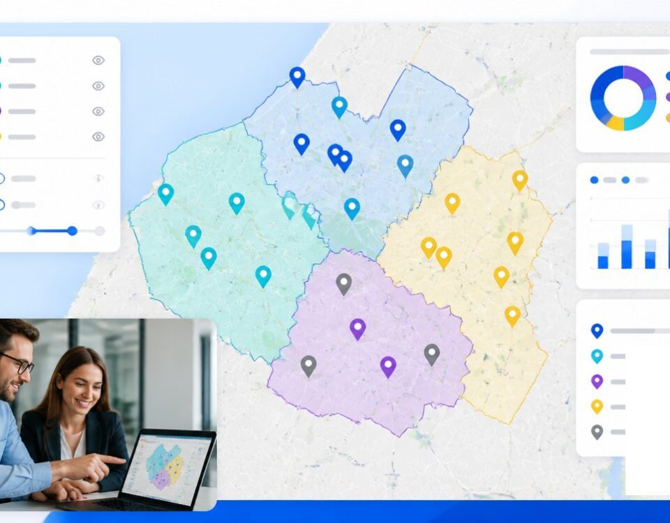
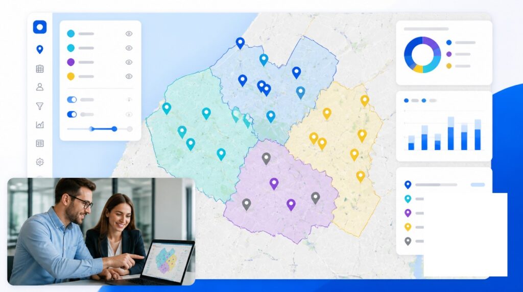
The thing that scales is not the map. It is the canonical location record that the map renders. Master data management is the discipline of maintaining one accurate, governed source of truth for each unit, and at scale the franchisor’s location record is the master entity that every other system has to align to.
When the canonical record is governed, the map is downstream of it. When the canonical record is not governed, every department maintains a private list, and the maps drift apart until reconciliation becomes a project of its own.
The Canonical Location Record
A franchise location record at scale carries more than an address. It carries:
Legal entity name and unit number
Canonical address, the one the FDD references
Geocoded latitude and longitude
Status (in development, signed, under construction, open, closed, transferred, terminated)
Manager and franchisee identifier
Lease start, lease end, kickout dates, renewal options
Territory polygon identifier
Area Development Agreement parent, if applicable
Sister-brand co-tenancy flag
The field that breaks most systems is the geocoded coordinate. Geocoder drift between vendors creates phantom moves. A franchisor switching providers can watch 600 units move by an average of 18 meters with no human edit. Every polygon-based assignment silently recalculates. The remediation is to lock the canonical coordinate to a single authoritative geocoder and stamp the source on the record.
Version Control on Territory Polygons
Version control on territory definitions is where most franchisors fail, and the failure is invisible until litigation. A boundary redrawn in 2024 has to remain addressable as the 2024 boundary forever, because the 2023 FDD signed by a franchisee references the 2023 boundary. Audit trails for territory changes are not a nice-to-have past 100 units. They are evidence in the next encroachment dispute.
Polygons become versioned assets with effective dates, supersession rules, and immutable history. The territory assigned to a franchisee in 2021 should be retrievable in 2031, in its original geometry, with the FDD it was attached to. Treating polygons as overwritable files rather than as versioned data is the most common silent error in this category.
Federated Ownership of Territory Data
At scale corporate cannot manually approve every territory edit. A 1,000-unit franchisor processing 200 to 400 real estate deals a year does not have the headcount to route every polygon adjustment through one analyst, and that analyst becomes a bottleneck that caps deal velocity. The federated ownership model is the response.
Corporate owns the canonical brand territory definitions, the polygon library, ADA grants, and encroachment policy. Area developers own their sub-territory queue and candidate site list inside the granted geography. Franchisees own day-to-day operating data, including sales, staffing, and local marketing radius. Aggregation flows upward into the warehouse and joins back to the polygon layer for reporting.
The federated model trades manual approval for governance rails. Every edit is logged, every actor is identified, every change has an effective date, and every supersession is reviewable. The franchisor giving up centralized approval is not giving up control. The franchisor is moving from gate-keeping control to audit-trail control. That difference is what makes scale possible.
The model breaks when the rails are skipped. An analyst redraws a polygon to close a new deal. Nobody logs the supersession. The original geometry disappears from the active layer but is still referenced in three signed FDDs. Two years later a franchisee inside the original boundary discovers they no longer have what they signed for, and the franchisor has no defensible record of the change.
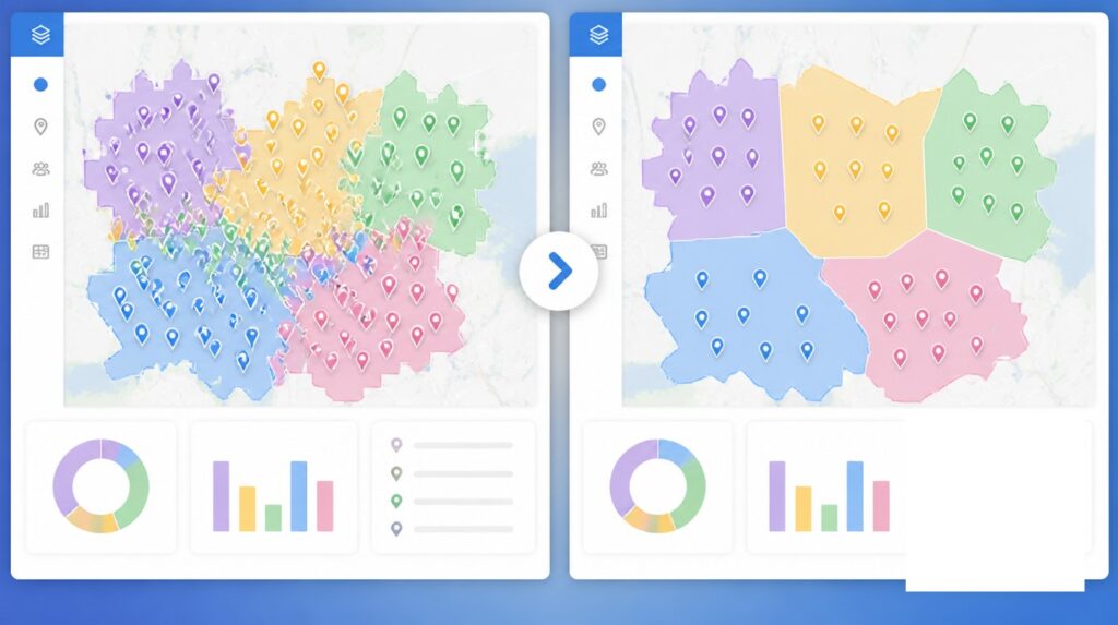
Sister-Brand Overlay and Non-Exclusive Territories
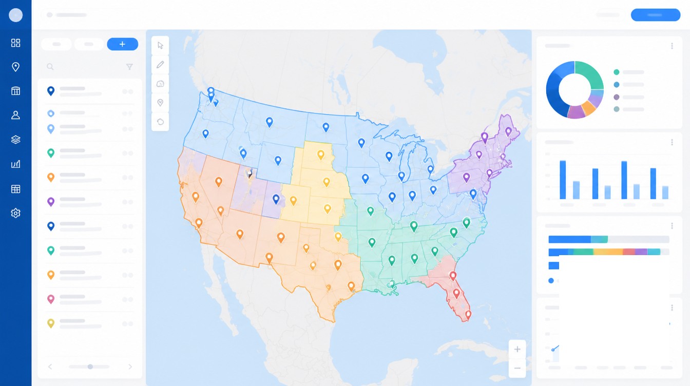
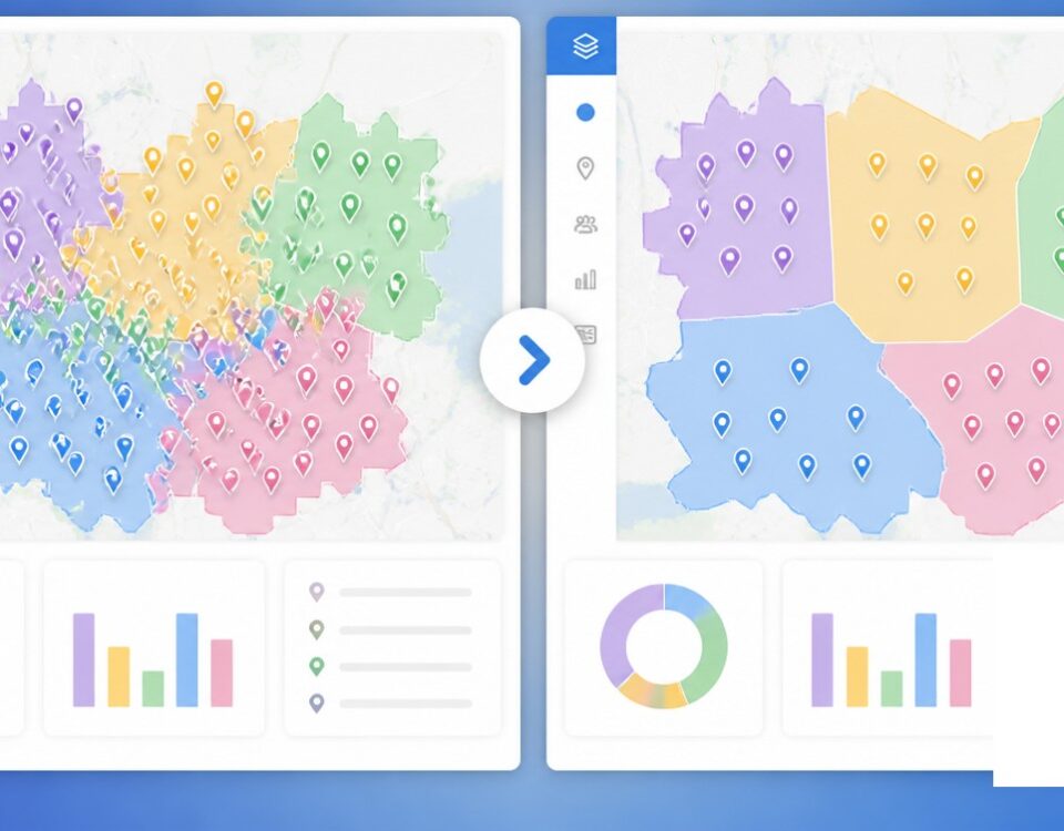
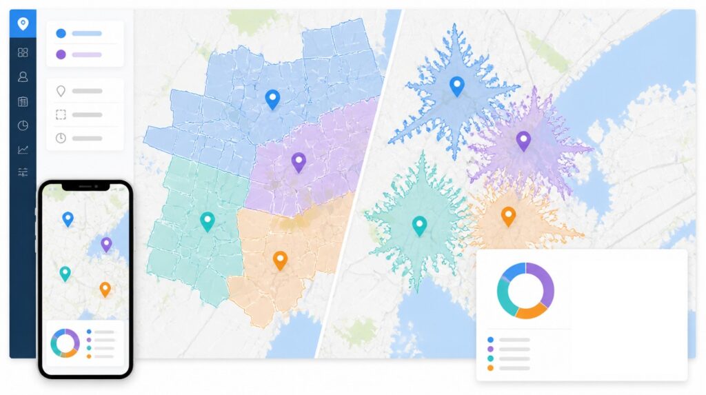
The platform franchisor operating multiple banners has a problem the single-brand operator does not. The territories of Brand A and Brand B may legitimately overlap, but field operations, demographics, and co-marketing decisions need to see both layers at once. The map at this scale is a multi-layer canvas where each banner is an addressable layer that can be toggled, queried, and joined to the others.
Multi-Brand Layer Architecture
Yum! Brands surpassed 61,000 units across four banners at the end of 2024, with 98% franchised. Inspire Brands operates more than 33,300 restaurants across six concepts. Restaurant Brands International closed 2024 at 32,125 units across four banners. Authority Brands operates 2,700+ locations across 15 home-service concepts and added 322 new territories in 2024 alone. Each of these portfolios needs an architecture that keeps brand polygons separate but addressable in a single query.
The pattern that scales is one location master, one polygon library, brand as a dimension. A query asking “show me every Authority Brands unit within five miles of a planned Mister Sparky site” runs against the unified data. The same data with a filter answers “show me only the Mister Sparky layer at the metro level.” The architecture is what makes the rest of the work possible.
Lodging illustrates the non-exclusive end of the range. Marriott operates roughly 9,360 properties across its brands. A system at that scale cannot grant standard exclusive territories. Marriott may negotiate limited area-of-protection windows for a specific hotel for a specific period, but the default is non-exclusive, and Hilton operates on a similar model. The work past 100 units in those systems is not preventing overlap. It is making overlap legible and defensible.
ADA Carve-Down Rules
Area Development Agreements layer on top of single-unit territories. An ADA gives a developer the right and obligation to open a defined number of units in a defined geography on a defined schedule. Miss the schedule, lose the territory or part of it. At scale the franchisor is tracking the ADA boundary polygon, the development schedule, actual openings against the schedule, the carve-down rule when milestones slip, and each individual unit franchise agreement signed underneath.
The multi-unit operator is now the dominant operator profile in U.S. franchising, with the share rising from 51% in 2024 to 62% in 2025. The scale franchisor sells territory to operators who already run 5, 10, or 50 units and want geography contiguous to what they hold. The carve-down rule protects the franchisor when a developer overcommits. Without a governed polygon library, the carve-down is a renegotiation. With one, the carve-down is a calculation.
Reporting, Field Ops, and Real Estate Integration
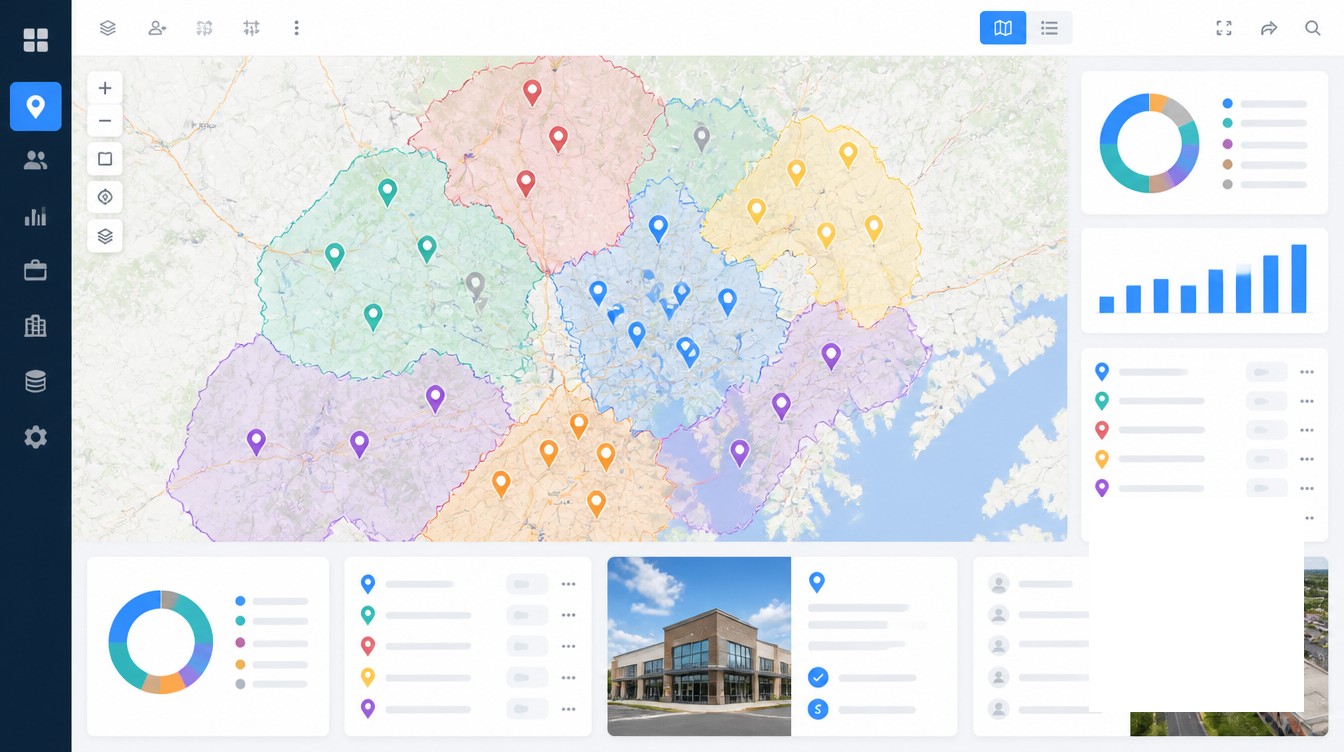
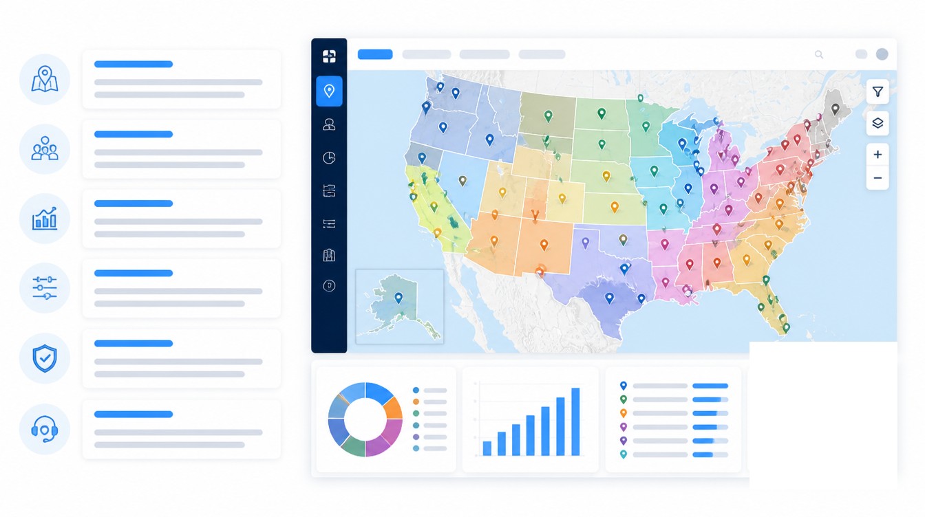
The same map has to render usefully for three audiences working at three different zoom levels. The CEO views the country and asks about penetration by region. The RVP views the metro and asks about cannibalization between the three units in a corridor. The franchise business consultant views the trade area and asks if one franchisee is running Google Ads into a neighbor’s polygon. One underlying polygon layer, three rendering modes, three sets of questions.
Cannibalization analysis is the calculation the franchisor runs on every proposed deal. When two proposed territories share more than 20 to 25% of their drive-time polygon, revenue transfer between them is almost guaranteed. The math is run before the deal is signed, because retrofitting the answer onto a signed FDD is what produces arbitration.
White-space analysis at this scale is not the question of where to put one unit. It is the question of where to put 80 units over five years. The franchisor with 500+ units feeds white-space output into the development pipeline directly, with unsigned polygons flagged as inventory and ranked by demand model.
The real estate pipeline is where this data has to be live. A broker submits a candidate site through a portal. The site auto-scores against the territory it falls inside, including grant status and the developer’s milestone position. Demographic overlay runs at the polygon level. Cannibalization is checked against open units and against signed-but-unopened ADAs. The approved deal flows back into the record as “signed, not yet open.” When this pipeline lives in a spreadsheet, deal velocity caps at maybe 50 deals a year. When it lives in a platform with territory data live underneath, mid-cap franchisors close 200 to 400 deals annually.
Field consultants use the same data for a different job. A district manager planning a route across 12 units, a regional VP looking at DMA penetration, and a franchise business consultant checking for advertising leakage into a neighbor’s polygon all pull from the same governed layer. Marketing allocates co-op spend by polygon. Finance matches sales to royalty obligations. The polygon is the join key for everything downstream.
Failure Modes Specific to Scale
Five failure patterns do not exist sub-100 units and become routine past it. They surface in the field months or years after the error was introduced, which is what makes them expensive.
Retroactive Polygon Edits
Someone in real estate redraws a polygon to make a new deal work. The previous polygon was signed in a 2019 FDD. Without an audit trail, the original geometry disappears from the live layer and survives only in a PDF nobody references. Litigation risk crystallizes years later when the original franchisee runs the math on what they were sold and finds it does not match the map. The defense relies on producing the version history. If the version history does not exist, the franchisor settles.
Shadow territories sit alongside retroactive edits. Operators advertise, deliver, or run off-site catering into polygons they were never granted. Without a map that overlays advertising data on territory boundaries, the franchisor cannot see the encroachment, and the neighboring franchisee absorbs the cannibalization without a path to remediation.
Geocoder Drift and Phantom Moves
A franchisor changes geocoding vendors. The change moves 600 lat-longs by an average of 18 meters. Every polygon-based assignment silently recalculates. Some units now sit a few meters outside the polygon they were assigned to. Royalty calculations relying on polygon membership produce different totals. Field consultants pulling unit lists by region see units appear and disappear from their assignments. Nothing has moved. The geocoder moved.
M&A integration is the third pattern. An acquired brand arrives with 200 polygons defined as shapefiles, 80 defined as zip code lists, and 40 with no machine-readable definition at all. Harmonizing this into the parent system can take 12 to 18 months. Add-on acquisitions accounted for 75% of all private equity buyouts in H1 2024, with roll-ups representing more than 80% of lower-middle-market deals. The franchise category is now a primary target of PE consolidation, and inherited territory data is the integration challenge most acquirers underestimate.
Phantom multi-brand cannibalization closes the list. A sister brand opens within 200 meters of an existing unit. Each brand’s CRM reports no cannibalization because each system sees only its own polygons. The shared customer’s wallet says otherwise. Detection requires the multi-brand overlay on a single governed canvas.
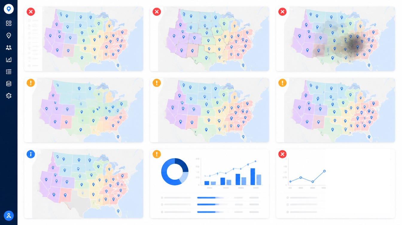
Maptive supports this work at enterprise volume, with WebGL rendering for high marker counts, polygon and zip-based territory tools, version-controlled territory definitions, and collaborative editing across departments. The platform is the integration. When every department pulls from one governed master, the franchisor scales. When every department maintains its own copy, the system accumulates the technical debt that eventually surfaces in arbitration.
Frequently Asked Questions
How does a franchisor manage territories across 100+ locations?
At 100+ units the manual approach stops being safe. Scale franchisors centralize a single governed location master record (canonical address, geocoded coordinates, status, manager, lease terms, territory polygon ID, ADA parent) and feed it into every downstream system. Territory polygons are version-controlled so the boundary on a 2021 FDD remains addressable years later for compliance and litigation defense.
What is master data management for franchise locations?
Master data management for franchise locations is the discipline of maintaining one accurate, governed source of truth for every unit, covering address, coordinates, status, manager, lease, and territory assignment. The discipline creates and maintains a single consistent view of the franchisor’s core data entities, and Location MDM specifically supports site selection, expansion, and supply-chain decisions for multi-location operators.
What is an Area Development Agreement in franchising?
An Area Development Agreement gives a franchisee the right and obligation to open a defined number of units inside a defined territory on a defined schedule. The ADA is the master commitment. Each individual unit still requires its own franchise agreement signed at the time of opening. Missing the development schedule can trigger territory carve-down or full termination of the ADA.
How is an Area Development Agreement different from a master franchise agreement?
An Area Developer must operate units themselves or through affiliates and cannot sub-franchise. A Master Franchisee can sub-franchise locations to third parties within their territory. ADAs are the dominant structure in U.S. multi-unit franchising. Master franchise agreements are more common in international expansion where the master pays an upfront fee and earns a share of sub-franchise revenue.
What does Item 12 of the FDD have to disclose about territory?
Item 12 must disclose the location type (specific or to-be-approved), the exclusivity status of the territory, any conditions on exclusivity such as performance milestones, the franchisor’s reserved rights inside the territory, and any plans to operate a competing system. If the territory is non-exclusive, the franchisor must include the FTC-mandated statement that the franchisee will face competition from other channels and competing brands the franchisor controls.
What is franchise encroachment?
Franchise encroachment is when a franchisor places a competing unit close enough to an existing franchisee’s protected territory that it cannibalizes sales. The term also covers cases where one franchisee advertises or operates inside another’s territory with the franchisor’s tacit allowance. Most states imply a covenant of good faith and fair dealing into franchise contracts, and several state and federal statutes give franchisees specific encroachment remedies.
What is cannibalization analysis in franchise territory planning?
Cannibalization analysis is a spatial modeling technique that quantifies the revenue impact of opening a new unit on nearby existing stores in the same network. When two proposed territories share more than 20 to 25% of their drive-time polygon, revenue transfer between them is almost guaranteed. Scale franchisors run this check on every proposed deal before signing.
What is white-space analysis in franchising?
White-space analysis identifies geographic markets where the gap between customer demand and current supply creates an opportunity for a new store. For a franchisor with 500+ units, white-space analysis is not the question of where to put one unit. It is the question of where to put 80 units over five years, and it feeds the development pipeline directly.
How do cloud data warehouses handle franchise geospatial data?
Snowflake, Databricks, and BigQuery now all support native geospatial. Snowflake offers 19 native H3 functions and 60+ spatial SQL functions. Databricks has native H3 since DBR 17+ and Apache Sedona integration. BigQuery uses S2 indexing and includes BigQuery ML for predictive analytics on geospatial data. GeoParquet is becoming the interchange standard across all three.
How does AI help with franchise territory optimization?
AI-assisted territory optimization uses machine learning to balance polygons by population, drive time, demographic load, and projected demand, producing fair, defensible territories without weeks of manual GIS work. SiteSeer released an enhanced Automated Territory Optimization Model in February 2025. Platforms across the category use real-time economic indicators, competitor analysis, and foot traffic patterns to re-map trade areas as conditions change.
What happens to territory data during a franchise M&A or roll-up?
Acquired brands typically arrive with inconsistent territory data, with some boundaries defined as shapefiles, some as zip lists, and some only as PDFs. Harmonizing the data into the parent system can take 12 to 18 months. Add-on acquisitions accounted for 75% of all private equity buyouts in H1 2024 and roll-ups represented more than 80% of lower-middle-market deals, so this integration is now routine for franchise operators backed by private equity.
What percentage of franchisees operate multiple units?
Multi-unit operators went from 51% of franchisees in 2024 to 62% in 2025, an 11-point swing in IFA-aligned industry data. Multi-unit operators are now the dominant operator profile in U.S. franchising, which is why scale franchisors design their territory and development programs around portfolio operators rather than first-time buyers.


