Maptive vs Competitors: The Benefits of Choosing Maptive
If you’ve spent hours trying to make sense of clumsy mapping software, you know the frustration. Long wait times, confusing buttons, and endless import errors slow you down when you need quick, accurate answers. Maptive addresses these pains with an interface built for speed and reliability, everything you need to keep moving, without getting lost in menus.
Maptive vs Maptitude
Compare Maptive with Maptitude to learn what to expect. Maptive removes the need for installs, works on any device, and is easier to use. Teams can map data quickly and share results, with no complicated setup or long wait times.
Maptive vs CARTO
See how Maptive compares to CARTO. Expect faster performance, easier setup, and no hidden costs. Handle large datasets, get quick support, and skip complicated features. Maptive helps your team map and share data without extra steps or delays.
Maptive vs QGIS
Maptive is easier and more reliable than QGIS. No downloads, no plugins, and no steep learning curve. Start mapping in minutes from your browser, share live updates, and get help when you need it. Teams save time and avoid common QGIS headaches.
Maptive vs Mapline
Maptive is a better choice than Mapline for mapping. Expect smoother uploads, more features, and reliable address plotting. Avoid limits on map size, get flexible sharing, and access built-in tools for analysis without paying extra or struggling with a slow interface.
Maptive vs Mango GIS
If you’ve hit the limits of Mango Maps, see what you can do with Maptive. Create detailed business maps, handle bigger data, and get real support when you need it. Explore better features and smoother sharing that help your team work smarter.
Maptive vs ArcGIS
Maptive offers a simpler, faster alternative to ArcGIS. It works in your browser, handles large datasets without lag, and has clear pricing. All features are included, support is quick, and teams can start mapping in minutes, no training needed.
Maptive vs eSpatial
Maptive is a faster, simpler eSpatial alternative. It manages large datasets smoothly, has a clear interface, and includes all mapping tools in one price. Support is responsive, sharing is easy, and teams can start working without extra training or surprise fees.
Maptive vs Mapbox
Maptive delivers faster, more reliable mapping than Mapbox, with no coding required and transparent pricing. It handles large datasets without freezing, keeps your data private, and includes every feature in every plan. Share securely, customize maps, and get live expert support, without the outages, hidden fees, or setup headaches common with Mapbox.
Maptive vs Smappen
Maptive outperforms Smappen with global coverage, accurate data, and all features included in every plan. Upload large datasets instantly, create routes, manage territories, and customize maps without hidden fees or missing tools. Get fast, personal support by phone, chat, or email, and keep projects moving with reliable, full-featured mapping for any location.
Maptive vs RouteXL
Maptive removes the limits that slow RouteXL and similar tools. Handle hundreds of stops, import large lists, and share routes without errors or slowdowns. Fast support, flexible editing, and clear pricing keep growth simple.
Maptive vs ArcGIS vs CARTO
Maptive vs Mapbox vs Mapline vs eSpatial
Maptive vs QGIS vs Maptitude vs Mango Maps
Stop Wasting Time on Complicated Mapping Tools
Most mapping tools force you to learn technical steps before you get any results. Trying to import data or find simple features can leave you stuck, risking wasted effort and missed deadlines.
Maptive does not put up roadblocks, a practical layout and step-by-step controls let anyone upload data and build maps in minutes. Real people with no technical background find what they need without digging through endless menus.
Get More from Your Data Without Extra Work
Growing datasets no longer mean more manual work. With Maptive, you can upload files from Excel, CSV, or Google Sheets in seconds, no matter how large. See every location and trend at a glance, so you stop sorting raw data by hand.
Maptive takes the busywork out of mapping, making insights available as soon as you import your data.
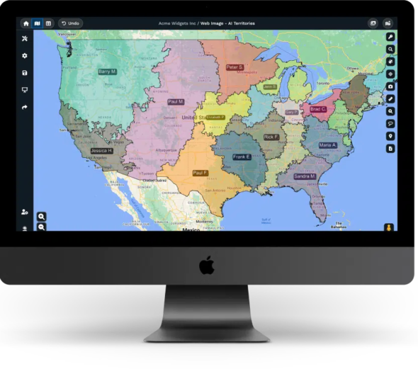
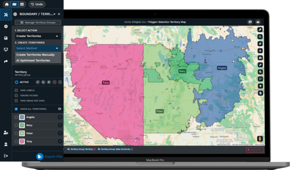
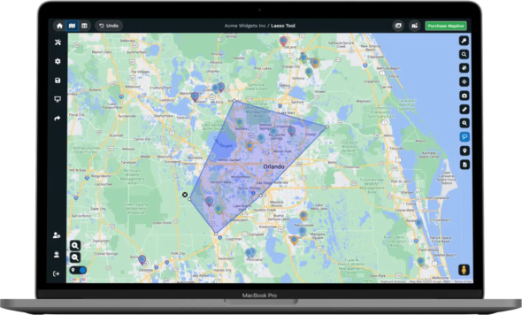
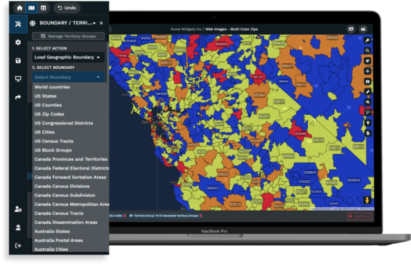
Build Smarter Territories and Sales Plans
Planning sales regions by hand often leads to overlap, confusion, or unbalanced coverage. With Maptive’s territory tools, you can quickly draw, split, and merge areas on the map, even as customer and sales data change.
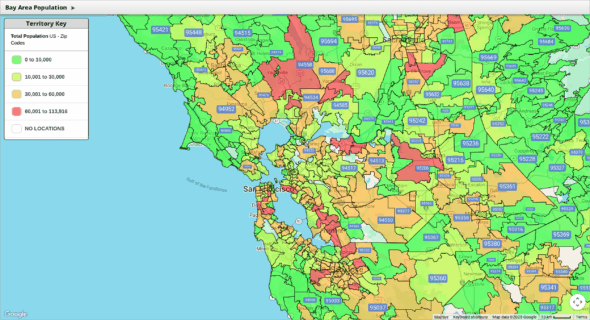
Overlay extra information, like demographic profiles or past sales, so your plans target the right places every time, helping you avoid gaps or wasted effort.
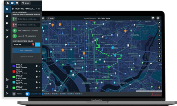
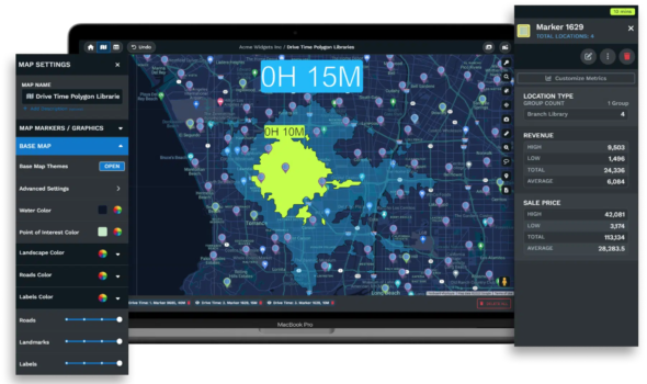
Plan Efficient Routes and Cut Costs
Route planning has a bad reputation for draining time. Manual tools expect you to enter stops one by one, then recalculate every time your list changes. Maptive’s route tools automatically order up to 100 stops by fastest travel time, factoring in traffic and service windows if needed.
Save hours previously wasted on manual updates, and help your teams cut fuel and travel costs across every route.
Share Maps and Insights with Zero Friction
Sending static map screenshots or waiting for IT to set up sharing slows everyone down. Maptive allows instant sharing, send a secure link to teammates, embed maps on web pages, or export high-res images for reports.
Everyone views or comments on the latest data, while you skip the hassles of locked-down software and outdated files.
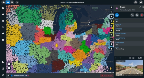
Location Intelligence Made Simple
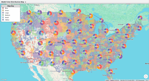
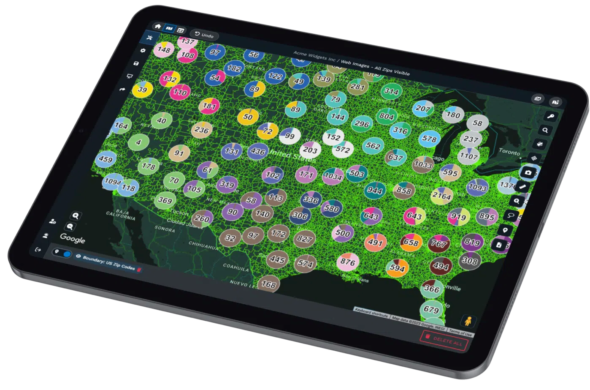
Mapping should help you spot answers, not add confusion. Maptive features tools like heat mapping, demographic layers, and radius searches, each designed to reveal trends and highlight opportunities fast.
These visual tools are ready for anyone to try, without special training. Make every decision clearer, whether you’re mapping prospects or reviewing coverage areas.
Why Businesses Trust Maptive for Everyday Decisions
Reviews from companies on Capterra, G2, and Gartner report teams finishing mapping tasks up to 40% faster than before. Staff with no technical skills handle new territory setups, map reviews, and sales planning with the same ease as analysts or IT.
People trust Maptive because it delivers simple controls, accurate location tools, and responsive service every day, for real-world business needs.

Personalized, Responsive Support Whenever You Need It
Getting started with new tools can raise questions, Maptive does not leave anyone to figure things out alone. Live chat, email, and phone support channels are open, and users get personal walkthroughs, onboarding help, and clear training material.
Problems get resolved without delay, and anyone can request help with custom features or unique workflows.
Maptive’s Features Built for Results
Fast Map Creation
Upload your data and build interactive maps in seconds, no GIS skills required
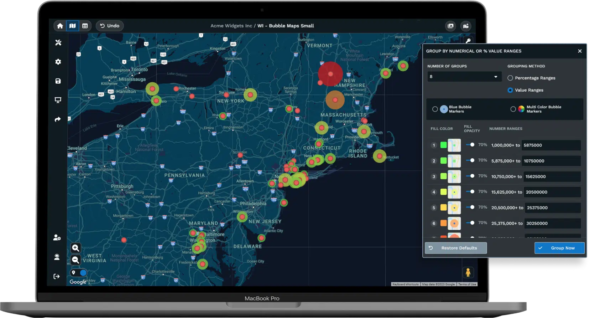
Advanced Analytics Tools
Use territory mapping, heat maps, and demographics for smarter planning
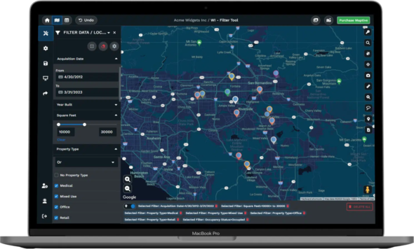
Flexible Data Imports
Handle Excel, CSV, Google Sheets, or API data, up to 100,000 locations
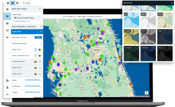
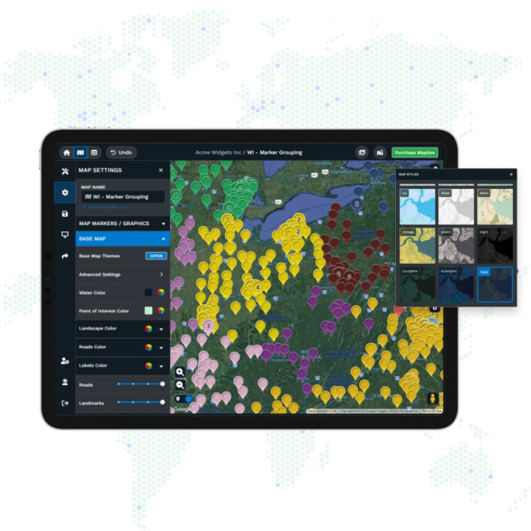
Customizable Maps
Brand your maps with company colors, custom icons, and labels
Effortless Sharing
Share with a link, embed, or export high-resolution images for reports
Proven Reliability
Google Maps technology for fast loading and accurate locations
Start Using Maptive, No Friction, No Hidden Steps
Sign up for Maptive takes only a moment. No credit card needed, no waiting. With friendly support available right away, you will see your data mapped and actionable within minutes. There is nothing slowing you down at any step.
Maptive Alternative FAQs
How does Maptive handle large data sets?
Maptive is made for big data. People import tens of thousands of rows from Excel, CSV, or Google Sheets with smooth and quick results. The system allows up to 100,000 locations on each map, using real-time batch geocoding so maps are ready right away, even with the largest business files.
Can I use my existing Excel or Google Sheets files?
Yes, you can. Uploading from Excel, CSV, or Google Sheets is direct. Drag your file into Maptive, choose which columns go on your map, and everything displays in moments. No special formatting or coding is needed, so anyone can use their current files without extra steps.
Is it easy to share maps with other people?
Maptive removes the hassles other tools create. Generate a sharing link, invite people to view or edit, or embed interactive maps on dashboards or sites. No extra software, license keys, or static screenshots needed, everyone gets the latest data on demand.
Do I need any technical background to use Maptive?
No technical knowledge is required. Maptive’s controls are labeled, the setup is simple, and in-app guides walk you through each feature. Customers from business and field teams rate Maptive at the top for easy use, with almost nine out of ten saying their staff started without formal GIS experience.
What can I do if I need to adjust territories or regions?
Changes to territories or regions are quick with Maptive. Use simple drawing tools to split, merge, or redraw boundaries, and see impacts to coverage or workloads instantly. Everything calculates live, removing the wait times or errors from manual map edits and giving you an up-to-date view every time.
How does Maptive support new users?
Every user gets clear onboarding, prompt help via chat, and step-by-step guides. The team provides one-on-one walkthroughs and demos for any feature, helping users feel ready from the start. Feedback from customer surveys points to this support as one of the strongest reasons for staying with Maptive.
What makes Maptive easier than other mapping tools?
Maptive’s simple steps and fast setup are key. No hidden menus, no confusing import steps, drag-and-drop files, see live previews, and use visual controls at every stage. Awards from G2 and Capterra list Maptive as best for usability based on actual team feedback and field testing.
How quickly can I get help from Maptive support?
Support is immediate. Reports show first responses under 15 minutes, with most requests handled the same day. The support team answers questions, helps with setup, and provides custom data services so users get help when they need it and never wait days for answers.
Why do businesses choose Maptive for mapping?
Companies use Maptive because it replaces complicated, slow systems with fast, clear mapping anyone can use. Reviews mention less planning time, better staff productivity, and accurate targeting for sales and logistics. Consistent ratings for trust and ease make it a reliable part of any modern business process.