Transportation Mapping Software
Whether you’re moving goods as part of a supply chain, or delivering products to customers, creating effective transportation strategies is one of the most critical components of a successful business. Use Maptive’s transportation mapping software to optimize routes, select sites for depots, spot inefficiencies, and more.

What is Transportation Mapping Software?
In order to create an effective transportation network, you need to visualize it. Transportation management software allows you to plot key locations, such as suppliers, depots, store locations, customers, and more on an interactive map.
With these points marked, use route planning tools, drive time radii, demographic insights, and customer mapping to build a plan that will let you reach and exceed your goals.
What Can You Do with Transportation Mapping Software?
Transportation mapping software has a number of different applications when it comes to logistics. Here are a few of the ways it benefits your business:

Optimize Your Delivery Routes
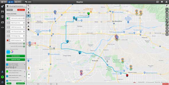
Longer driving times mean more fuel burned and higher maintenance costs. Use routing software to find the fastest and most efficient routes between all your stops so your vehicles spend less time on the road. Not only will this allow you to service more customers, but it will also reduce your fuel costs, labor, and the wear and tear on your fleet.

Site Selection
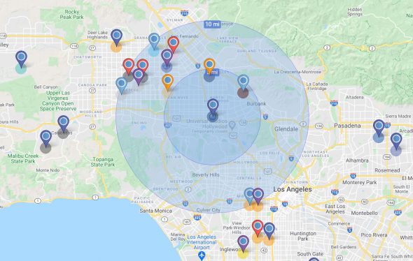
A strategically placed depot will help you reach a greater number of customers. It also makes things easier for your fleet managers and delivery drivers. Utilize drive time radii to see which locations are within driving distance of your site, and use demographic insights and customer mapping to determine whether the market is suitable for your business.
- Build a Better Supply Chain: Find vendors that are near your business locations by utilizing drive time radii and determine the best routes to build the perfect supply chain.
- Manage Your Performance: Compare your actual travel times with the expected times generated by your transportation mapping software. Use this information to identify inefficiencies and boost your performance.
- Map Customer Satisfaction: Plot your customers on your map and grade their satisfaction levels. See where your satisfaction is the lowest to improve your customer service and build better transportation operations.
How to Create a Transportation Map with Maptive
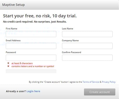
Step 1: Sign up for a Maptive free trial account. Try Maptive for free and explore the many mapping tools we have to offer.

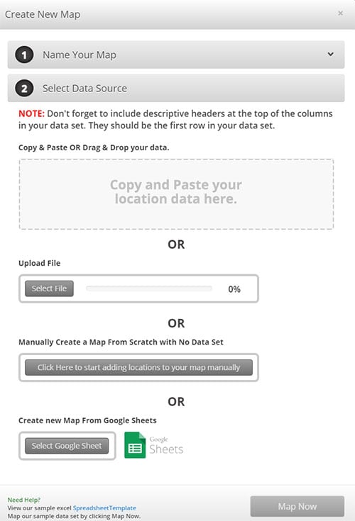
Step 2: Upload or input your addresses and locations. Upload the address data for your business locations, depots, suppliers, and customers directly from a spreadsheet. Or input your data manually.

Step 3: Click the green “Map Now” button to view your map. Your locations will now be plotted on a beautiful interactive map.
Step 4: Color code different locations. Use the grouping tool to color code and differentiate the markers for your depots, suppliers, customers, and other location types.
Step 5: Explore Maptive’s tools and features. Utilize a wide range of tools, including route planning software, drive time radius, heat maps, demographic insights, and more to build your ideal transportation map.
What Tools Does Maptive Offer?
With Maptive’s platform, there are a number of ways you can customize your map and get the most out of your data. Here are a few tools that are perfect for transportation maps:
- Route Optimizer: Our route optimization software lets you quickly calculate the fastest route between two or more locations to simplify your trip planning. Simply enter your starting location and all your stops to generate your route.
- Drive Time Radius: Need to know how many customers are reachable from a depot? Want to see how close a supplier is to your business locations? Use the drive time radius tool to see which locations are within driving distance of any point on your map.
- Customer Mapping: Upload the addresses of your customers and clients to automatically plot their locations on your map. See where your customers are most prevalent to help you serve them better.
- Heat Mapping: Use this tool to measure the density of your data, such as customers or population. It’s a great feature to use when evaluating the market of a given area.
- Demographic Insights: Maptive gives you access to a wide range of demographic data, including population, age, income, housing, education, employment, transportation, and more.
Why Choose Maptive?
Enjoy the latest in GIS technology when you choose Maptive. Our maps are:
- Shareable: Export your data to a spreadsheet, send a private link to your team members, or embed it online. Do all of this in just a few clicks.
- Cloud-Based: Access your map anywhere, whether you’re in the office, on the road, or speaking with customers. View your map on a PC, Apple and Android smartphones, and many other devices.
- Secure: We use 256-bit SSL encryption and work with the best security partners to ensure your information is always kept safe.
- Fast: Maptive uses Google Maps API to power it’s software. This sophisticated technology ensures you’re able to create maps quickly and efficiently.
Start Your Free, No Risk, 10 Day Trial
No credit card required. No surprises. Just Results.
START MAPPING NOW