Enterprise Mapping Software Made Simple
Enterprise mapping software built for teams without GIS analysts. Maptive delivers powerful spatial analysis, territory management, and demographic intelligence. Trusted by Amazon, GE, and Coca-Cola.
START MAPPING NOWSOME OF OUR CUSTOMERS INCLUDE:


Results From Our Users
📍 75% reduction in territory planning time
📍 22% more service calls completed weekly
📍 18% lower fuel spend across field teams
📍 15% revenue lift from optimized coverage
📍 14% higher achievement on sales targets
📍 $100K+ in reported quarterly savings
(click on the image to enlarge)
(click on the image to enlarge)

(click on the image to enlarge)

(click on the image to enlarge)
(click on the image to enlarge)
(click on the image to enlarge)
(click on the image to enlarge)
(click on the image to enlarge)
GIS Intelligence On Demand
Answer the Where Questions Yourself
Expansion targets, territory balance, account assignments, coverage gaps. You can answer these without filing a request or waiting on another department. Upload your data, see it on a map, and send the recommendation before the meeting ends.
Find the Revenue Your Data is Hiding
Spreadsheets show rows. Maps show patterns. Clusters of underserved prospects, territories carrying twice the load of others, ZIP codes with high income and zero coverage. These become obvious when you can actually see them
Spend Less on Every Mile Driven
Real roads, live traffic, optimized sequences. Routes your team can actually follow, not straight-line estimates that fall apart in the field. Fuel costs go down, service calls go up, and dispatchers stop fielding complaints.
Get to Yes With Stakeholders Faster
Executives and clients make quicker decisions when the data is visual. Export polished maps for the boardroom, embed interactive views on your website, or send protected links to partners who need specific regions without full platform access.

We Set Up Your Maps With You
Send your data however it looks right now. The team cleans your file, configures the import, builds your territories, and walks you through the finished product. First response averages under 15 minutes, most issues close the same day, and G2 users rate support at 9.7 out of 10. You get specialists who know spatial analysis, not scripts.
What Our Customers Say About Us
See what others have to say about Maptive.

Maptive is essential to how we understand the global distribution of our leaders, helping us to reduce unnecessary travel time, costs and our impact on the environment.
David,
The Royal Bank of Scotland
As our data visualization partners, Maptive has become an integral part of our operations—from Logistics to Project Tracking to Scheduling. (You guys rock!)
Miquel Fernandez,
RMSI Retail Solutions
I have used several mapping tools, and Maptive is by far the most user-friendly and most comprehensive tool available.
Nicole,
Indiana State University - RUEDI
True insight into our data is vital to our success—and Maptive gives us exactly that.
Anjil,
BRAC
Maptive helps us drastically with compliance, marketing and itinerary planning.
Leonie,
Ecotourism Australia
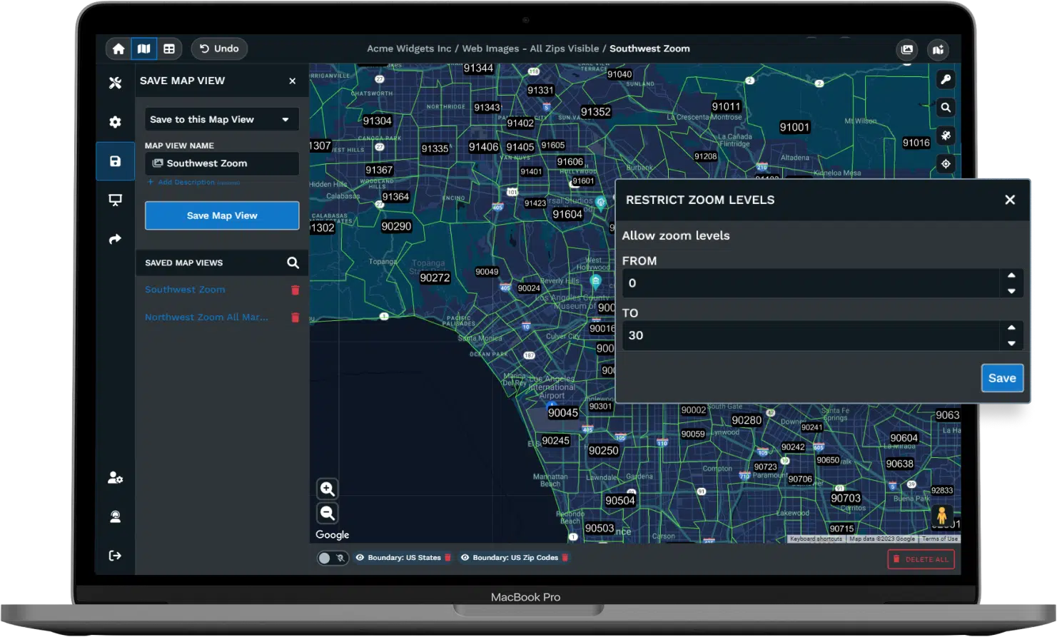
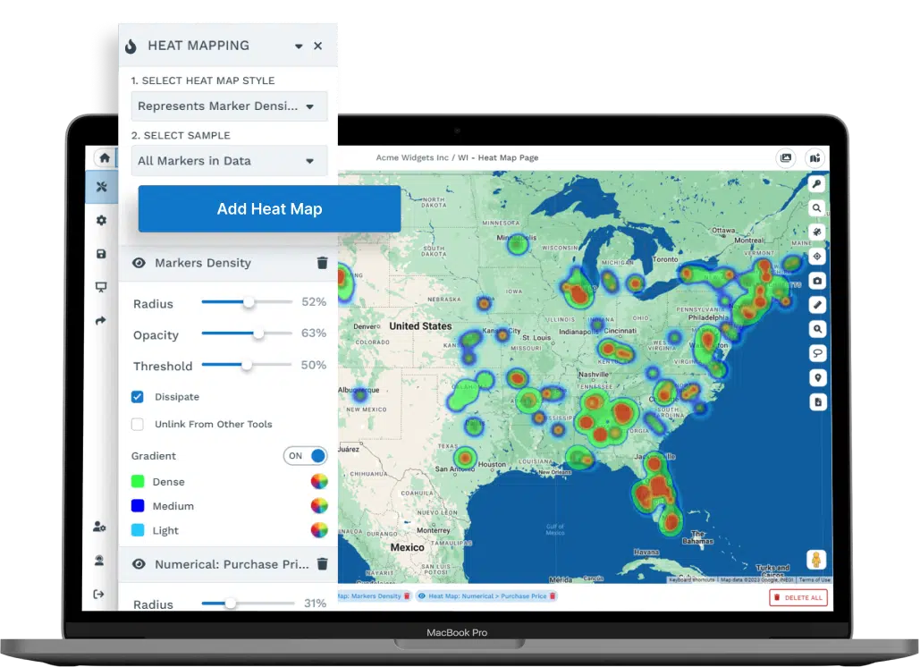
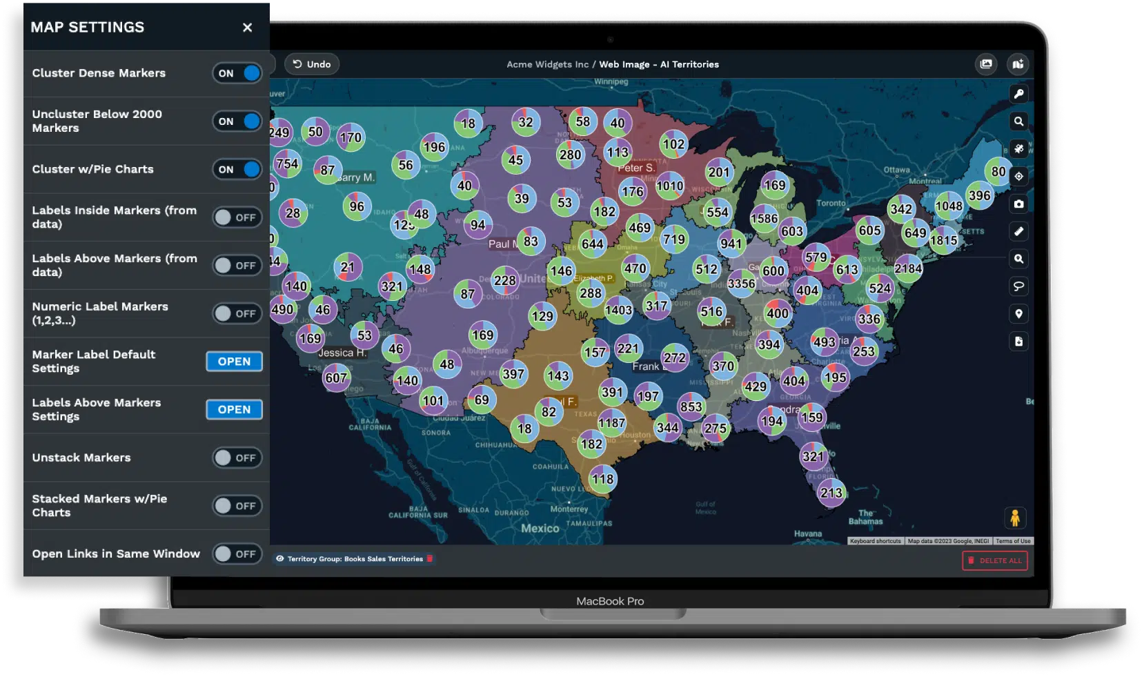
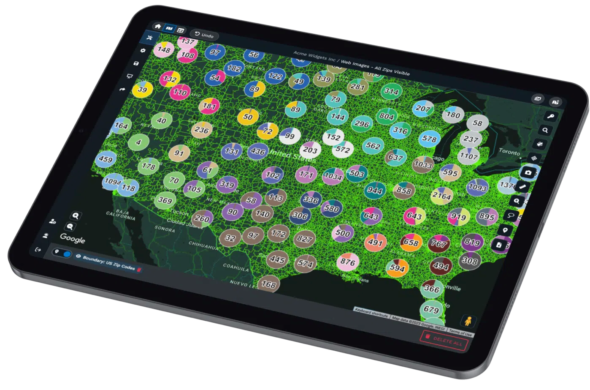
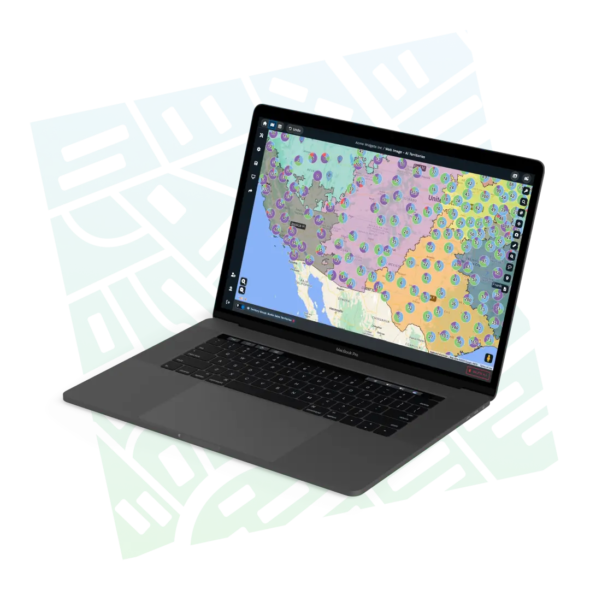
60+ GIS Tools Built Into Every Account
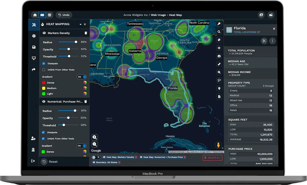
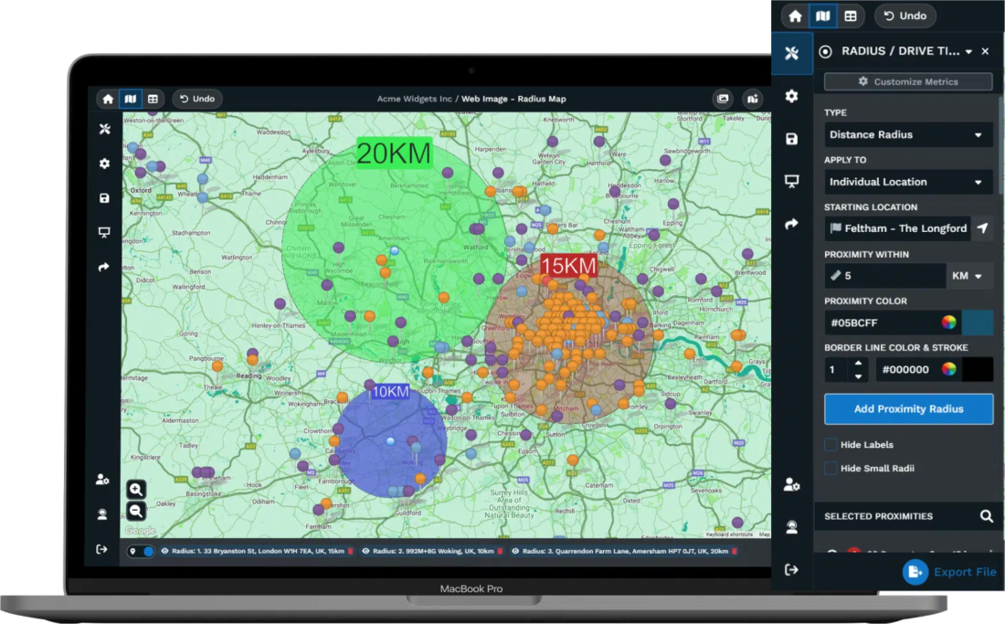
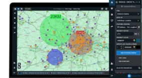
Spatial Analysis
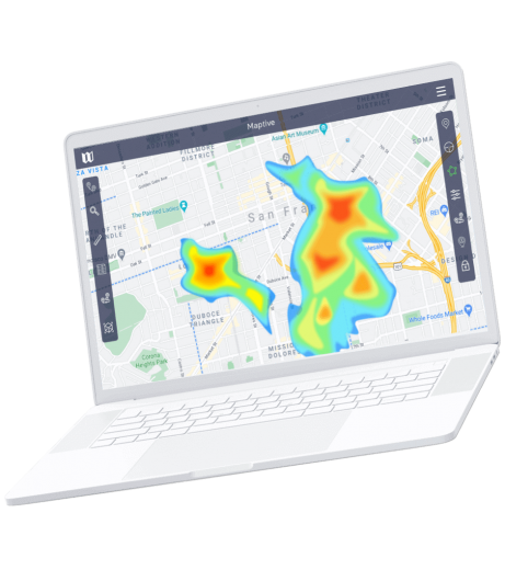
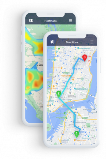
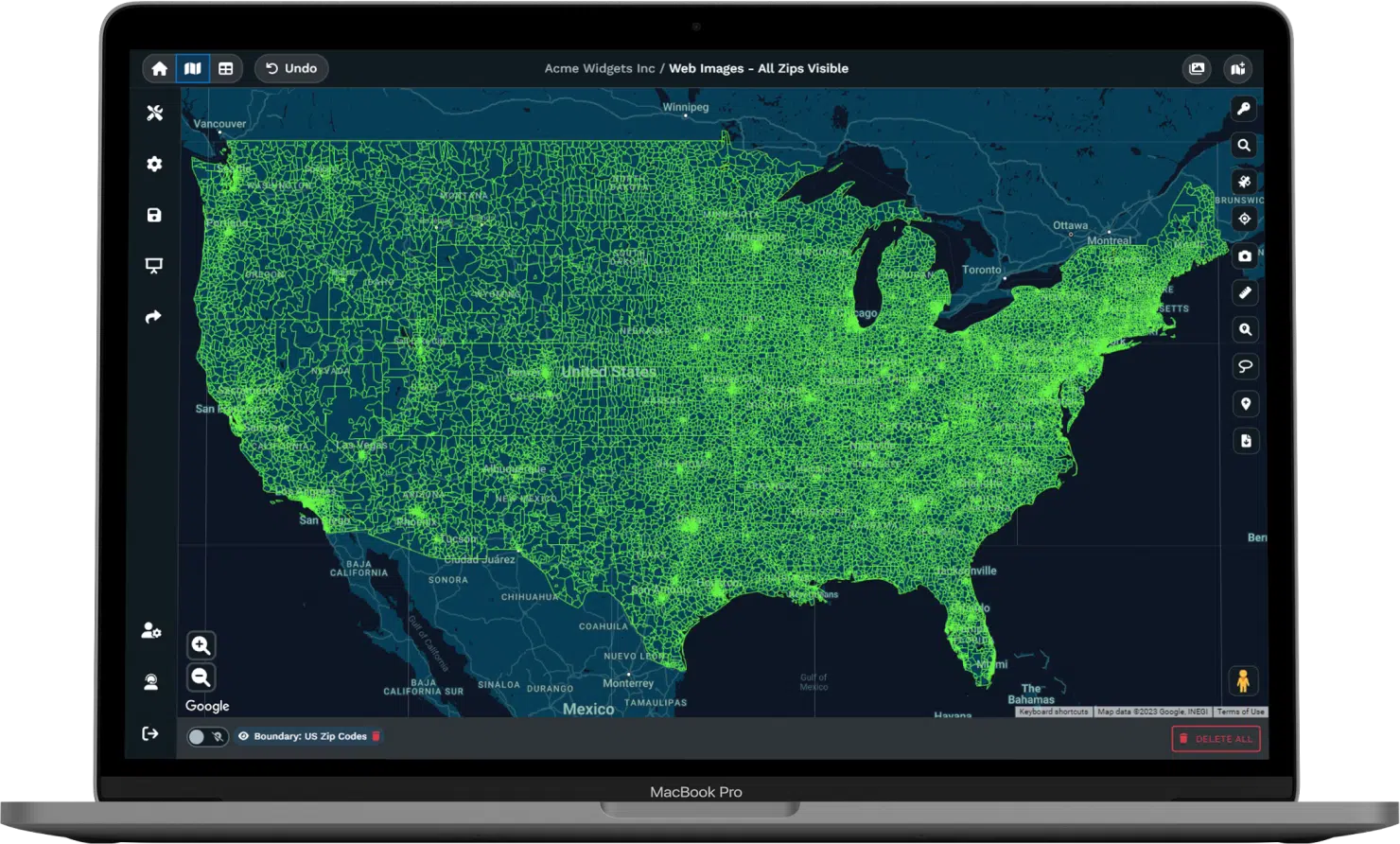
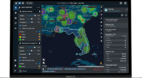
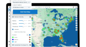
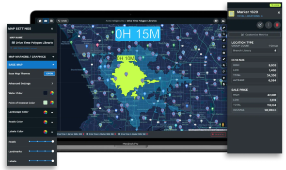
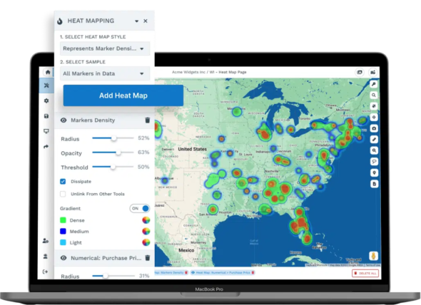
Radius mapping, drive time polygons, heat maps, proximity analysis, and boundary calculations. The platform handles geoprocessing operations that typically require desktop GIS software, and drive-time calculations use real road networks with data.
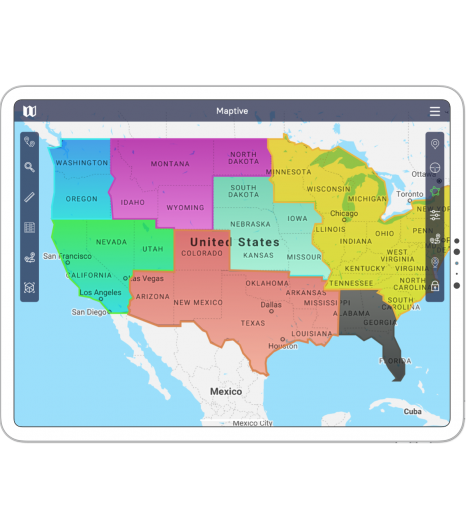
Territory Management
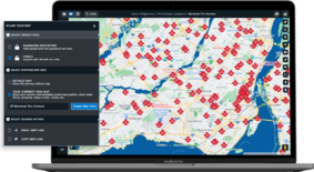
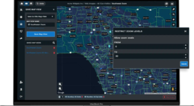
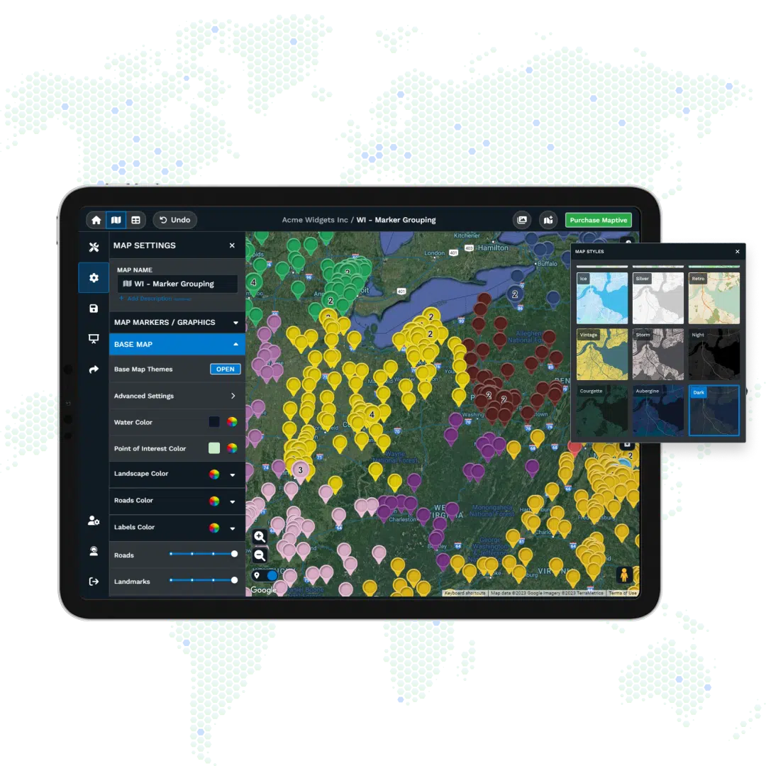
Build territories from states, counties, ZIP codes, census tracts, or draw your own. Automated optimization balances workloads across multiple metrics at once. Drag boundaries to adjust and watch the numbers update live.

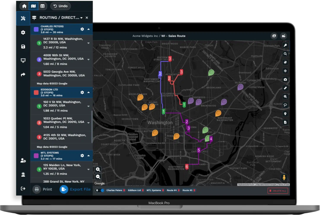
Route Planning
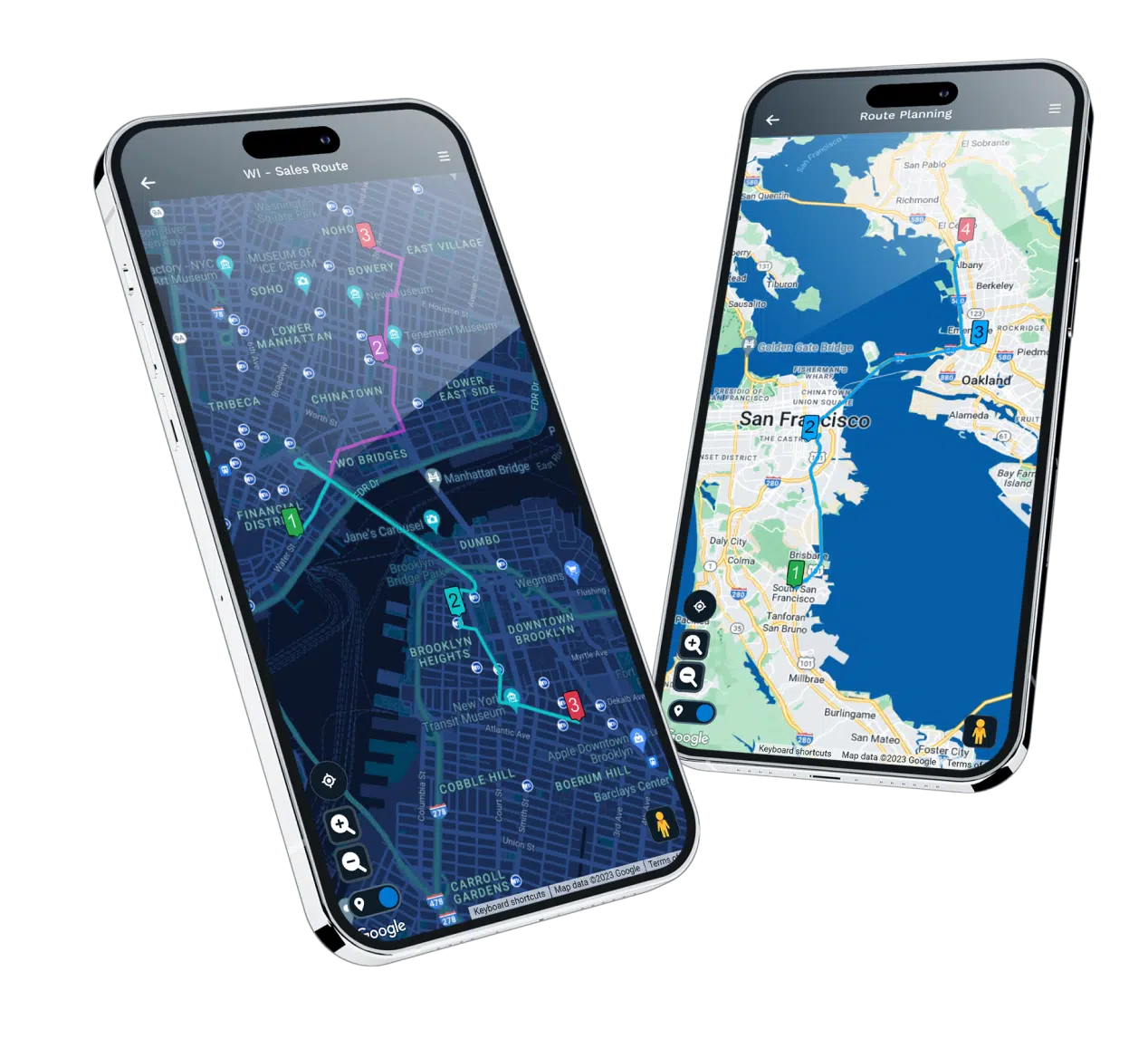
Multi-stop optimization sequences your locations for minimum drive time, and calculations reflect actual route conditions. Export routes to any navigation app or push updates to drivers already in the field.
Data Intelligence
Access 100,000+ demographic and market data layers, including census variables, consumer spending, healthcare statistics, and real estate metrics. Data is also available at state, county, ZIP, and census tract levels.
Enterprise-Ready Without the Enterprise Hassle

Integrations That Sync Automatically
Salesforce, HubSpot, Zoho, Pipedrive, and Keap connect with bidirectional sync. Google Sheets updates your maps when the spreadsheet changes. REST API handles automated lookups and assignments for custom workflows.
Security That Passes Vendor Reviews
256-bit SSL encryption, two-factor authentication, SSO, role-based access controls, and audit logging. Salesforce AppExchange security review already passed. Your security team's questions are already answered.

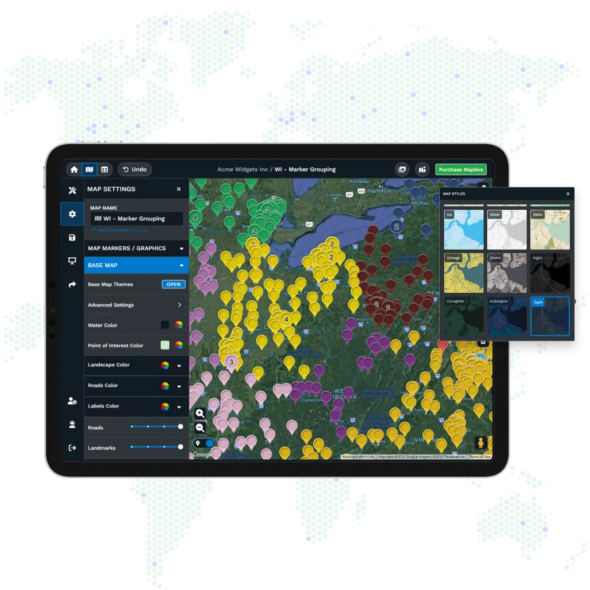
Visualization You Can Present Anywhere
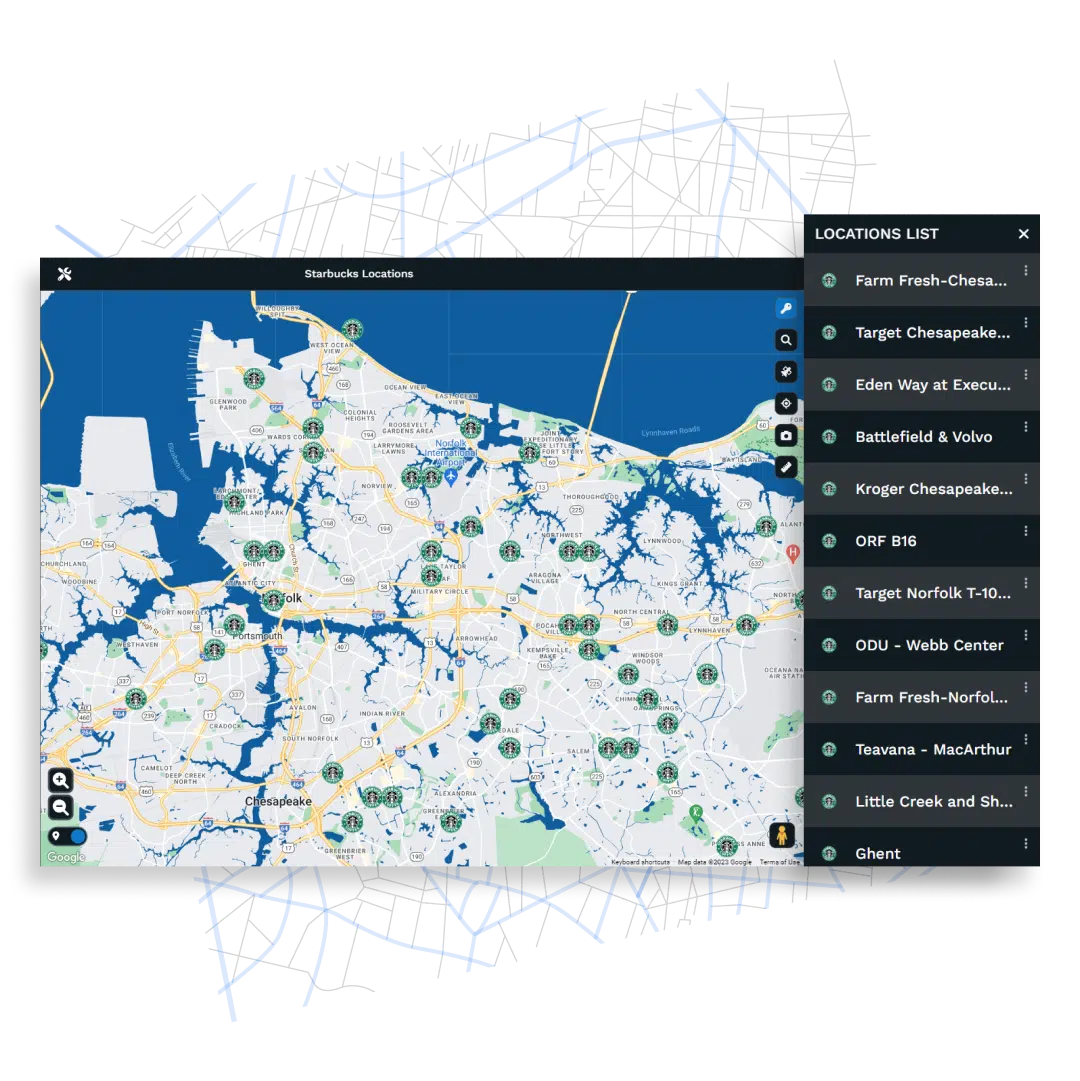
Custom markers with your colors and logos. Heat maps, choropleths, bubble maps, and pie charts on the same view. Export at print-ready resolution or embed interactive maps directly on your website.
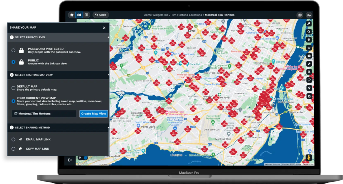
Collaboration Without Version Confusion
Password-protected sharing controls exactly who sees what. Granular permissions restrict access to specific tools, columns, or editing capabilities. Spreadsheet versioning tracks changes so rollbacks are always possible.
Start Your Free, No Risk, 10 Day Trial
No credit card required. No surprises. Just Results.
START MAPPING NOWFAQs
What is Maptive?
Maptive is an enterprise-grade location intelligence platform and GIS Software. Organizations upload data, and the platform converts it into location intelligence maps for territory optimization, route planning, market analysis, and operational decision-making. Amazon, General Electric, the US Department of Energy, Coca-Cola, and Stanford Hospital & Clinics run their spatial operations on Maptive. The entire platform operates in your browser with no software installation, no IT infrastructure, and no GIS training required.
Who uses Maptive?
Fortune 500 companies, government agencies, healthcare systems, and high-growth businesses across 112 countries rely on Maptive for mission-critical spatial analysis. The client roster includes Siemens, UBS, Volkswagen, Capital One, Adobe, Harvard Business School, CBRE, Hilton, Bridgestone, American Red Cross, Aetna, and Adidas. These organizations use the platform for sales territory management, supply chain optimization, site selection, field service routing, and executive reporting.
What can Maptive handle?
The platform processes up to 100,000 locations per map with WebGL rendering that displays over 200,000 markers simultaneously. Batch geocoding converts 50,000 addresses in 30 seconds. The cloud infrastructure maintains 99.9% uptime with no documented major outages, backed by hardware redundancy and automatic failover across multiple data centers.
What does Maptive include?
Every plan unlocks 60+ mapping and analysis tools with no feature restrictions. This includes automated territory optimization, route planning for up to 73 stops per trip, drive time polygons extending up to 8 hours with live traffic data, 50+ US Census variables, 100,000+ additional data layers covering consumer spending, healthcare utilization, and real estate metrics, plus CRM integrations with Salesforce, HubSpot, Zoho, Pipedrive, and Keap. High-resolution exports reach 5120×3200 pixels for poster-size printing.
What results do organizations achieve with Maptive?
Organizations using Maptive report a 75% reduction in territory planning time, 18% lower fuel costs, 22% more service calls per day, and over $100,000 in quarterly fuel savings. One nationwide parts distributor compressed two weeks of territory redesign into a single afternoon. Field teams using the route optimization tools save 12% on travel while increasing customer coverage.
How does Maptive compare to desktop GIS software?
Maptive performs the same geoprocessing operations as traditional desktop GIS, including spatial joins, boundary aggregation, area dissolves, demographic overlays, and isochrone mapping, but runs entirely in your browser. You get the analytical power without software licenses, installation headaches, or specialized training. Organizations that previously required dedicated GIS installations now run equivalent workflows through Maptive’s visual interface.
Is Maptive secure enough for enterprise data?
The platform meets security standards required by Fortune 500 companies and federal agencies. This includes 256-bit SSL encryption for data in transit and at rest, two-factor authentication, single sign-on integration, role-based access controls, comprehensive audit logging, and regional data storage selection for compliance requirements. Maptive has passed the Salesforce AppExchange security review, demonstrating compliance with rigorous third-party assessments.
What does Maptive cost?
A 45-day pass costs $250 with full feature access. The individual annual plan runs $1,250 per year with up to 400,000 geocodes monthly. The team annual plan is $2,500 per year supporting up to 1,000,000 geocodes monthly with collaboration features. Every tool, every data layer, and every integration is included on every plan. There are no feature tiers or premium upsells.
What level of support does Maptive provide?
A 30+ person US and Canada-based team handles all customer inquiries directly from San Francisco headquarters. Support specialists are trained mapping experts who understand spatial analysis and territory management. First response time runs under 15 minutes, most requests resolve the same day, and the team provides hands-on assistance with data imports, file cleanup, and custom configurations at no additional cost. G2 rates Maptive’s support quality at 9.7 out of 10.
Do I need technical expertise to use Maptive?
No. You upload a spreadsheet with addresses or coordinates, and the platform handles geocoding, rendering, and analysis through a visual interface. The same geoprocessing operations that require scripting in traditional GIS software happen through point-and-click tools in Maptive. Organizations deploy the platform to sales teams, operations staff, and executives who have no GIS background and see full adoption within hours.