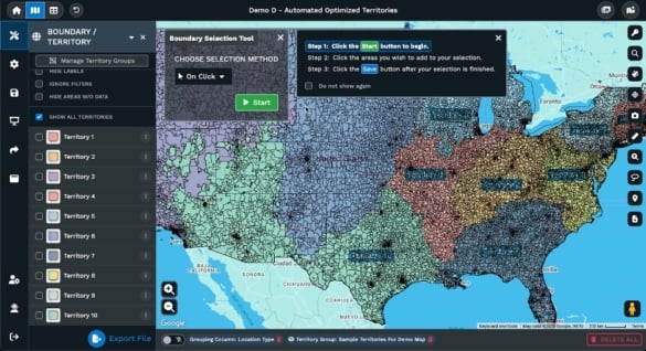
Picking a business location is not a game of guesswork, and neither is measuring up to the competition. Small gaps in information can cost money or market share. At Maptive, we handle site selection and competition checks with maps built to show real business details. There’s no room for distraction or extra color in this process. Below are four map types you should use on Maptive to get straight to the facts.
Table of Contents
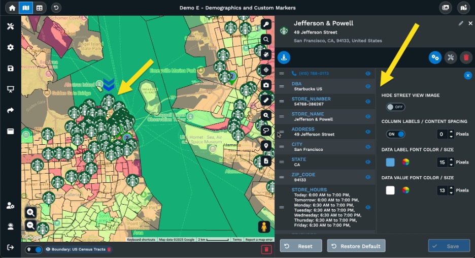
Targeting who lives, works, and spends in an area is the core of site selection. Property price or walk-in traffic tells part of the story, but pinpointing your customer base starts with the right set of numbers. Age groups, income levels, population density, and education background sit at the heart of these maps.
For example, a grocery store chain would waste time scouting low-income suburban spots for high-margin organic food. Pulling up a Maptive demographic map, you can zone in by age or income. You match your offer to the actual people in those blocks. We use current U.S. Census information and real estate sources, so you get fresh numbers, no outdated guesses. These maps can be color-coded, making customer clusters pop out, which is vital for any business relying on regular local foot traffic.
Next, stack on economic data: unemployment, average household earnings, and spending trends. Setting up a service or shop in a high-unemployment area can mean slow returns, while areas with good job stats often indicate steadier sales. Maptive pulls from credible economic reports and public datasets. You catch opportunity pockets before competitors see them, or avoid slow-growth zip codes entirely. This is practical information that can change which neighborhood you choose.
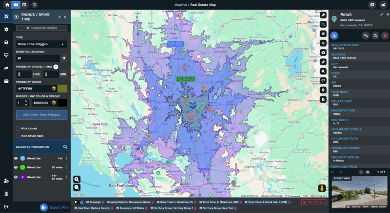
Commute time, delivery routes, and supply runs all cut into profits. The proximity of your location to highways, logistics hubs, and suppliers makes a difference.
Suppose you run a warehouse or a bakery. You need to know if your trucks will get stuck in city traffic every morning, or if your delivery route circles an extra ten miles because of a river or rail line. With Maptive, you build radius maps around your key points, suppliers, customers, or service areas. These maps draw out market reach with basic rings or colors. You immediately see if a spot is too far for regular shipments or out of reach for local delivery.
Then use our drive-time tool. Minutes matter for certain types of retail, service, or distribution. A suburb with heavy morning traffic will show up as a problem straight on the map. Medical offices, food chains, or urgent delivery hubs all have different limits. Once those rings are on your map, gaps and coverage weaknesses are obvious.
For field teams, these maps also help plan day-to-day stops. In some case studies, a national food retailer used these features to cut delivery costs by plotting the shortest daily truck routes. That’s real savings, on top of better service.
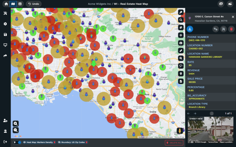
Knowing where the competition has set up tells you where the market is tight and where it is open. If you miss a competitor near your planned location, you lose business before you open your doors.
Maptive allows you to upload your own list of known competitors or import public information on store and office locations. A map puts the data on the table without half-truths. If you see a crowded area, that’s a sign to reconsider. If you spot a gap, you might have room to grow. Retailers testing new sites often use these features to see if a part of town has too many bakeries or coffee shops.
These maps also allow for side-by-side comparison with demographic layers. That way, you can tell if competitors are drawing from the same pool or missing a part of the community. In some industries, a half-mile matters. You can spot how far you need to be to avoid overlap, or how close you can place a store before the market splits. Reports from our food and retail clients confirm that plotting out these maps before renting or building pays off. You avoid stepping into a street already dominated by a popular brand.
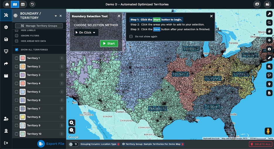
Trade area maps draw a line around your target space, not always a circle, but a working border shaped by roads, drive times, or even competitor locations. These are vital for anyone who needs to know how far customers will travel or where supply lines can stretch.
Different businesses set custom rules. A small café will want to map out walk-times or bike routes from offices. A distribution center will care more about highway ramps and supplier zones. Maptive lets you set these limits and see right away if the available site fits your real business, not someone else’s template.
Trade area maps are where you answer the big questions: Who can reach me fast? Will heavy traffic at certain times cut into my lunch rush? Is my location easy to cross to, or does a major road split my potential base in half? The maps point out those trouble spots without room for hunches.
You can layer these maps to combine foot traffic, local amenities, crime rates, or parking spaces. Maptive gives you tools to apply as much custom data as you have. You decide what matters and plug those criteria in. For a pharmacy, you might care about the distance from medical clinics and the average age in the area. For a warehouse, you look at truck access and shipment frequency.
Stakeholders, owners, investors, and partners get a view of the facts before money changes hands. You can use Maptive’s sharing tools to let every team member review or comment, build printed reports, or even present changes within a browser session.
Good site selection comes down to three steps. First, define what you need and set hard rules, not guesses. This can mean a traffic count, average local income, or delivery range. Next, gather your own data and official numbers. That means sales records, census readings, or third-party real estate reports. Enter and filter these into Maptive, using the filter tool until only the best matches turn up.
Now, pin all your locations, potential, actual, and competing, on a single map. Start reviewing demographic and economic colors. Layer on infrastructure and proximity rings. Drop in competitor markers and play with drive-time distances. If patterns jump out, pay attention. If your best site falls into a dead zone for customers or gets buried under big-name trademarks, look again.
Finally, trade area and custom maps force you to stress-test each site. Does it still hold up with walk time filters? With supplier route overlays? With every map, you keep control and clarity.
Retail brands and logistics companies that use Maptive for site selection report tighter, more profitable setups. In one case, a retail chain compared five potential sites using Maptive’s demographic maps. After adding economic and competitor layers, only two locations matched the target profile and offered real potential for long-term returns. After plotting supply lines and actual drive times, only one was left on the list that hit all the required points.
Distribution centers have turned to Maptive for warehouse placement. They look at supplier proximity maps and run routes using drive-time estimates. This pinpoints the location that offers the fastest access with the lowest ongoing delivery costs. Field teams shave miles off daily trips, cut fuel, and improve speed.
These aren’t marketing claims; they’re practical reports from companies who needed to lower risk, reduce wasted site visits, and wring more value from their data.
Every map on Maptive’s platform serves a clear business need. Good site selection and a strong position against competitors require sharp, honest data you can see, touch, and act on. From demographic basics and economic health, through logistics questions and competitor mapping, right up to custom trade areas and walk-time checks, every working map brings potential risks and gains to the surface.
If you want to put your business in the right spot the first time, these maps are your checklist. Skip the guesswork. Use the data. Make choices based on what’s in front of you, not out-of-date trends or hearsay.
Maptive offers the tools and the framework. You provide your rules and your business sense. The result: a mapped decision that holds up, on paper and in practice.
Fred Metterhausen is a Chicago based computer programmer, and product owner of the current version of Maptive. He has over 15 years of experience developing mapping applications as a freelance developer, including 12 with Maptive. He has seen how thousands of companies have used mapping to optimize various aspects of their workflow.
