Mapping Software for Business
Maptive turns data into interactive maps built for territory management, route planning, market analysis, and location intelligence. Upload your data, and the platform plots your locations with easy-to-use enterprise tools that handle the spatial work your business runs on.
Start a Free TrialSOME OF OUR CUSTOMERS INCLUDE:


Start Mapping in Minutes
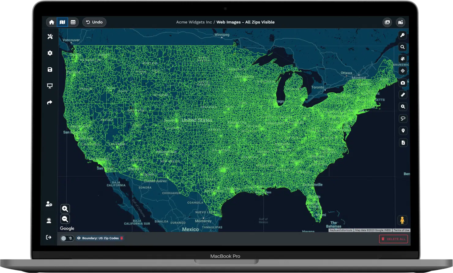
Drag an Excel file into Maptive or connect Google Sheets directly. Maptive plots your addresses, corrects formatting errors during upload, and renders locations on an interactive map. No software installation and no GIS background needed.
(click on the image to enlarge)
(click on the image to enlarge)
(click on the image to enlarge)
(click on the image to enlarge)
(click on the image to enlarge)
(click on the image to enlarge)
(click on the image to enlarge)
(click on the image to enlarge)
(click on the image to enlarge)
(click on the image to enlarge)
(click on the image to enlarge)

(click on the image to enlarge)
(click on the image to enlarge)
(click on the image to enlarge)

(click on the image to enlarge)
(click on the image to enlarge)
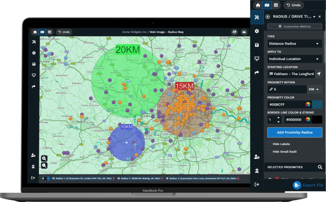
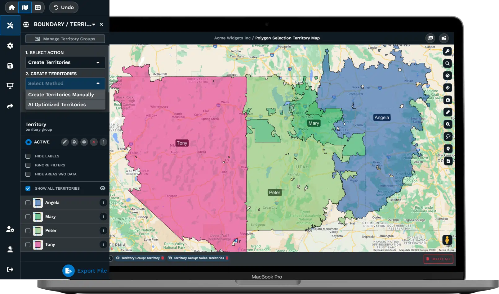
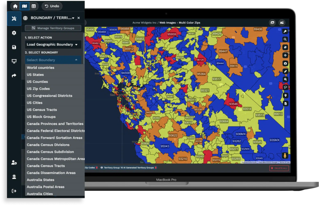
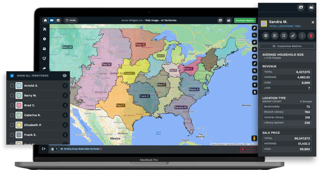
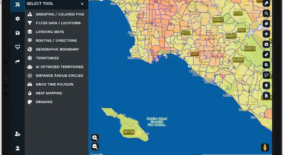
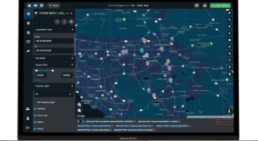
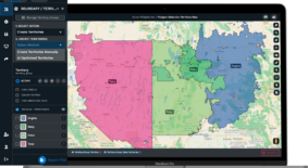
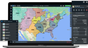
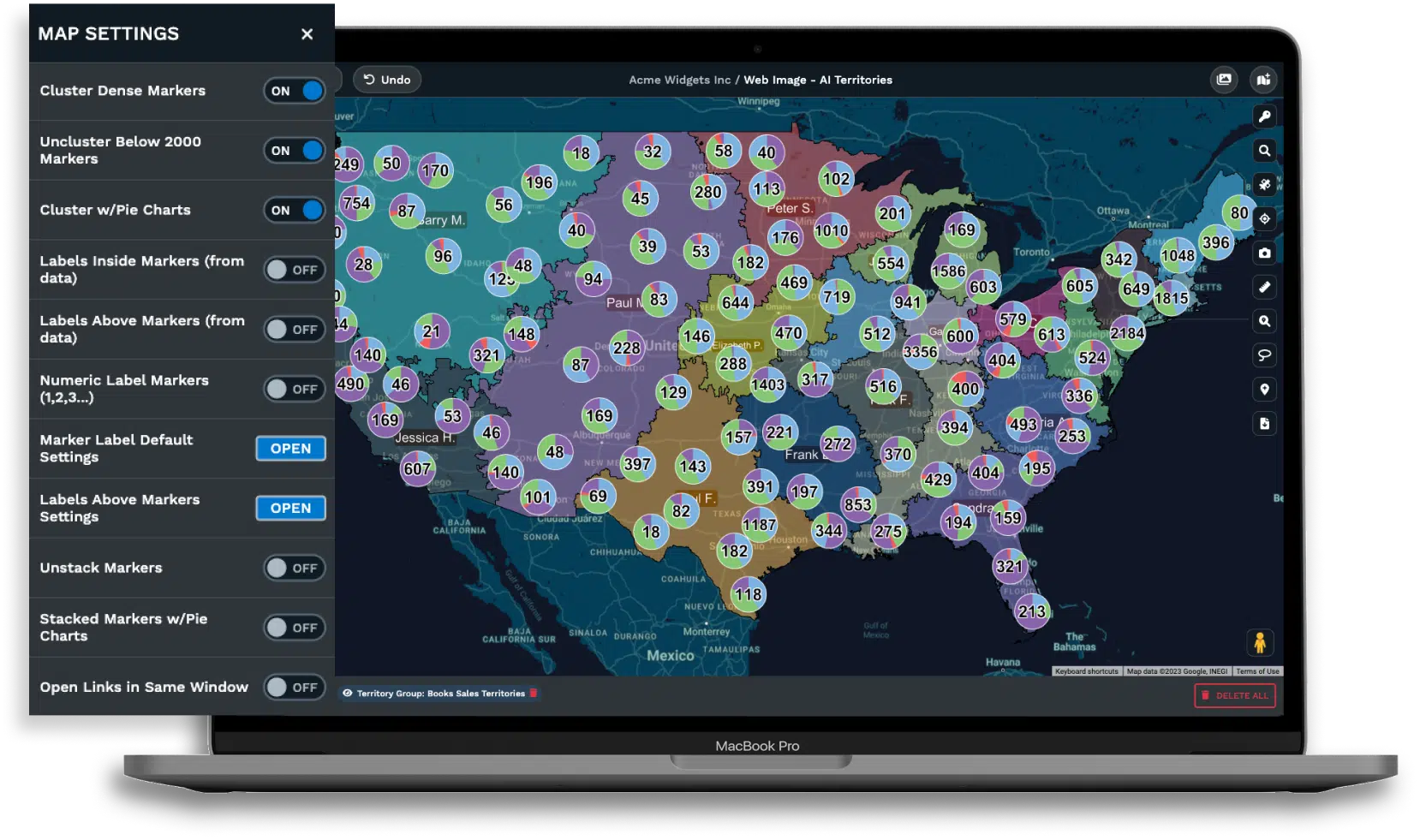
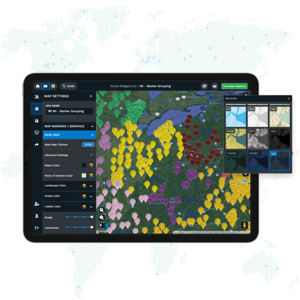
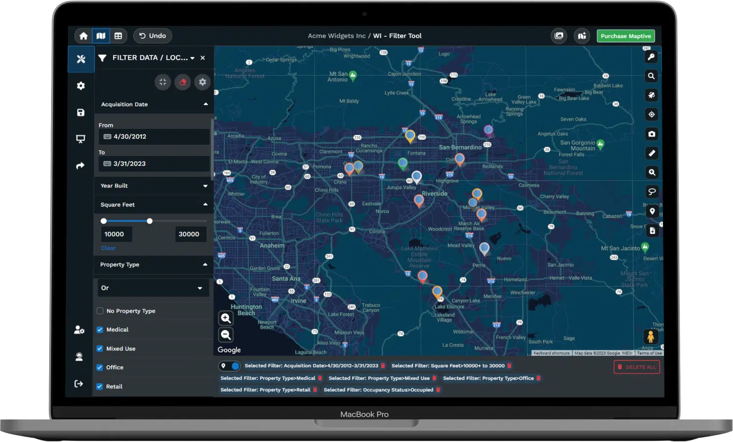
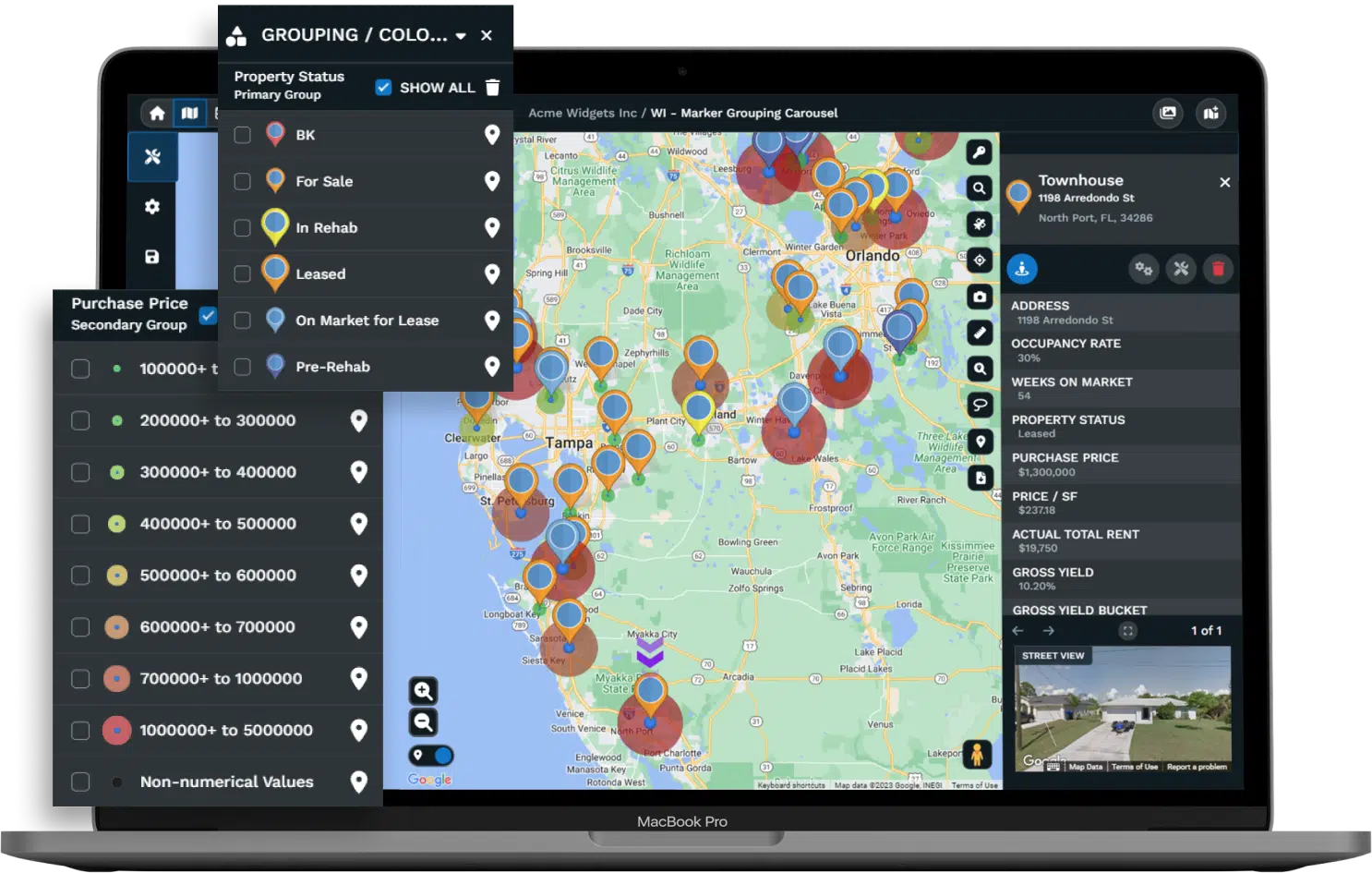
Build Territories That Balance Workloads Automatically
Maptive builds territories from zip codes, counties, census tracts, or boundaries you draw yourself. The automated optimizer distributes accounts based on constraints you define including drive time limits, revenue targets, customer counts, and rep home locations. Adjust one boundary and totals recalculate across every territory.
Bulk editing updates all markers inside a territory in one operation. Split-screen view shows your map alongside the spreadsheet so edits sync visually as you make them. Teams that spent two weeks on annual realignments now finish the work in a single afternoon.
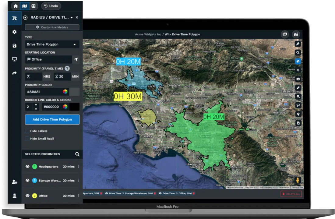
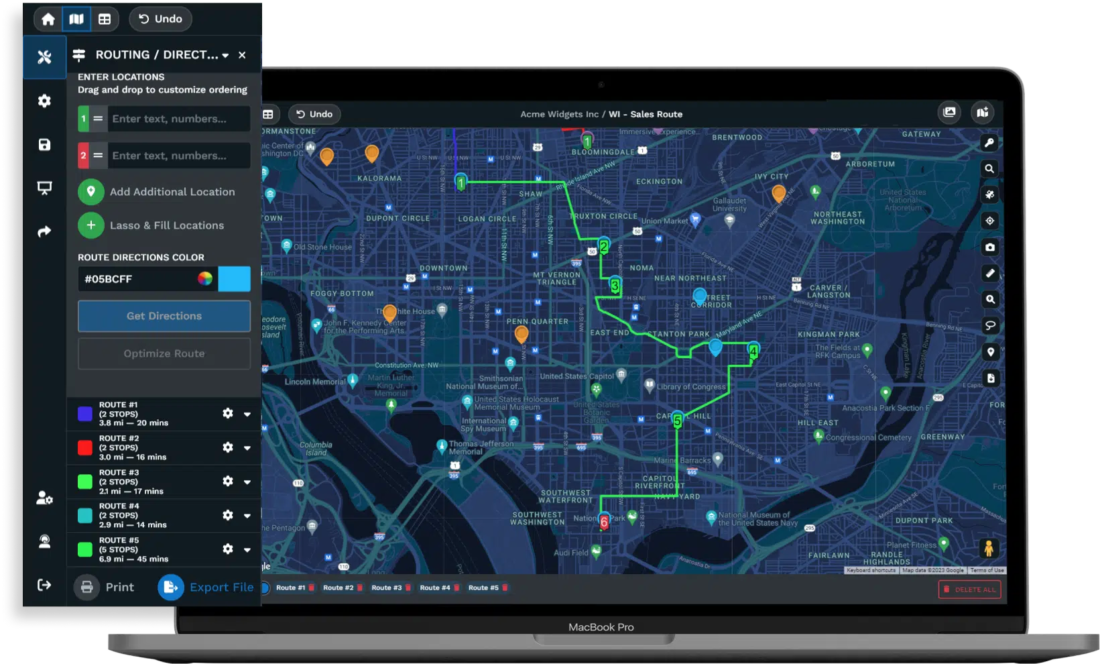
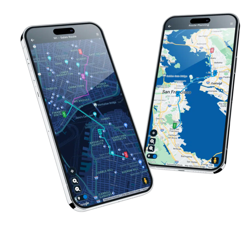
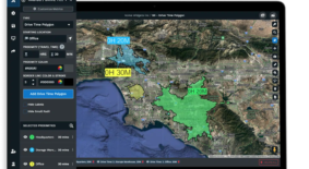
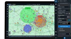
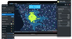
Plan Routes Using Google's Routing Engine
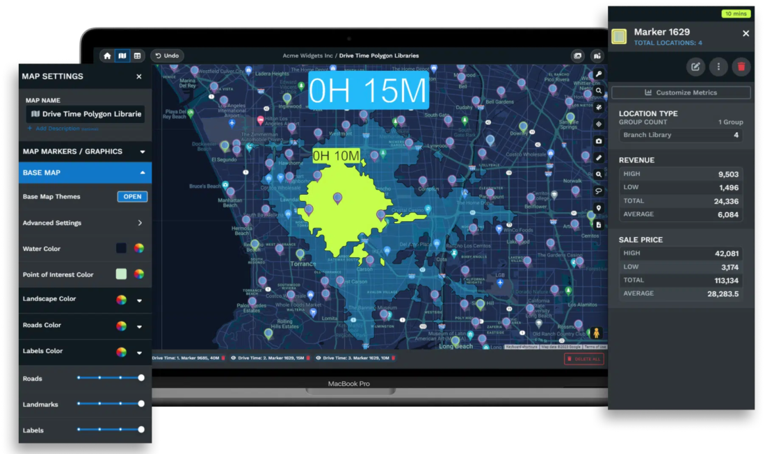
Maptive sequences your stops into efficient driving paths using the same routing infrastructure that powers Google Maps. The optimizer reads real road networks, clusters nearby visits, and cuts out the backtracking that wastes hours in the field. Export routes to mobile devices with turn-by-turn directions ready for navigation.
Field teams using optimized routes report 18% lower fuel costs and 22% more completed service calls per day. Drive time polygons show reachable areas from any starting point using actual road conditions rather than straight-line guesses between addresses.

Talk to Mapping Experts When You Need Help
Maptive support connects you with trained specialists who understand territory planning and spatial analysis. No chatbots and no scripted responses. The team works Monday through Friday, 8 AM to 8 PM Eastern, and provides data import assistance at no additional cost when your files need cleanup.
G2 rates Maptive 9.7 out of 10 for support quality. Most requests are resolved the same day. Teams adopting the platform receive training sessions that accelerate onboarding. Complex implementations get dedicated attention from people who know the product and can walk through advanced use cases.
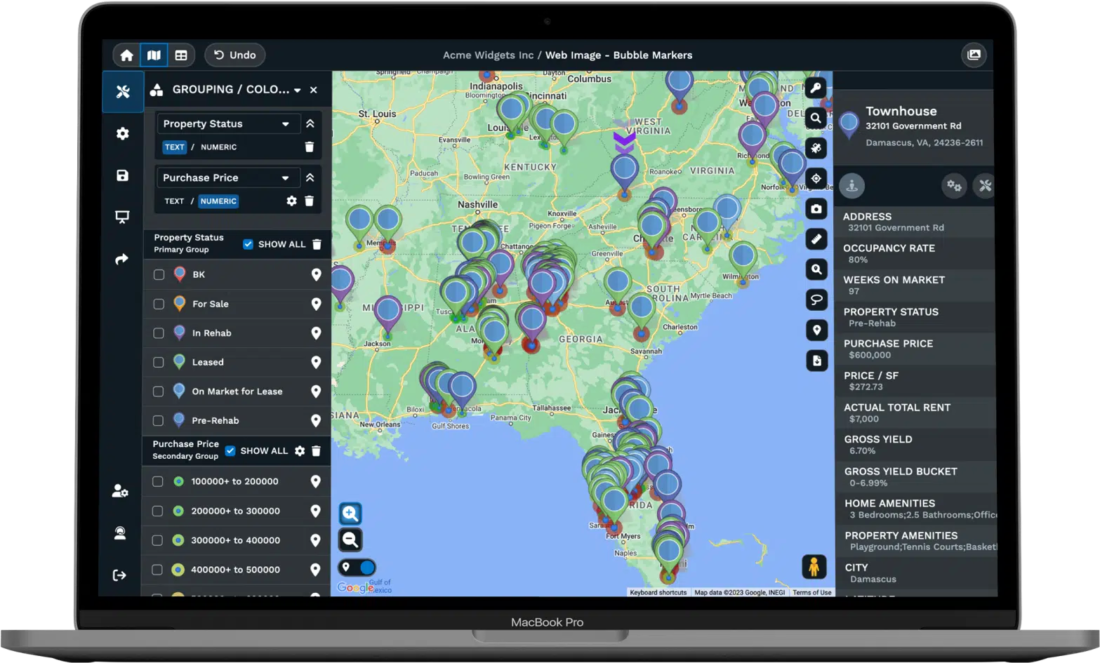
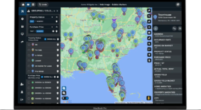
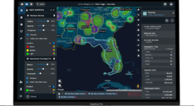
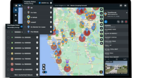
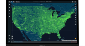
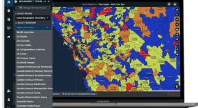
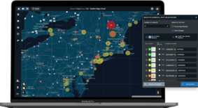
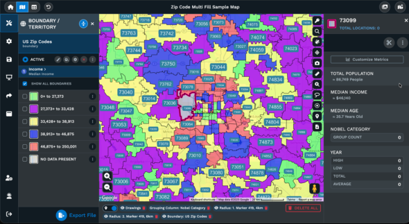
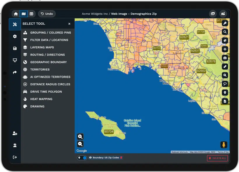
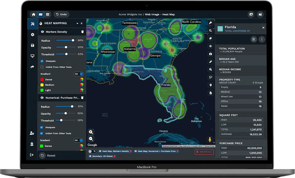
Layer U.S. Census Data Over Your Business Locations
50 demographic variables from the U.S. Census Bureau map directly over your locations at state, county, zip code, census tract, or block group precision. Median income, population density, age distribution, education levels, and household composition sit ready to overlay on any territory or boundary you create.
Canadian census data from Statistics Canada covers provinces with the same depth. Build choropleth maps that shade regions by any variable you choose. Compare your customer footprint against local demographics to spot where sales lag behind the market potential sitting in a given area.
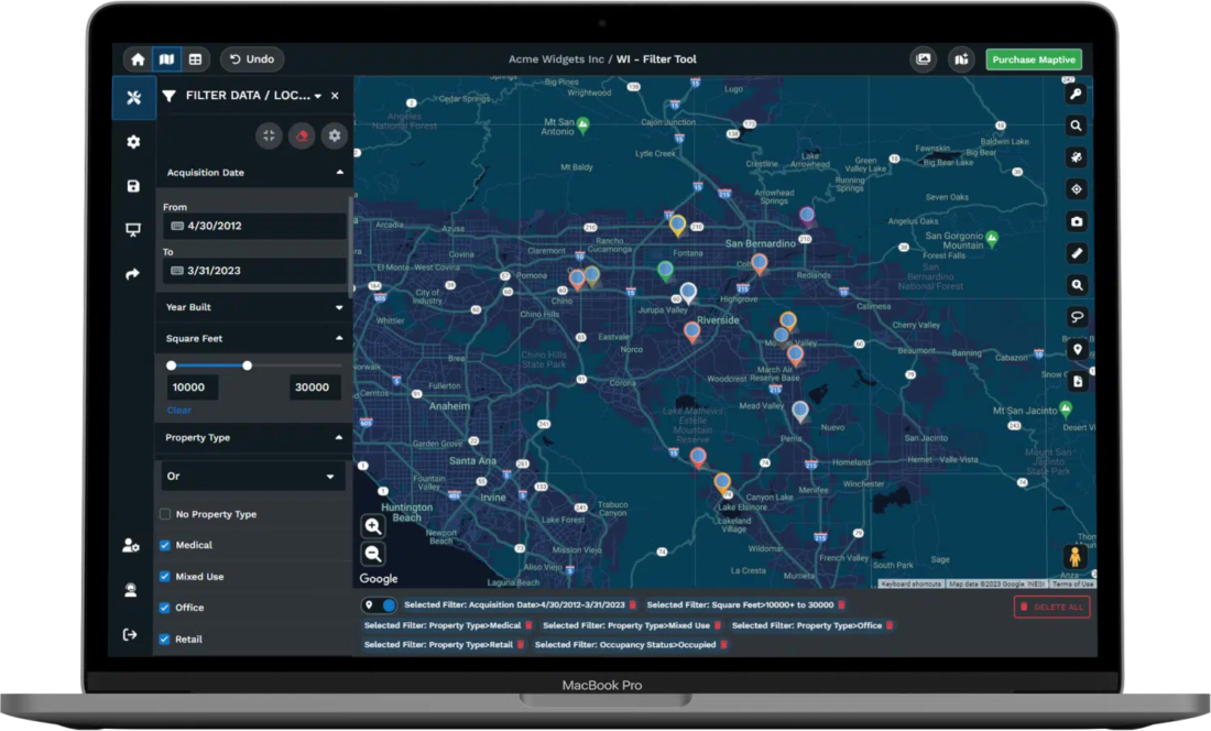
100,000 Data Layers Coming for Deeper Market Intelligence
Maptive is adding over 100,000 commercial data layers through a partnership with a provider that has served Fortune 500 companies for three decades. Consumer spending by category, healthcare utilization, credit characteristics, property values, vehicle ownership, and industry metrics will all map at zip code and census tract levels.
Data updates quarterly. Retail teams will run site selection against actual spending patterns. Healthcare organizations will locate underserved populations with precision. Sales leaders will measure territory performance against real market potential rather than internal assumptions about where opportunity exists.
Connect Your CRM and Keep Territory Maps Current
Salesforce, HubSpot, Zoho, Pipedrive, and Keap connect to Maptive, so territory maps update when your pipeline data changes. Salesforce users sync 50,000 leads weekly with under 90 seconds of lag between CRM update and map refresh. Google Sheets connections sync continuously for teams managing location data outside a CRM.
The REST API handles over a million address lookups monthly for teams running automated workflows. New leads land in the correct territory the moment they enter your system. Account reassignments propagate to every map that references the data without requiring manual exports or file uploads.
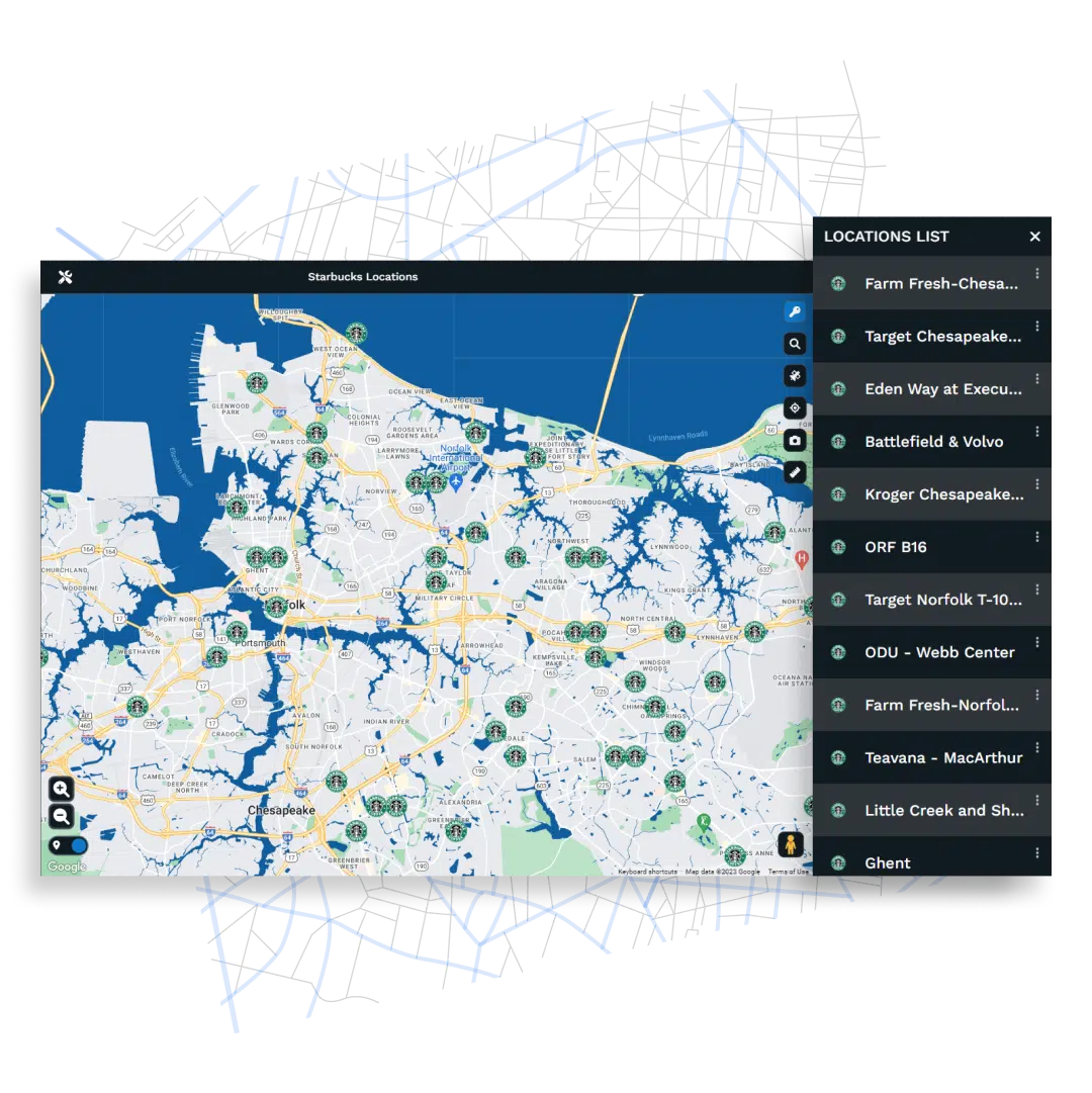
Share Maps While Controlling Who Sees What
Password protection, role-based permissions, and column-level visibility let you share maps without exposing data that should stay internal. Send a territory view to a client without showing compensation numbers. Run a public store locator and private sales planning on the same platform without crossover.
Exports render up to 5120×3200 pixels for presentations and print. Interactive embeds work on websites with search boxes, radius tools, and filter controls intact. Generate sharing links you can revoke anytime. Viewers access what you allow them to see and nothing more.
What Our Customers Say About Us
See what others have to say about Maptive.

Maptive is essential to how we understand the global distribution of our leaders, helping us to reduce unnecessary travel time, costs and our impact on the environment.
David,
The Royal Bank of Scotland
As our data visualization partners, Maptive has become an integral part of our operations—from Logistics to Project Tracking to Scheduling. (You guys rock!)
Miquel Fernandez,
RMSI Retail Solutions
I have used several mapping tools, and Maptive is by far the most user-friendly and most comprehensive tool available.
Nicole,
Indiana State University - RUEDI
True insight into our data is vital to our success—and Maptive gives us exactly that.
Anjil,
BRAC
Maptive helps us drastically with compliance, marketing and itinerary planning.
Leonie,
Ecotourism Australia
Mapping Tools Designed for Business Operations

Territory Management
Build from zip codes, counties, or census tracts. Balance by revenue, accounts, or custom fields. Totals update live as you edit.

Route Optimization
Sequence stops into logical driving paths using Google's routing engine. Export directions to mobile for field team navigation.
Demographic Mapping
Overlay 50+ census variables at state, county, zip, or block group levels. Map income, age, education, and population data.
Commercial Data Layers
100,000 layers covering consumer spending, healthcare, real estate, and financial metrics will arrive soon at zip and tract levels.

Drive Time Polygons
Calculate areas reachable within set drive times using actual road networks. Visualize true service coverage from any address.
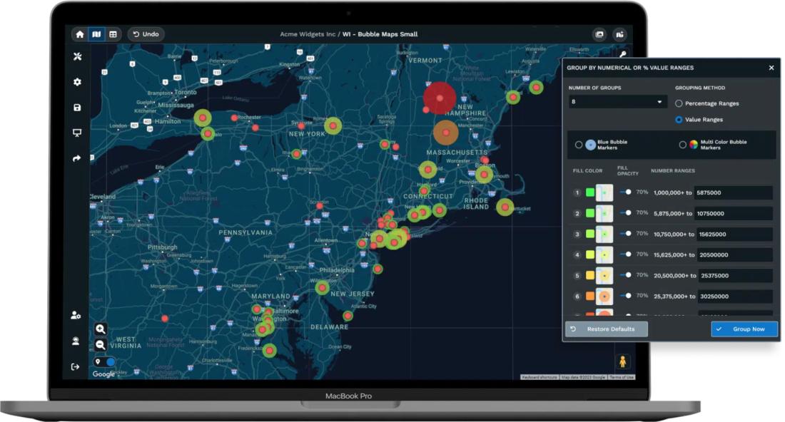
Heat Map Visualization
Weight markers by revenue, volume, or any number field. Watch the map shade itself to show where your activity concentrates.
CRM Integration
Connect Salesforce, HubSpot, Zoho, or Pipedrive. Territory maps refresh when records change. No manual exports needed.

Enterprise Security
256-bit encryption, two-factor authentication, SSO, role-based access, and Salesforce AppExchange certification keep your information protected.
Business Mapping Software FAQs
What is business mapping software?
Business mapping software plots location data from spreadsheets onto interactive maps where you can visualize customers, plan territories, optimize routes, and analyze markets geographically. Instead of scanning rows in Excel trying to understand where your accounts cluster or how far apart your stops are, you see the information laid out spatially. Maptive runs entirely in the browser on Google Maps infrastructure, so there’s no desktop software to install and no GIS expertise required to use it.
How does Maptive handle large datasets?
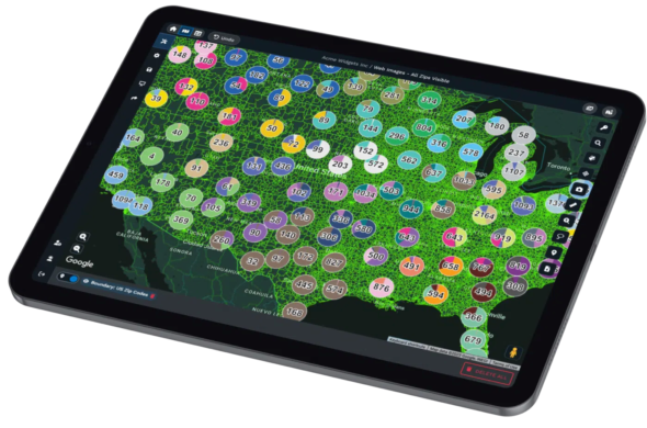
The platform uses WebGL rendering to display over 200,000 markers simultaneously without freezing your browser or slowing performance. Large spreadsheets process quickly through cloud infrastructure that handles enterprise-scale geocoding. Teams in insurance, logistics, and retail regularly map tens of thousands of locations and work with the data interactively rather than waiting for the system to catch up.
Can I create sales territories automatically?
Yes. Maptive’s territory optimization tool generates balanced territories based on constraints you set. Tell it to distribute accounts by revenue, customer count, drive time limits, or rep home locations and the algorithm builds territories that meet your criteria. You can also draw territories manually or build them from geographic boundaries like zip codes, counties, and census tracts. Adjustments to one territory trigger automatic recalculations across all others.
What demographic data comes with Maptive?
U.S. Census data maps directly over your locations at state, county, zip code, census tract, and block group levels. Fifty variables cover population density, median household income, age distribution, education attainment, and household composition. Canadian census data from Statistics Canada provides similar coverage for provinces. You can shade territories by any demographic variable and compare your sales footprint against the characteristics of local markets.
What are the 100,000 data layers Maptive is adding?
Maptive is integrating commercial data layers through a partnership with a provider that has served Fortune 500 companies for over 30 years. These layers cover consumer spending by category, healthcare utilization rates, credit characteristics, property values, vehicle ownership patterns, and industry-specific metrics. Data maps at zip code and census tract precision with quarterly updates. This expansion turns Maptive into a market intelligence platform where you can measure territory performance against external benchmarks.
Does Maptive integrate with CRM systems?
Maptive connects to Salesforce, HubSpot, Zoho, Pipedrive, and Keap. When records update in your CRM, territory maps refresh automatically so your view stays current without manual exports. Salesforce users sync 50,000 leads weekly with under 90 seconds of lag between updates. Google Sheets connections sync continuously. The REST API supports automated workflows for teams with custom systems or internal databases.
How does route optimization work?
Add stops to the route planner and Maptive sequences them into an efficient driving path using Google’s routing engine. The optimizer accounts for actual road networks and clusters nearby visits to eliminate backtracking. Routes export to mobile devices with turn-by-turn directions ready for navigation apps. Field teams adjust routes mid-day when calls run long or priorities change. Companies using optimized routes report 18% fuel savings and 22% more daily stops.
Is my data secure on Maptive?
The platform encrypts data with 256-bit SSL both in transit and at rest. Two-factor authentication and single sign-on protect account access. Role-based permissions control who can view or edit maps, and audit logging tracks activity across your team. Maptive passed Salesforce AppExchange security review, which requires rigorous third-party assessment. Regional data storage options support compliance requirements for organizations with geographic data residency rules.
What kind of support does Maptive provide?
You talk to trained mapping specialists, not chatbots or scripted agents. The San Francisco team works Monday through Friday, 8 AM to 8 PM Eastern, with most requests resolved the same day. G2 rates Maptive 9.7 out of 10 for support quality. Data import assistance comes at no extra cost when your files need cleanup. Teams adopting the platform receive training sessions, and complex implementations get dedicated attention from people who understand advanced use cases.
How do I get started with Maptive?
Sign up for a free trial without entering a credit card. Upload a spreadsheet or connect Google Sheets and your locations plot on an interactive map within minutes. All features are available during the trial so you can test territory tools, route optimization, and demographic overlays on your actual data. Paid plans start at $250 for a 45-day pass, $1,250 annually for individuals, and $2,500 annually for teams with higher geocoding limits.