
While physical maps are mostly a thing of the past, digital maps are being utilized more than ever before. Use them to help you analyze data, share important insights with your team, and educate customers about your business.
But, the best part is that you’re not limited to one kind of map. Many different kinds of maps can effectively share your findings or convey your message. We recommend experimenting with multiple maps to see which one works best for your needs.
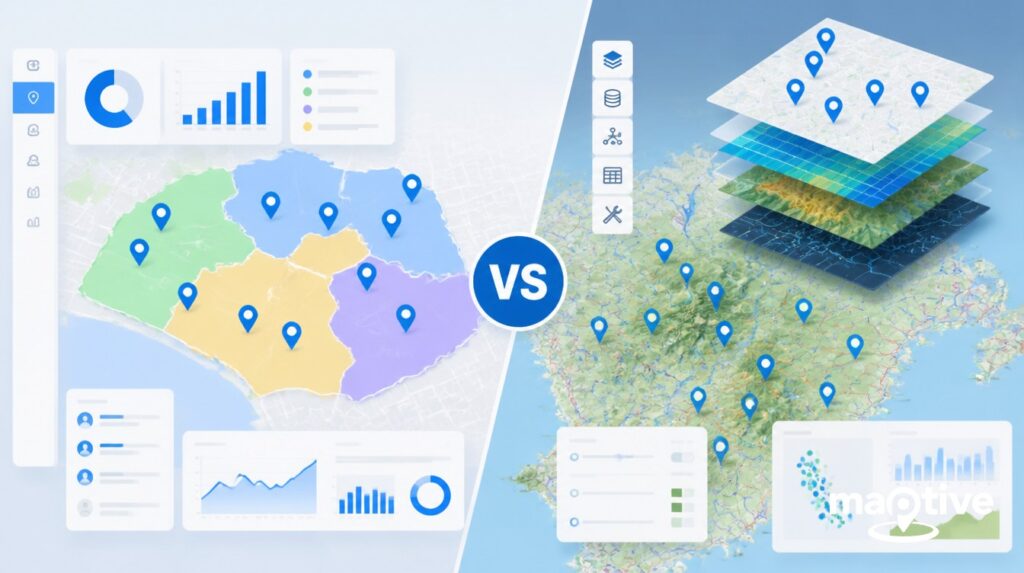
Don’t know where to start? Here are our 10 favorite kinds of maps.
Topographical Map
This is one of the most basic map variations but it’s still extremely useful. Topographic maps display the physical features of the land’s surface, shown through the use of contoured lines or shaded areas. This includes flat surfaces, shallow areas, hills, mountain ranges, and trees. Most modern mapping platforms, like Maptive and Google Maps, contain some level of topography.
These maps have obvious benefits for hikers, campers, hunters, and other outdoors people. However, they’re also used extensively by surveyors, builders, and urban planners.
Road Map
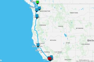
Technology has allowed maps to be used for a wide range of applications. However, their most common use is still helping people get from point A to point B. Road maps display the layout of various minor roads, streets, and major highways and navigate you to your desired destination.
Use Maptive’s routing tool to find the quickest route between two points or multiple locations on your map.
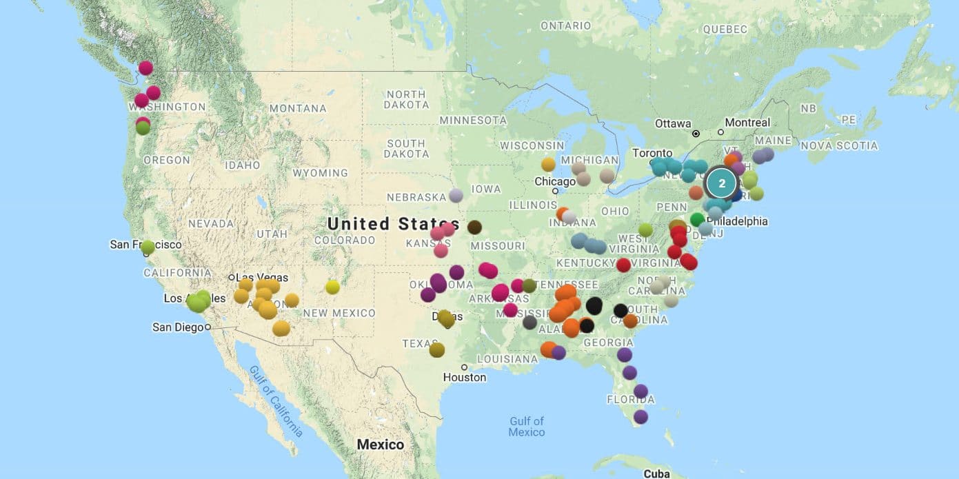
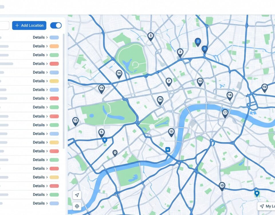
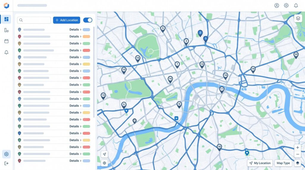
Pin Map
Pin maps are very simple but very effective. With these types of maps, a pin represents each data point. Use these maps to plot the location of places, people, sales, and virtually anything else.
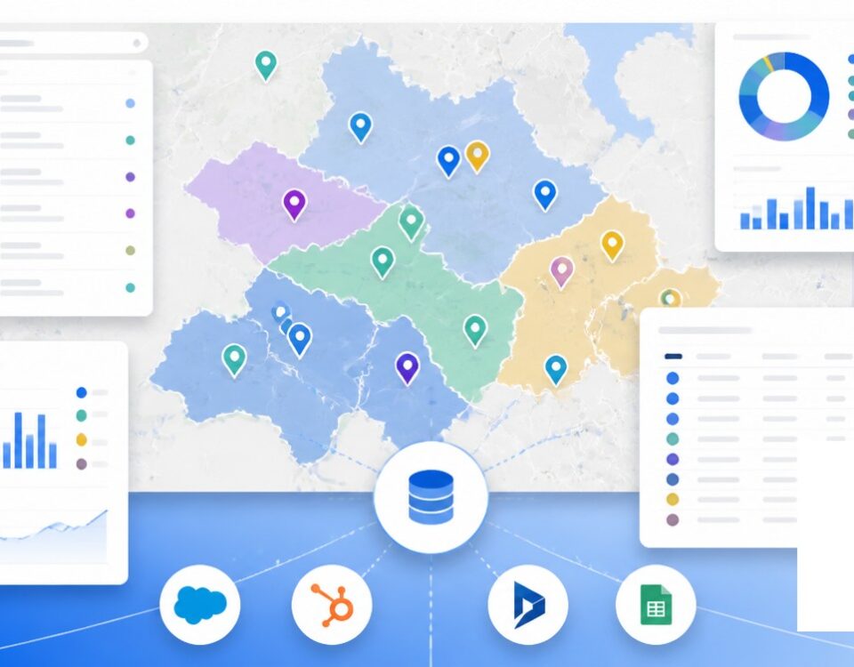
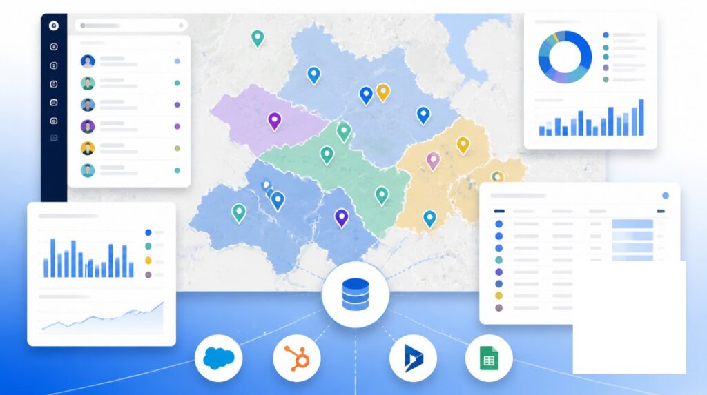
Create pin maps with Maptive in just a few steps. Simply upload your spreadsheet data to automatically plot your location-based information. Customize the size and color of your pins, and add additional information to each pin that’s accessed through a clickable popup.
Cluster Map
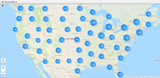
When your data becomes too dense for pin maps, cluster maps simplify your visualization. With this type of map, you’ll cluster tightly packed markers together into an icon that displays key information. If you want to see the individual map markers simply zoom in closer. The more you zoom in the more pins will be visible.
To create a cluster map with Maptive, simply turn the “Cluster Dense Markers” option on.
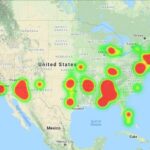
Heat Map
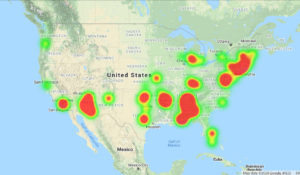
When it comes to figures such as sales, customers, and population, you want to be able to see where most of your data is coming from. Are your sales stronger in certain regions? Where are most of your customers located?
Heat maps use color to represent data, with darker shaded areas indicating a high number of data points packed tightly together, whereas lighter shaded areas indicate sparse data in a particular area.
Maptive’s heat-mapping tool makes it easy to create these types of maps to display a wide range of information.
Dot Density Map
Dot density maps (also known as dot distribution maps) work similarly to heat maps except they use dots rather than colors. Each dot represents a data point, making them an effective way to measure density.
Areas with many dots clustered together indicate high density, while areas with few or no dots indicate low density. Dot density maps have maintained popularity for over a century because of their simplicity and effectiveness.
Zip Code Maps
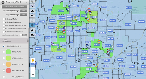
Many businesses, especially sales businesses, often look for ways to segment their service area and customer base. In most cases, boundaries such as states, counties, and even cities, do not provide the level of insight you need. This is where drawing zip codes on your map is extremely useful.
Use Maptive’s boundary tool to easily create a zip code map for sales territories, analyzing localized demographic data, establishing distribution centers, and much more.
Territory Maps
Sales territories segment customers and create an even playing field for salespeople. If your business utilizes territories, use mapping software to make creating and managing them easier.
Maptive offers two tools to map territories. Use the boundary tool to create territories based on the locations of geographic boundaries, such as zip codes, cities, counties, and states. Or, create custom territories based on your data with the territory tool.
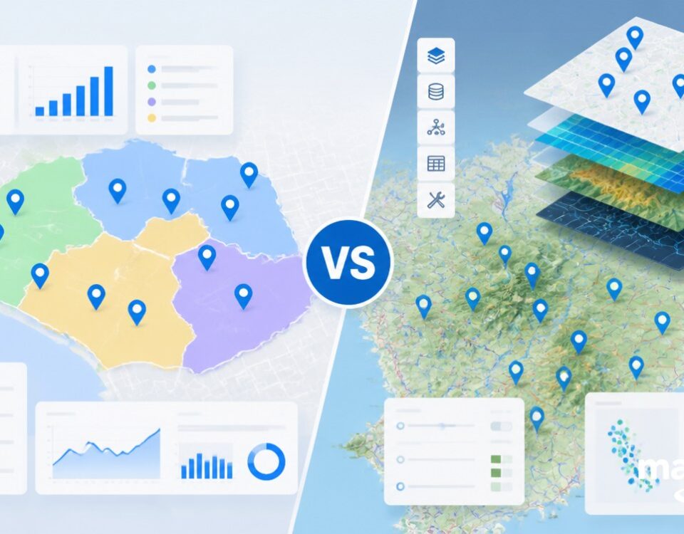
Choropleth Maps
Choropleth maps use colors and patterns to represent statistical data within a geographic area. Different colors represent different classifications of data. Generally, lighter colors/shades represent lower numbers and darker colors/shades stand for higher numbers.
For example, a choropleth map often represents sales for different territories. Territories that have under $10,000 in sales could be yellow, territories that have between $10,000 – $20,000 could be orange, and territories with over $20,000 could be red.
Population Map
Knowing the population of a given area is valuable information for virtually any business. Whether you want to analyze your current service area, form your sales and marketing strategy, or look into opening a new location, population density matters.
Population maps come in a number of varieties, including heat maps, dot-density maps, choropleth maps, and more. Maptive provides the latest population data for both the United States and Canada, giving you the ability to create a wide range of population maps for your business.
Time Zone Maps
Does your business have offices in different states or countries? Do you serve customers all around the world? If so, you likely contend with time zone differences on a daily basis.
Time zone maps make it easy to visualize the time in different areas. So, plot key locations on your own unique map to quickly see which time zone they fall into. This means you always know when team members work and what times are best to call customers about potential sales.
Create Your Ideal Map with Maptive
Use Maptive’s wide range of tools and customization options to build several different kinds of maps in minutes. Sign up for a free trial and start creating your maps today.


