Isochrone Map Generator
Learn about Isochrone Maps and how to use them for your business.
If you’re trying to figure out what isochrone maps are and how to use them for your business, you’re in the right place.
Chances are you’ve got some interesting questions and are trying to find a good solution to figure out what areas can be reached within specific time parameters.
The good news is this article will touch upon the most relevant topics to dispel the mystery around an isochrone map:
- What is an isochrone map?
- Benefits of Isochrone Maps for Businesses
- How to Generate an Isochrone Map
- Use Cases for An Isochrone Map
Overall, isochrone maps can help businesses visualize and understand how locations and travel times relate and are a great tool for gaining valuable insights for various industries and applications.

What Is an Isochrone Map?
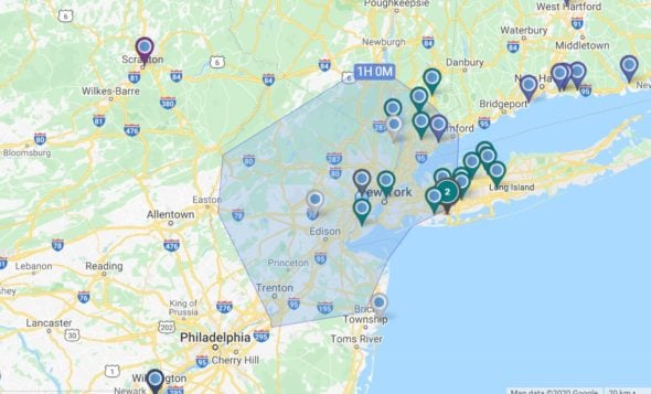
Isochrone maps are a type of visualization that shows what areas can be reached within a given time or travel distance from a specific location.
It may sound simple enough, but these maps are very sophisticated and generally require mapping software to calculate and visualize the time or distance from a central point using geographic data and algorithms.
Generally speaking, to create an isochrone map, the first step would be to determine the starting point–perhaps your distribution center, vehicle depot, or logistics hub–, and you would then use data about the road network, public transit schedules, and other transportation information to calculate the time or distance it will take to travel from that point to other locations in the surrounding areas. From there, you would then feed that information into a map showing the places you can reach within a set timeframe or a specific distance limit from the starting point.
Depending on the nature of your business or organization, isochrone maps can be useful in many ways, from figuring out commuting zones and analyzing access to public services to identifying optimal business locations and planning emergency response and evacuation routes.
Benefits of Isochrone Maps for Businesses
An isochrone map can be a powerful tool for businesses to make better decisions about location, delivery areas, and target markets.
- Understand Your Potential Reach. By showing the area that can be traveled to within a certain amount of time, an isochrone map can help businesses understand how far their delivery or service area can stretch. Once you compare the areas you are currently serving with all the places you could reach, these maps can unlock incredible insights that you can use to scale your business.
- Find Efficiencies and Lower Costs. For example, a business can use an isochrone map to see where their customers are located and determine the most efficient delivery areas to target. By doing this, you can save time and money on transportation costs, something we have all been keenly aware of given recent price increases for fuel.
- Make Data-Driven Decisions. Creating an isochrone map can help your business make smarter decisions backed by concrete data. For example, suppose you are considering opening a new store location or distribution center. In that case, an isochrone map will help you visualize the potential overlap in delivery or service areas with your existing location, ultimately informing your future growth strategy.
- Increase Customer Satisfaction. An isochrone map can help you figure out which areas you need to allocate more delivery or service teams, and that, combined with a birds-eye view of your best routes, will lead to your crews delivering goods or servicing clients on time far more regularly, ultimately improving customer satisfaction.
How to Generate an Isochrone Map
- Choose the point of origin: start by selecting the location for which you want to generate an isochrone map. This could be a specific address or a point on the map. Businesses commonly use their logistics hub or distribution centers as the starting point, while urban planners might choose key city landmarks for their public transit isochrones.
- Set the maximum travel time or distance: once you have chosen the point of origin, you need to set the maximum travel time or distance for the isochrone map. You can do this by specifying the time or distance in minutes or miles (or kilometers). As an example, you wouldn’t send a service crew more than 3 hours away from their point of origin, assuming they work a standard 8h workday and that it will take them another 3h to get back to base.
- Select the mode of transportation: the type of transportation you choose will determine the shape and size of the isochrone. As a really simple example, think of this: if you pick “driving,” the isochrone map will be much larger than if you select “walking.” While driving is often the travel mode that makes the most sense for businesses, city planners might choose other alternatives, such as cycling or public transit.
- Generate the isochrone map: After setting the parameters, you can generate your isochrone map. What it ultimately looks like will depend on what isochrone maps API you’re using, but it’s likely to display as a shaded area, with the origin point at the center. The color of the shading will represent the distance or time from the origin, with darker colors indicating longer distances or times.
Creating isochrones can be a powerful tool for businesses making location-based decisions, such as choosing delivery areas or targeting specific markets. But while the steps listed above sound simple enough, you will need reliable mapping software to generate the types of visualizations you need.
Maptive is often used as an isochrone generator in transportation planning by both private businesses and public entities looking to quickly and easily generate an isochrone map to help people make more informed decisions.
If you are not familiar with Maptive and everything this powerful mapping software can do, here is a brief overview of the different tools it offers to create isochrones:

Travel Time Maps
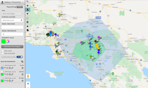
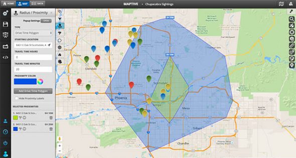
The Travel Time Maps tool in Maptive is super handy for businesses wanting to create isochrone maps that focus on their service or delivery crews’ travel time between their base and customer locations. This tool is also perfect if you’re looking for areas within a certain radius, such as delivery areas or potential new target markets. After generating the isochrone map, the shaded area around the starting point will be shown with colors indicating the level of accessibility within the set time or distance.

Drive Time Maps
This tool is similar to Travel Time Maps but takes into account the time it takes to drive between locations. It allows users to set the maximum drive time or distance and factor in real-time traffic data to generate more accurate maps. This is particularly useful for businesses with a fleet of vehicles or delivery drivers looking to optimize their routes and reduce travel time.

Distance Radius Maps
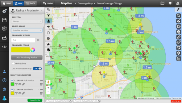
The Distance Radius Maps tool is great for creating circular radii around a central point, indicating a specific distance from that point. This is especially helpful for businesses looking to identify areas that are within a certain distance, such as finding potential customers for a store or restaurant. The resulting map shows a circle around the central point with the radius being the specified distance.
As an isochrone map generator, Maptive’s tools and features allow businesses and public entities to generate detailed isochrones that can help guide important decisions around new locations, delivery areas, and target markets. By factoring in different modes of transportation and maximum travel times or distances, organizations can gain valuable insights into the accessibility of certain areas and optimize their operations accordingly.
Use Cases for An Isochrone Map
Specific use cases of an isochrone map include:
- Delivery Companies: delivery companies often use an isochrone map to optimize their delivery routes and identify the most efficient delivery areas. By mapping out the areas they serve and generating an isochrone map, they can identify the best areas to deliver to within a certain time frame, helping them to reduce delivery times and costs, and improve customer satisfaction.
- Real Estate Agencies: real estate agencies are power users of isochrones. Homebuyers often give real estate agents strict parameters and preferences for when they want their new home to be located, how far from their jobs, from specific schools, and so on. With an isochrone map, real estate professionals can clearly visualize the boundaries of the area they should be searching within. By generating distance radius maps or travel time maps, they can identify properties that meet their clients’ criteria, making it easier for them to find the right property in the right location.
- Transportation Companies: an isochrone map can help companies identify areas with good access to public transportation. It can also help them plan their routes based on transit times and improve their services by providing more convenient and efficient transportation options, which can attract more customers and improve customer satisfaction.
- Urban Planners: an isochrone map can be a vital tool for urban planning, especially when it comes to determining the coverage and accessibility of public transportation, identifying areas that are underserved by transportation options, and adequately planning for emergency response services–like fire departments, emergency medical services, search and rescue teams, and police departments. What’s more, an isochrone map can also be used to analyze traffic patterns, identify traffic congestion areas, and plan the creation of new infrastructure.
Conclusion
In conclusion, an isochrone map can be a powerful tool to quickly and easily identify areas within a certain radius, plan delivery routes, and make data-driven decisions about location, marketing, and transportation.
And Maptive, with all its flexible and easy-to-use mapping tools and features, can help you generate your first isochrone map.
With Maptive’s 10-day free trial, there is no reason not to try this powerful tool for yourself and see how it can benefit your business or organization. So why not give it a try? Just click the link below to get started!
Start Your Free, No Risk, 10 Day Trial
No credit card required. No surprises. Just Results.
START MAPPING NOW