
If businesses understand one thing, it’s the power of information. After all, information can tell you virtually everything you need to know about your company. You can target audience demographics and gain valuable insight at a granular level.
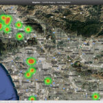
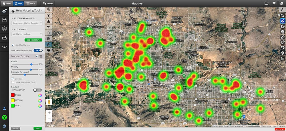
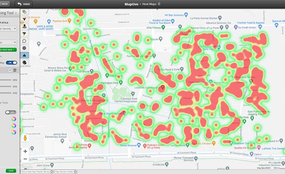
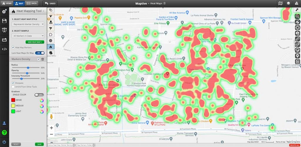
Connect these data sources with mapping software like Maptive; you’ve created a fully integrated experience. Maptive combines the power of data visualization datasets with imported consumer data to create a powerful application for the company or business owner wanting more.
How?
Data is critical to your business and mapping your business data alone may not be enough.
By adding data from free public data sets to your own business location data, you can gain new insights, make better decisions, and mitigate risks to your business. With Maptive you can quickly and easily upload datasets directly to our mapping software and start seeing your business in a new light.
How do datasets help your business?
Data breaks down generic content into useable pieces of information. It paints a picture of your business and your current customer audience.
Using public data sets can add critical components to your content, improving customer understanding overall. These datasets incorporate every component of your sales funnel – from customers in different parts of the sales process to critical demographic details.
It streamlines your consumer approach into a robust and targeted focus. The more information you know of your customers or competitors, the more likely your business will succeed overall.
What more could a business ask for?
In this article, we’re going to share our list of the best free data sources online for map data visualization and how you can integrate them into your Maptive maps.
What are GIS data sources?
Free GIS data sources are comprehensive sets of data that contain location data such as addresses, latitude and longitude coordinates, zip codes & postal codes. With analysis, companies can use these additional data sources to home in on business strategy, identify answers to questions, or implement new sales, marketing, or product development strategies.
The data types will vary, depending on what you’re hoping to achieve. With the reliance on the internet comes a host of valuable information if you know where to find them. Open data initiatives keep free data sources accessible to businesses of all sizes.
As we continue to push more information through than ever before, information is everywhere. When it comes to free GIS data sources, the options are endless.
But don’t panic.
We’ve put together a list of reputable, high-quality data sources designed to help your business skyrocket your analysis efforts.
To get you started, here are 12 free GIS data sources:
1. Data.Gov

The government made all data publicly available in 2015, with nearly 200,000 datasets available. You’ll be able to unearth crime rates to climate change and everything in between. The platform is exceptionally user-friendly, with plenty of search options available. If you’re looking for general data on the US population, consider the US Census Bureau. For current Maptive users, US demographics come built into the software.
2. Canadian GIS

This GIS service holds government data sets from countless industries. Users can access business locations, restaurant details, and more compiled into easily accessible content. From education programs to open data portals, it’s the go-to resource for Canadian geomatic communities. Assisting Canadians since 2005, this platform has comprehensive information available free of charge.
3. GeoPlatform

As a cross-agency collaborative effort, GeoPlatform facilitates government-to-citizen communication and transparency. Under the authority of the Geospatial Data Act of 2018, users can find authoritative geographically enriched data. Data sets include geological datasets, major ports, and mineral exploration sites. In fact, you’ll find over 92,000 different datasets available for download.
4. Global Health Observatory Data Repository

The Global Health Observation data repository is home to comprehensive health statistics worldwide. It harvests the UN WHO’s content, focusing on healthcare industry datasets. You’ll find everything from vaccination rates, malaria, and antimicrobial resistance. The portal includes a preview functionality, giving users the option to see data tables before downloading them.
5. Terra Populus

Integrating census data from over 160 countries, this portal connects individuals with nearly six decades worth of insight. You can aggregate data for more than 80 different countries, including spatial and temporal changes. These changes highlight the human-environment shift across geographic space. It’s ideal for anyone wanting to identify temporal data within a user-friendly interface.
6. Esri Open Data Hub

The largest commercial GIS organization manages the website in the world. Known as the hidden gold mine of free GIS data, it houses over 250,000 available data sets from at least 5,000 organizations. The search offers a convenient map preview with location or topic capabilities. Download formats are available as shapefile, KML, or spreadsheet.
7. Natural Earth Data

This data set is ideal for most cartographers looking for global physical vector and cultural GIS datasets. These datasets offer relief for maps and are available in the public domain. You’ll be able to modify, use, or disseminate data in whatever manner you’d like.
8. Google Dataset Search

Initially launched in 2018, Google Dataset Search brings standard search engine functionality but strictly for data. You’ll be able to search for a specific topic or keyword, aggregating data from external sources. As users continue to turn to Google for directions, search functions, or online search, it seems individuals should add data to the list too.
9. USGS Earth Explorer

This platform brings a user-friendly interface that makes remote sensing data effortless. Registration is free, combining global satellite imagery with a simplified filter function. You’ll be able to download multiple data sets simultaneously, too, thanks to their bulk download application.
10. Kaggle

Like Google Dataset Search, Kaggle brings aggregated datasets thanks to a community hub. Initially launched in 2010, users can access the data platform completely free. Business owners will find plenty of different datasets through the platform covering almost any topic you can think of. You’ll discover cloud-based collaboration, data analysis techniques, and educational tools for teaching artificial intelligence.
11. NASA’s Socioeconomic Data and Applications Center (SEDAC)

If you’re looking for GIS data that highlights human interactions with the environment, SEDAC has a variety of coarse global free GIS data. The flagship product is a gridded population of the world, complete with over 800 citations for accuracy. These population details include demographic components like education, density, and age.
12. Statistic Brain Research Institute

This platform holds over 500,000 unique data sets, available in raw form. The website is currently used by over 3 million people every month, making it a dominating force in the dataset realm. Although this website does charge a fee, the reliability and authority earn it an honorable mention across the GIS data sources.
Conclusion: GIS Data Sets Brings a Competitive Edge to Your Business
Building GIS datasets into your mapping software is essential if you’re truly looking to understand your clients. Maptive helps business owners, just like you, develop interactive maps, complete with demographics and opportunities. Mapping software helps build consumer awareness by formulating applicable demographic data. You’ll simultaneously connect your business to hidden opportunities and experiences.
In other words, data sources connect you with what matters most – your customers.
Interested in giving Maptive a try? Signup for a 10-day risk-free trial – No credit card required.


