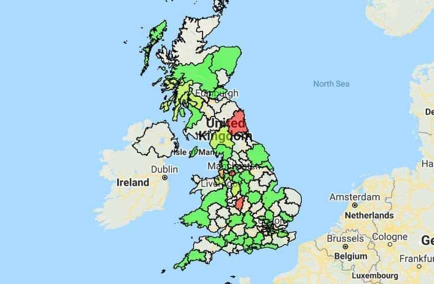
UK Postcode Heat Maps
If you operate a business in the UK, you’re likely aware of the importance of postcodes. UK postcode heat maps allow you to visualize and analyze important data within these specific geographic areas, uncovering valuable insights and opportunities for your business.
What Are UK Postcode Heat Maps?
In the UK, postcodes are essential for segmenting different areas of towns, cities, and regions. With a UK postcode heat map, you can automatically create boundaries around each postcode, allowing you to segment and analyze your data within these areas.
By visualizing data in this manner, you can spot key differences between postcodes, target customers more efficiently, and identify areas where your business might be underperforming.
What Can a UK Postcode Heat Map Do?
- Comparison Analysis: Easily compare data based on postcodes. Which postcodes are generating the most sales or traffic? Which ones might need more attention? With a UK postcode heat map, these questions become easier to answer, guiding your business strategies.
- Territory Mapping: Define sales or service territories based on postcodes, ensuring efficient coverage and resource allocation.
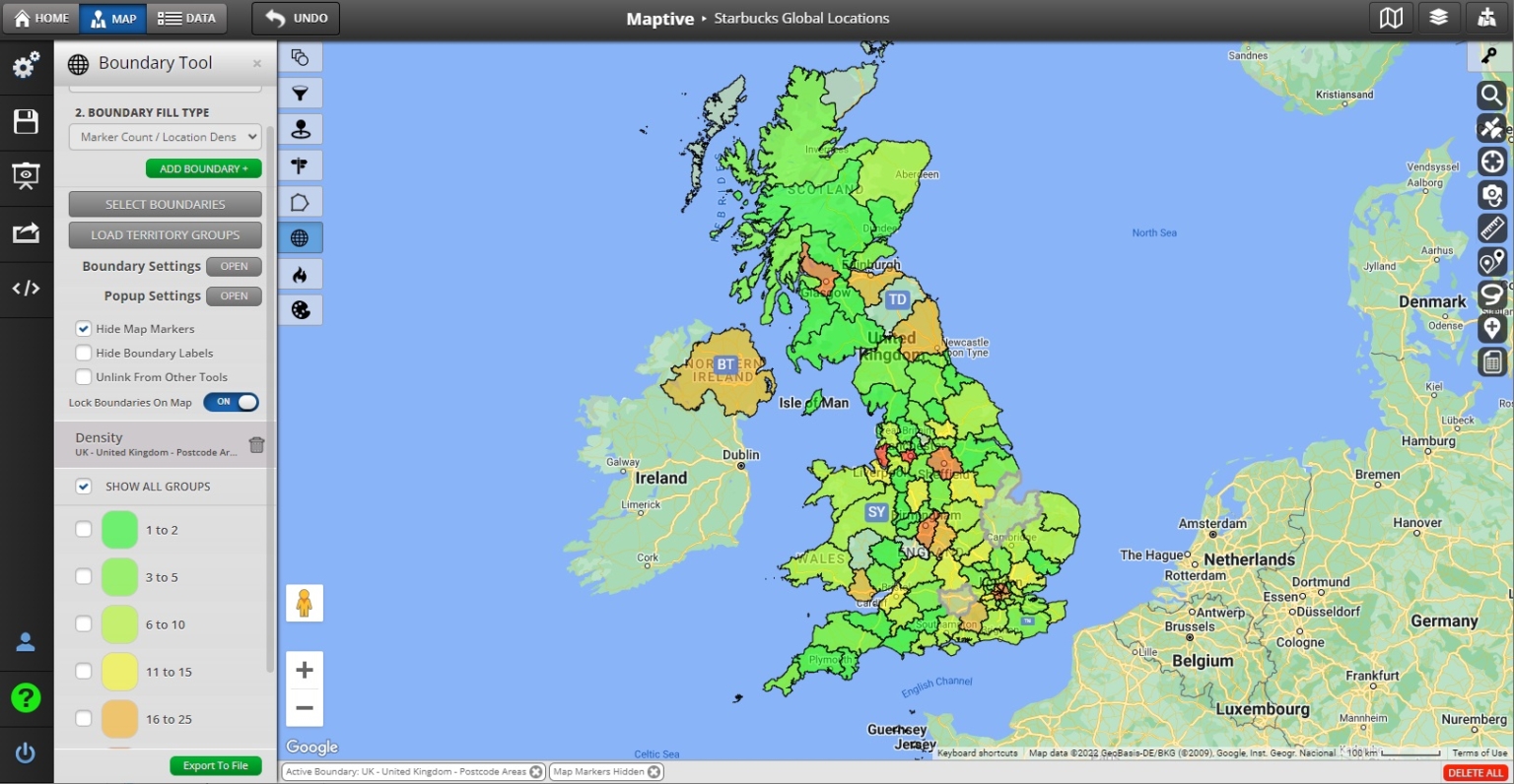
How to Create a UK Postcode Heat Map
Creating UK postcode heat maps with Maptive is straightforward:
- Sign up for a free trial of Maptive.
- Log in and select “Create My First Map.”
- Enter a name and description for your map, then proceed.
- Input your data. This can be done manually, or by uploading an Excel spreadsheet or Google sheet.
- Select the boundary tool from the tools menu.
- Choose the postcode option for the UK from the dropdown menu.
- Define which data column you want to use to populate your postcode map.
- Create your postcode heat map.
Ready to Dive Deeper?
Are you prepared to uncover valuable insights with UK postcode heat maps? Sign up for a free trial and start mapping today.
Applications of UK Postcode Heat Maps
Postcode heat maps are not just visual tools; they offer a plethora of applications across various sectors. Here’s how businesses and organizations can leverage them:
- Market Analysis: By visualizing sales or customer data across postcodes, businesses can identify high-performing areas, potential markets, or regions that might need more marketing efforts.
- Resource Allocation: Companies can allocate resources, be it sales teams, delivery fleets, or service personnel, more efficiently by understanding the demand in each postcode area.
- Real Estate and Property Trends: Real estate agencies can use postcode heat maps to highlight property value trends, rental hotspots, or areas with high demand.
- Public Services and Infrastructure: Local governments and councils can use these maps to identify areas that might need more public services, infrastructure development, or maintenance based on population density or other metrics.
- Crime Analysis: Law enforcement agencies can visualize crime rates or specific types of incidents across postcodes, helping in strategic planning and resource deployment.
- Healthcare Planning: Health organizations can map out areas with higher incidences of certain diseases or health conditions, aiding in targeted awareness campaigns or healthcare resource allocation.
- Retail and Franchise Planning: Retail businesses can identify potential locations for new outlets or franchises based on consumer demand in specific postcode areas.
- Environmental Studies: Researchers can use postcode heat maps to study environmental factors, such as pollution levels or green spaces, across different areas.
- Education and School Planning: Educational boards can visualize student populations, performance metrics, or facility availabilities across postcodes to make informed decisions about school openings, closures, or resource allocations.
- Transportation and Logistics: Companies can optimize delivery routes, identify high-demand areas, or plan transportation networks more efficiently using postcode heat maps.
Postcode heat maps are not just visual tools; they offer a plethora of applications across various sectors. Here’s how businesses and organizations can leverage them:
Start Your Free, No Risk, 10 Day Trial
No credit card required. No surprises. Just Results.


