ArcGIS Alternative
Mapping software should help you work faster, not fight you with slow performance, confusing menus, and expensive licenses. Maptive gives you fast, reliable mapping that makes sense from day one, built for business teams without a GIS background.
No credit card required
- No GIS training needed
- Works on any browser or device
- Every feature included, clear pricing
- Fast on 100,000+ locations
Trusted by teams at


Why Teams Move On From ArcGIS
Powerful GIS should not mean slow, complicated, and expensive. For most business teams, it does.
Large datasets bring most mapping tools to a crawl. Teams wait minutes for maps to load, watch the software freeze when they add a layer, and lose hours of work to crashes at the worst moments. Even expensive tools fail when you need them most, turning simple tasks into day-long projects.
Complex menus hide the features you need behind dozens of clicks, so new users spend weeks learning the basics. License costs climb as essential features turn out to cost extra, and add-on fees pile up fast. Teams end up paying more for software that delivers less.
Compare Maptive and ArcGIS
Where each tool fits, side by side.
| Feature | Maptive | ArcGIS |
|---|---|---|
| Ease of Use | Built for business users. Make maps in minutes with no GIS training. | Professional GIS with a steep learning curve. Specialist training and technical skill required. |
| Setup Time | Instant cloud access. Start mapping from any browser. | Complex install with significant IT setup and configuration. |
| Business Focus | Built for business mapping: territories, route optimization, demographics, and market research. | Built for professional GIS and scientific work. Business features need extra configuration. |
| Performance | Fast, stable cloud on Google Maps infrastructure. Handles up to 100,000 locations smoothly. | Resource-heavy, with slow performance and occasional crashes on large datasets. Needs high-end hardware. |
| Pricing | Transparent pricing with every feature included at each tier. | Expensive, complex licensing. Extra costs for extensions and advanced features. |
| Customer Support | 9.7/10 on G2. Live chat, phone, and email, with white-glove service on every plan. | Mixed reviews, slow responses, and a complex support structure through distributors. |
| Platform | Any device with a browser: PC, Mac, tablets, and mobile. | Windows desktop only. Mac users need a virtual machine or Boot Camp. |
| Data Integration | Simple Excel, CSV, and Google Sheets import, with Salesforce and an API. | Extensive APIs, but integration takes technical work across enterprise systems. |
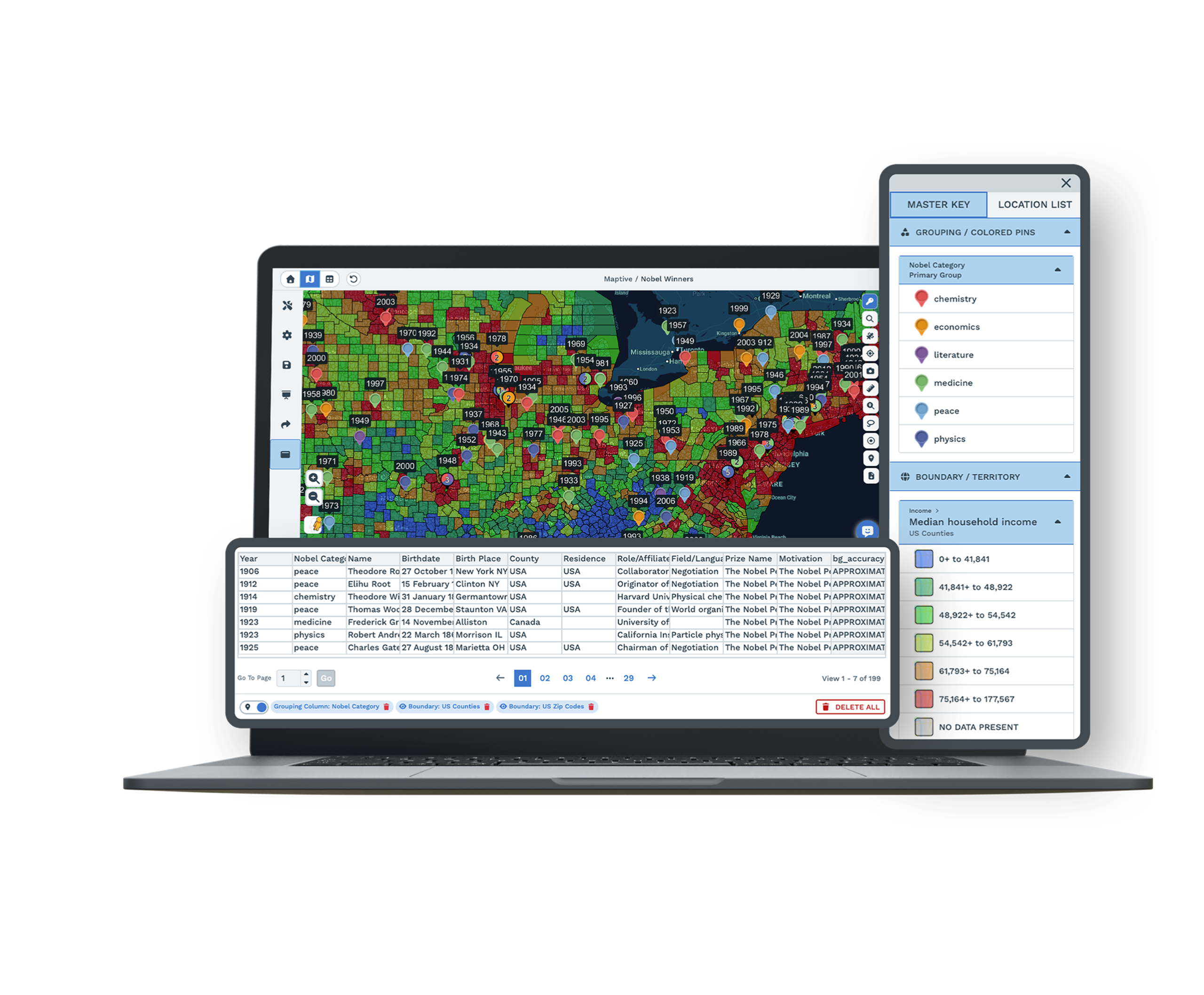
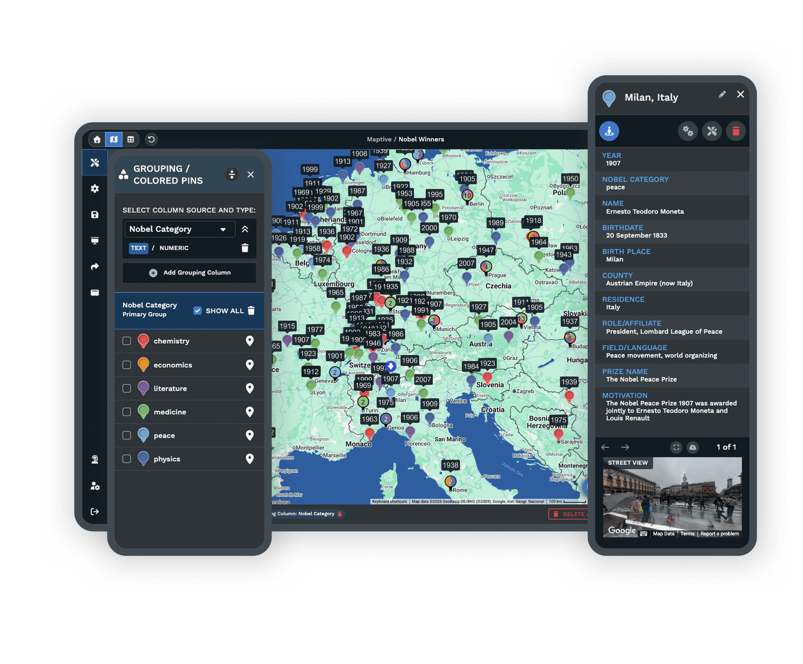
| Advanced GIS | Business-focused tools: territory mapping, route optimization, heat maps, demographic overlays. | Industry-leading GIS and scientific analysis for complex spatial work. |
| Collaboration | Share by secure link, embed, or export, with real-time cloud collaboration. | Cloud collaboration exists, but setup and sharing are technical. |
| Target User | Business professionals, sales, marketing, and operations with no GIS background. | GIS professionals, scientists, and analysts who need advanced spatial analysis. |
| Time to Value | Immediate. Build useful business maps within minutes of signing up. | Weeks to months of training and setup before productive use. |
A Reliable, Smoother Mapping Experience
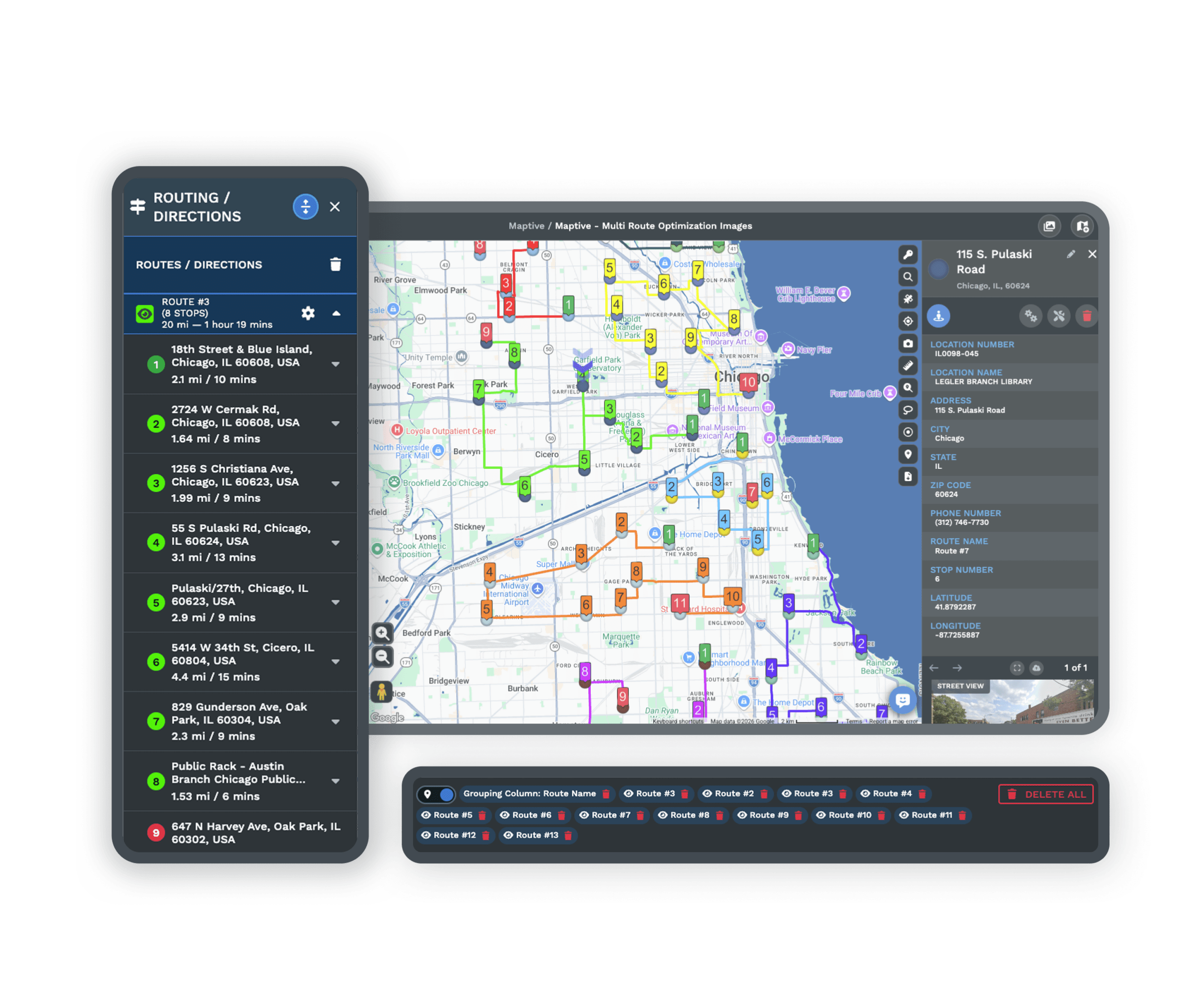
Maptive handles thousands of data points without a stutter. Users report zero lag loading complex layers or running live analysis, so project managers focus on results instead of workarounds.
Near-perfect uptime keeps your work on track, and the heavy datasets that crash other tools run smoothly here, so teams deliver on time without technical interruptions.
Easy to Learn, Without the Training Overhead
First-time users build a working map within minutes. The interface makes sense from the start, with logical workflows and drag-and-drop controls that guide each step.
GIS veterans and newcomers get productive immediately, so teams start working together faster with no training videos or expensive onboarding sessions.
Support From Real People, Fast
Tickets get answered in hours, not days. Live chat connects you to mapping experts who solve the problem in one conversation, instead of bouncing you between departments.
Satisfaction ratings stay well above the industry average because real help arrives when you need it, and the team stays with you until the issue is resolved.
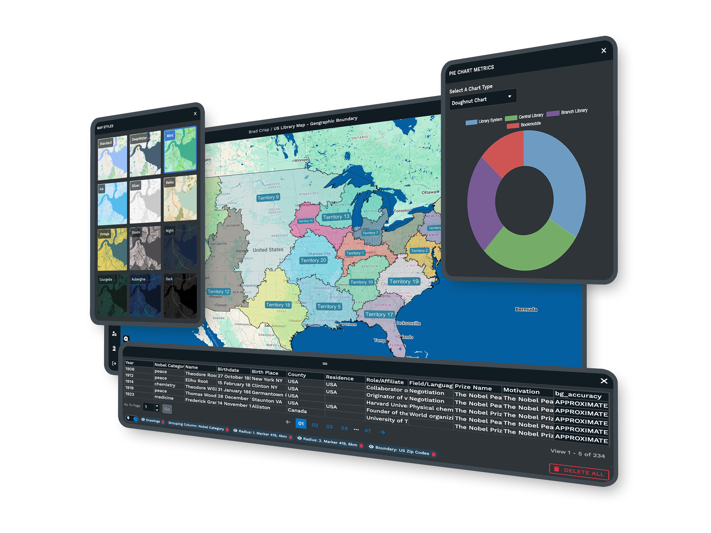
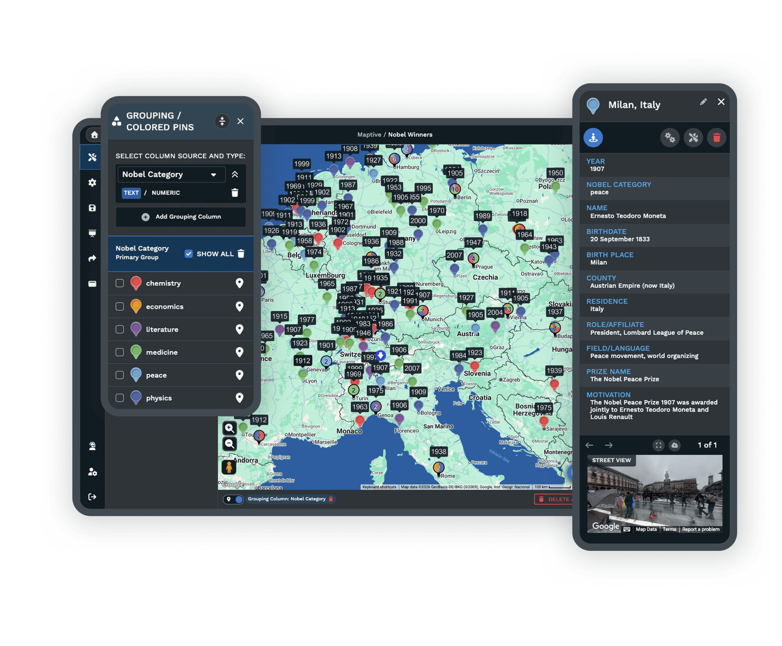
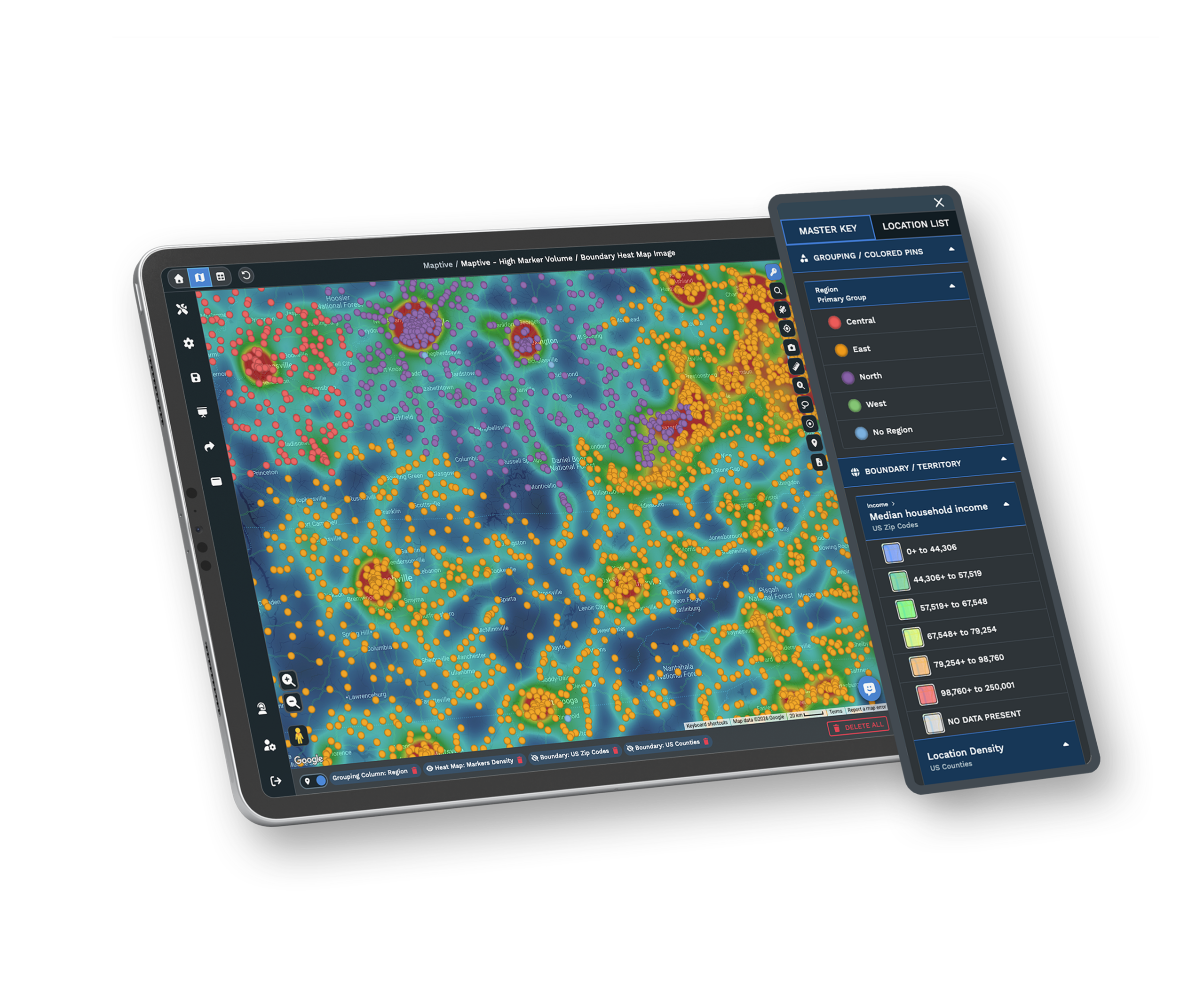
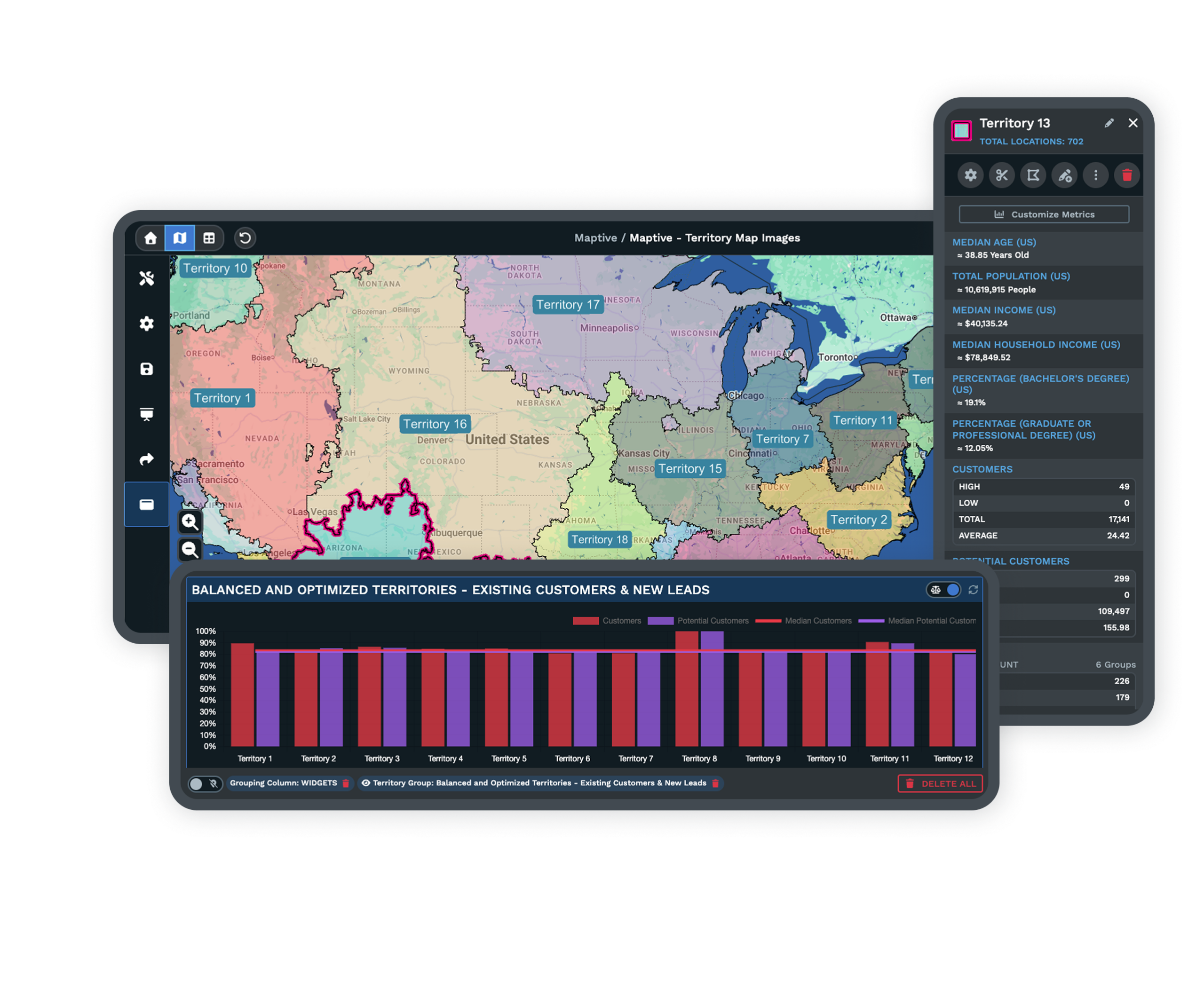
Features That Make Maptive Simple and Effective
Intuitive Interface
Clean layouts and visual workflows make map building effortless. Most users create a usable map within minutes, even with no mapping experience.
Fast Processing for Big Data
Load tens of thousands of points without lag or crashes, and real-time analysis finishes in seconds. No need to shrink your dataset to make a map work.
Flexible Import and Export
Import spreadsheets, databases, or CSVs with automatic matching and error checking, then export maps and reports in one click.
No Hidden Fees
Every subscription includes unlimited maps, data uploads, and analytics, with no charges for exports, sharing, or usage spikes.
Cross-Platform Access
Open Maptive in any modern browser on Mac, PC, Chromebook, or tablet. Nothing to install, so IT tickets drop.
Responsive Human Support
Connect directly with expert staff for friendly, solution-focused help with onboarding, troubleshooting, or workflow setup.
ArcGIS Alternative FAQs
What makes Maptive easier to use than ArcGIS?
Does Maptive charge extra for core features?
How quickly can I get help from Maptive support?
Is it easy to switch from ArcGIS to Maptive?
What platforms and devices does Maptive support?
How does Maptive protect my data privacy?
Can Maptive handle large datasets and complex maps?
What kind of onboarding does Maptive offer for new users?
How does Maptive support teams with different skill levels?
How does Maptive improve mapping outcomes for businesses?
Free trial, every tool, no credit card
See Maptive Next to Your Data
Start a 10-day free trial with no credit card and every tool unlocked, or book a demo to see Maptive run on your own data. Most people build their first map in under five minutes.
Switching From ArcGIS?
Guided onboarding and automated data import move your maps and projects over quickly, with direct help on formatting and no contracts to lock you in.

