Territory Management Software

Upload your data, and Maptive's Automated Territory Optimizer builds balanced territories using real geographic boundaries, 100,000+ market intelligence data layers, and 60+ analysis tools.

Territories That Perform From Day One

Create, Balance, & Analyze Your Territories in Minutes

1

Upload Your Data

Upload an Excel file, a CSV, or connect to Google Sheets. Maptive's geocoding engine handles missing ZIP codes, abbreviated street names, and inconsistent formatting. Every location plots within minutes.

2

Build & Balance Territories

Boundaries come from states, counties, ZIP codes, census tracts, or custom shapes you draw. Automated optimization distributes workloads across reps. When inputs shift, balancing recalculates. Test scenarios before publishing.

3

Analyze, Act, & Share

100,000+ data layers sit next to your internal numbers at ZIP and census tract precision. Heat maps show where deals close and where they stall. Reps see optimized routes between stops with navigation exported to their phone. Export territory data to XLS, CSV, or TSV, or share interactive maps with password protection and role-based permissions. The map updates when the data does.

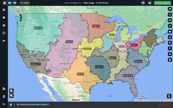
What Maptive Delivers for Sales Territory Management

Automatic Territory Optimization & Generation

Maptive's territory engine uses rep locations, workload distribution, account density, and custom data fields to build balanced territories automatically. What previously required a week of spreadsheet work completes in minutes.

200K+ Locations on a Single Map

WebGL rendering handles over 200,000 markers without slowing the browser. Customer bases, prospect lists, and full account portfolios load on a single interactive map regardless of how large the operation is.

Build from Real Geographic Boundaries

Maptive builds territories from states, counties, ZIP codes, or census tracts. Draw custom shapes or combine boundary types. Every line is defined by precise geographic data, not informal estimates.

100K+ Data Layers for Market Intelligence

Maptive includes census demographics and 100,000+ data layers covering consumer spending, healthcare utilization, real estate metrics, and industry variables at ZIP and census tract granularity. Territory potential runs on both external market data and your internal sales numbers.

Predictive Data with Historical Trends & Projections

Maptive's data layers include historical trends, future projections, and predictive analytics sourced from a provider with 30+ years of Fortune 500 service. Your territory plans account for both where the market sits today and where it's headed.

Every Feature on Every Plan

Maptive includes 60+ mapping and analysis tools on every plan with no tiered restrictions. No feature gates, no premium add-ons for territory capabilities. Your purchasing decision is about what your team needs, not which tier has the feature you actually want.

How Teams Put Maptive to Work

From Spreadsheet to Territory Map in Minutes

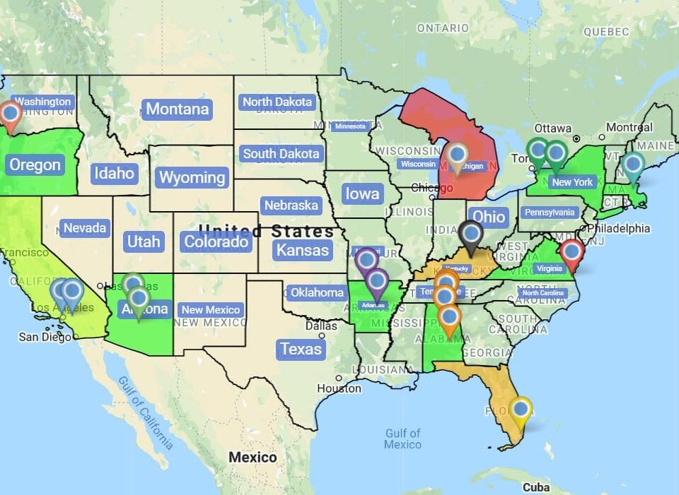
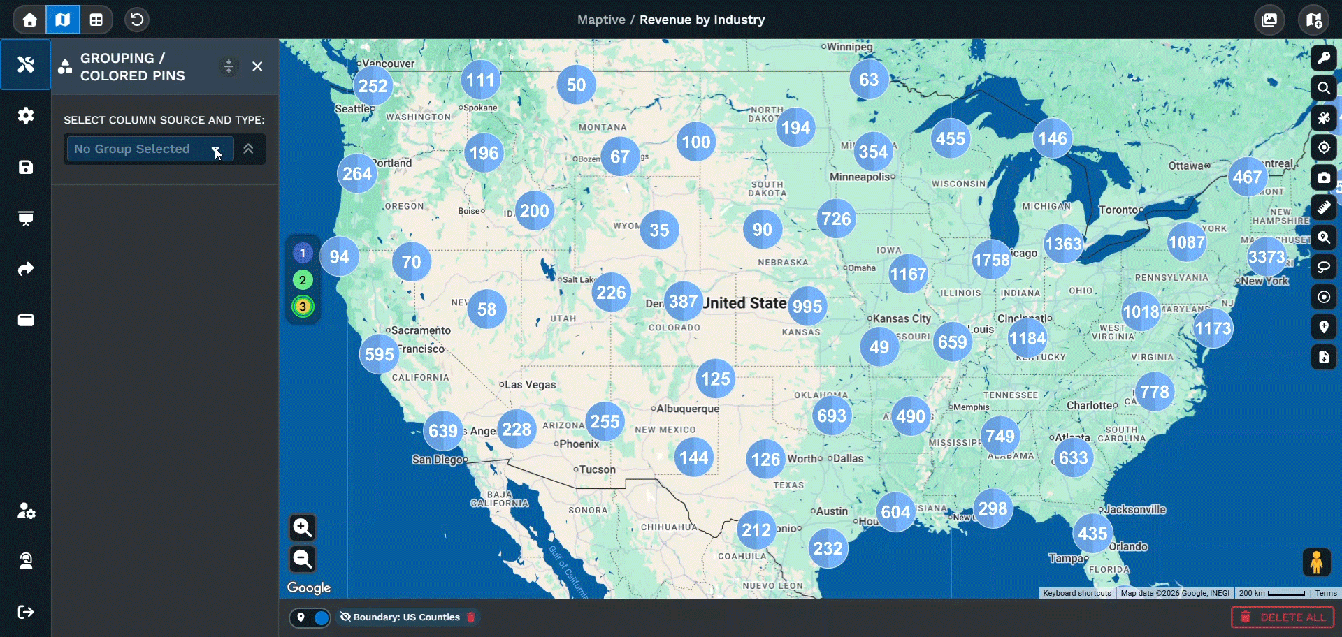
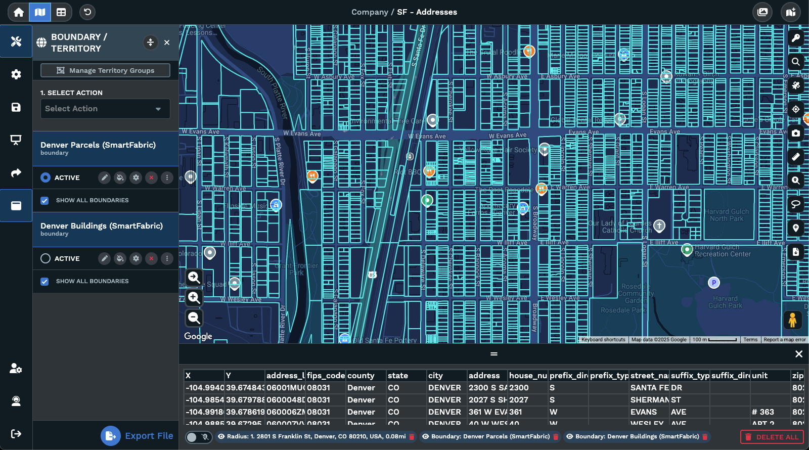
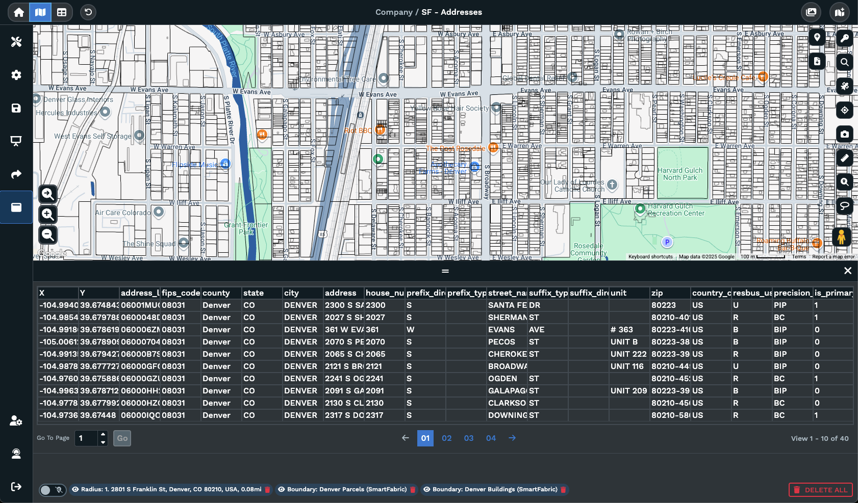
Upload an Excel file, a CSV, or connect to Google Sheets. Maptive's geocoding engine handles the messiness your team has been living with: missing ZIP codes, abbreviated street names, inconsistent column formatting. Within minutes, every location is plotted on an interactive map and ready for territory building.

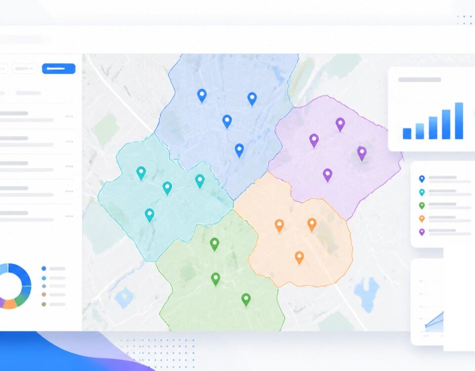
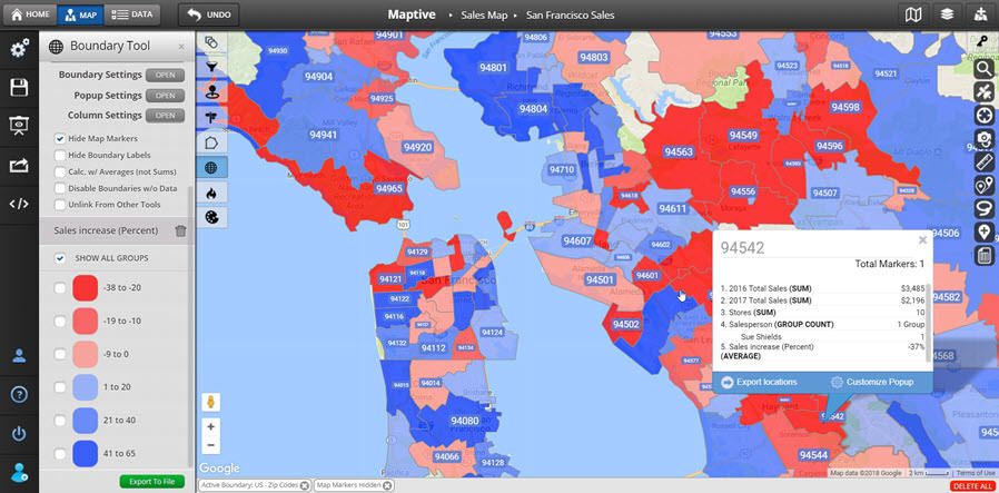
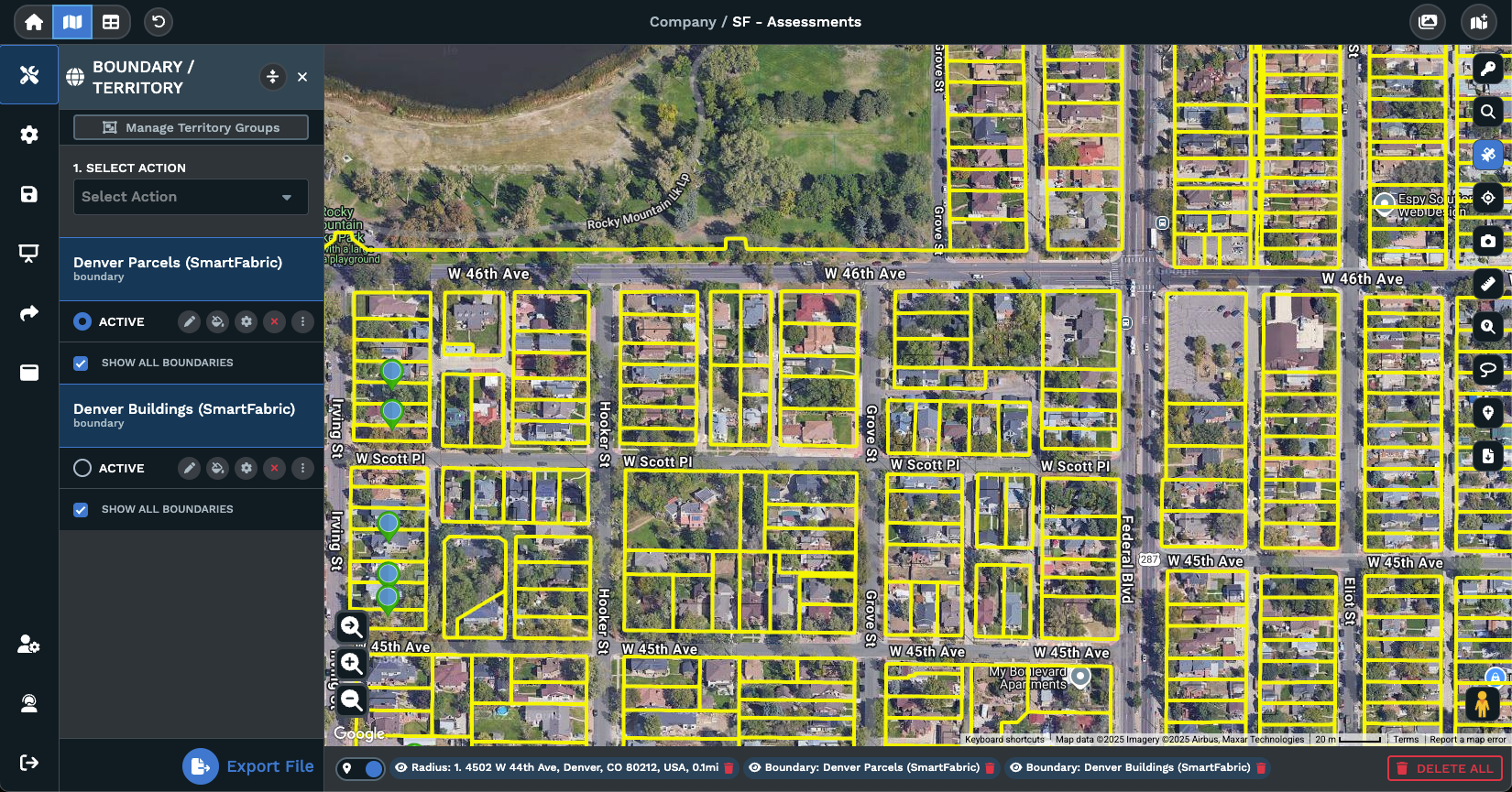
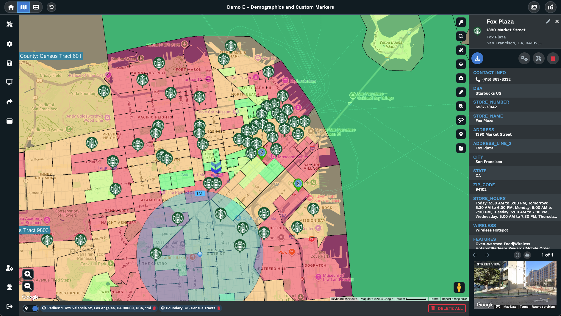
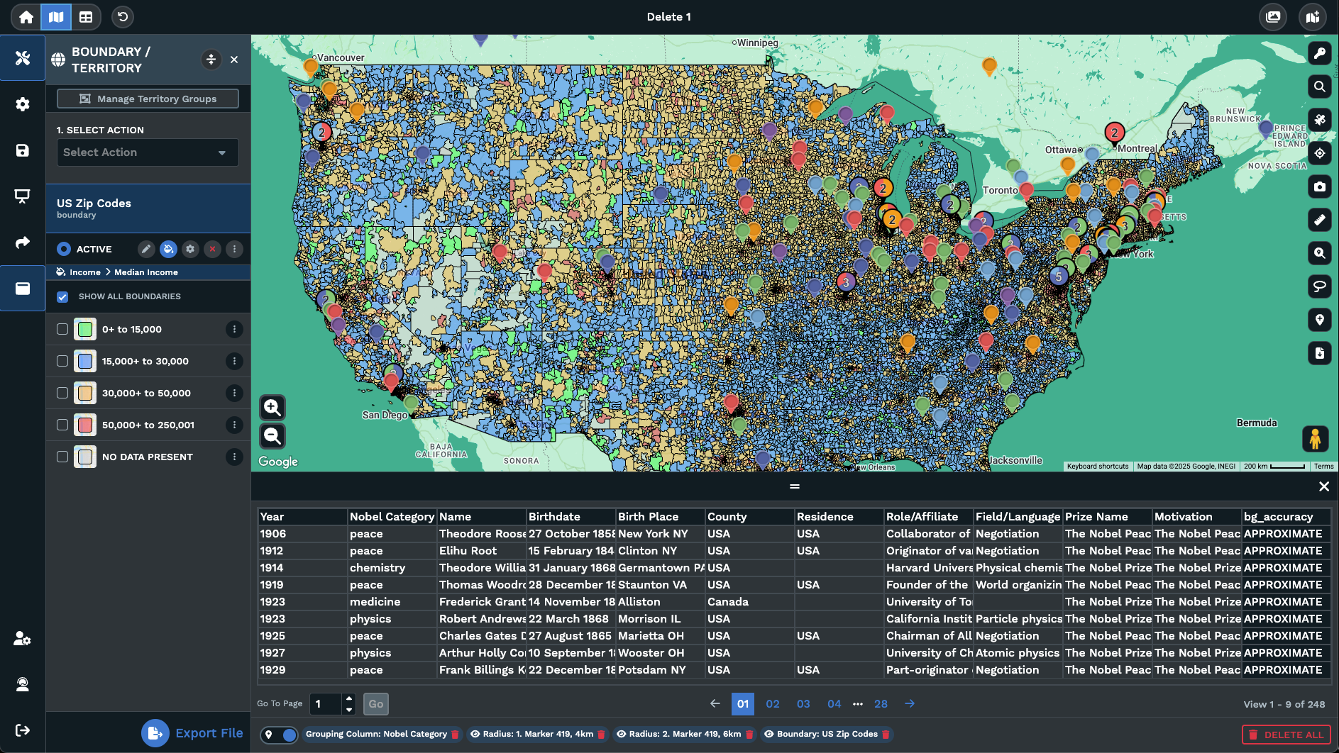
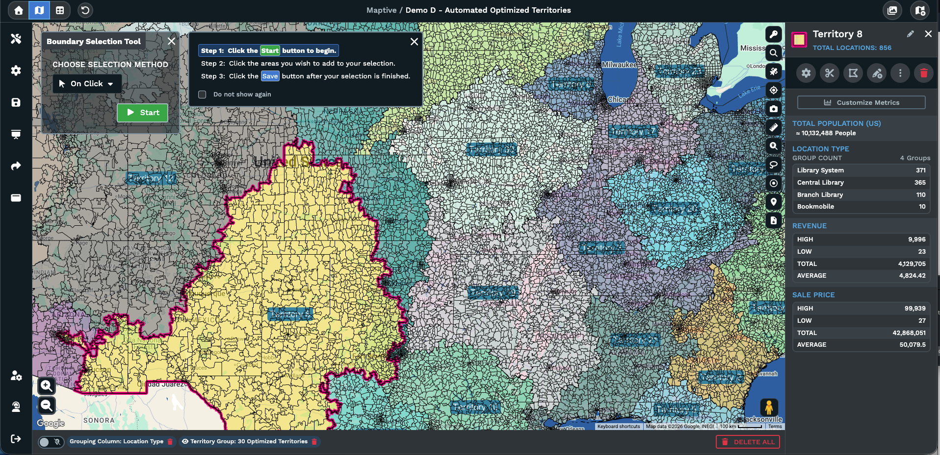
From there, boundaries are added from states, counties, ZIP codes, census tracts, or shapes you draw yourself. The included data layers sit alongside your internal data, letting you overlay consumer spending patterns, demographic details, and industry variables immediately. Automated optimization distributes workloads across reps based on the criteria you set.

Accurate geocoding matters more than most planning tools acknowledge. Maptive resolves locations even when formatting varies across regions or entries are missing key fields, so no time goes into cleaning files before planning starts.

Manual territory work that previously required a full week completes in a single session. Getting started means uploading a file, with no implementation timeline, external services, or data migration team required. That speed matters most when the territories have to keep working after the first build.

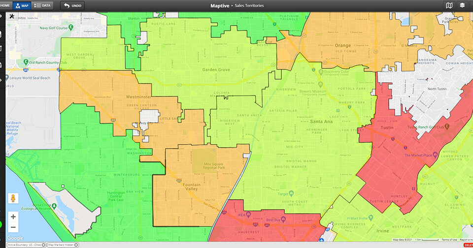
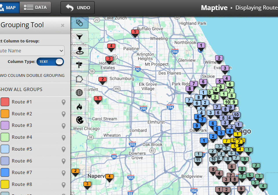
Balancing Territories That Stay Balanced

Territory plans break the moment a rep leaves, a region outgrows its quota, or headcount changes. What looked balanced in January rarely holds by April. Maptive handles ongoing territory management, not just the initial build. Automated balancing recalculates based on current data whenever your inputs shift.

Managers can test scenarios before publishing: split a territory, merge two, add a new rep, and see the workload impact before anything goes live. Drag-and-drop editing makes adjustments fast. The split-screen view keeps the map and your spreadsheet data side by side, so changes update in real time on both.

When a territory needs to move, you see the downstream effects before anyone else does. No revised spreadsheet routing through three rounds of review before it becomes official. The changes happen on the map, in front of the team, with the data visible.

Maptive is not a one-time planning tool. It is the system of record for how your territories operate from quarter to quarter. Most CRM territory features handle assignment, but they were not built for the ongoing optimization needed to maintain balanced coverage as conditions change. Maptive fills that gap. Once the territories are set, the view shifts to the rep executing inside them.

Giving Reps a Territory They Can Execute

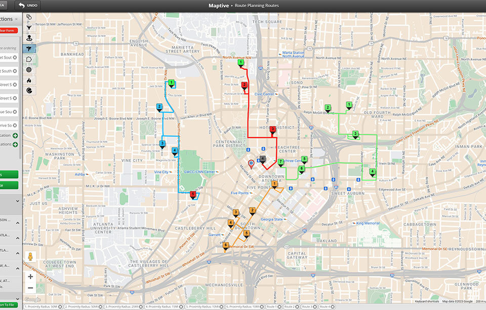
Once territories are built, each rep sees their accounts on a map with optimized routes between stops and the ability to filter by deal stage, product, or priority. Turn-by-turn navigation exports directly to their phone.

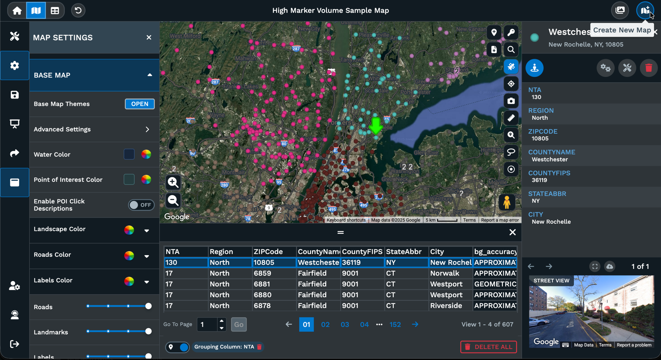
Role-based access limits each rep to their own territory, which keeps the interface focused and the data secure. Managers control what each rep can view, edit, or export, so Maptive scales across org structures without exposing sensitive territory data to unauthorized users.

The daily planning loop changes. Your reps stop building their day in a spreadsheet and start executing from a map that already knows the most efficient path through their accounts. The strategic work you did at the territory level carries through to the drive between meetings. Most platforms lose that connection between territory design and daily field execution. Maptive keeps it intact. That reliability is what makes the platform worth deploying at scale.

Trusted at Scale by Teams That Cannot Afford Downtime

Enterprise Organizations Running Maptive Today

Amazon, General Electric, the US Department of Energy, and Coca-Cola each completed procurement, security review, and IT approval before deploying Maptive across their teams. Each selected Maptive after evaluating it against other options for territory operations at scale, based on internal requirements for data security, system reliability, and integration.

For mid-market teams, this provides a clear reference point. The platform has already been reviewed under stricter procurement standards than most organizations will apply. Common questions around security, uptime, and system compatibility have been addressed through those evaluations.

Enterprise-Grade Infrastructure & Security

Cloud-hosted with WebGL rendering for high-performance visualization. Maptive runs 256-bit SSL encryption, two-factor authentication, SSO, role-based access controls, and audit logging, with 99.9% uptime and no documented major outages in 2025. Your data is encrypted at rest and in transit, with access permissions configurable down to the individual user level.

This is the section you forward to IT, InfoSec, or your procurement committee when they ask what they are approving.

US-Based Support That Understands Sales Operations

Development and support teams operate from San Francisco, with engineering across the US and Canada. Account managers work alongside enterprise teams on custom configurations and onboarding. The people answering your questions understand sales operations workflows. They know what territory balancing looks like at 200 reps, and they know the pressure of getting it right before a new fiscal year.

When something needs configuring, you talk to someone who understands the use case you are solving. That is a differentiator that shows up the first time something needs attention at 4 PM on a Thursday before quarterly planning.

See Your Territories in 10 Minutes

Free Trial: Full Platform, No Credit Card

The free trial runs ten days with no credit card required. Every feature is unlocked, including the same 60+ tools, 200,000+ marker capacity, and automated territory generation that enterprise teams use daily. Upload your data and build your first territory map in minutes on the full production platform.

There is no financial risk, no IT involvement, and no feature gating between you and a working territory plan. If the tool fits your data and your team, the budget conversation gets easier when everyone has already seen the output.

Book a Demo for Your Use Case

If you want to see the platform applied to your specific data and workflow before investing time in a trial, a Maptive specialist will walk through your territory challenge and show you how Maptive addresses it.

This is the path for buyers who need stakeholder alignment before committing, or for teams running evaluations across multiple tools. Bring your questions about data, security, and pricing. The demo is a working session, not a slide deck.

Frequently Asked Questions

1How does Maptive compare to Salesforce Maps for territory management?
Salesforce Maps is limited to the Salesforce ecosystem, requires expensive add-ons for territory planning, and does not include external market data layers or automated territory optimization. Maptive works with data from any CRM. Export to CSV or Excel and import directly. If your team uses HubSpot, Zoho, Dynamics, or any other platform with an export function, the data works in Maptive without middleware or custom integration. 60+ tools included on every plan, plus 100,000+ data layers covering consumer spending, healthcare, real estate, and industry metrics at no extra cost. Your CRM tracks accounts. Maptive shows you where the market opportunity actually sits, using data your CRM was never built to hold. The two systems complement each other. Your CRM is the system of record for account data. Maptive is the system of record for territory strategy.
2Can Maptive handle large field sales teams?
200,000+ markers per map with WebGL rendering, role-based access, SSO, and audit logging. Enterprise clients including Amazon and General Electric run Maptive for field teams at full scale. If your concern is whether the platform holds up under real enterprise load, the infrastructure and the client list answer that question directly. Teams with 10 reps and teams with 500 reps use the same platform with the same features.
3How fast can Maptive set up territories?
Minutes. Upload a spreadsheet, the geocoding engine maps your data, and you start building territories immediately using built-in geographic boundaries or automated optimization. Most users are productive within 30 minutes of their first login. Compare that to enterprise tools that require multi-week implementations, dedicated onboarding teams, and custom data pipelines before anyone sees a territory map on screen. Maptive is built for sales operations leaders who need answers this quarter, not next quarter.
4What data does Maptive include?
50+ US Census variables at every geographic level, plus 100,000+ data layers covering consumer spending, healthcare utilization, real estate metrics, and industry variables at ZIP and census tract precision. Data sourced through a provider serving Fortune 500 companies for 30+ years, with historical trends, future projections, and predictive analytics included. The data refreshes regularly, so your territory models stay current as market conditions move beneath them. Mobile signal data through Maptive iQ achieves 90% precision for market analysis. Everything is included on every plan. Most competitors charge separately for comparable data or do not offer it at all. The result is that your territory planning accounts for the full picture of market demand in each geography, not a partial view limited to your own internal pipeline data.

Related Reading