Enterprise Mapping Software
Enterprise mapping software built for teams without GIS analysts. Maptive delivers powerful spatial analysis, territory management, and location intelligence.
What Our Customers Say About Us
See what others have to say about Maptive.

Results From Our Users
- $100K+ Quarterly savings reported
- 75% Faster territory planning
- 34% Faster site selection
- 27% Lower regional marketing spend
- 41% Faster demographic analysis
- 29% Fewer overloaded territories
- 19% Higher lead conversion
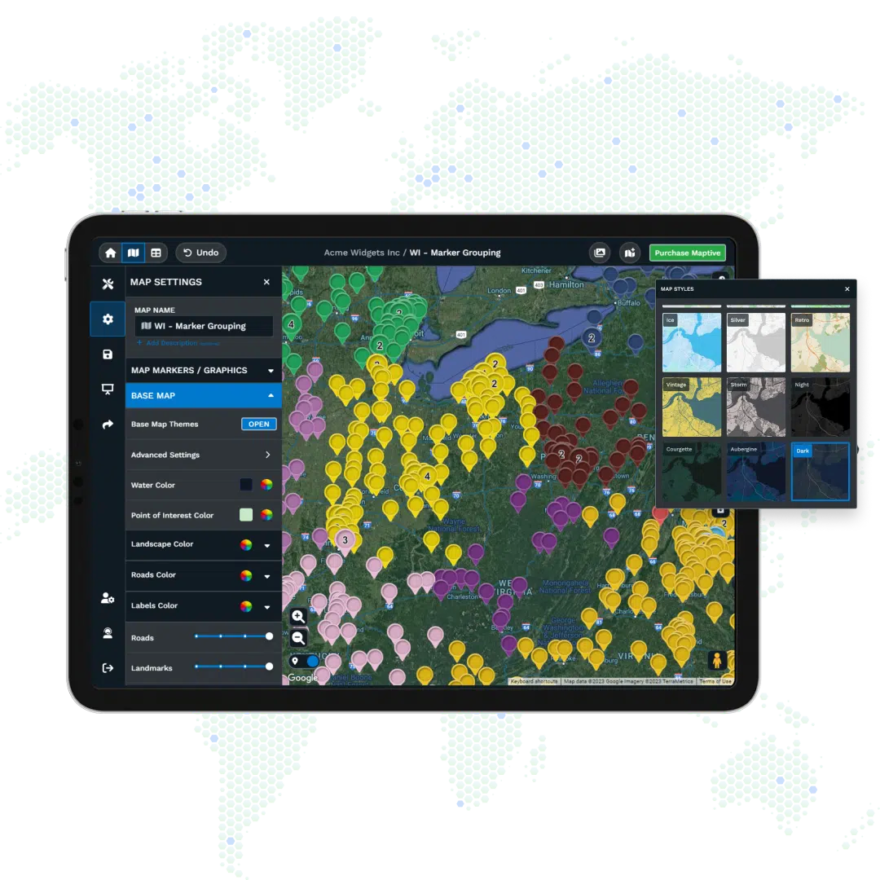
GIS Intelligence On Demand
Answer the Where Questions Yourself
Where should we expand next? Are territories balanced? Which accounts go where? Where are the coverage gaps? You can answer these yourself without filing a request or waiting on another department. Upload your data, see it on a map, and send the recommendation before the meeting ends.
Find the Revenue Your Data is Hiding
Spreadsheets show rows. Maps show patterns. Put your data on a map and you see what the rows were hiding: clusters of underserved prospects, territories carrying twice the load of others, high income ZIP codes with no coverage. Try spotting any of that in Excel.
Spend Less on Every Mile Driven
Maptive calculates directions on real roads with optimized stops, giving your team routes they can actually follow. Fuel costs drop, service calls increase, and your dispatchers stop fielding complaints about impossible ETAs.
Get to Yes With Stakeholders Faster
Executives and clients make quicker decisions when they can see the data. Export polished maps for the boardroom, embed interactive views on your website, or send protected links to partners who need a look without full platform access.
White Glove Support for Every Customer
Maptive connects you with mapping specialists who answer the phone, join your chat, and guide you through your project step by step. Same expert support on every plan, no bots, no scripts, no waiting days for a reply.
Explore Maptive’s Mapping Tools
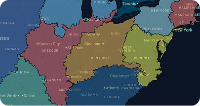
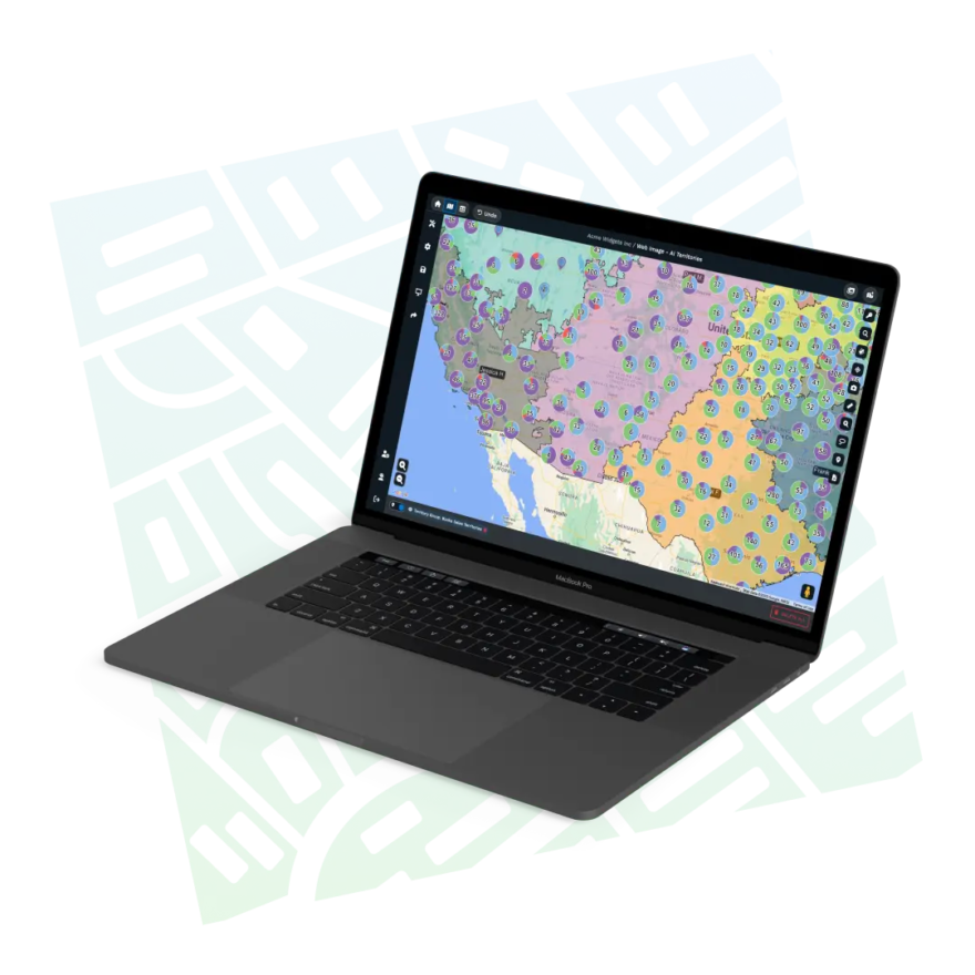
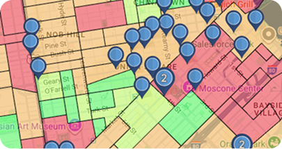
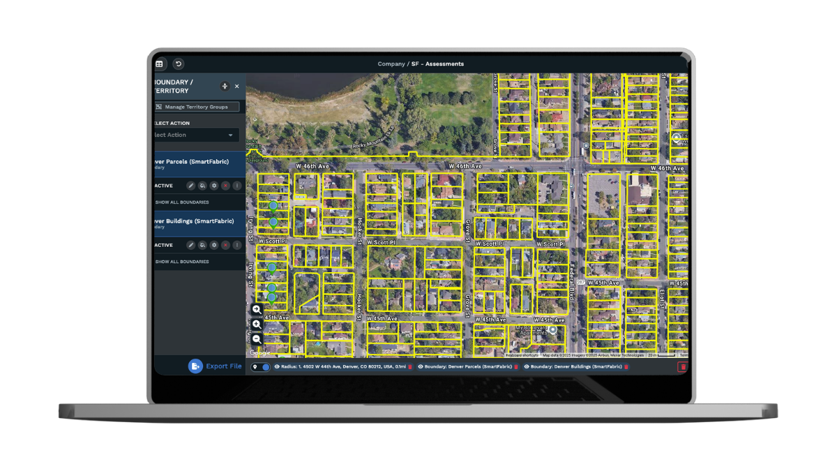
Create Sales Territories
Build sales territories with custom boundaries or zip codes, then aggregate sales and demographic data to guide smarter planning.

Route Optimization
Save time with optimized routes across up to 73 stops, complete with exportable turn-by-turn navigation for field teams and drivers.
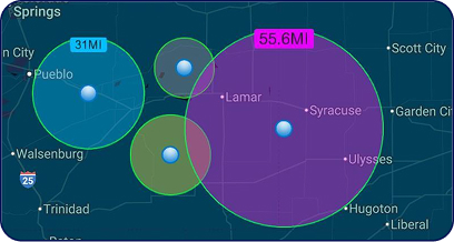
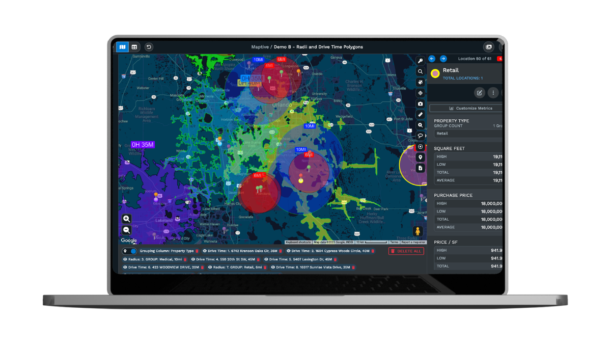
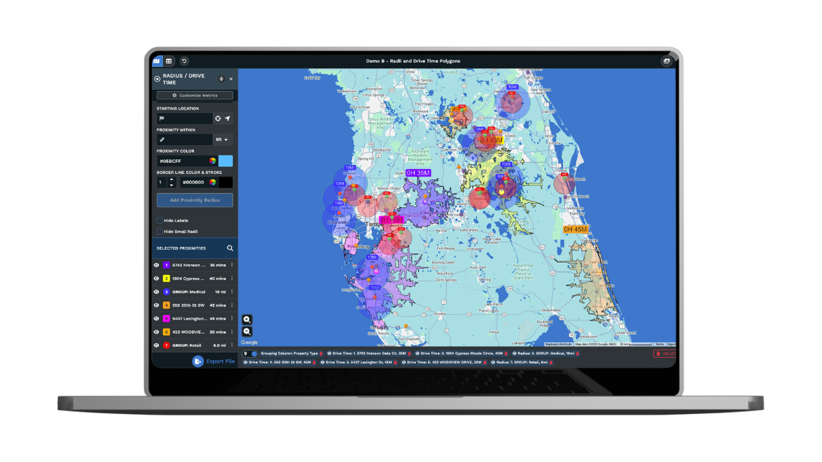
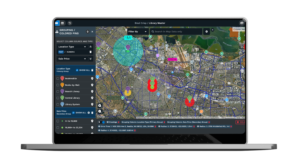
Map Radius Tool
Define areas with a simple radius, then export locations or send them directly into route planning and directions.
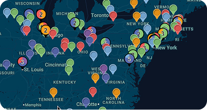
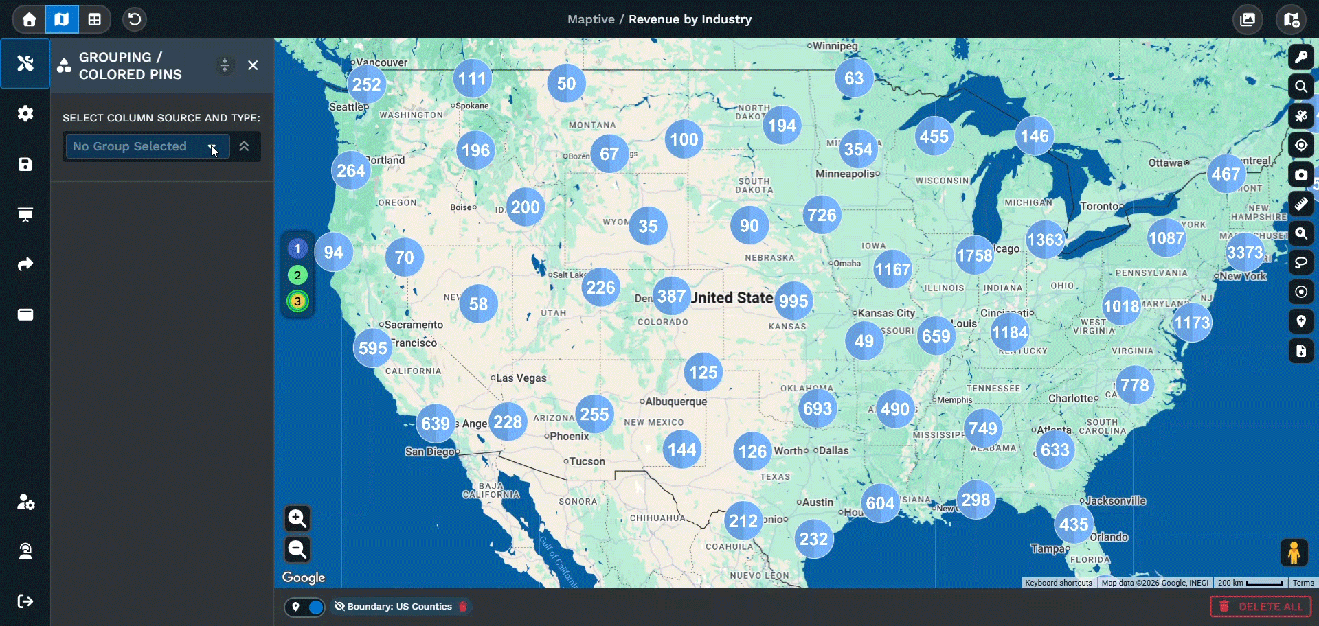
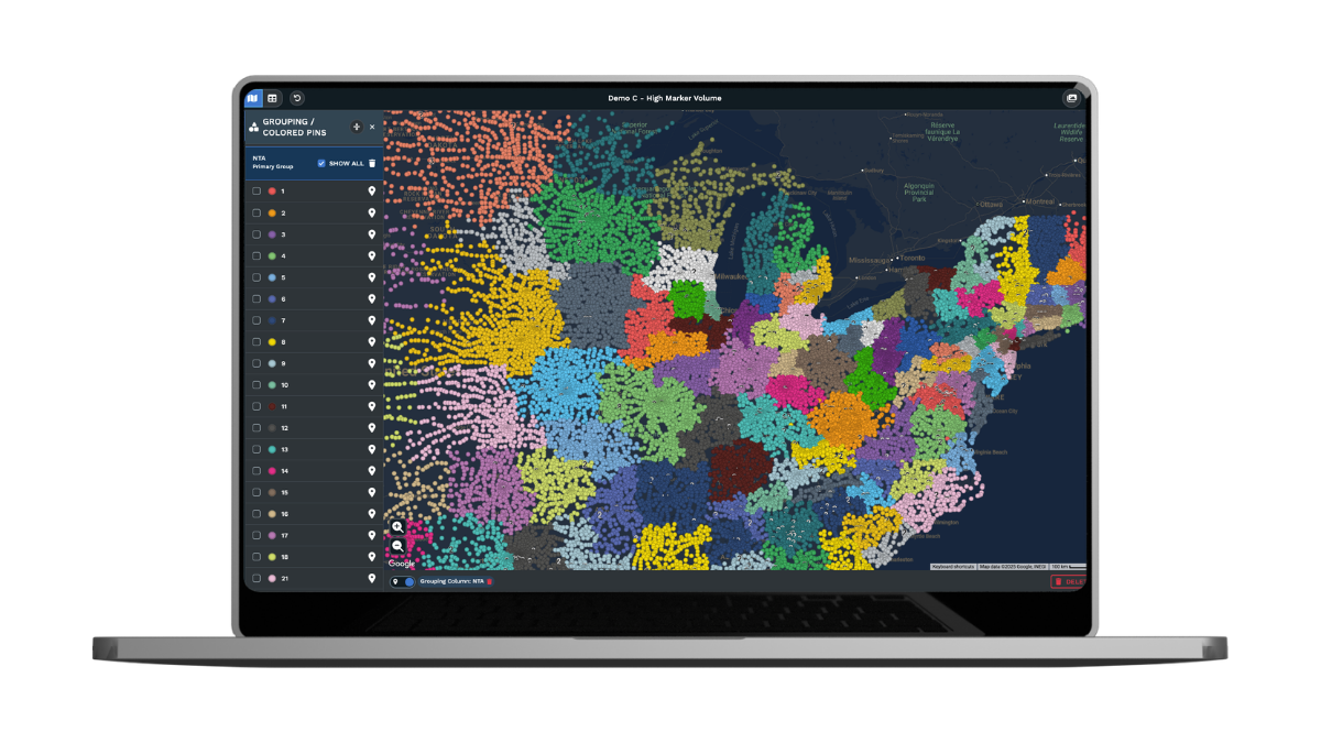
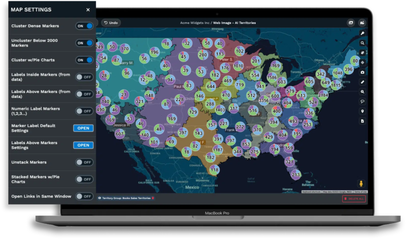
Colored Marker Grouping
Bring clarity to data by grouping markers by category, instantly visualizing spreadsheet values with dynamic color coding.
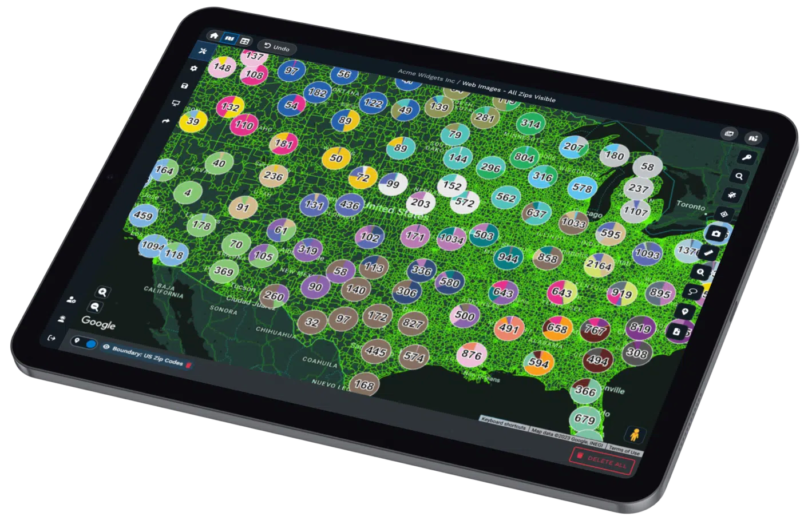
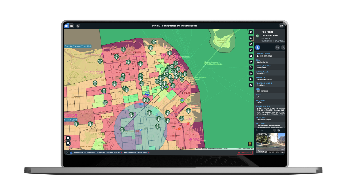
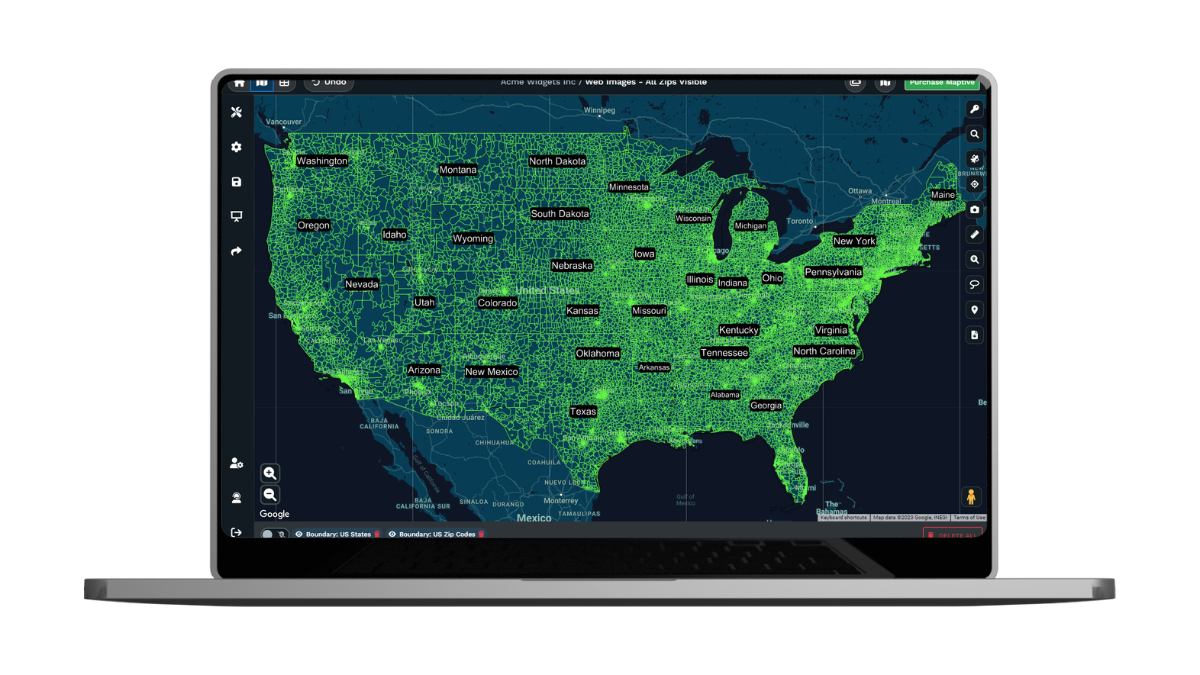
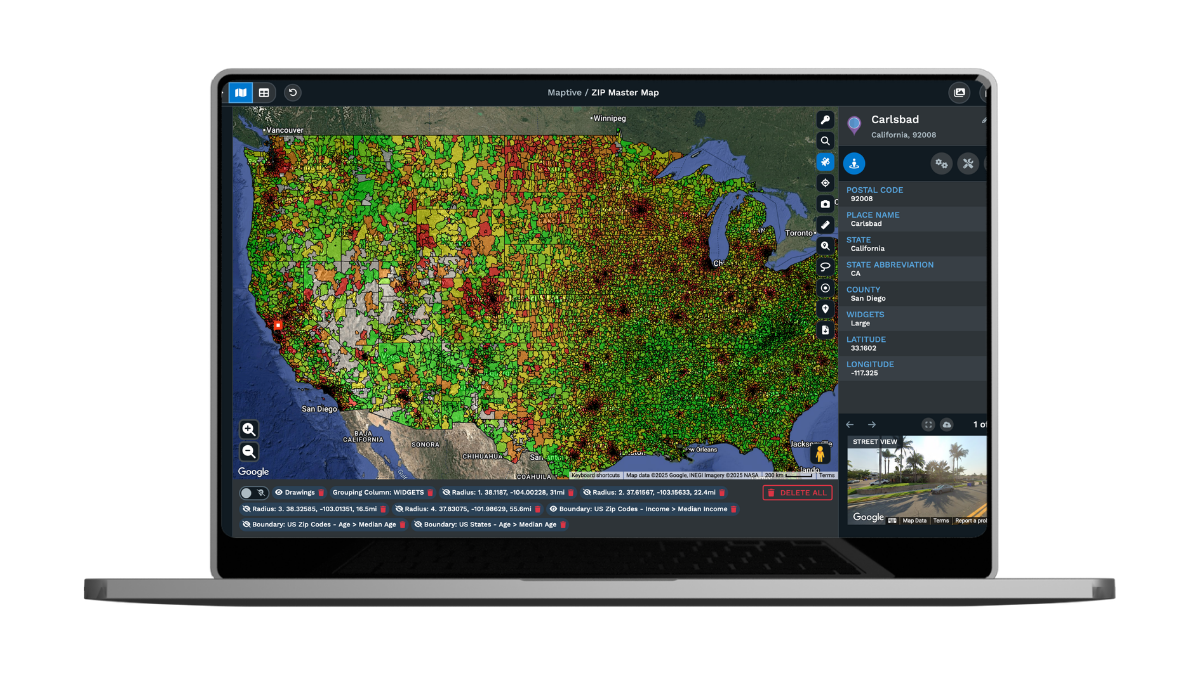
Demographic Maps
Integrate census data from the U.S. and Canada to evaluate population density, income levels, age groups, and more.
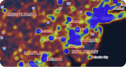
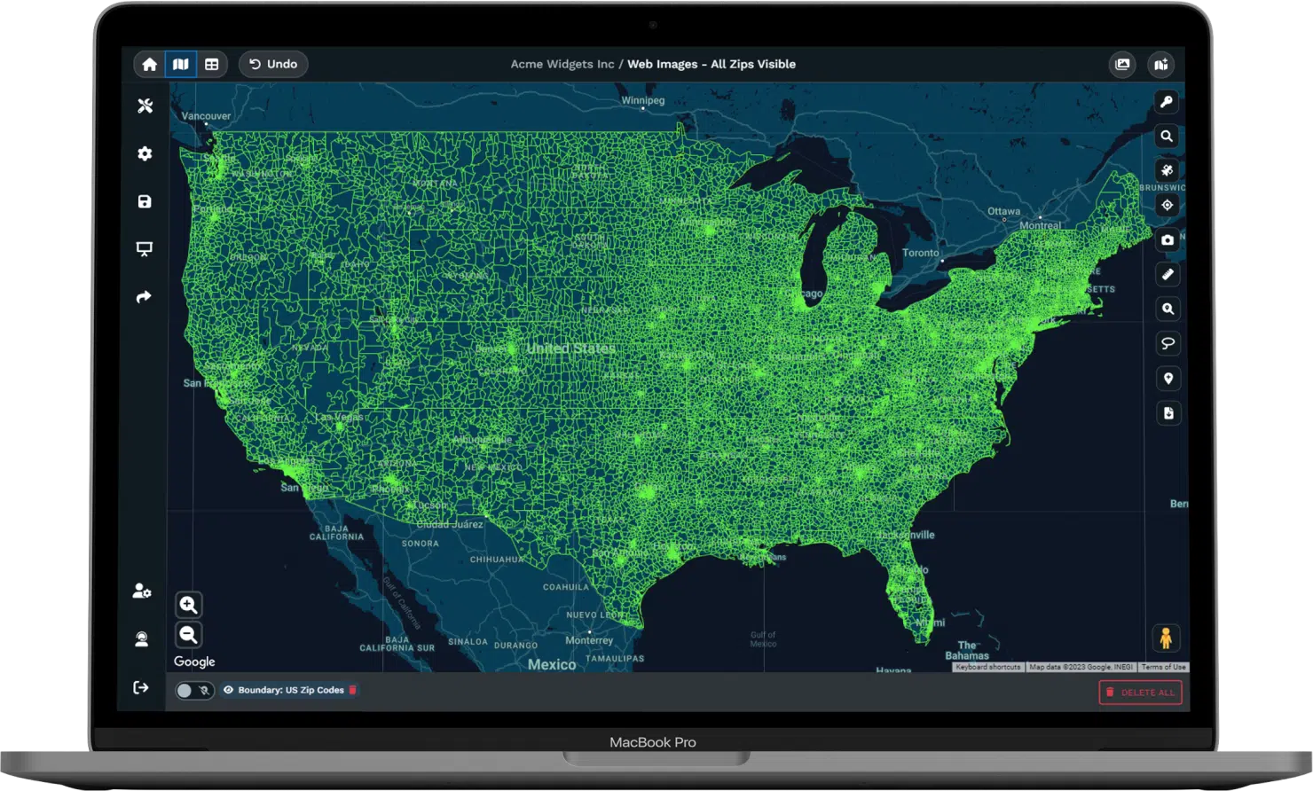
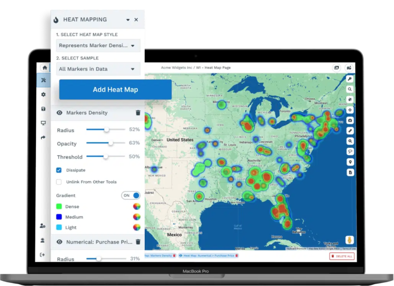
Heat Map Generator
Visualize performance, density, or demographics with heat maps that transform raw numbers into clear, presentation-ready insights.
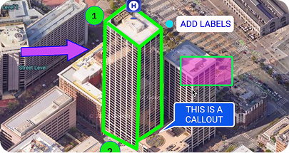
Drawing Tool
Highlight key areas with shapes, labels, text, or icons to make maps more informative for reports and client presentations.
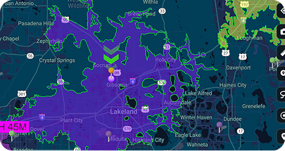
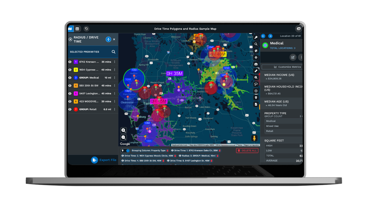
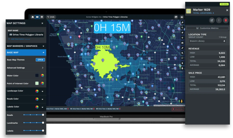
Drive Time Polygons
Measure reach with polygons that display how far teams can travel within specific drive times, expressed in hours and minutes.
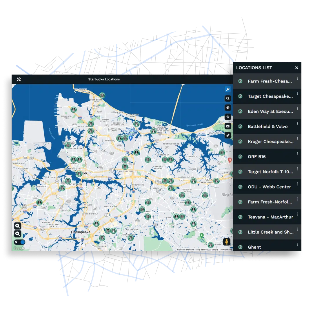
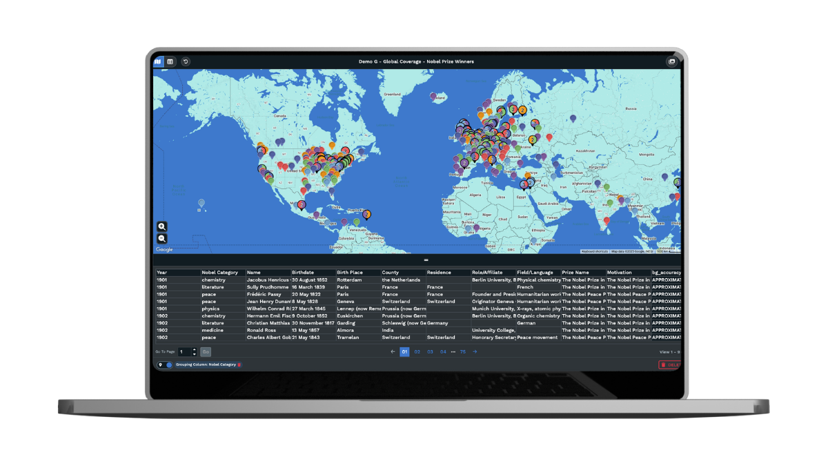
See Our Maps in Action
Scroll Through Example Maps Below:
60+ GIS Tools Built Into Every Account
Spatial Analysis
Territory Management
Build territories from states, counties, ZIP codes, census tracts, or draw your own. Automated optimization balances workloads across multiple metrics at once, and you can quickly reassign boundaries between territories as needed.
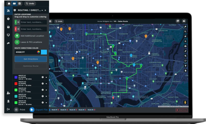
Route Planning
Multi-stop route optimization arranges your stops to minimize drive time, with live updates so your team always has the latest directions ready in their preferred navigation app, such as Google Maps or Apple Maps.
Data Intelligence
Soon, access 100,000+ demographic and market data layers, including socioeconomic indicators, consumer spending, healthcare statistics, and real estate metrics. Census data is already available for all accounts at the state, county, ZIP, and census tract levels.
What Maptive Delivers for Your Business
Clarify complex data and reclaim valuable time. Sales, retail, supply chain, and nonprofit teams use these tools to identify trends, improve productivity, and act faster. Enrich customer insights with demographics, optimize routes for efficiency, monitor supply chains with accuracy, and pinpoint growth opportunities hidden in spreadsheets.
 Learn about your customers with demographic data.
- Increase employee productivity with optimized routes.
- Understand your supply chain.
- Identify areas of weakness and grow your business.

Create Your Maptive Account
Start a free 10-day trial to explore every feature. Upload spreadsheets, Google Sheets, or paste data directly, and begin mapping with powerful, customizable tools.
No Credit Card Required


