

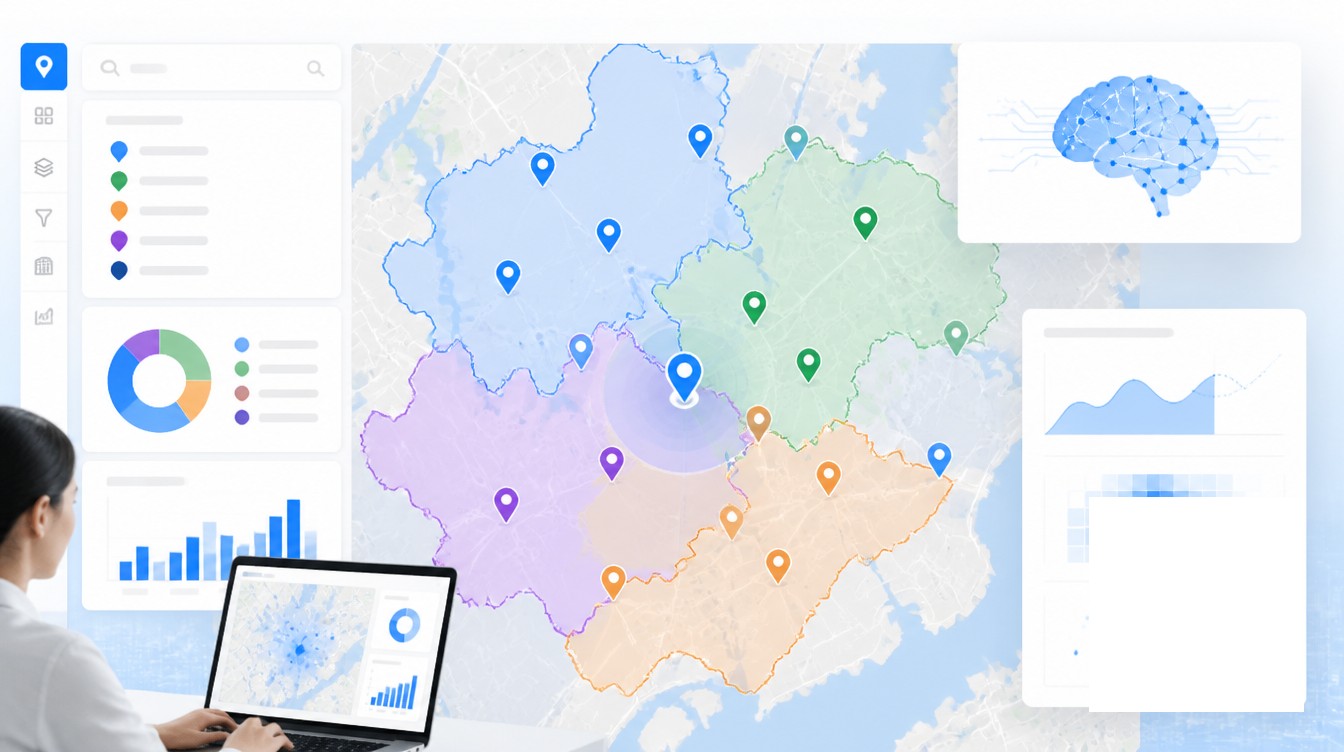
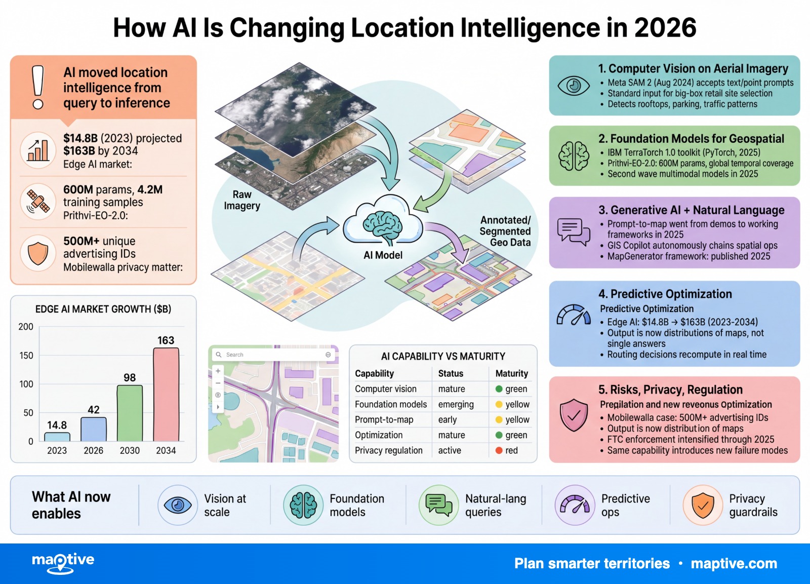
AI is moving location intelligence from descriptive mapping into predictive, real-time, and partially autonomous analysis, with foundation models reading satellite imagery, agents running spatial queries from plain-text prompts, and learned models solving routing problems at scales that classical solvers struggle with.
The clearest marker of this transition is Prithvi-EO-2.0, the 600-million-parameter geospatial foundation model that IBM and NASA released in December 2024 and that has since been deployed in orbit aboard a NASA spacecraft. Prithvi was trained on 4.2 million global time-series samples drawn from the Harmonized Landsat and Sentinel-2 archive at 30-meter resolution. A model of that size, fine-tuned on a target task such as flood mapping or burn-scar detection, beats the prior generation by 8% on downstream benchmarks.
Worldwide AI spending is forecast at $2.52 trillion in 2026, up 44% year over year, with $401 billion of that going to infrastructure. The geospatial intelligence market alone is projected to climb from $37.13 billion in 2025 to $62.88 billion by 2030. The capability described below sits inside that wider spend.
Computer Vision on Aerial and Satellite Imagery
Computer vision is the most mature AI application in location intelligence. Convolutional neural networks, Vision Transformers, Swin Transformers, and Mask R-CNN now do the routine work of pulling features out of imagery, and 2024 brought a new promptable architecture from Meta that has been adapted for geospatial use.
Building and structure detection at continental scale
Microsoft’s open GlobalMLBuildingFootprints dataset added 18 million building footprints and 4.2 million height estimates in its February 2025 release, drawn from Maxar and Vexcel imagery captured between 2017 and 2024. A January 2026 update added another 3.5 million footprints and 3.4 million height estimates from 2020-2025 imagery. The model behind those releases segments roof outlines at sub-meter scale and infers height from shadow geometry and stereo cues.
Meta’s Segment Anything Model 2, released in August 2024, accepts text or point prompts and returns object masks in real time across images and video. The SAMGeo Python package adapted the model for satellite and aerial imagery, and production support inside the Wherobots platform now lets users describe targets in plain text and segment terabyte-scale imagery collections without labeling a training set in advance. For practical site work, that compresses tasks like roof inventory, swimming pool inventory, and solar panel detection from weeks of labeling to hours of prompting.
Agriculture and parking telemetry
John Deere’s See & Spray system uses 36 cameras and onboard machine learning to identify weeds plant-by-plant and apply herbicide only where needed. The system covered 5 million acres during the 2025 growing season and saved 31 million gallons of herbicide mix. Growers using the platform averaged about two additional bushels per acre, with some seeing as much as 4.8. The training corpus behind those models now reaches more than 330 million engaged acres of proprietary field data.
A different and far less heroic application of the same toolchain counts cars in retail parking lots. Vision models running on commercial satellite feeds estimate occupancy hourly, and the resulting series is paired with mobile-device panel data to forecast visit volumes at proposed and existing store locations. The combination is now standard input to large-format retail site selection.
Foundation Models for Geospatial Data
A foundation model is a large pretrained model that can be fine-tuned for many downstream tasks rather than trained from scratch for each one. Prithvi-EO-2.0 follows that template applied to Earth observation. Its 600 million parameters and 4.2 million training samples cover global temporal and seasonal variation, and the model exposes temporal and location embeddings that downstream tasks can use directly.
The open ecosystem around Prithvi is the more durable development. IBM’s TerraTorch 1.0 toolkit, built on PyTorch and released in 2025, natively supports the Prithvi family, the Granite geospatial family, Clay, SatMAE, Satlas, DeCur, and DOFA. Practitioners who would have spent months training a custom CNN can fine-tune a pretrained backbone in days and obtain higher accuracy on data-sparse tasks such as deforestation tracking, cropland classification, or urban change detection.
A second wave of multimodal foundation models arrived in 2025. SkyMoE applies a Mixture-of-Experts architecture to vision-language tasks on remote sensing imagery. EarthVL, GeoEyes, and GeoAlignCLIP align ultra-high-resolution imagery with text descriptions, which means a user can search a satellite archive with queries such as “container ships at anchor near a fuel depot” and get ranked results without writing a classifier. These models still need domain-specific fine-tuning before they perform reliably on niche tasks, and the GEOBench-VLM benchmark introduced at ICCV 2025 makes that performance gap measurable.
Generative AI and Natural-Language Querying
The second visible change is the disappearance of code as the entry point to spatial analysis. A 2025 study published in the ISPRS International Journal of Geo-Information fine-tuned ChatGPT to convert natural-language queries into executable Python using GeoPandas, Shapely, and Rasterio. The resulting workflow lets a non-developer ask, “Which counties have the fewest clinics within a 15-minute drive?” and receive both the answer and a reproducible script.
Map narration is a related capability. Large language models inspect a finished map and produce written summaries of its main findings, such as “Northern counties show three times higher visit density than southern counties, with a notable cluster around metro fringes.” Google’s Geospatial Reasoning workflow combines Gemini with custom foundation models to chain those summaries with deeper queries.
Prompt-to-map generation moved from research demos to working frameworks during 2025. The MapGenerator framework, published in a peer-reviewed map-science journal in December 2025, trains a diffusion model on map tiles to render new maps from text prompts. The underlying technique, diffusion-based image generation, iteratively refines a random starting field into a target image conditioned on a text description. MapStory, posted to ArXiv in May 2025, produces editable map animation sequences from natural-language scripts and uses an agentic architecture to coordinate the generation steps. Commercial systems convert text, CSV inputs, and URLs into interactive maps without manual styling.
Agents are the layer above. An agent in this sense is a system that decomposes a spatial task into a sequence of tool calls, executes each call against real data, and reports back. The GIS Copilot framework, described in a 2025 Tandfonline paper, autonomously selects geoprocessing operations, runs them, and returns annotated outputs. Houseal Lavigne’s EuclidHL planning assistant answers city zoning and land-use questions on top of a parcel database. Maptive and other location-intelligence platforms increasingly expose similar conversational entry points alongside their conventional map interfaces.
Predictive and Combinatorial Optimization
The third change concerns prediction. Gradient boosting models such as XGBoost and LightGBM dominate the tabular side of location intelligence, where they forecast demand, sales, and traffic at the store-by-SKU level. An XGBoost variant published in a June 2025 retail benchmark reached 92.71% accuracy on a sales forecasting task, versus 87.75% for traditional gradient boosting, while requiring far less training time than neural networks of comparable performance.
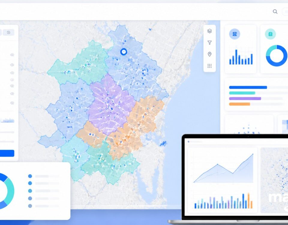
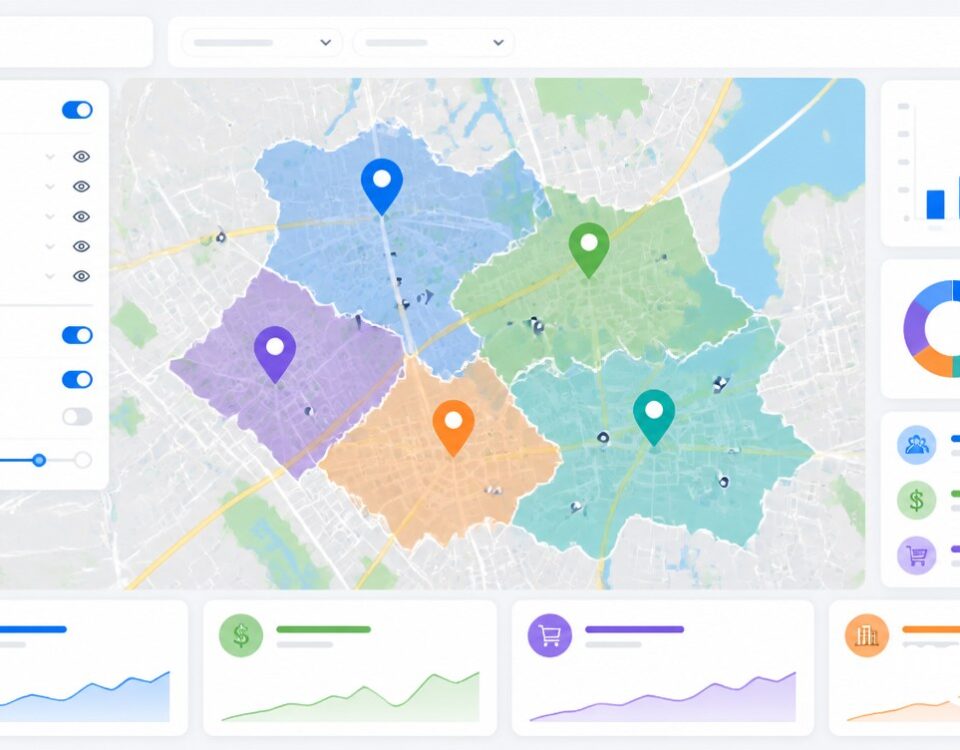
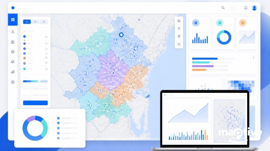
Site selection has absorbed this toolchain end to end. A representative pipeline ingests mobile-device foot-traffic panels covering tens of millions of devices, layers demographic and psychographic overlays, fits gradient boosting models on historical store sales, and projects cannibalization risk for a proposed new location against every existing location within a defined trade area. The output is no longer a single map. It is a ranked list of candidate sites with revenue intervals, cannibalization estimates, and confidence scores.
Routing is the most economically consequential application. Neural combinatorial optimization, a technique that uses a learned model to propose route orderings rather than a hand-coded solver, has been extended to real-world asymmetric distances and time-dependent durations through 2025 research published on ArXiv in March 2025. UPS’s dynamic ORION upgrade, deployed across 97% of its van fleet by July 2024, trimmed an additional two to four miles per driver on top of earlier ORION gains, saving roughly 100 million miles, 10 million gallons of fuel, and $300 to $400 million per year. FedEx runs an analogous AI control tower that monitors network state in real time and prepositions assets when disruption is predicted.
Edge AI extends the same predictive capability to the device. The edge AI market is projected to grow from $14.8 billion in 2023 to $163 billion by 2033, at a compound annual rate of 21.7%. Current mobile chips can run full visual-language models locally, which means a phone, drone, or vehicle can identify a building or count an inventory of assets without a round trip to a data center. For field workers in connectivity-poor areas, that capability is the difference between a workflow that runs and one that does not.
Risks, Privacy, and Regulatory Headwinds
The same capability that makes 2026 interesting introduces failure modes that earlier mapping software did not have to address.
Hallucination and geographic bias
Large language models generate incorrect coordinates with notable frequency, especially for rural and under-represented places. Research published in 2025 documented that GPT-3.5 and GPT-4o often collapse multiple rural toponyms to the same coordinates and show systematic bias toward higher-density, higher-income, predominantly white US counties. Some general LLM benchmarks have reported factual-error rates as high as 82%. The “Mitigating Geospatial Knowledge Hallucination” paper, posted to ArXiv in July 2025, introduced a Dynamic Factuality Aligning method based on Kahneman-Tversky Optimization that improved factuality on the authors’ benchmark by more than 29.6%.
The practical implication is that an LLM should never be the source of authoritative coordinates. It should be a planner that calls a verified geocoder and a verified spatial database, and the calling agent should validate the returned coordinates against a known reference before any downstream computation. Most production deployments now wrap the model in exactly that pattern.
Data law and the EU AI Act
Regulation arrived in parallel with the capability. The general-purpose AI rules of the EU AI Act took effect in August 2025. The high-risk AI rules were given a longer transition path through the November 2025 Omnibus proposal from the European Commission, which targets a maximum 16-month adjustment and full enforcement by August 2027. Location intelligence applications that fall under high-risk categories, including biometric identification, critical infrastructure monitoring, and location-driven scoring, must meet documentation, conformity assessment, and transparency obligations on top of the GDPR rules covering personal location data.
US enforcement moved through the same period. The FTC finalized orders against X-Mode and Outlogic in early 2024, against InMarket, and against Mobilewalla in late 2024, with a final order against Gravy Analytics and Venntel issued in January 2025. The Mobilewalla matter alone covered more than 500 million unique advertising identifiers paired with precise location collected between 2018 and 2020. The Gravy final order prohibits the association of sensitive location data with LGBTQ+ service places and political or social gathering places, and similar restrictions apply to healthcare facilities, places of worship, and schools.
The downstream effect on AI workflows is that brokered location data inputs to machine learning models carry mounting legal risk. Buyers are moving toward first-party telemetry, contractually clean panel data, and privacy-preserving aggregation methods such as k-anonymity and differential privacy. A 2025 Eagleview survey of more than 100 geospatial professionals found 48% cautiously optimistic and 23% strongly enthusiastic on AI adoption, with C-level executives driving 41% of purchase decisions, GIS teams driving 33%, and IT and data science driving 31%. The pattern in those numbers is that enthusiasm is tempered, and the budget owners are asking governance questions before they sign.
Frequently Asked Questions
What is GeoAI?
GeoAI is the integration of artificial intelligence methods with geographic information systems and spatial data. It covers machine learning, deep learning, computer vision, generative models, and LLM agents applied to spatial problems, and it includes both traditional ML used on geographic data and spatially explicit models that represent geographic relationships such as spatial autocorrelation directly.
What are foundation models for geospatial data?
Foundation models for geospatial data are large pretrained models that can be fine-tuned for many downstream Earth-observation tasks. Examples include Prithvi-EO-2.0 from IBM and NASA, with 600 million parameters trained on 4.2 million global time-series samples from Landsat and Sentinel-2 imagery at 30-meter resolution, the Clay Foundation Model, and IBM’s Granite geospatial family. All are supported by the open-source TerraTorch 1.0 toolkit.
How is machine learning used in GIS?
Machine learning in GIS handles image classification and segmentation on satellite and aerial imagery, building footprint extraction, land cover change detection, demand and traffic forecasting, route optimization, and pattern detection in mobility data. Vision Transformers and Mask R-CNN are common for high-resolution segmentation, while XGBoost and LightGBM dominate tabular site selection and sales forecasting.
How do you use AI for site selection?
AI for site selection combines mobile-device foot-traffic panels processed with machine learning to estimate visits per point of interest, demographic and psychographic overlays, gradient boosting models that forecast new-store sales and cannibalization risk, and computer vision on aerial imagery to assess parking, building, and trade-area characteristics. The output is a ranked list of candidate sites with revenue intervals and confidence scores.
What is generative AI used for in mapping?
Generative AI is used for natural-language query translation, automated map narration, prompt-to-map generation via diffusion models, automated label placement, and agentic workflows that pick the right geoprocessing tool for a task. Recent prompt-to-map systems include the MapGenerator framework from December 2025 and the MapStory animation system from May 2025.
Can ChatGPT do GIS analysis?
ChatGPT can perform limited GIS analysis when fine-tuned or wrapped in an agent that lets it generate Python using GeoPandas, Shapely, or Rasterio, or PostGIS SQL. A 2025 study fine-tuned the model for exactly this purpose. Out of the box, ChatGPT and similar LLMs hallucinate coordinates, especially in rural and under-represented regions, and need a verified spatial-data backend.
What is an autonomous GIS agent?
An autonomous GIS agent is an LLM-powered system that takes a natural-language spatial task, plans a sequence of GIS operations, executes them against real data, and reports back, with limited human oversight. The GIS Copilot framework described in a 2025 Tandfonline paper demonstrated agents that retrieve data, run spatial analyses, and generate maps end-to-end.
How is AI used in route optimization?
AI is used in route optimization through neural combinatorial optimization models that learn to solve vehicle routing problems directly and through reinforcement-learned policies that respond to real-time disruptions. UPS’s dynamic ORION upgrade in 2024 trimmed an additional two to four miles per driver on top of earlier gains, saving roughly 100 million miles and $300 to $400 million per year.
Does AI hallucinate location data?
Yes. Large language models produce incorrect coordinates with measurable frequency, especially for rural or under-represented places where training coverage is thin. Research from 2025 documented that GPT-3.5 and GPT-4o collapse multiple rural toponyms to the same coordinates and show bias toward higher-density, higher-income, predominantly white US counties. A July 2025 benchmark paper introduced a method that improved factuality by more than 29.6%.
How is AI used in precision agriculture?
AI in precision agriculture combines computer vision, GPS, and satellite imagery for weed-by-weed targeting, yield forecasting, soil mapping, and autonomous machine guidance. John Deere’s See & Spray system covered 5 million acres during the 2025 harvest with 36 onboard cameras and saved 31 million gallons of herbicide mix. Growers using the system averaged roughly two additional bushels per acre.
How is AI used in insurance for location risk?
Insurance carriers use AI to model catastrophe risk at structure-level granularity. AI-driven catastrophe models combine satellite imagery, IoT sensor data, and historical loss records to simulate event probabilities, support real-time underwriting, and verify post-event damage. AI played a major role in classifying affected structures after the 2025 Los Angeles County wildfires.
What is edge AI in location intelligence?
Edge AI in location intelligence runs spatial inference models directly on devices such as phones, drones, vehicles, and IoT sensors rather than sending data to the cloud. This lowers bandwidth use, preserves privacy, and keeps systems responsive when connectivity fails. The edge AI market is projected to grow from $14.8 billion in 2023 to $163 billion by 2033.


