Map Coordinates: Find Locations by Latitude and Longitude
Latitude and longitude maps were invented in the 3rd century BCE to help people pinpoint their exact location. While this system is still in use today, most people rely on street addresses to determine the location of a specific point on a map.
If the only location data you have are longitude and latitude coordinates, what can you do?
Today’s mapping software has reverse geocoding abilities that can take map coordinates and convert them into readable addresses that are much easier to understand for the average person.
What are Latitude and Longitude?
Latitude and longitude are part of a coordinate system that allows any location on Earth to be specified by two numbers. They make up the most common geographic coordinate system currently in use today.
The system utilizes two sets of lines:
- Latitude, which runs east to west
- Longitude, which runs north to south.
The equator serves as 0° latitude. The North Pole is 90° N while the South Pole is 90° S. The Prime Meridian serves as 0° longitude, and longitude extends 180° both east and west.
By indicating both your latitude and longitude, you can indicate exactly where you are anywhere in the world. For example, New York City’s coordinates are 40.7128, -74.0060. This is the decimal degree (DD) format for representing coordinates. However, another common format is degrees, minutes, and seconds (DMS). In that case, the coordinates would be 40° 42′ 46.08” N, 74° 0′ 21.6” W.
What is the Difference Between GPS Coordinates and Latitude and Longitude?
You’ve likely heard people talk about GPS coordinates in a similar way to latitude and longitude. In most cases, these two terms mean the same things, since the majority of GPS systems utilize this geographic coordinate system. Depending on the device you’re using it may express these coordinates in different formats, but in almost all cases it will still be referring to latitude and longitude.
How Do You Find an Address Using Latitude and Longitude?
Finding an address from latitude and longitude used to be a complicated process. Luckily, advanced mapping software like Google Maps and Maptive makes the process extremely easy. By entering your map coordinates into these tools you can instantly convert them into a street address.
Here’s how to find locations by latitude and longitude:
Google Maps
Open Google Maps and enter your coordinates into the search bar. Both the DD and DMS formats will work. A pin will appear at those coordinates and you’ll be able to see the address of that location.
Maptive
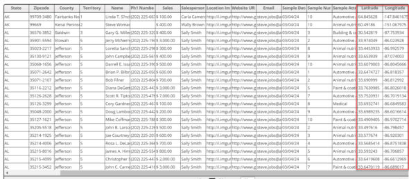
Open Maptive and click on “Data,” then enter your map coordinates or upload them from a spreadsheet. Make sure your latitude and longitude are in two separate columns, then once you’re ready click “Map” to view your coordinates. Like Google Maps, both DD and DMS formats will work.
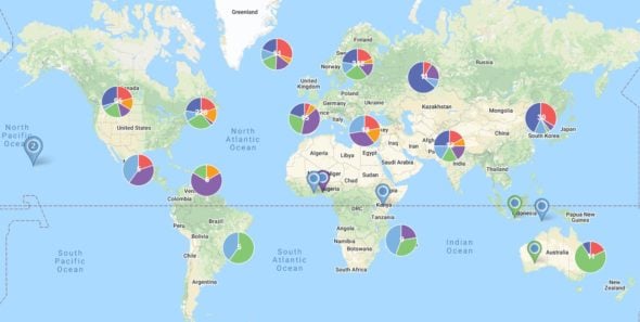
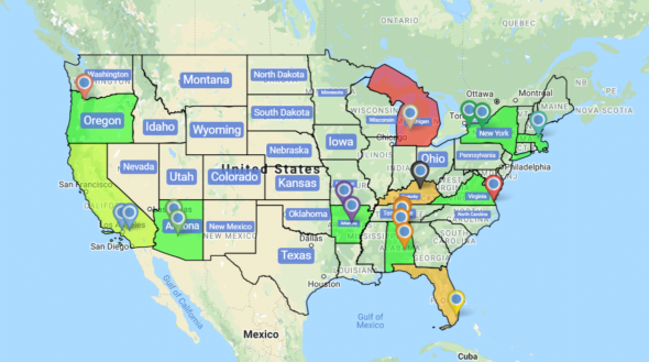
Maptive gives you a number of customization options and tools to help you draw additional insights from your coordinates. You can color-code pins to segregate different locations, use the boundary tool to determine what zip code, district, or city they’re in, and more.
You can also include a number of additional data points along with your coordinates that will be displayed when you click the corresponding pin on the map. Using the filter tool, you can decide which data points are shown at any time to help you find the information you need.
Maptive will find map coordinates for an address as well. This process is known as geocoding and the software does this automatically when you input addresses.
Tips for Formatting Your Coordinates
When entering your coordinates into mapping software follow these rules to ensure they are plotted correctly:
- Use the degree symbol to indicate degrees, not the letter “d”.
- Use periods to indicate decimals, not commas.
- Always list latitude before longitude.
- Double-check that your map coordinates are correct. For example, latitude coordinates should be between -90 and 90, and longitude coordinates should be between -180 and 180.
Start mapping now!
Just follow these simple steps:
Copy & Paste OR Drag & Drop Your Data Set Here.
OR you can Upload your file
Drag And Drop Your Data Here

Important: Remember to include column headers in your data set. (like the example)

Date Security: Your data is transferred using encrypted https